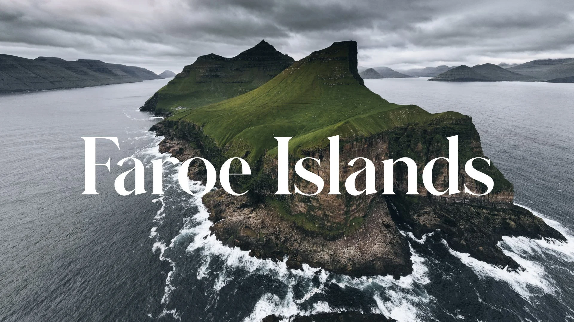
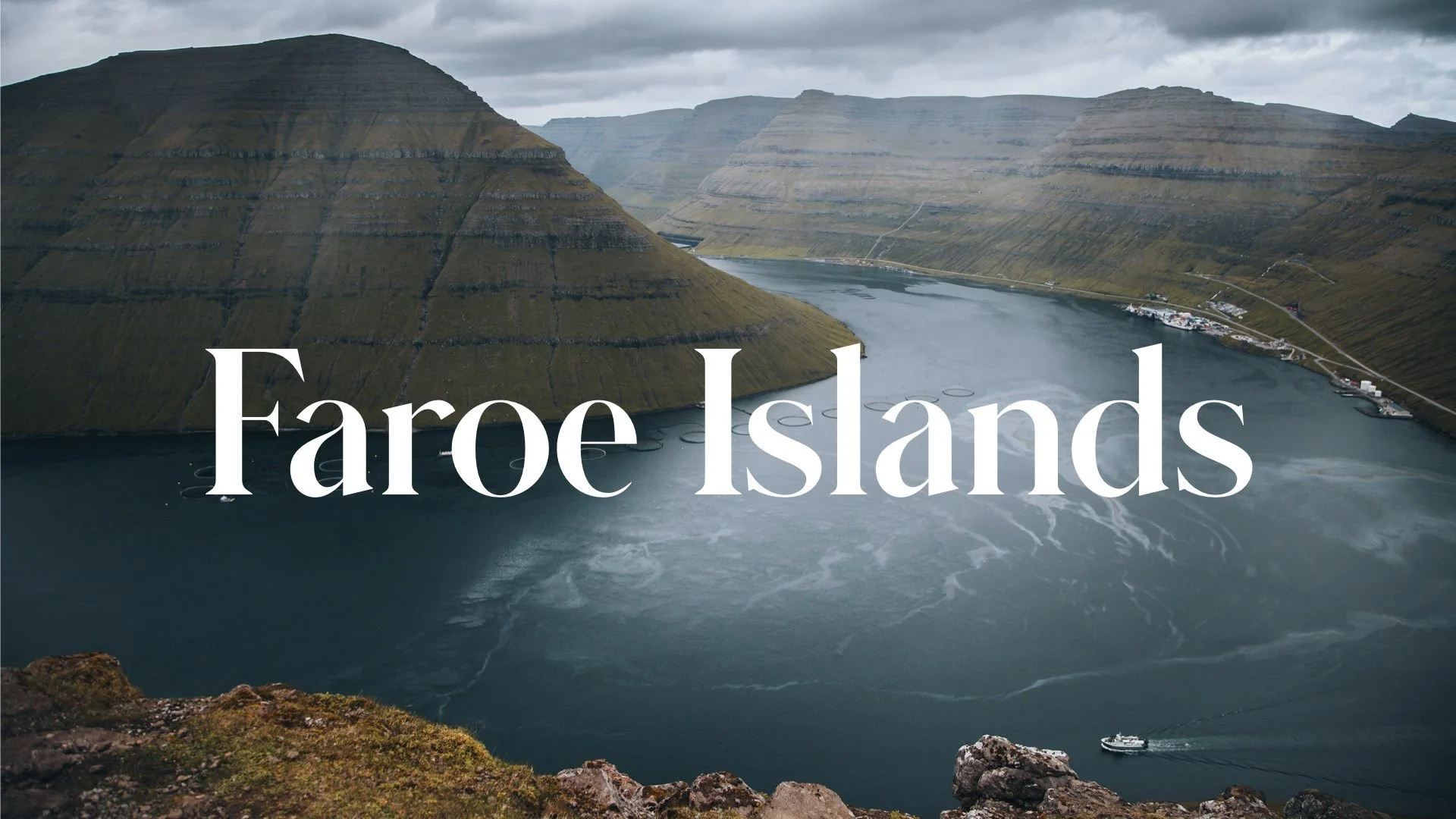
A Journey to the Faroe Islands: The Island of Kalsoy

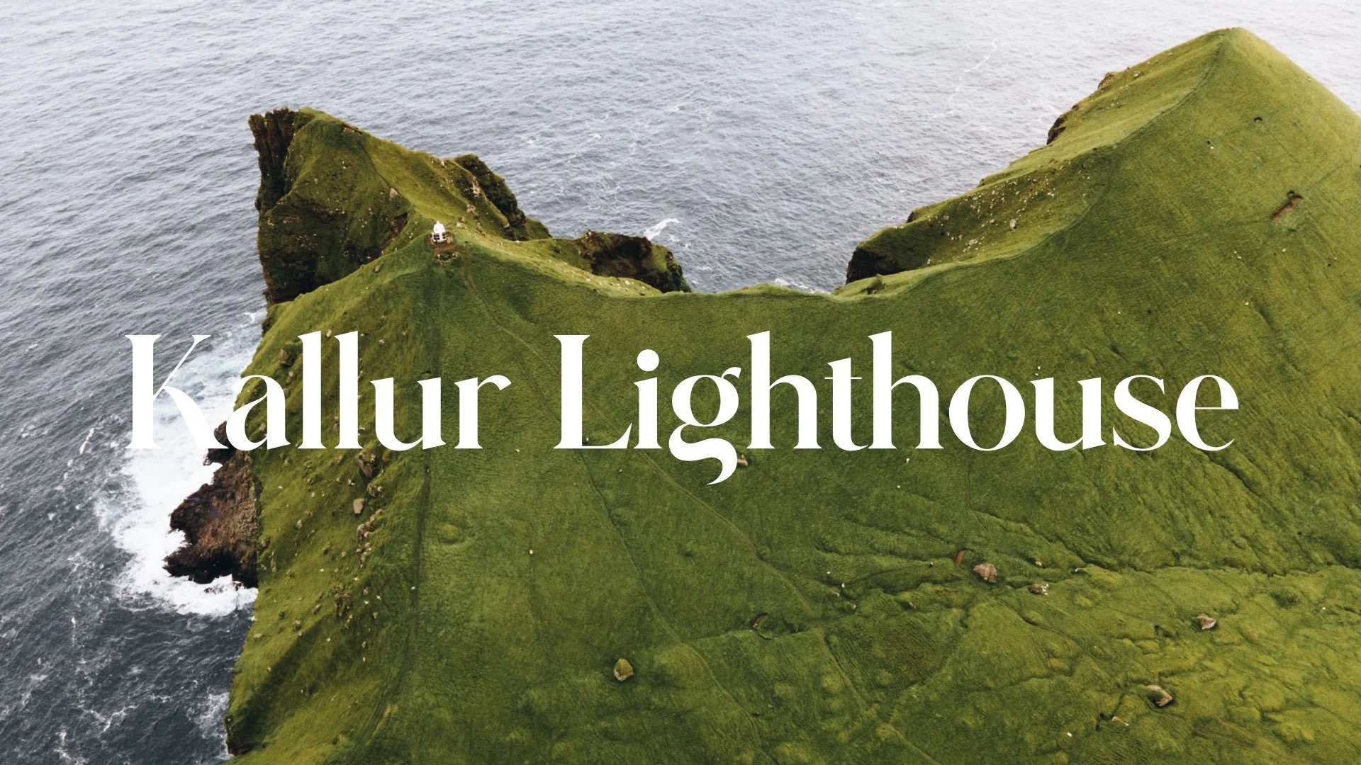
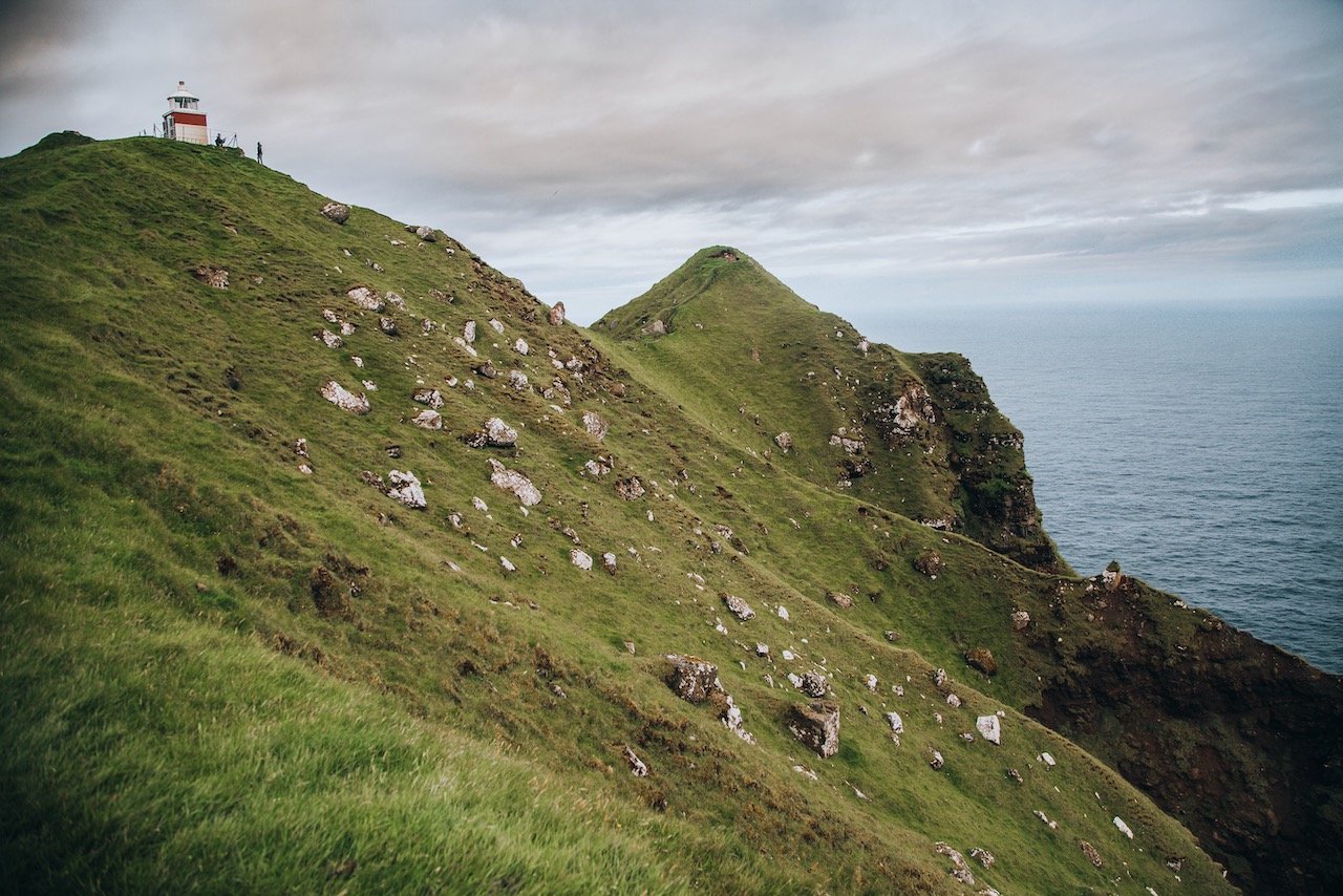
Kallur Lighthouse, Kalsoy, Faroe Islands (ISO 400, 4.5 mm, f/2.8, 1/40 s)
(Some links in this post are affiliate links. If you click through and take action, I'll be compensated.) If you are also interested in any PRINTS from any of my posts, be sure to check out my store where you can buy prints as posters, in metal/wooden frames or on canvas.
**This post is the 6th of a 11-post series discussing what to see in this part of the Faroe Islands (You can check out the other parts in the list below, separated by each specific island (just click on the island name to see the blog post. Everything is also summarized in another post here.**
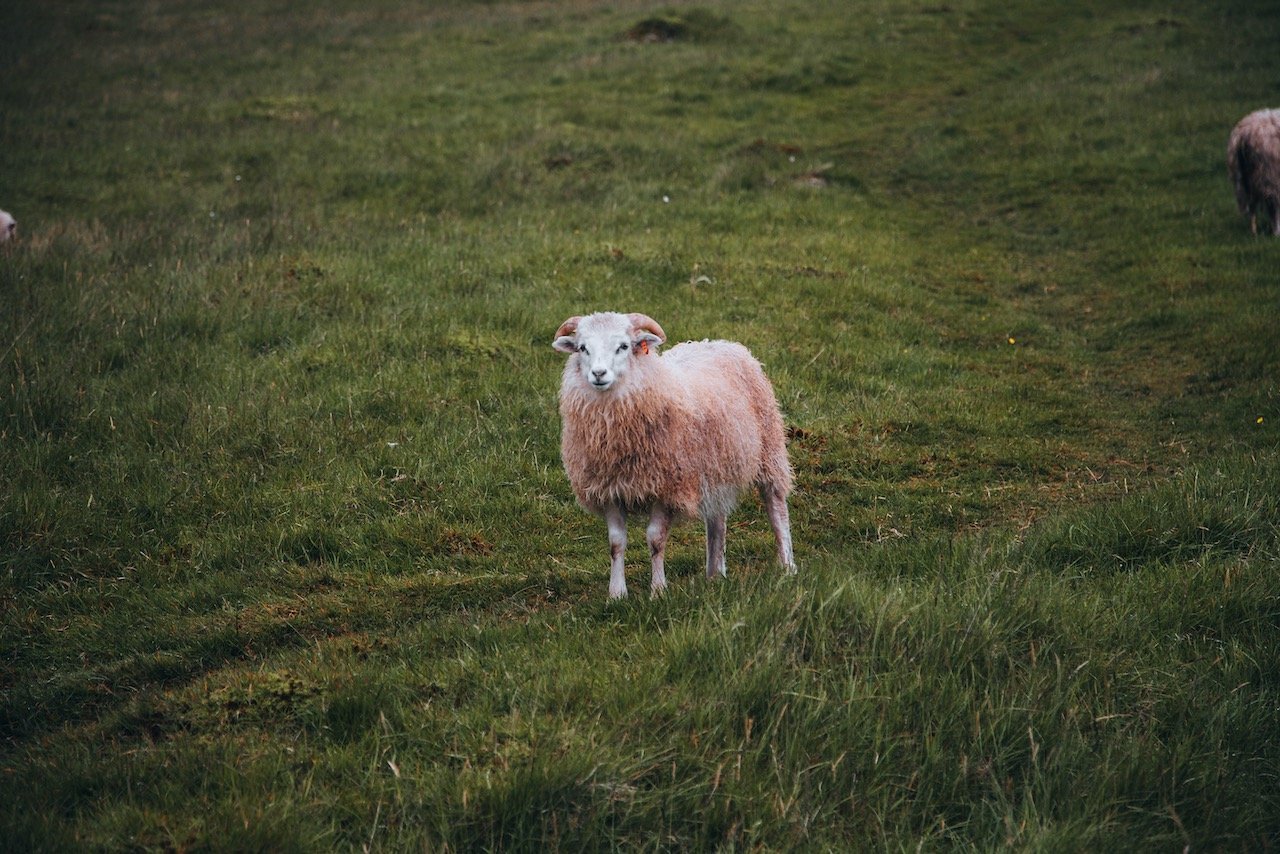
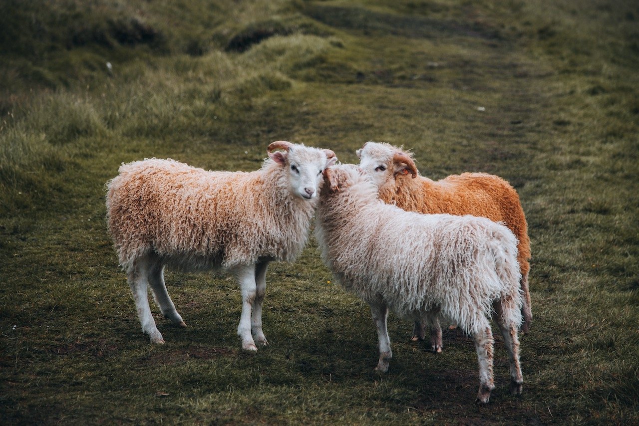
The Faroe Islands, or the Faroes, are an archipelago located in the North Atlantic Ocean and are a part of Denmark. The subpolar oceanic climate, moderated by the Gulf Stream, make the temperature of the Faroes nearly constant throughout the year. Origins of the Faroe Islands date back as early as 500 AD, thought to be settled by people from Great Britain or Ireland. [Funfact: The population of sheep (70,000) outnumber the human population (54,000)]
Featured

Tórshavn (Blog Post: A Journey to the Faroese Capital of Tórshavn)
Vágar (Blog Post: A Journey to the Faroe Islands: The Island of Vágar)
Streymoy (Blog Post: A Journey to the Faroe Islands: The Island of Streymoy)
Eysturoy (Blog Post: A Journey to the Faroe Islands: The Island of Eysturoy)
Bordoy (Blog Post: A Journey to the Faroe Islands: The Island of Bordoy)
Kalsoy (Blog Post: A Journey to the Faroe Islands: The Island of Kalsoy)
Vidoy (Blog Post: A Journey to the Faroe Islands: The Island of Vidoy)
Mykines (Blog Post: A Journey to the Faroe Islands: The Island of Mykines)
Sandoy (Blog Post: A Journey to the Faroe Islands: The Island of Sandoy)
Kunoy (Blog Post: A Journey to the Faroe Islands: The Island of Kunoy)
The Waterfalls of the Faroe Islands (Blog Post: The Waterfalls of the Faroe Islands)

Faroe Islands (ISO 400, 24 mm, f/4.5, 1/640 s)
In this blog post, I will cover the island of Kalsoy. A Google Map of these places I will talk about can be seen at the end of this article. Check out my video on the Kallur lightouse in the Faroe Islands below!
How to Get to the Faroe Islands
The Faroe Islands are accessed primarily through Vágar Airport (FAE), the only airport in the archipelago. Vágar Airport connects the islands to major Northern European hubs:
Copenhagen Airport (CPH), Denmark: Several daily flights by Atlantic Airways and SAS; flight time about 1 hour 45 minutes.
Reykjavik Keflavik Airport (KEF), Iceland: Seasonal flights by Atlantic Airways, about 1 hour 15 minutes.
Edinburgh Airport (EDI), UK: Seasonal summer flights lasting roughly 2 hours.
Most travelers connect via Copenhagen, which has extensive international connections.
How to Get to Kalsoy Island
Step 1: Vágar Airport to Tórshavn
After arriving at Vágar Airport (FAE), the main international gateway to the Faroe Islands:
By Bus (Route 300)
Duration: Approx. 50 minutes
Cost: ~60 DKK (~8 EUR)
Schedule: Hourly service from 07:30 to 22:00
Notes: Purchase tickets onboard or via the SSL mobile app
By Taxi:
Duration: ~40 minutes
Cost: ~600–700 DKK (~80–95 EUR)
Step 2: Tórshavn to Klaksvík (Borðoy Island)
Klaksvík is the main town near the ferry port to Kalsoy.
By Bus (Route 400)
Duration: Approx. 2 hours 15 minutes
Cost: ~120 DKK (~16 EUR)
Frequency: 3–4 times per day
Highlights: Passes through the stunning Eysturoyartunnilin undersea tunnel
By Rental Car:
Route: Tórshavn → Skálabotnur → Eysturoyartunnilin → Klaksvík
Distance: ~80 km
Time: ~1 hour 30 minutes
Step 3: Klaksvík to Kalsoy Island by Ferry
Ferry Terminal: Located just outside Klaksvík at the Kalsoy Ferry Terminal
Operator: Strandfaraskip Landsins
Route: Klaksvík ↔ Syðradalur (Kalsoy)
Ferry Number: Route 56 (MS Sam)
Crossing Time: ~20 minutes
Frequency: 3–5 daily sailings (more in summer)
Passenger Ticket: ~60 DKK (~8 EUR)
Vehicle Ticket: ~160 DKK (~21 EUR) — limited space, arrive early
Note: No public transport on Kalsoy — bring a car or plan to hike/cycle
Getting Around Kalsoy Island
Kalsoy has one narrow main road (Route 791) that runs from Syðradalur ferry port to Trøllanes, passing through several small villages:
Distance: ~13 km from Syðradalur to Trøllanes
Time by car: ~20 minutes
Time on foot: ~2.5–3 hours (one way, popular with hikers)
Villages en route: Húsar, Mikladalur (famous for the Seal Woman statue), and Trøllanes
🔹 Note: There is no bus service on Kalsoy. Most travelers drive or hike to reach the trailhead for Kallur Lighthouse at the northern tip.
Total Travel Time from Vágar Airport to Kalsoy Island (Public Transport)
Approximate Time: 4.5 to 6 hours (depending on ferry wait times)
Estimated Cost: ~240–260 DKK (~32–35 EUR)
Final Travel Tip
The ferry to Kalsoy is small and often fills up quickly with cars — especially in summer. If you're planning to bring a rental car across, arrive at least 30 minutes before departure. Alternatively, consider staying overnight in Klaksvík and taking the first ferry the next day for a head start on your Kalsoy adventure.
If you like some of my photos that you have come across, just know that I have many prints showcasing a variety of landscapes, including Faroe, available for purchase below! (Sold as Posters, Canvas, or in Metal-Frames and Wooden-Frames).


The most recent claim to fame Kalsoy can redeem is that it was used as a setting for the Kuril Islands (located in Eastern Russia) for the 25th James Bond Movie, No Time To Die. This was where the villian’s lair was supposedly located (which was clearly added digitally).

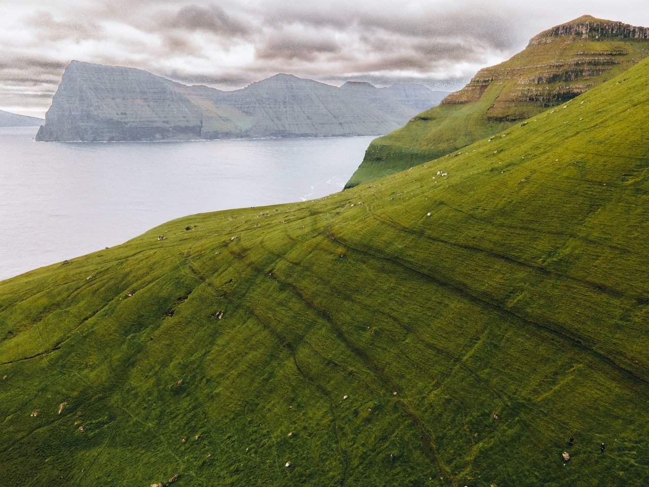
Kalsoy, Faroe Islands (ISO 200, 4.5 mm, f/2.8, 1/30 s)
As mentioned, Sydradalur is the first village you see while taking the ferry from Bordoy. It was settled at the start of the 19th century, its second time, as when it was first settled in the 17th century, it was then abandoned for unknown reasons.
Trollanes, Kalsoy, Faroe Islands (ISO 400, 24 mm, f/4.5, 1/1250 s)
Húsar is another village on the island and the oldest on Kalsoy, but is part of the Klaksvik municipality. This town is heavily involved in fish farming but my favorite part about it had to be their church, colloquially named Húsar Church.
Mikladalur, or the ‘great valley’, is the largest village on Kalsoy, situated in a big valley. Here, you can learn more about the legend of Kópakonan (the Seal Woman), a known legend in the Faroe Islands. The folktale goes:
‘Seals were believed to be former human beings who voluntarily sought death in the ocean. Once a year, on the Thirteenth night, they were allowed to come on land, strip off their skins and amuse themselves as human beings, dancing and enjoying themselves.
A young farmer from the village of Mikladalur on the northern island of Kalsoy, wondering if this story was true, went and lay in wait on the beach one Thirteenth evening. He watched and saw the seals arriving in large numbers, swimming towards the shore. They clambered on to the beach, shed their skins and laid them carefully on the rocks. Divested of their skins, they looked just like normal people. The young lad stared at a pretty seal girl placing her skin close to the spot where he was hiding, and when the dance began, he sneaked up and stole it. The dancing and games went on all night, but as soon as the sun started to peep above the horizon, all the seals came to reclaim their skins to return to the sea. The seal girl was very upset when she couldn’t find her skin, though its smell still lingered in the air, and then the man from Mikladalur appeared holding it, but he wouldn’t give it back to her, despite her desperate entreaties, so she was obliged to accompany him to his farm.’
The statue of the Seal Woman is also located in the village.
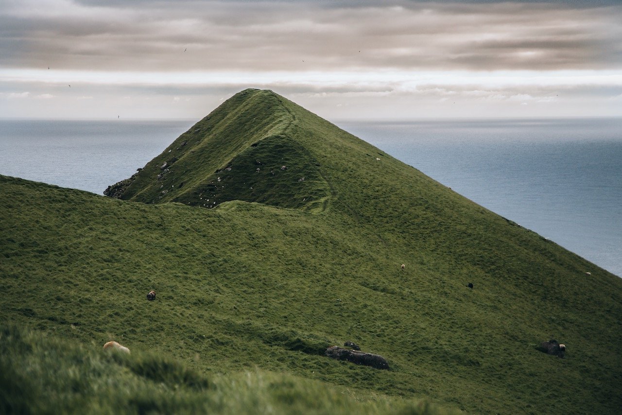
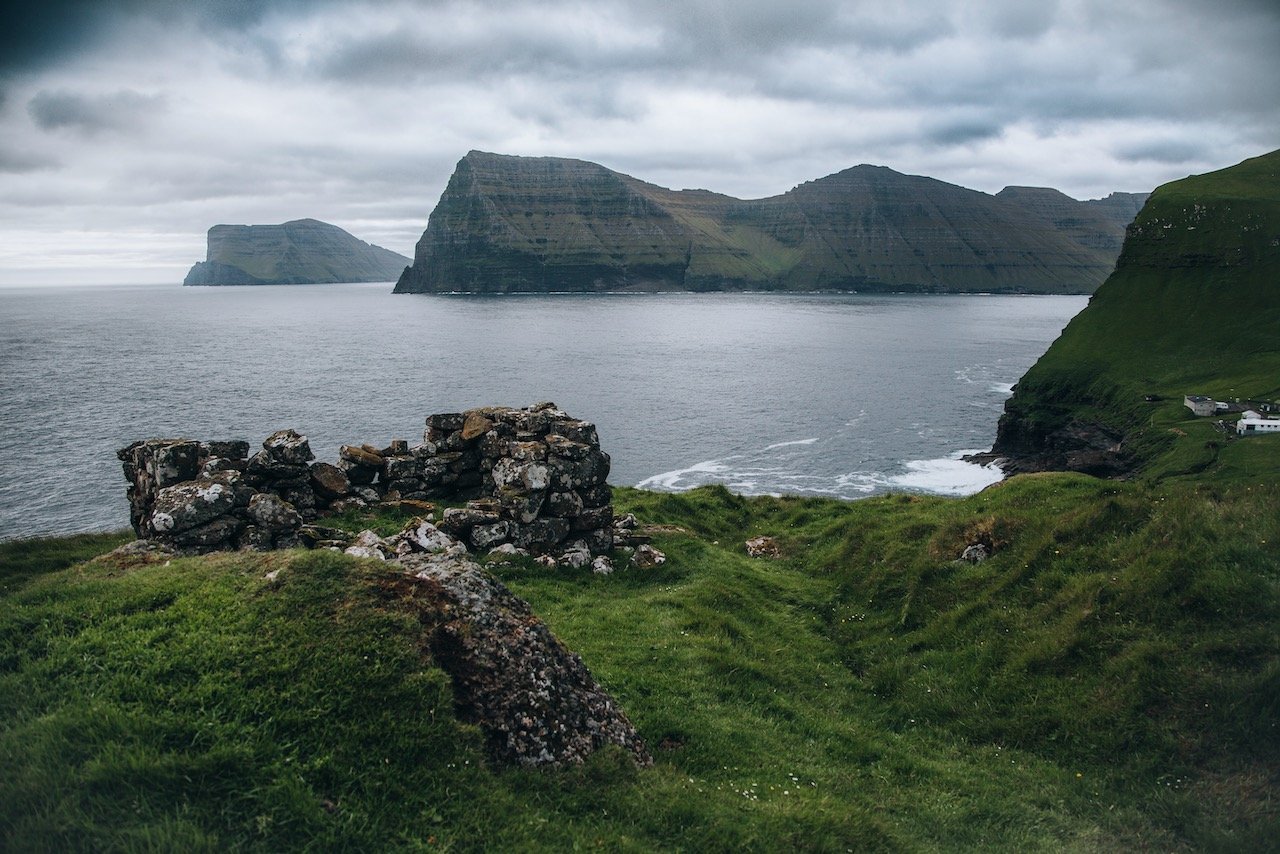
The village of Trøllanes is located on the northern tip of Kalsoy. Its name translates to ‘Troll Peninsula’, due to yet another legend of the area. Nonetheless, this is where you go to hike towards the awesome Kallur Lighthouse.
Starting from the parking area in town with the public bathroom, you make your way north to a fenced off area. When you go through the gate, you follow the somewhat meandering path up to the right of mountainside. After ascending for about 20 minutes, you will reach a point where you pass some old ruins and see the lighthouse far in the distance. Then just follow the respective path there and you have reached your destination. It’s as simple as it seams.
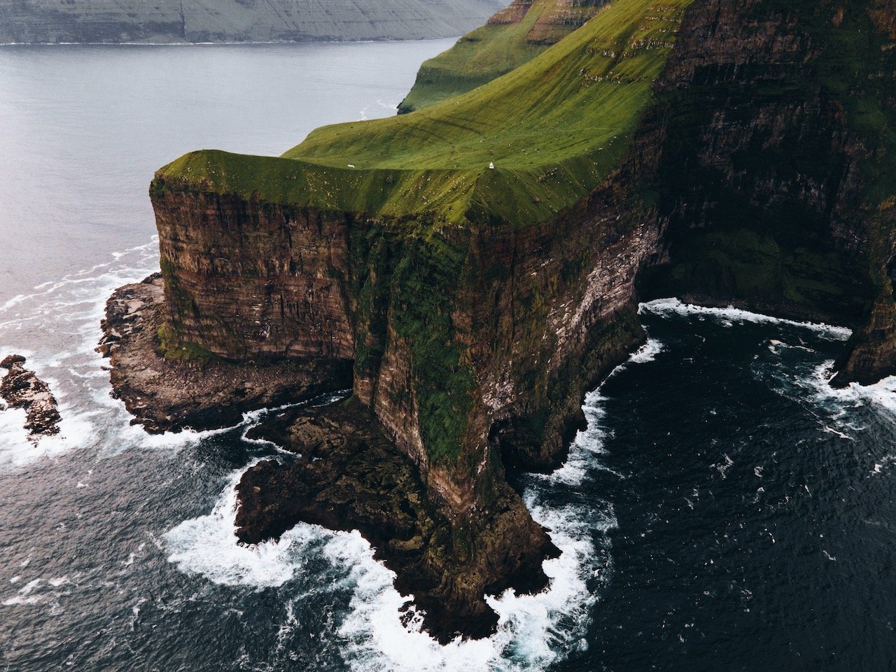
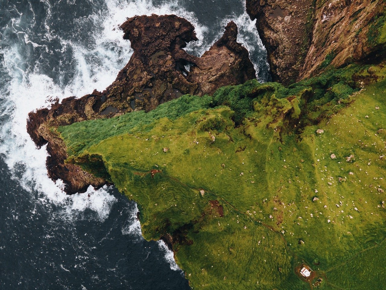
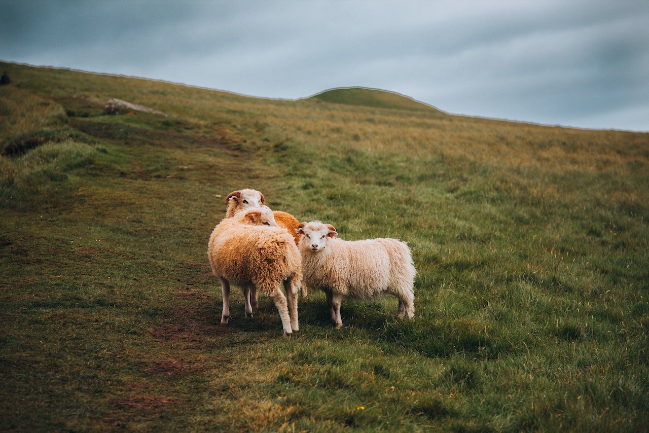
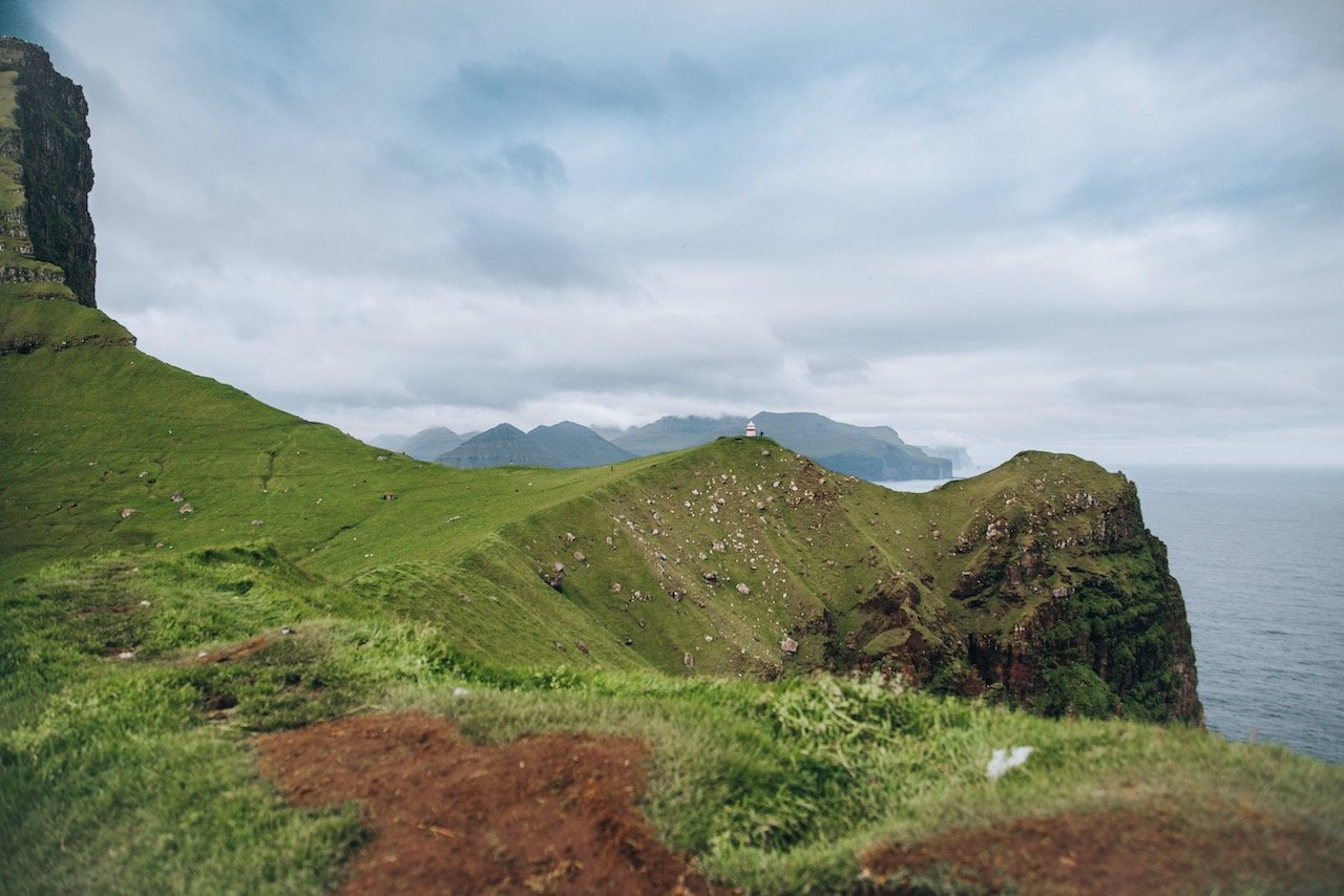
The landscape around this place was just incredibly. It reminded me of the plush green rolling hills that was the default wallpaper for Windows XP. Only a few sheep lived here, who usually stayed away from tourist visitors.
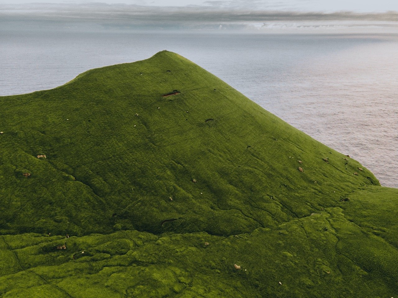
After walking up to the lighthouse, I walked further towards the end of a ridge where I had a great 360 view of the entire area. This was the perfect spot for photos with my drone.
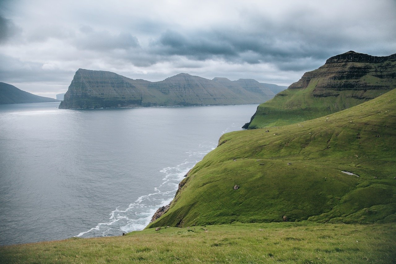
Here I found it best to sit and rest, while also getting some food into my stomach. I could have stayed here for a much longer time but I had to head back to catch the last ferry. Take some time here though to not just see the lighthouse, but to gaze at the scenery and look down at the cliffs and waterline below.
This is by far not a comprehensive list of what to see in Kalsoy, however it should be a good representation of what you can expect when you visit. I will discuss more on what to see on each of the Faroese islands in future posts!