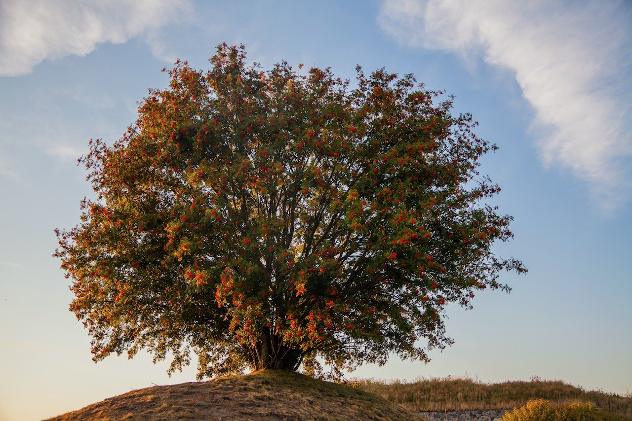
The ULTIMATE Guide to the Nordics

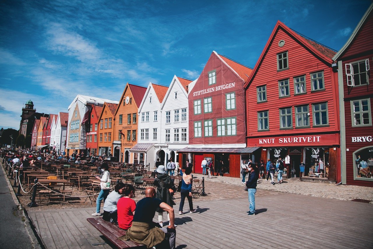
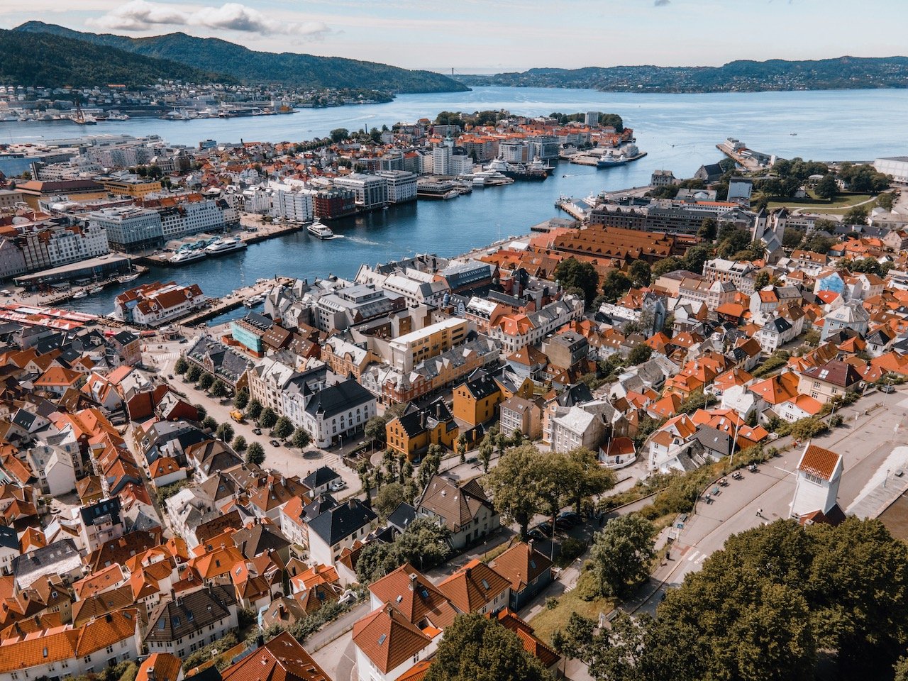
Bryggen, Bergen, Norway (ISO 100, 24 mm, f/4.5, 1/1600 s)
(Some links in this post are affiliate links. If you click through and take action, I'll be compensated.) If you are also interested in any PRINTS from any of my posts, be sure to check out my store where you can buy prints as posters, in metal/wooden frames or on canvas.
People don’t often think about the Nordics as a popular vacation spot. When you consider how cold these countries can be, how dark they can be, and how expensive they are, it kind of makes sense. I will be the first to say that this mindset is a mistake!
The Nordics are countries of Northern Europe and the North Atlantic composed of the countries of Sweden, Norway, Finland, Denmark, Iceland, the Faroe Islands as well as Greenland and Åland (autonomous islands owned by Finland).
I have been lucky enough to live in Sweden for a few years now, so I already have the advantage of living in the Nordics, allowing me to explore more of it. As such, I have been privileged to see not just the capitals of all these countries (Check out my blog post about the Nordic capitals), but many cities and natural attractions as well.
This post is broken down by each Nordic country, followed by specific places in those countries and my blog posts about each one of them. Therefore, you have a complete breakdown of each place that I have been to and have experience in myself. Feel free to also check out the videos and photos I have posted to get a flavor of what you can expect in these places.
Break down of each country and the cities/natural attractions I will discuss:
Sweden (Jump to section): Stockholm, Gothenburg, Malmö, Uppsala, Lund, Helsingborg, Kalmar, Öland, Marstrand, Visby, Fårö, Gotland, Swedish Castles
Norway (Jump to section): Oslo, Bergen, Stavanger, Tromsø, Trolltunga, Preikestolen, the Lofoten Islands
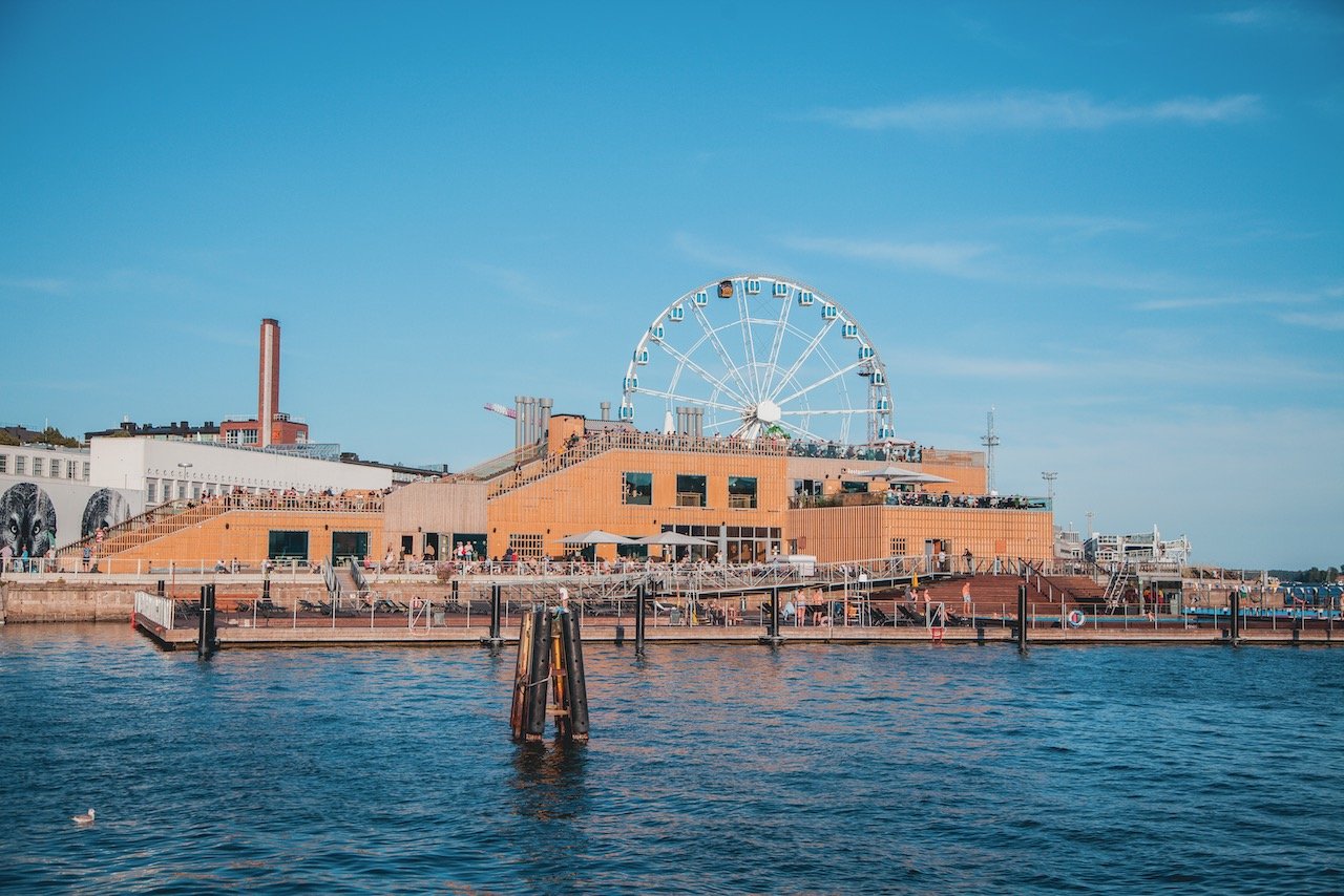
Finland (Jump to section): Helsinki, Suomenlinna
Denmark (Jump to section): Aarhus, Odense, Copenhagen
Iceland (Jump to section): Reykjavik, South Coast, Snaefellsnes Peninsula, Eastern Iceland, Northern Iceland, Iceland Waterfalls/Churches/Lighthouses
Faroe Islands (Jump to section): Tórshavn, Vágar, Streymoy, Eysturoy, Bordoy, Kalsoy, Vidoy, Mykines, Sandoy, Kunoy, Faroe Waterfalls
If you like some of my photos that you have come across, just know that I have many prints showcasing a variety of landscapes, including the Nordics, available for purchase below! (Sold as Posters, Canvas, or in Metal-Frames and Wooden-Frames).


Sweden
Stockholm, Gothenburg, Malmö, Uppsala, Lund, Helsingborg, Kalmar, Öland, Marstrand, Visby, Fårö, Gotland, Swedish Castles
My expat journey has taken me from my home in the US, to South Africa, to England, and now to Sweden and I can say that without a doubt, this country is my absolute favorite to live in.
I can’t quite put my finger on what makes Sweden such an attractive place but here are a few things that I have come to learn (and appreciate) about this country:
A strong emphasis on appreciating nature is instilled in every Swede from birth
Virtually all Swedes speak flawless English (among other languages)
Swedes usually keep to themselves but will help you out if you ask for it without hesitation
Midsummer is the most important national holiday, coinciding with the longest day of the year
Fika (a coffee break) is an institution; many jobs yield time for a fika or two during the work day


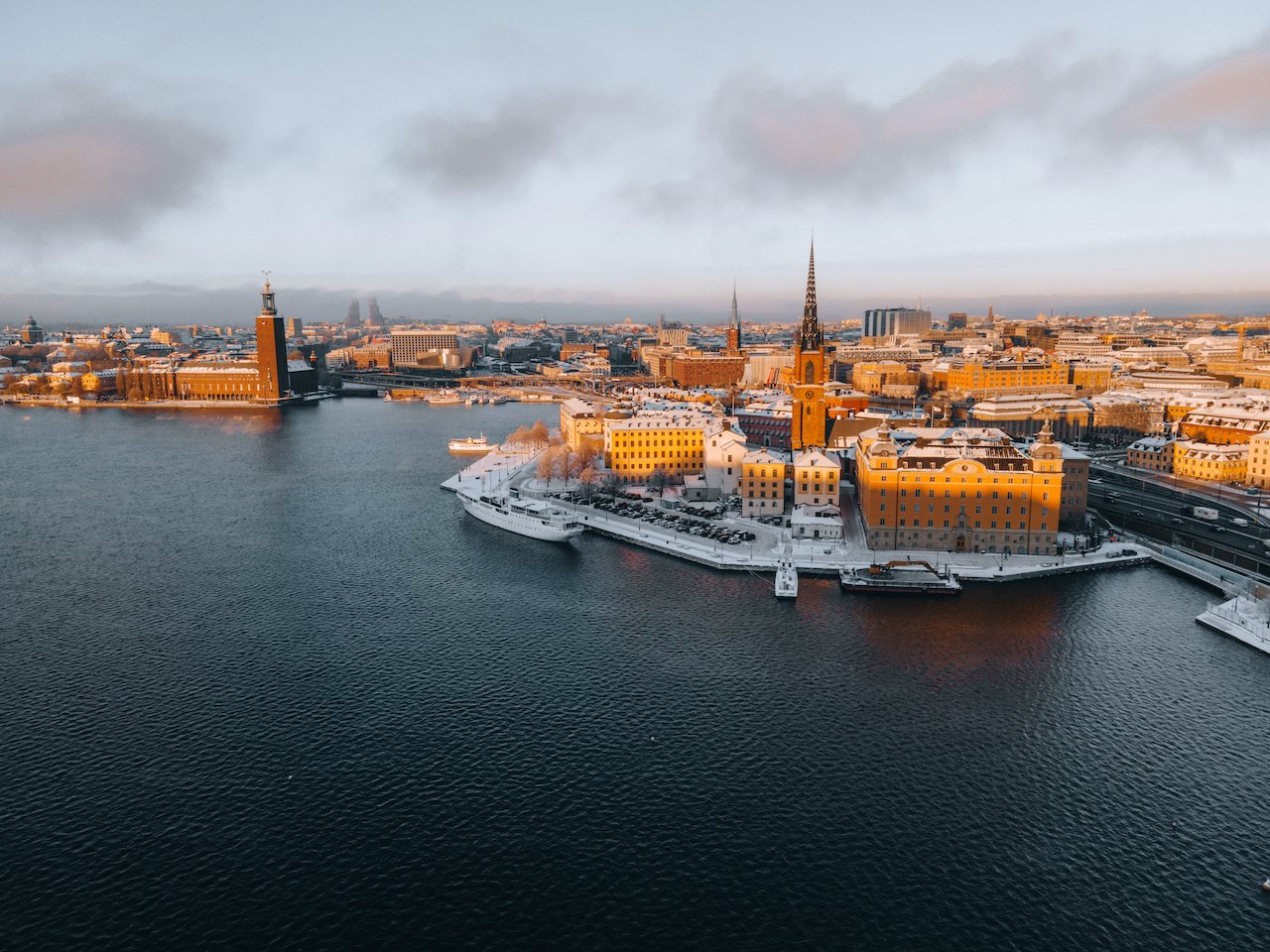
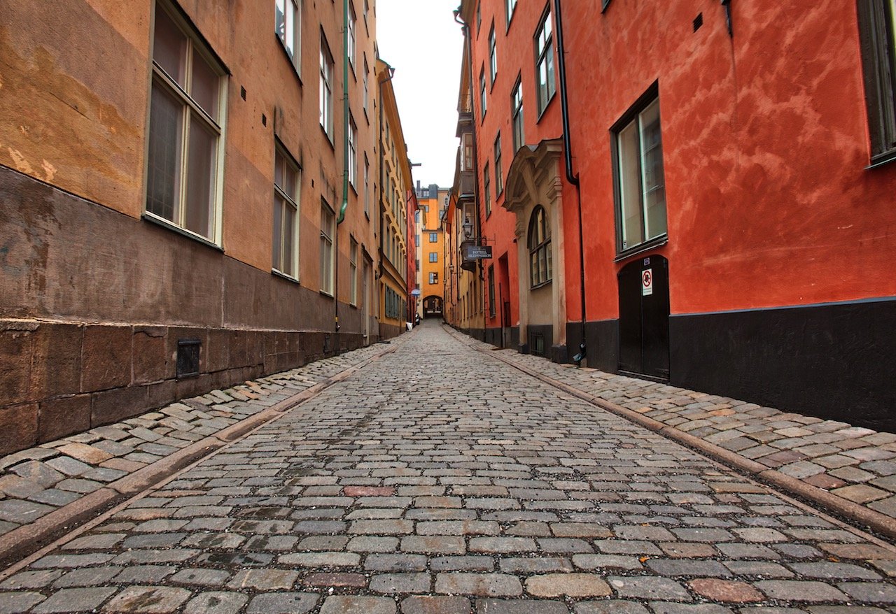
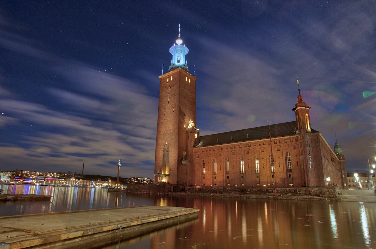
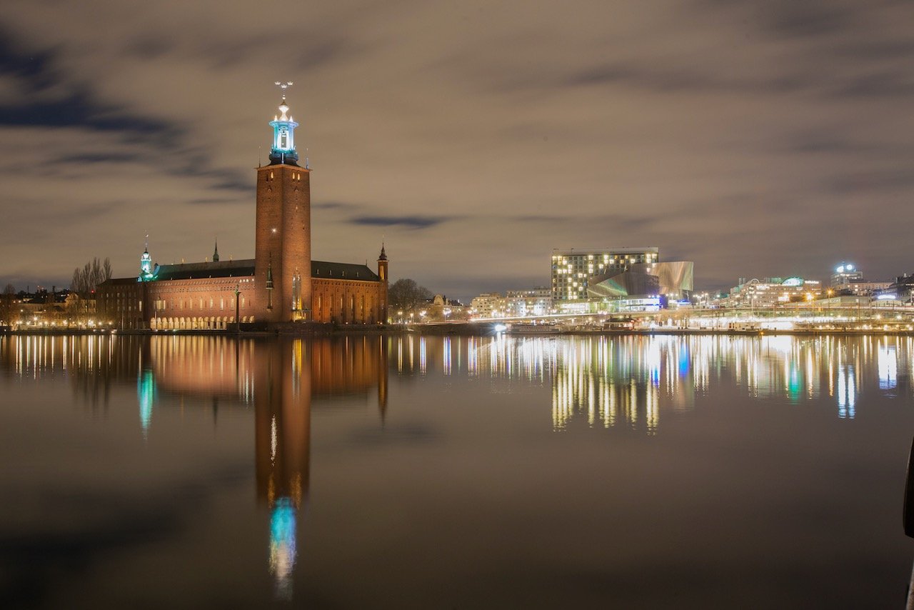
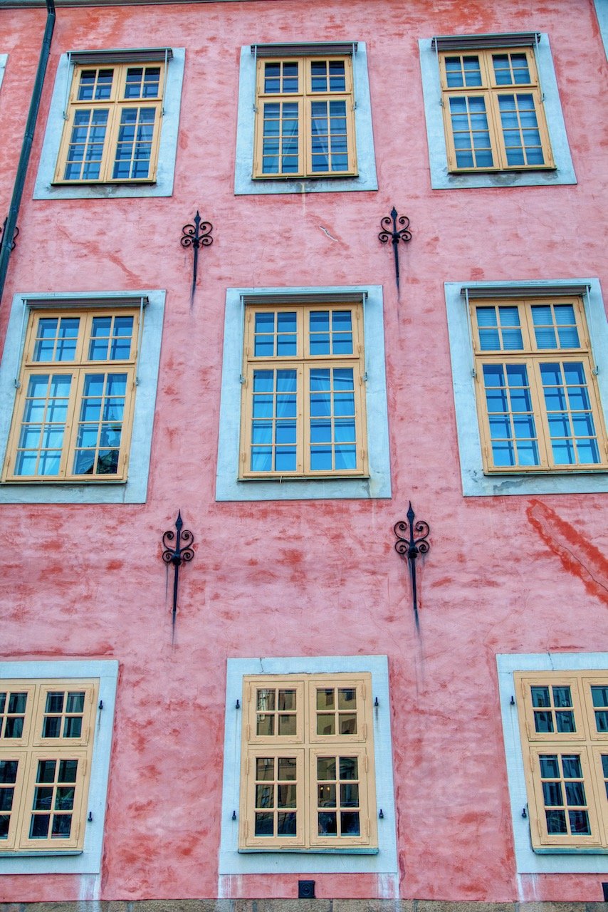
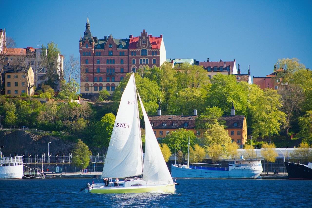
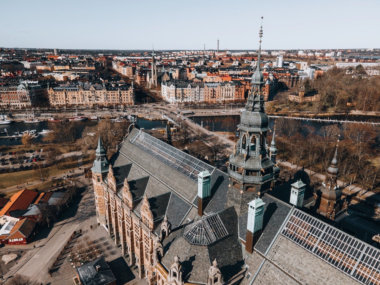
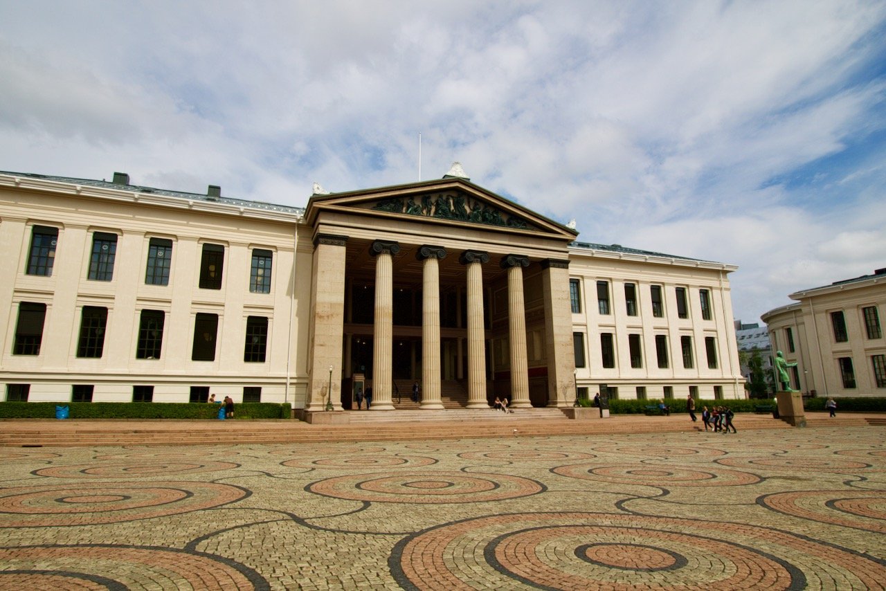
Stockholm
(See Blog Post - Why Stockholm is the Best Scandinavian Capital)
When compared to other cities in the world, Stockholm’s size by population is humbling (around 2.5 million people in the metropolitan area), and yet each island that make up this 14 island archipelago of a capital, has something unique to offer.
Stortorget, Rådhuset, Stenbock Palaces, The Royal Palace - all great places to see located in the Gamla Stan area
Kungsträdgården, Djurgården - Wonderful green spaces and good for people watching
ABBA, Vasa, and Fotografiska Museums
Monteliusvägen, Skinnarviksberget, Erik’s Gondolen, Norra Riddarholmenshamn - great for golden hour and sunsets!
Vete-Katten, Kajsas Fisk, Orangeriet, Greasy Spoon, La Neta City, Stampen for food/entertainment
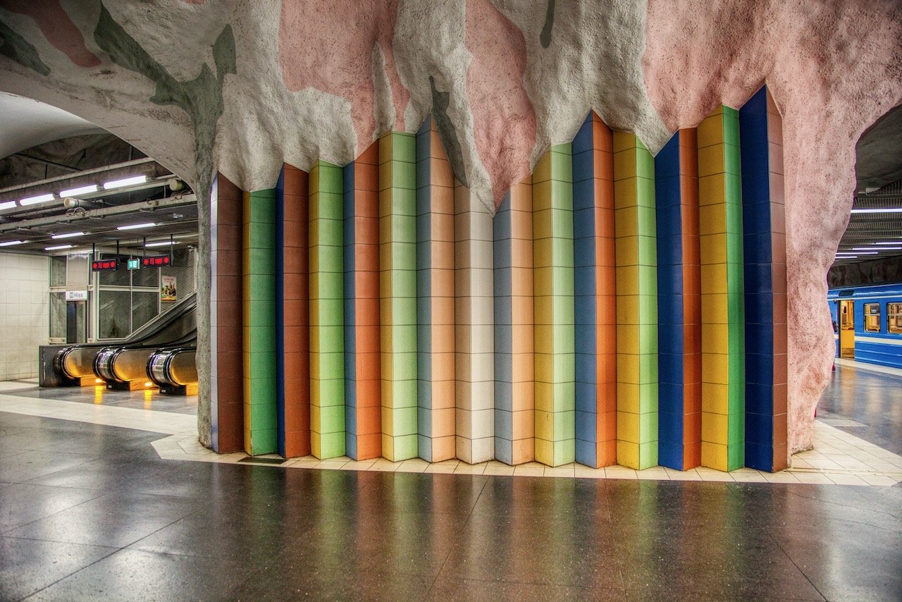
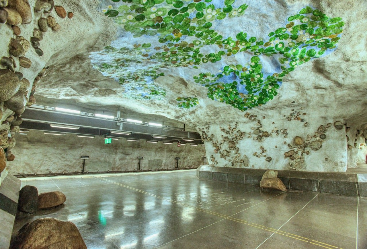
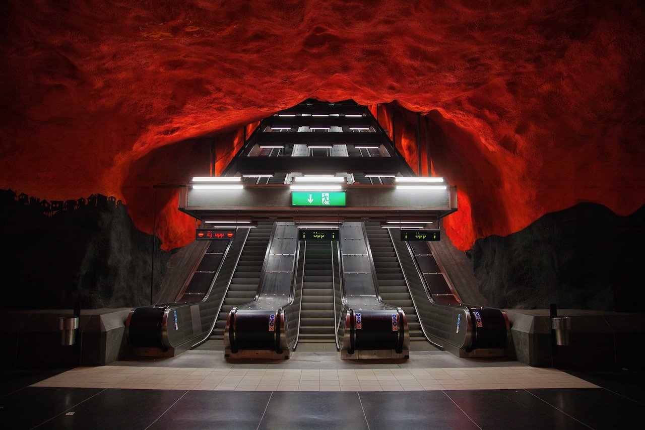
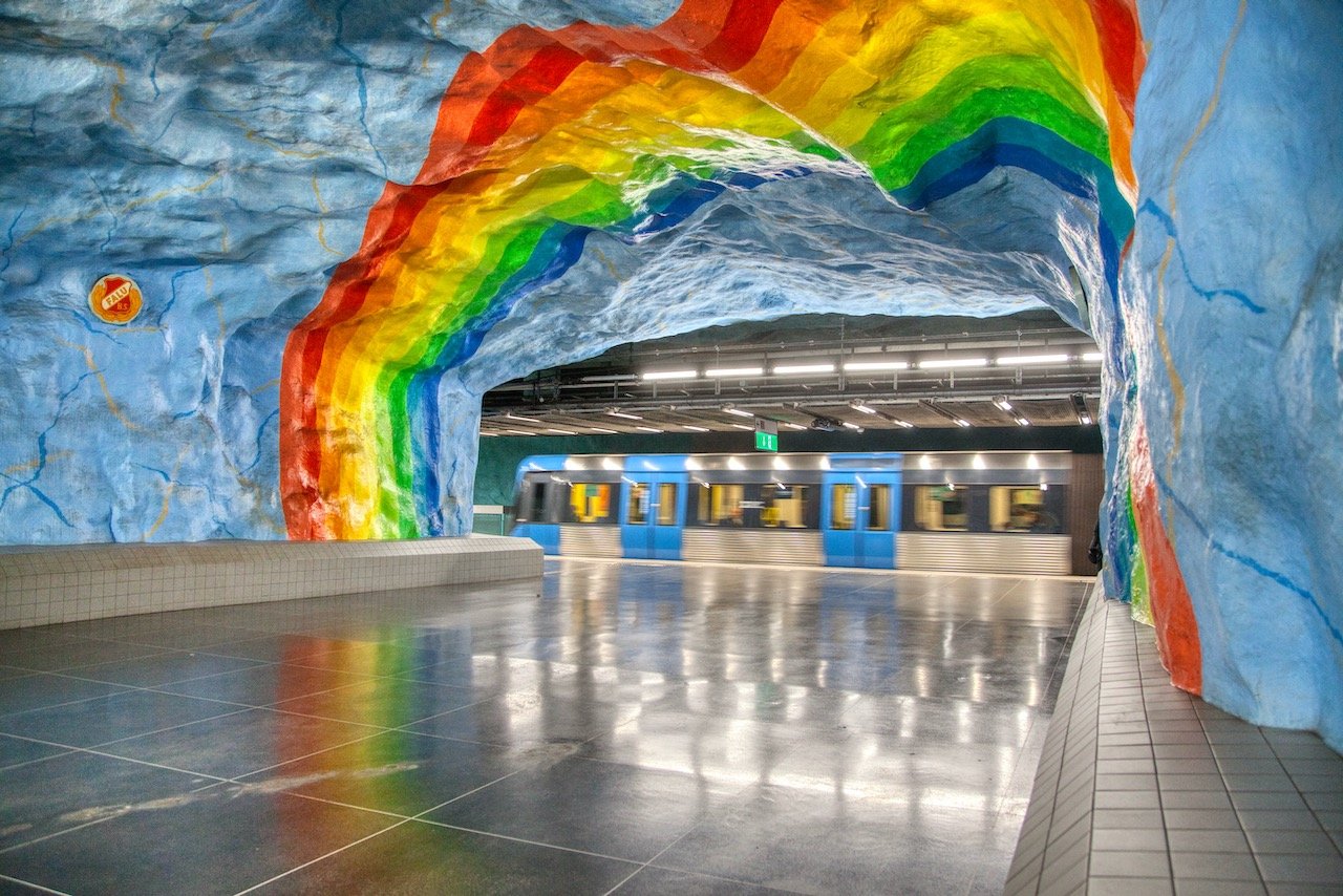
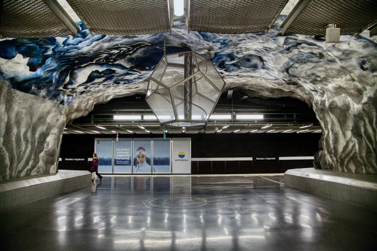
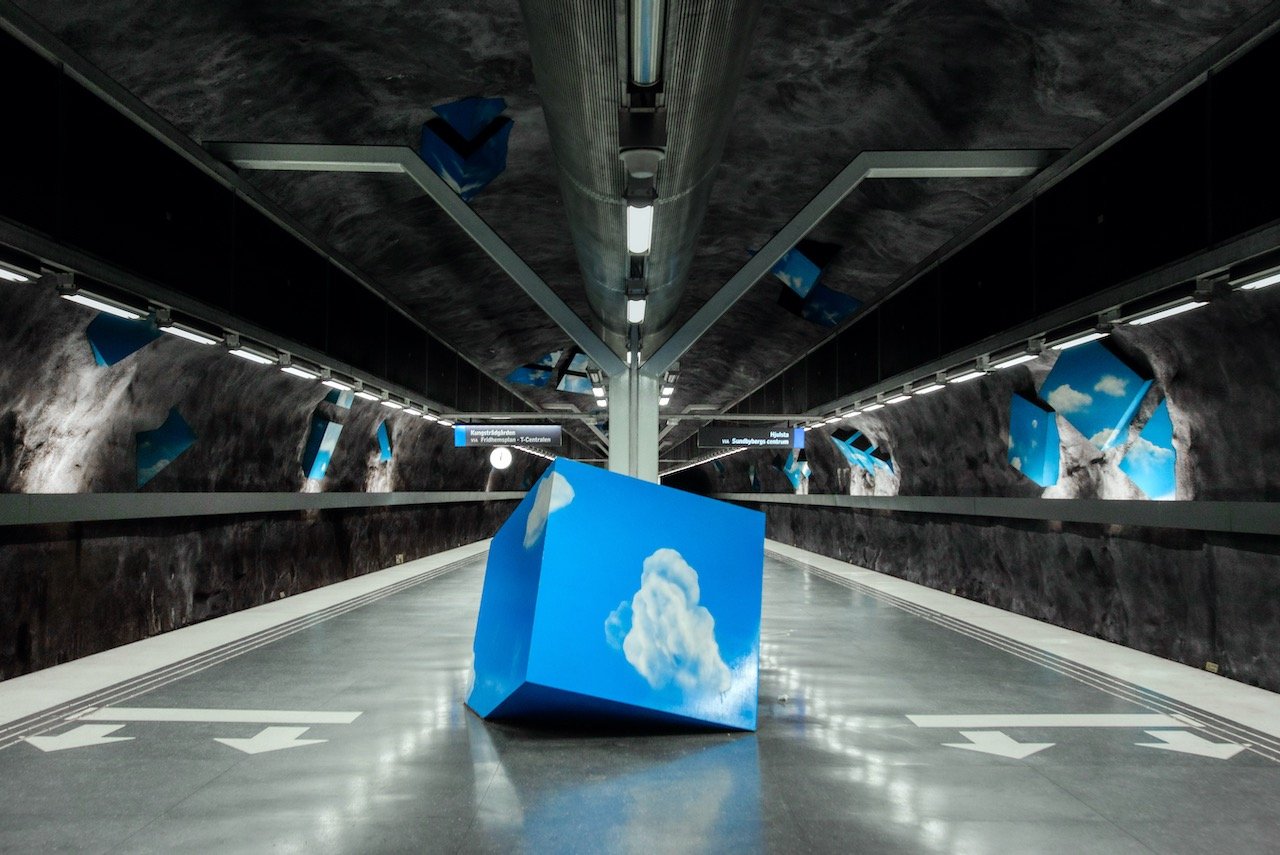
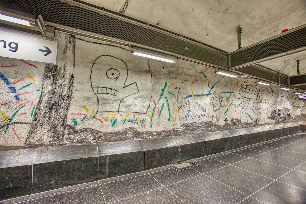
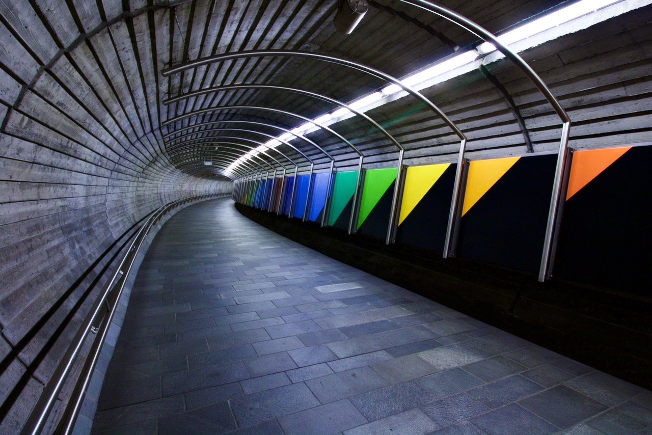
Solna Centrum, Solna Strand, Universitetet, Stadion, Tekniska Högskolan - artsy tunnelbana stations
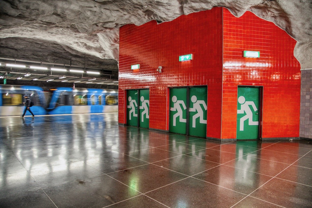
Stockholm Tunnelbana
(See Blog Post - The World’s Longest Art Gallery: Riding on the Stockholm Tunnelbana)
It seems quite ununsual that one of the things people suggest you do in Stockholm is to simply ride the metro system. However, you will find that this is particularly the case, not just for this city but a few others in the world as well (Moscow, London, New York). The Tunnelbana in Stockholm is considered the world’s longest art gallery, as many of the stations themselves feature works from [mostly] swedish artists.

Gothenburg
(See Blog Post - A Tour of Gothenburg: Sweden's 2nd Largest City)
Gothenburg is Sweden’s 2nd most populous city, located on the west coast of the country and within close proximity to Norway (to the north) and Denmark (to the south). This strategic location makes Gothenburg the largest port in all the Nordic countries. From here, you can take ferries to Germany and Denmark. Considered to be the ‘biggest little city’ in Sweden, Gothenburg is easy to navigate (by tram and buses), and offers plenty of attractions to take in as a weekend (or longer) visitor. Furthermore, the archipelago just off the coast provides an excellent escape to those wishing to flee the city noise (more on this below).
Gunnebo House, Skansen Kronan historical sites
Seminarieparken, Slottsskogen, Palm House (Horticulture Gardens)
Slottskogsobservatoriet Museum
Feskekörka, Stenpiren/Lilla Brommen for good views
Haga/Lejontrappen, Röda Sten Konsthall, Liseberg
Gothenburg Archipelago:
North - Vinga, Fotö, Hönö, Grötö, Kalvsund, Öckerö, Björkö, Hälsö, Källö-Knippla, Hyppeln, Rörö.
South - Asperö, Brännö, Köpstadsö, Vargö, Stora Förö, Knarrholmen, Styrsö, Donsö, Kårholmen, Sjumansholmen.
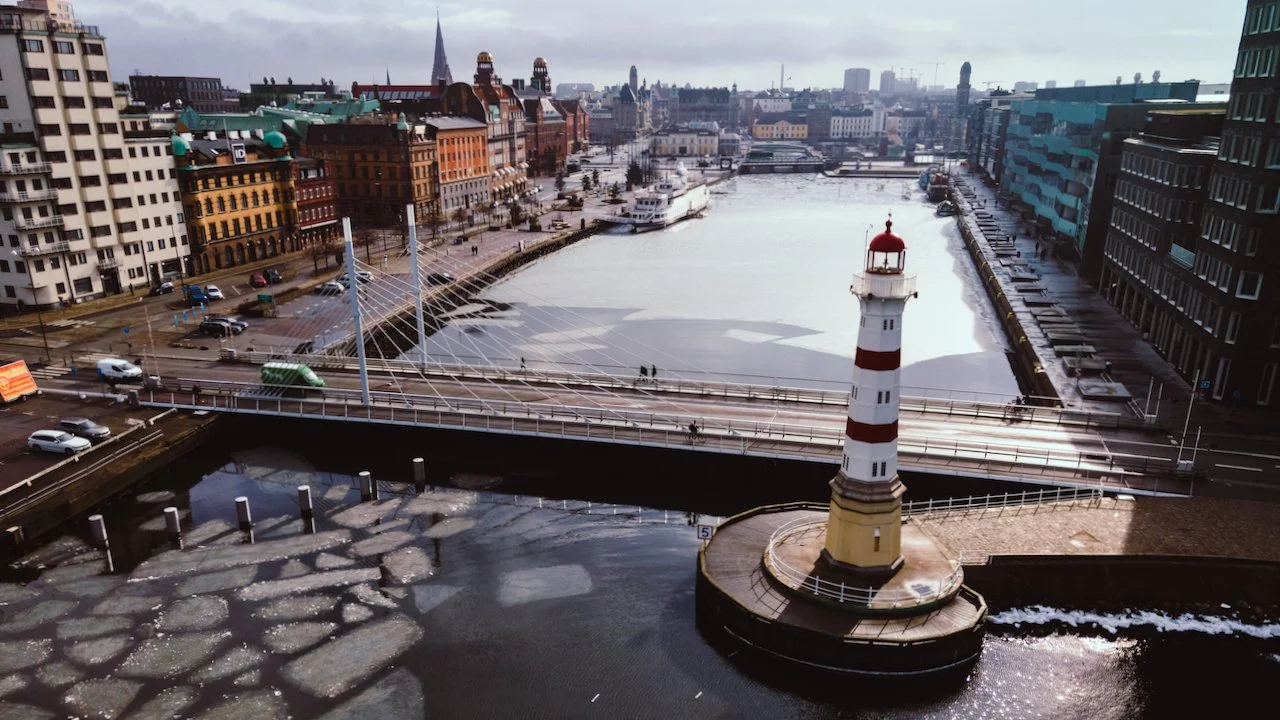
Malmö
(See Blog Post - Take a weekend break in Malmö, Sweden)
Malmö is Sweden’s 3rd largest city (6th largest in Scandinavia), situated in the southern region of Skåne. What was once a very industrialized city has now evolved into a biotech and IT hub. Half of the population of the city has a foreign background due to the influx of refugees that Sweden has accepted in recent years. This has turned the city into a melting pot of cultures giving it a different feel than traditional Swedish cities. A weekend trip to Malmö is a worthy proposition for those looking to experience a city with many modern conveniences but with cultural and historical entities of Sweden’s storied past.
Malmö Castle - originally built by Denmark in 1434.
Gamla Väster - old charming area in the city center.
St. Peter’s Church - a brick Gothic church located just Northeast of Gamla Väster.
Kungsparken and Slottsträdgården - both park lie near the Malmö City Library and Malmö Castle
Ribersborgsstranden - beach with a great view of Øresund bridge and access to the Open-air bath.
Turning Torso, Øresund bridge, Lilla Torg, Malmö City Library, Malmö Lighthouses - cool places
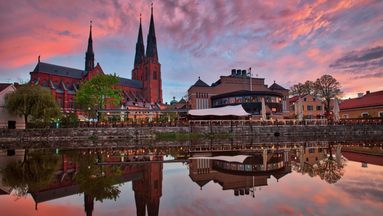
Uppsala
(See Blog Post - Uppsala: the hidden gem just North of Stockholm)
Most people who come to Sweden only really know about Stockholm, or maybe even the second largest city of Göteborg (Gothenburg), but Uppsala usually doesn’t come to mind (Sweden’s fourth largest city). Uppsala is a short 40 minute train ride from Stockholm Central which makes it ideal for a day/weekend trip and is easily walkable. It’s known as a university town as Uppsala University is the oldest in the country (established in 1477).
Linneanum, Uppsala Castle, Uppsala Cathedral, Gamla Uppsala - historical sites
Stadsparken, Engelskaparken, and Hågadalen-Nåstens Naturreservat
Linneanum Orangery and Tropical Greenhouse - museums
Gotlandsparken for great views
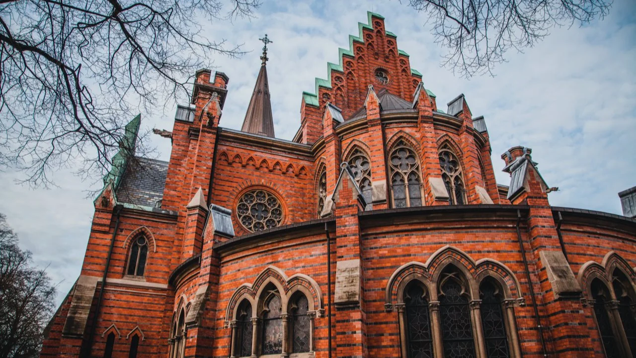
Lund
(See Blog Post - A Day Tour of the University town of Lund)
Lund is one of the two university towns in Sweden (the other being Uppsala). That means it is at its most lively when school is in session. Interestingly enough, its founding dates all the way back to 990 when it was then a part of Denmark (there have been so many wars fought between these Scandinavian neighbors that at one point Denmark ruled everything, and then Sweden did, and then repeat).
Lund Cathedral, All Saints Church - historical sites and landmarks
Lundagård, Botanical Garden - parks
Kulturen - museums
Stora Torget - place to see
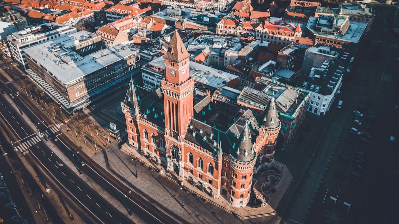
Helsingborg
(See Blog Post - Just a few reasons to see Helsingborg in the South of Sweden)
Helsingborg is a coastal city in the south of Sweden, otherwise known as Skåne. It sits just a few miles away from Helsingør, Denmark on the Øresund Strait. It is the 9th largest city in Sweden by population with about 112,000 inhabitants. It is one of the oldest cities in Sweden, as it was first permanently settled in 1085. It’s strategic position on the coastline was very important to Denmark, because controlling both sides of the Øresund Strait allowed the Danish King to tax transit through it.
Kärnan, Rådhuset - historical sites
Slottshagen for parks
Örestrandsbadet for good views
Helsingborg Lighthouse and Pilot House, Helsingør, Ven are some cool places to see
Kalmar
(See Blog Post - Kalmar: The town you should know more about in Sweden)
Kalmar is located in the Southeast corner of Sweden and sits on the Baltic Sea. As the 30th largest city in Sweden, you may not understand why there is a draw to go there. This small town is really defined by its collection of 17th and 18th century buildings still standing and for its castle that served it well during the Scanian War. Currently, the city has been instrumental in its drive to remove its dependence on fossil fuels by initiating a variety of reform programs.
Kalmar Cathedral, Kalmar Castle, Tripp Trapp Trull historical sites
Laboratorieholmen, Stadspark, Svinö for nice parks
Kalmar Konstmuseum
Kalmar Slottspark for great views

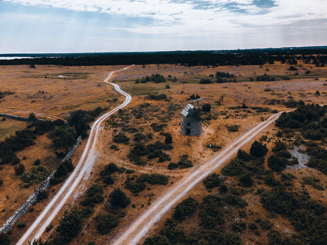
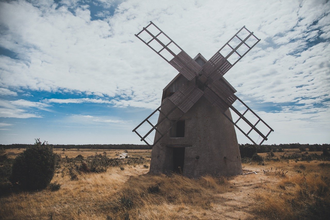
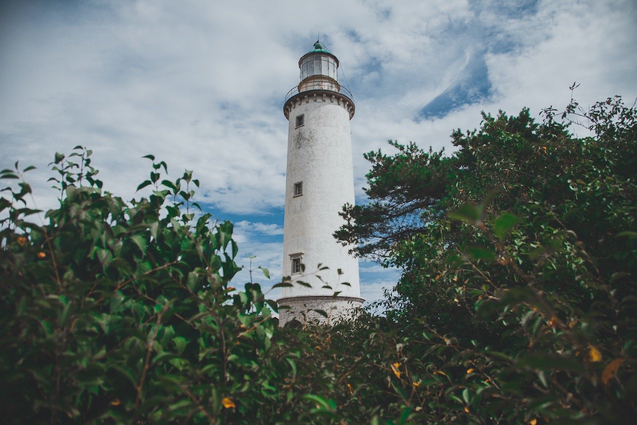
Öland
(See Blog Post - A Day Tour of the Swedish island of Öland)
It wasn’t until my visit to the small Swedish city of Kalmar, that I had first heard about the island of Öland, which lies right next to the city, accessible by a bridge and is full of old relics of Sweden’s past. So you can rest assured that I took some time out to explore this island when visiting Kalmar. The origins of Öland date back to around 8000 BC where early settlers were able to access the island (and present-day Kalmar) by using an ice bridge that formed across the Kalmar Strait. The island is full of Viking-age burial grounds and ring forts, all of which have yielded about 24,000 artifacts to date.
Ismantorp Fortress, Borgholm Castle, Eketorps Borg, Träby Borg are some historical sites
Köpingsvik Beach, Lerkaka, Karl X Gustavs Mur are nice parks
Långe Jan, Långe Erik for some cool lighthouses!
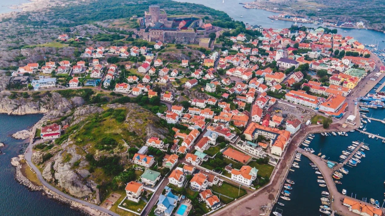
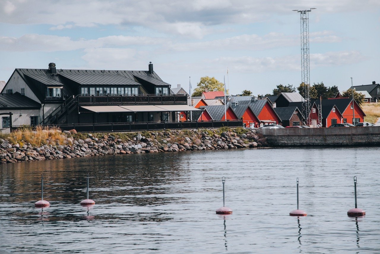
Marstrand
(See Blog Post - A day trip to the Swedish island of Marstrand)
Marstrand has always been one of those places I have heard about since living in Sweden, but was never really a priority for me to see. It’s not so much a city, but an island, situated about an hour north of Sweden’s 2nd most populous city of Gothenburg. The island is a popular spot for sailing and boat races. It has a population of around 1,320 inhabitants and is part of Västra Gotland county. The best thing to do on this wonderful island is to walk along its periphery and take in the wonderful coastlines, especially if you are coming in the spring and summer months. Then end up at one of the local cafes and have a coffee and Cardamom bun.
Carlstens Fästning is an absolute must see
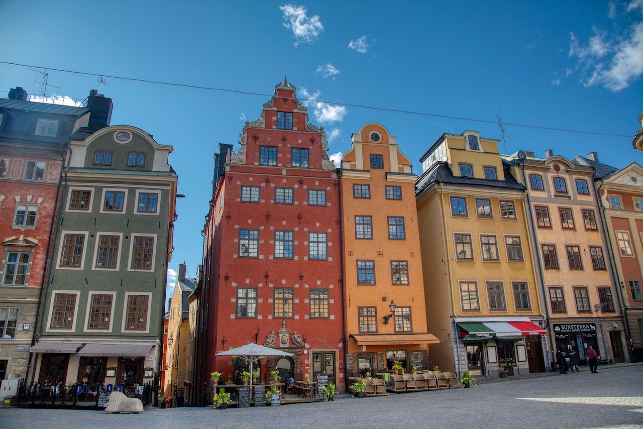
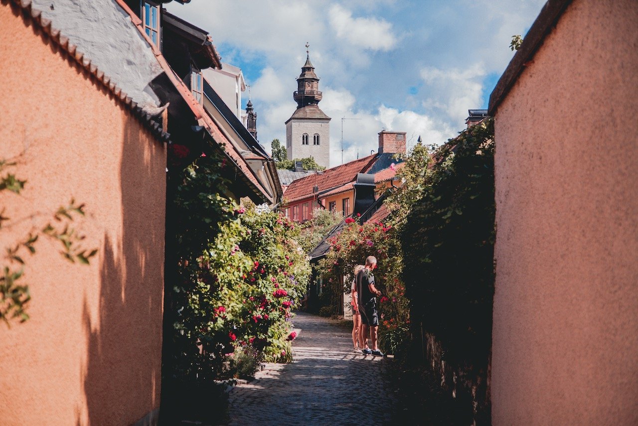
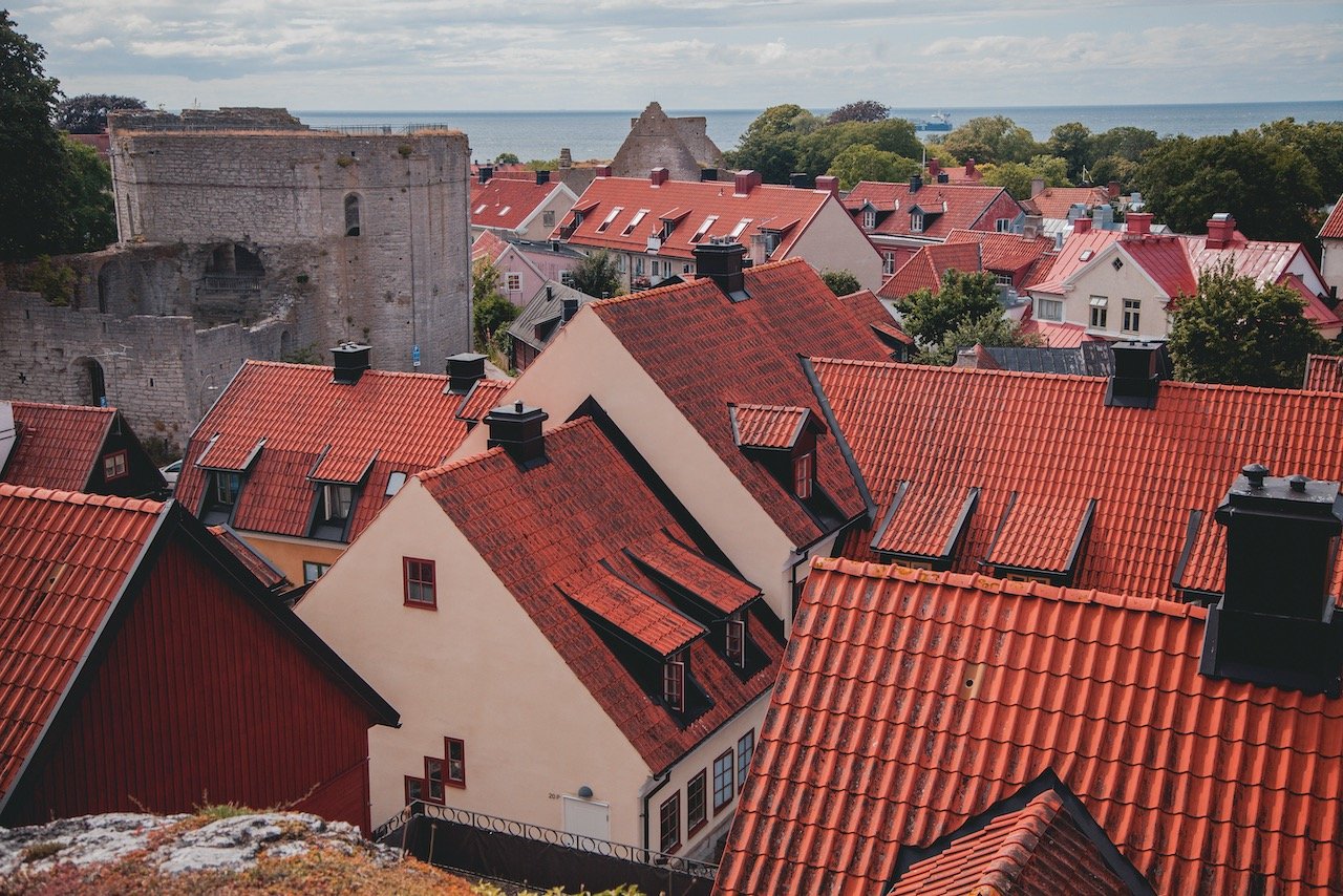
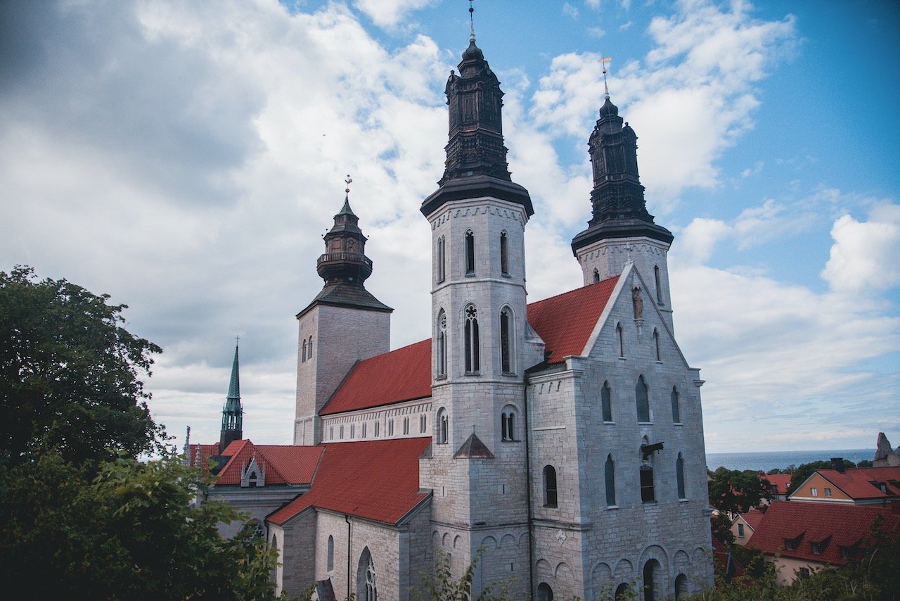
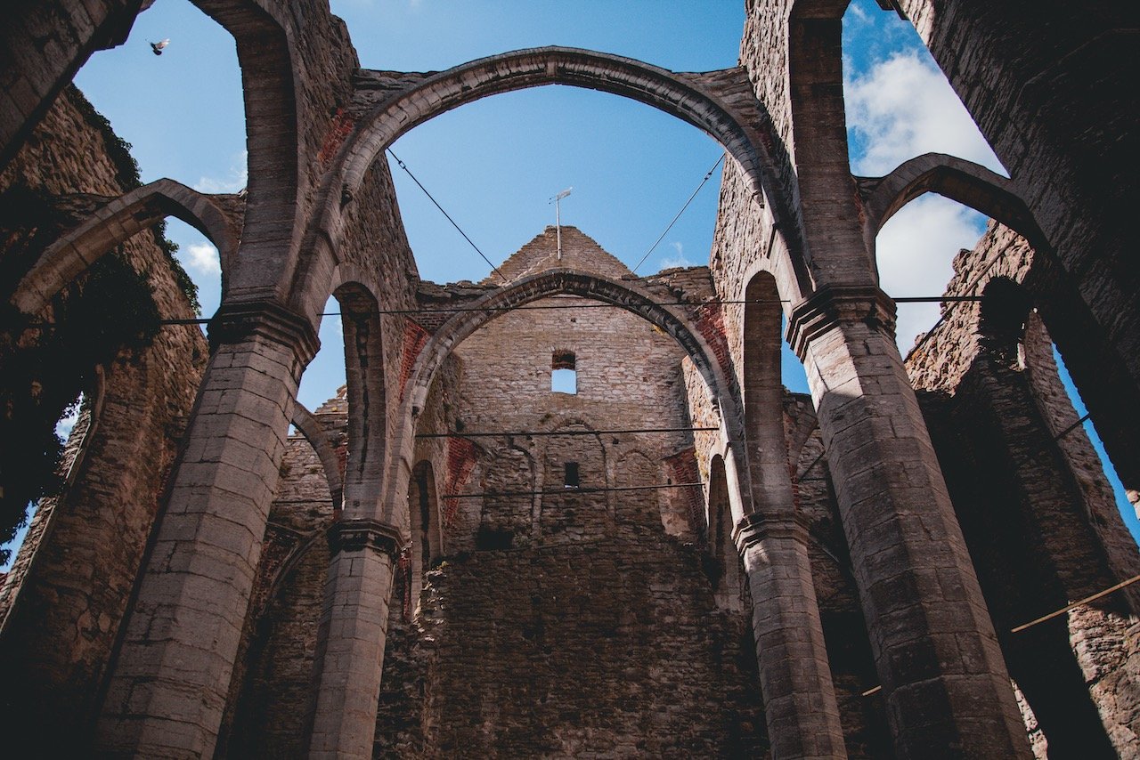
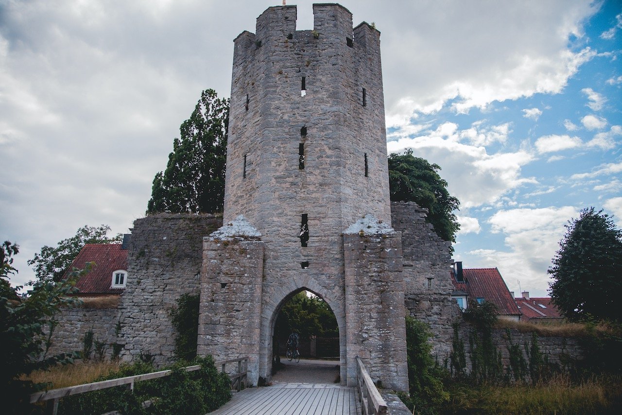
Visby
(Blog Post - A Closer Look at the Hanseatic Town of Visby in Gotland, Sweden)
Visby is a Medieval walled city, located on the Swedish island of Gotland, that houses roughly 40% of the Gotland population. The Old Town itself is in such an exceptional state that Visby was crowned a UNESCO World Heritage site back from 1995. And appropriately enough, the city hosts a Medieval Festival every year. Visby is also called the City of Roses/Ruins, and its names comes from Old Norse of the words ‘Vis’ and ‘by’ meaning ‘place of sacrifices’ and ‘village’, respectively. The city can only be reached by flying directly into Visby airport or by taking the ferry from Nynäshamn or Öland.


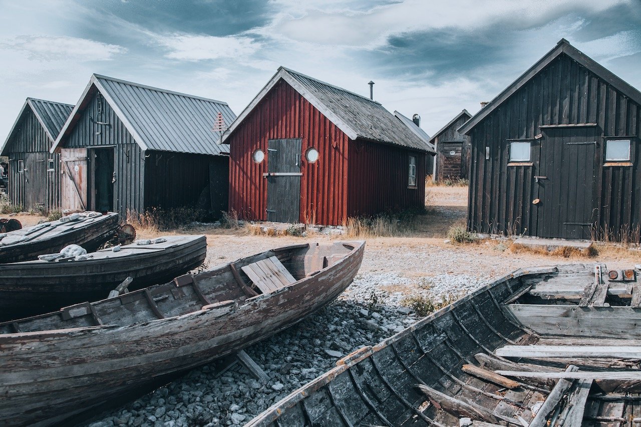
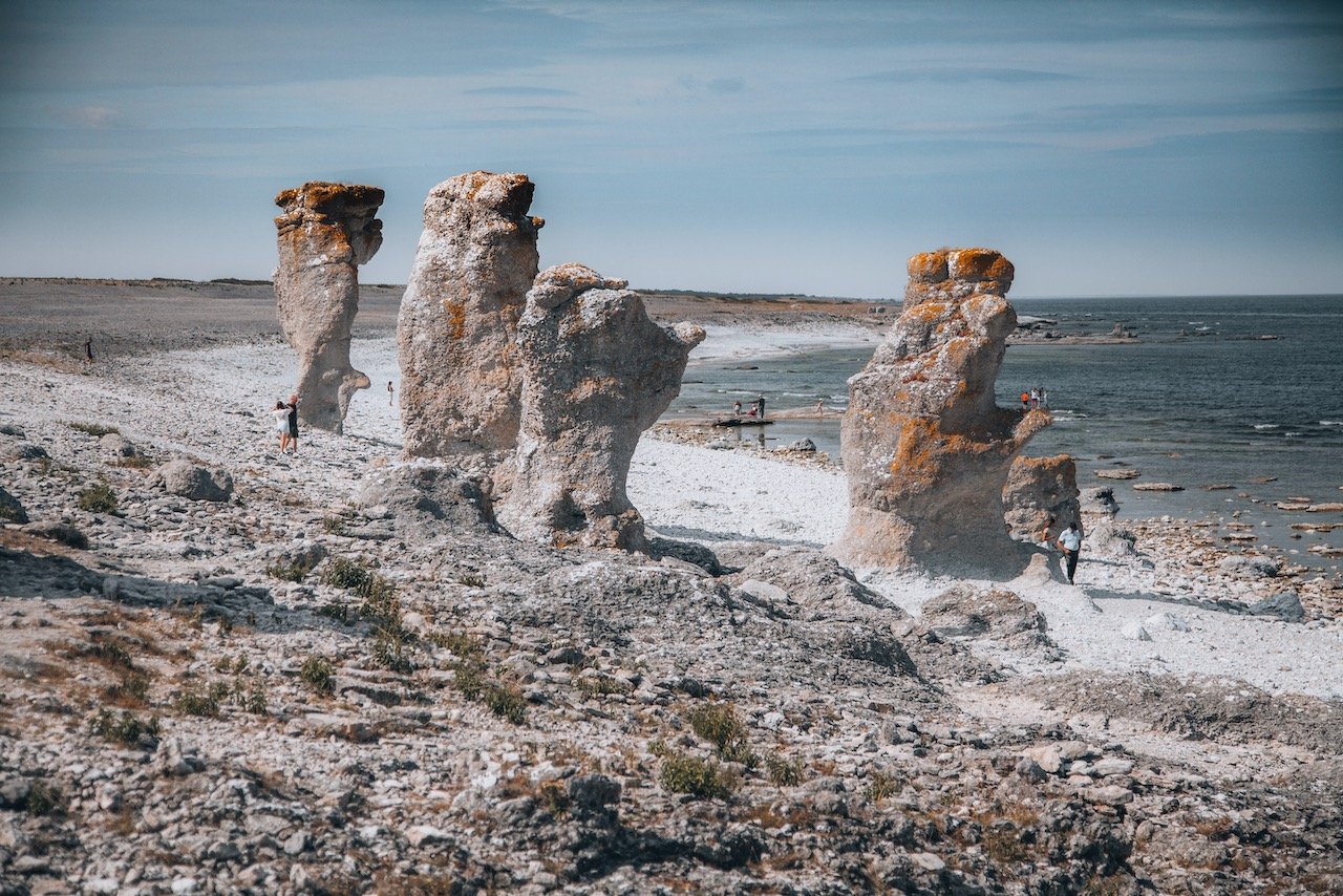
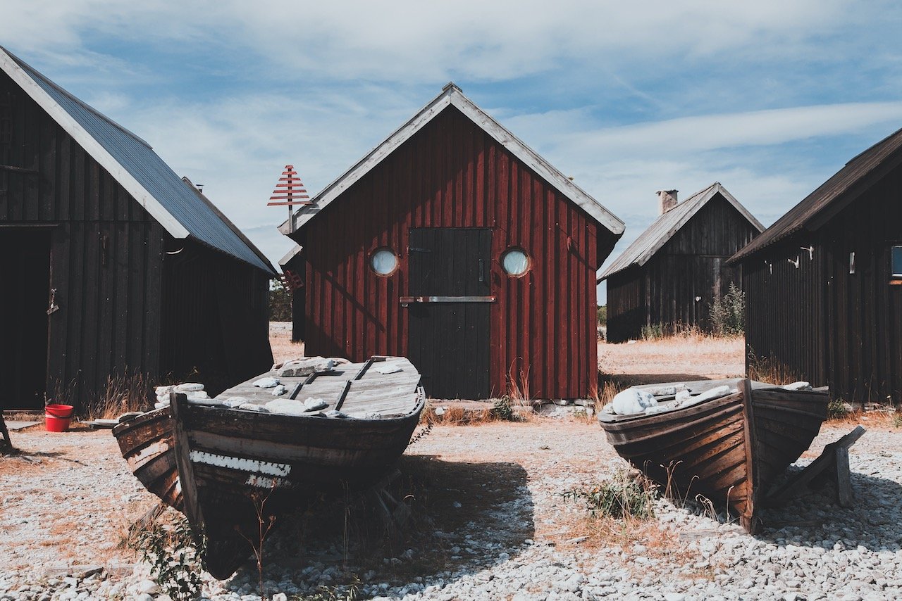
Fårö
(Blog Post - A Guide to the Swedish island of Fårö)
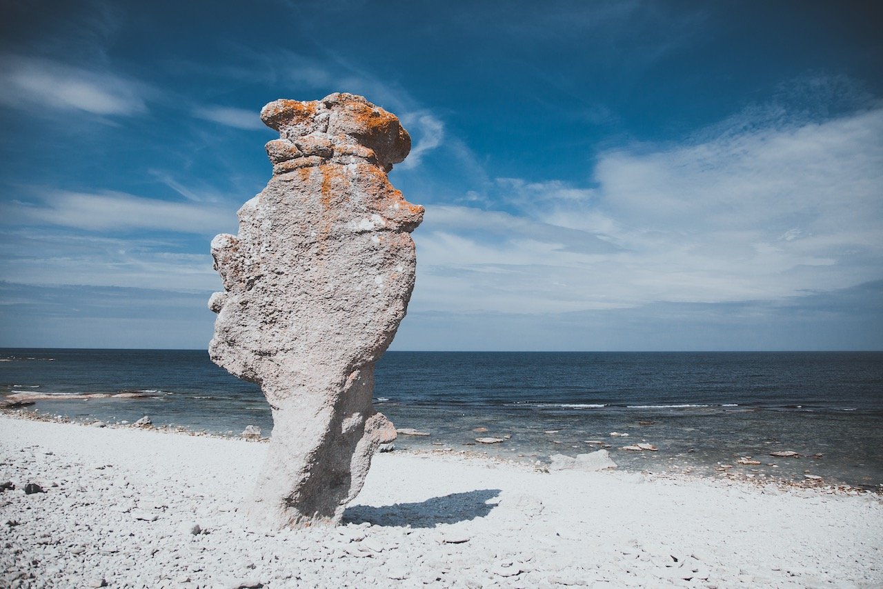
The Swedish island of Fårö sits just off the coast of Gotland in the Baltic Sea. Outside of the largest city of Visby on Gotland, it is the most popular place to visit within Gotland county. It has some spectacular natural rock formations, which I will discuss in this blog post, as well as old fishing villages and plentiful beaches to swim in the usually cold water.

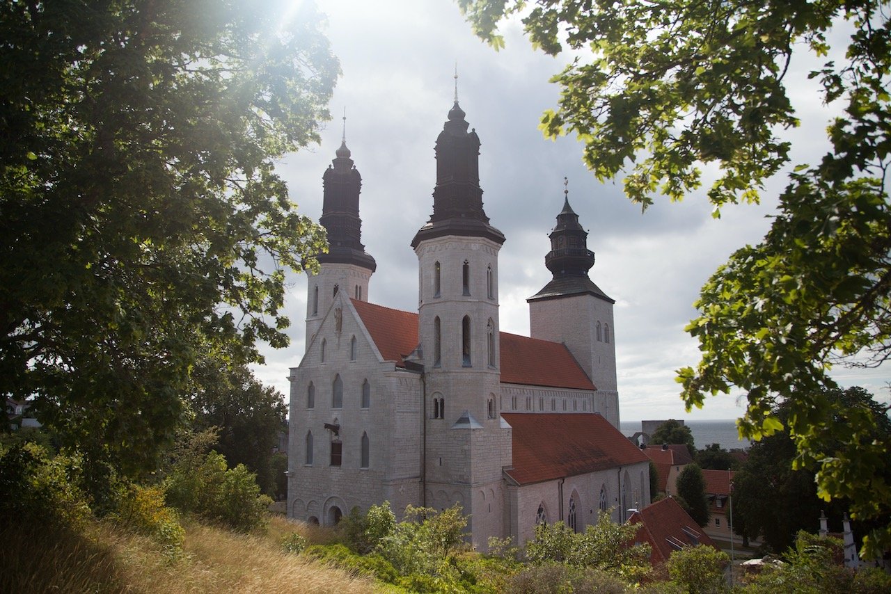
Gotland
(Blog Post - A Guide to the Swedish island of Gotland)
Gotland, located in the Baltic Sea, is the sunniest part of Sweden and arguably the best destination in Scandinavia. Its extensive shoreline and warmer climate (compared to the rest of Sweden), along with its long medieval history and intact walled city at Visby, easily made it one of my favorite places to see in Sweden. The population of Gotland is roughly, 57,000, with about 40% living in the county capital of Visby. The island can be reached by air via the Visby airport or by ferry from either Nynäshamn (via 1.5 hour train South from Stockholm) or Öland.


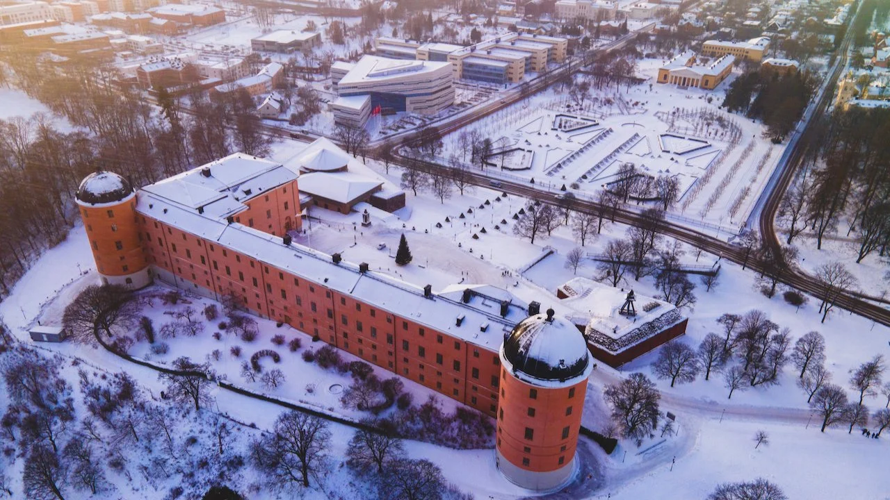
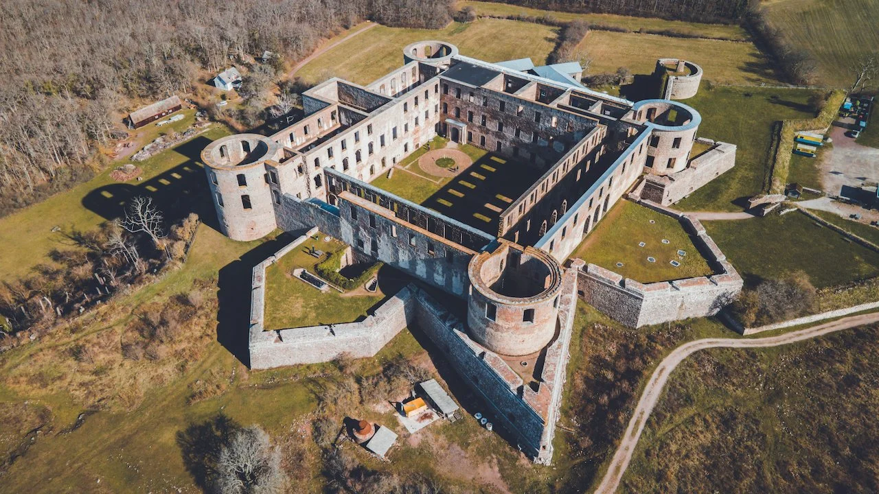
The Castles of Sweden
(Blog Post - A Tour of Sweden's Coolest Castles)
The castles that were built by the Swedes no doubt played a major role in the defense of the country. There are even some castles that were built by Swedish enemies, on conquered Swedish land at the time, which were subsequently taken back under control. As you can imagine, the history of each individual castle must be long and storied. I will talk about a handful of the castles I have been to myself and give a brief historical rundown on its existence and place in history, but bear in mind that this list is nowhere near comprehensive.

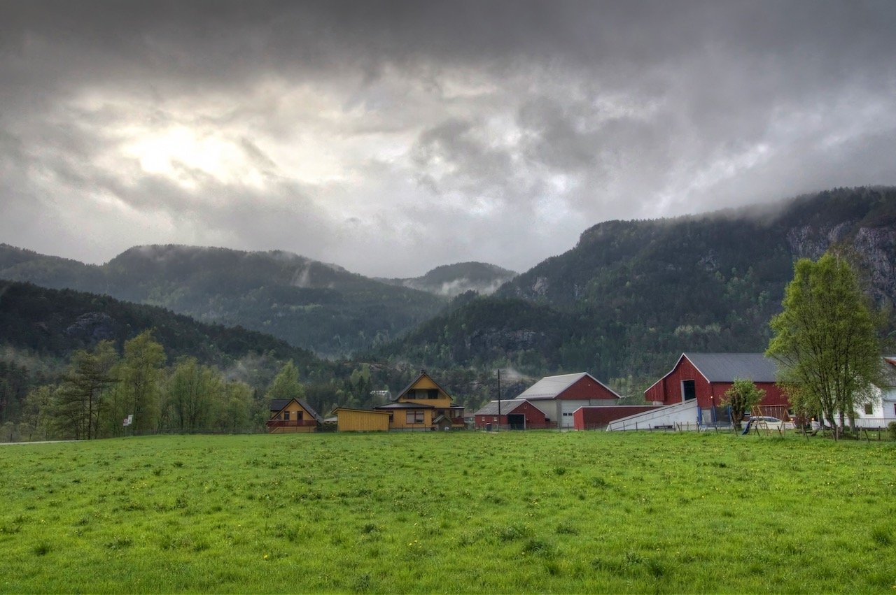
Norway
Oslo, Bergen, Stavanger, Tromsø, Trolltunga, Preikestolen, and the Lofoten Islands
Just a few things to note about Norway before your visit:
Scandinavia is Expensive, and Norway is no exception. Try to budget accordingly.
Speaking to point 1, a lot of travelers stay in hostels and cook their own meals to keep costs down.
Everyone is friendly! And they all speak excellent english.
If you want to drive through the country just know that Norway is LONG. Its true size is skewed on a typical map, so plan accordingly.
Because it is so beautiful, only take photos when you have pulled off in an appropriate area. There are accidents every year of people not respecting the road ways while trying to capture the country’s beauty.
The currency is the Norwegian Krone, or NOK.
Expect to take some ferries in your routes, which will save you time overall.


Oslo
(Blog Post - Oslo: A Guide to the Norwegian Capital)
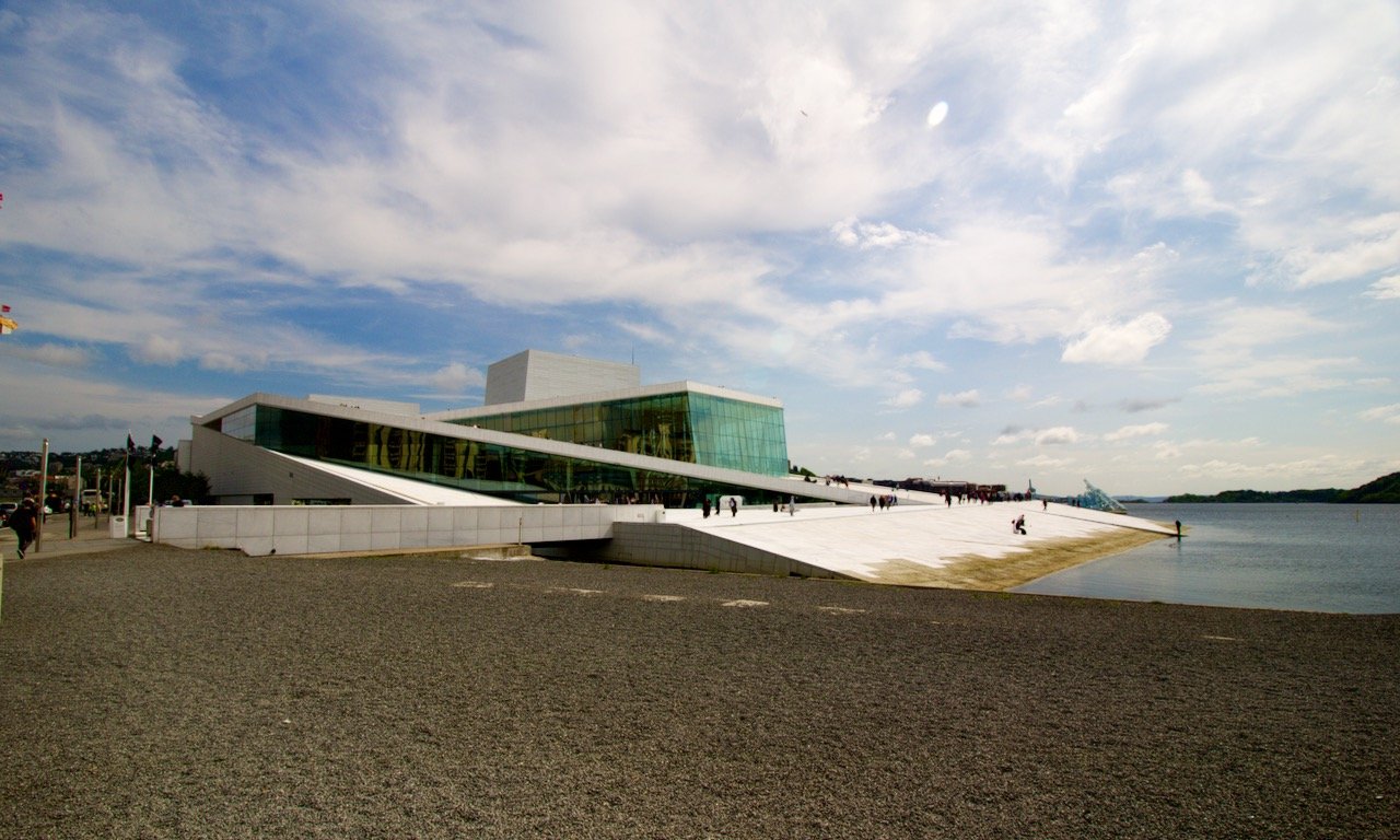
Oslo was the first Norwegian city that I happened to visit in the country. As the capital of Norway, it is its most populated city and has origins dating back to the end of the Viking Age in 1040. Present day, it is a ‘Beta World City’ and is home to many maritime industries. The city was rather large as it also spans the adjacent Bygdøy peninsula. I remember doing a lot of walking however in retrospect, I should have also taken some of the ferries that were available as well. I would recommend three days to really see what Oslo is about. Check out my blog post for more information on the link above. In the meantime, here are some pretty cool places in Oslo:
Oslo Opera House - What is so spectacular about this building is that its exterior serves as a plaza for patrons to walk on to enjoy panoramic views of Oslo. This means you can go from ground level and go up the angled walkway of the façade, all the way to the roof.
Akershus Fortress - A castle and modern-day museum that was first constructed a defense for the city against mostly Swedish forces centuries ago.
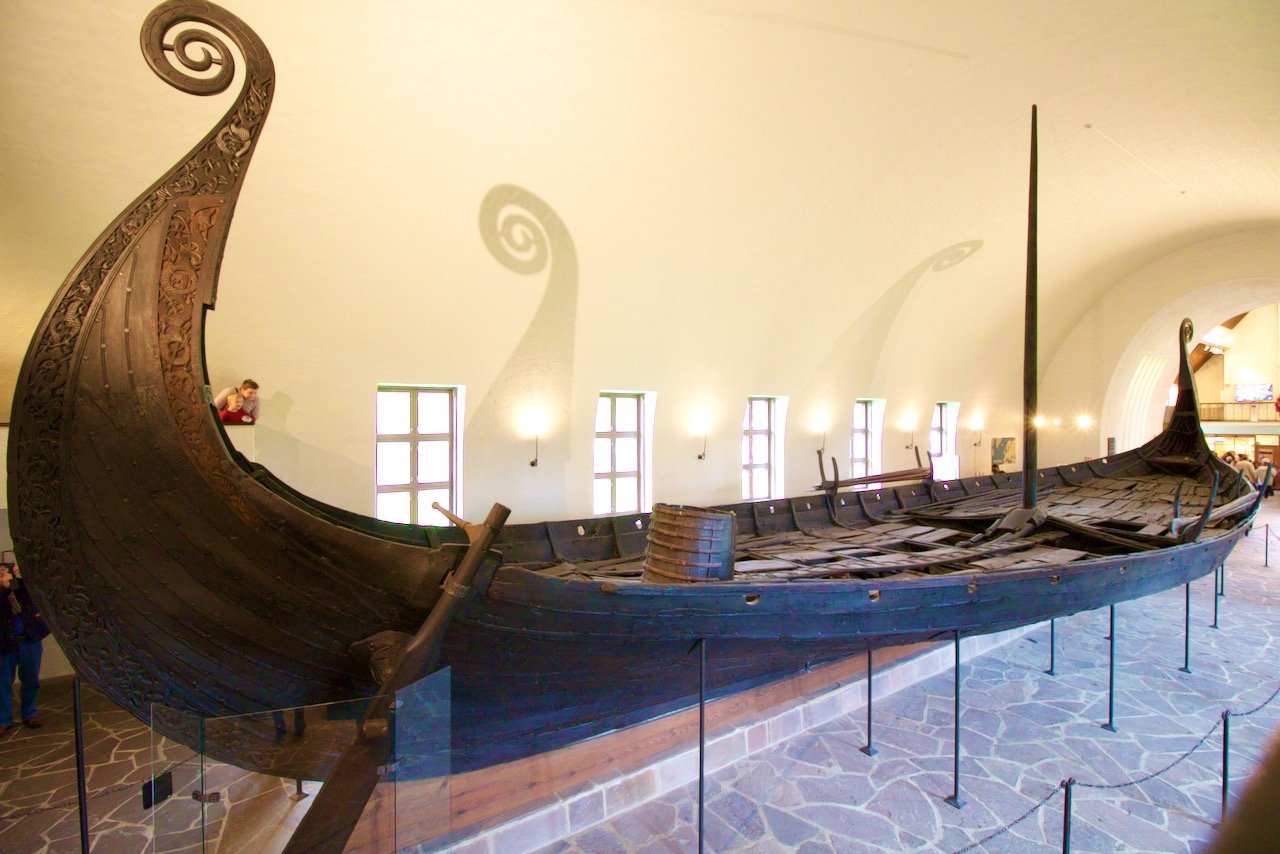
Viking Ship Museum - This museum on the Bygdøy peninsula contains actual unearthed Viking ships in excellent condition.

Bergen
(Blog Post - Exploring Norway's 2nd City: Bergen)
Bergen is Norway’s 2nd city, that is it is the 2nd most populated and as in most countries, is a natural rival (so to speak) with the capital city of Oslo. It is located on the western side of Norway and is known as the ‘city of 7 mountains’. Indeed, you can even hike to some amazing viewpoints to see all of Bergen in its entirety. The city was founded in 1070 and served as Norway’s capital only in the 13th century. I have been to the city twice myself, separated by a few years. I was fortunate enough to have good weather each time, which is quite rare. Nonetheless, the city was very walkable and could be seen in roughly 2 days. Check out my blog post for more information on the link above. In the meantime, here are some pretty cool places in Bergen:
Bryggen - A UNESCO World Heritage Site) which is a series of Hanseatic heritage buildings in the Vågen harbor. The buildings themselves are rather old, but are currently used as museums, restaurants, and bars.
Mt. Fløyen - A mountain top giving great views over all of Bergen. You can take the Fløibanen Funicular to reach it.
Bergenhus Fortress - A castle that dates back to the 13th century. It is very well preserved and is a gorgeous area to walk around and read more about the history of its existence. The castle is one of the oldest and best preserved stone fortifications in Norway.
Kode Art Museum - The museum boasts pieces from Picasso, Dahl, Dalí and more dispersed across 4 buildings in the city center. Old antiques are also showpieces in some of the exhibitions as well.

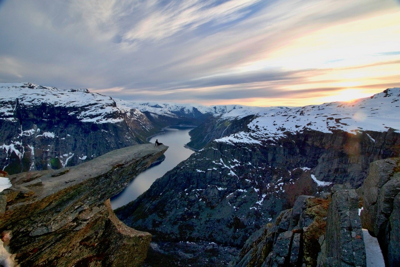
Trolltunga and Stavanger
(Blog Post - The Perfect Road Trip to Hike Trolltunga and Preikestolen in Norway)
Stavanger is the 4th largest city in Norway and is home to the Norwegian oil industry. It is also home to a number of international military installations, like the NATO Join Warfare Center. It was founded all the way back in 1125 with the completion of the Stavanger cathedral. It has a small town feel due to its large amount of 18th and 19th century wooden houses that are now part of the city’s cultural heritage.
I flew into Stavanger and used it as a starting point in a mini road trip to see Preikestolen and Trolltunga, two amazing natural formations in the Norwegian countryside that have become quite popular over the recent years:
Preikestolen translates to 'The Pulpit Rock', 'Pulpit', or 'Preacher's Chair' and is located in the Strand municipality. It is a steep cliff that is 604 meters above the Lysefjord. The top is uncharacteristically flat and almost a perfect 25 by 25 meter square. There is a lodge at the start of this hike where people can use facilities and grab food before the nearly 2 hour hike to the top.
Trolltunga translates to "Troll tongue" is another rock formation near the village of Skjeggedal in Norway. It sits 1100 meters above sea level and the rock that resembles the ‘tongue’ juts out horizontally from the cliffside. The hike itself is challenging with the first four kilometers giving the most drastic change in elevation. Camping is not allowed on the site unless with a licensed guide. And with how popular this hike has become in recent years, I cannot recommend this option enough as we had the entire formation to ourselves during our trip.

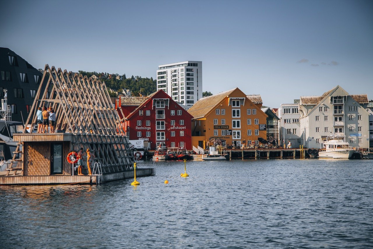
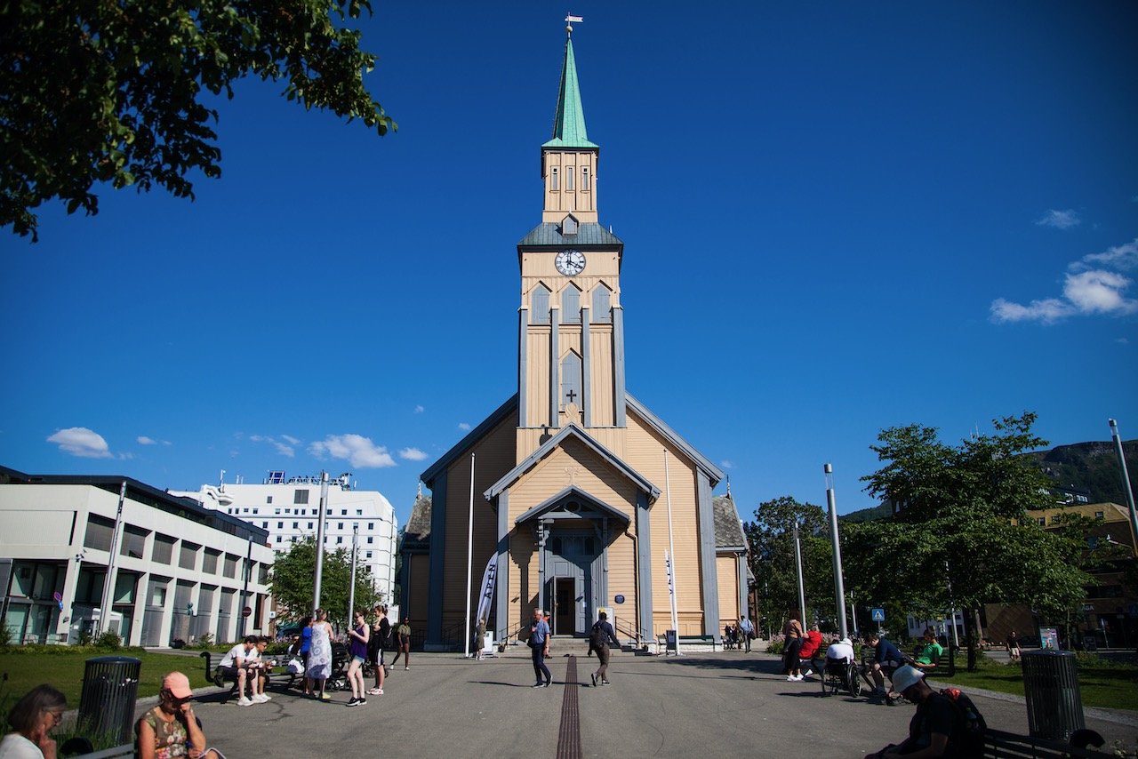
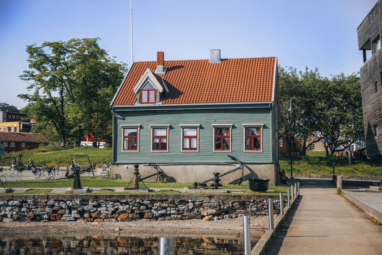
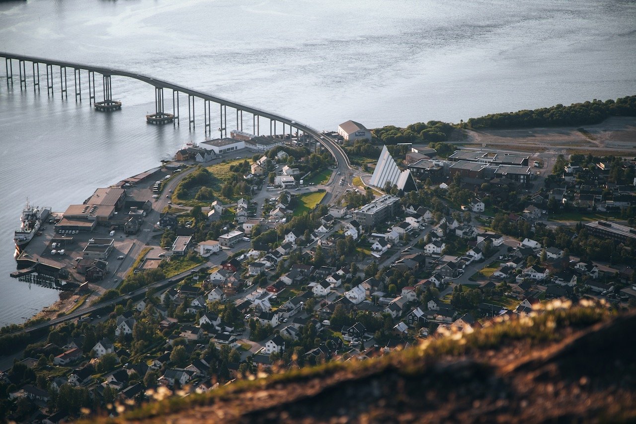
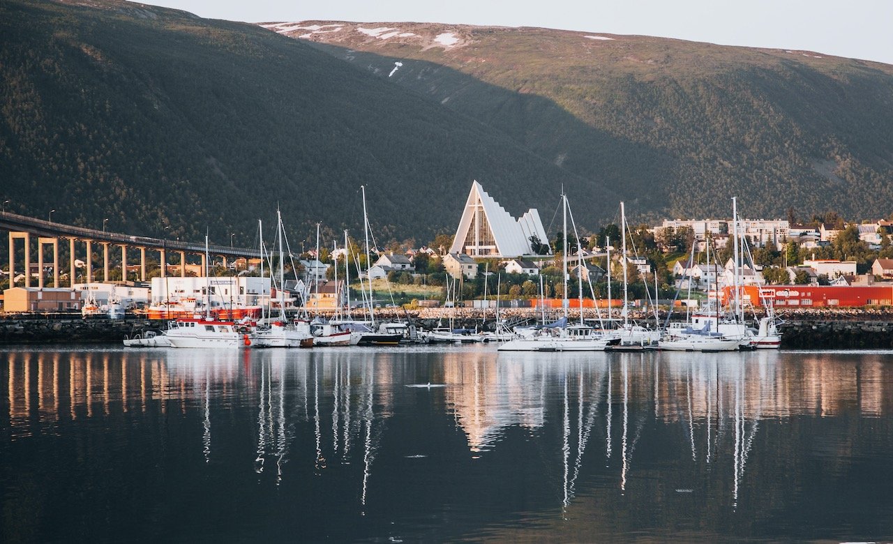
Tromsø
(Blog Post - A Guide to Exploring Tromsø: Norway's Northernmost City in the Arctic Circle)
Tromsø is located in Northern Norway and is the largest urban area in Northern Norway and third largest in the Arctic Circle after the cities of Murmansk and Norilsk in Russia. The city spans the island of Tromsøya and the landmasses on either side of it. As north as it sits geographically, the climate is actually very mild due to its position in the North Atlantic Drift (a Gulf Stream effect). Check out my blog post for more information on the link above. In the meantime, here are some pretty cool places in Tromsø:
Arctic Cathedral - This church possesses a large glass façade on its west side, and a large glass mosaic on its eastern side. There is a small fee to enter the church to see this glass mosaic in full. Nevertheless, the church was created by Jan Inge Hovig and dedicated in 1965.
Fjellheisen - A tramway located on the east side of the city (across the bridge) and takes you up to Tromsdalstinden, the 1,238 meter high peak that towards over the area. I cannot recommend this place enough in the summer to see the midnight sun!
Tromsø Harbor - There are plenty of restaurants here as well, but perhaps on the more pricier side. The collections of boats and view of Tromsø over the water towards the East are what make this spot particularly charming during golden hour.
Storgata - The main thoroughfare through Tromsø. This is the main street of the city with restaurants, cafes, and souvenir/specialty shops.


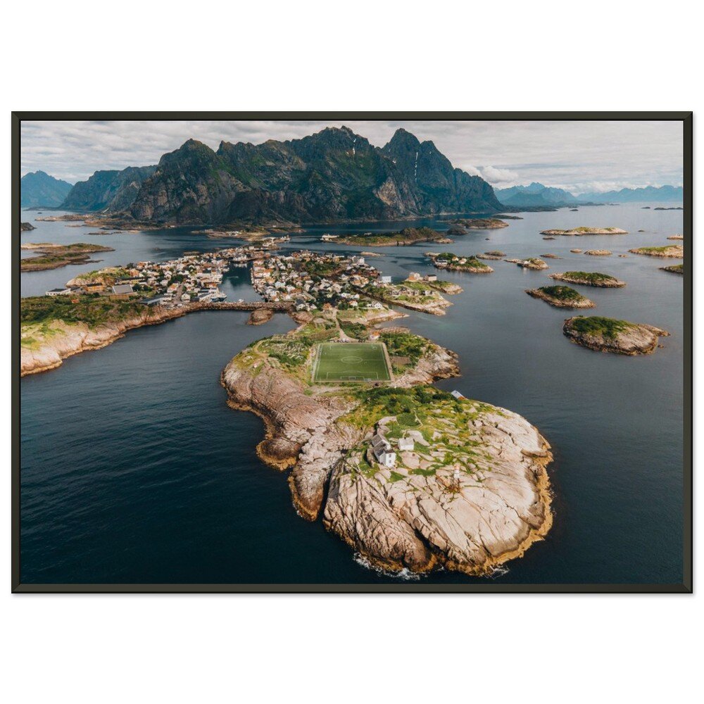
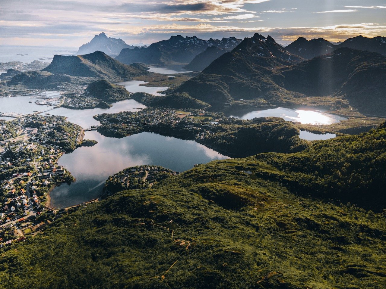
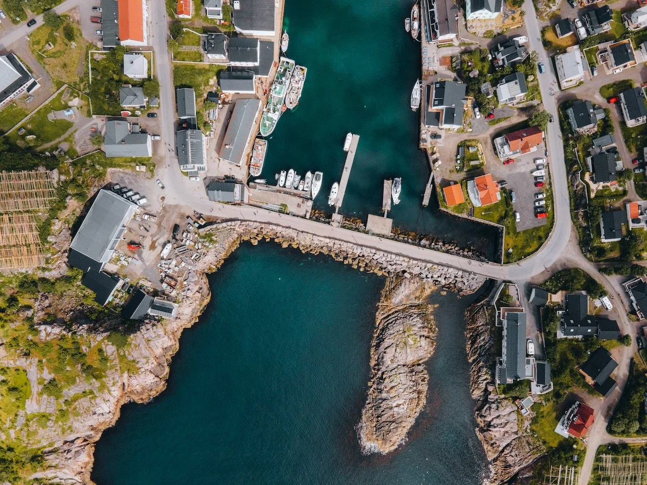
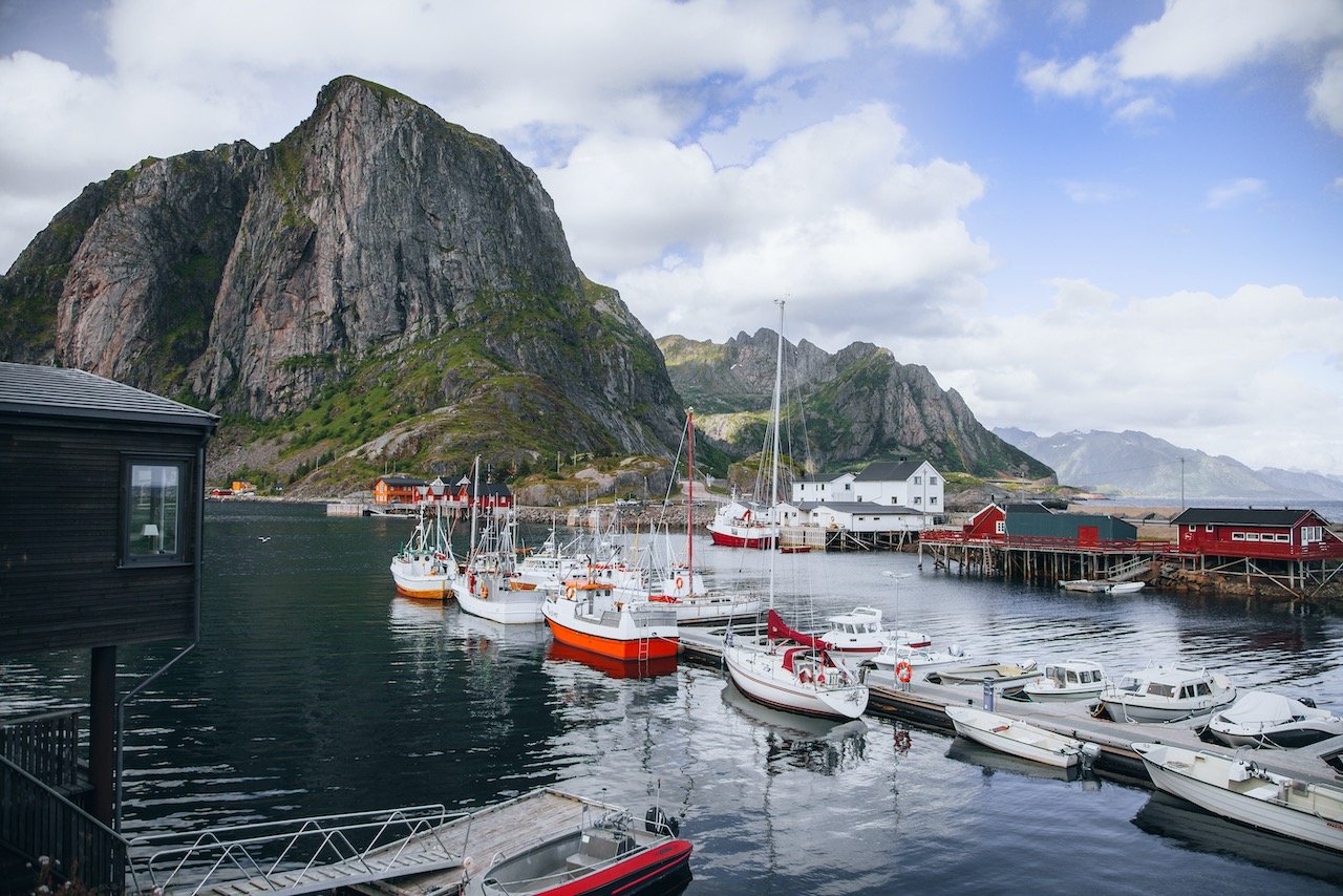
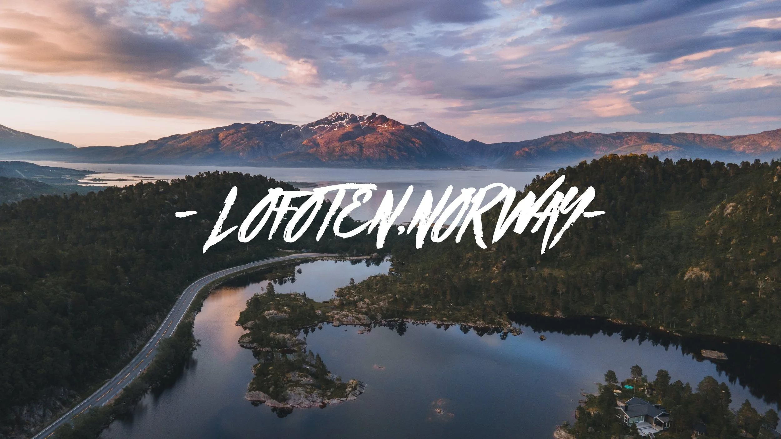
Lofoten - Austvågøya
(Blog Post - A Journey to the Lofoten Islands: The Island of Austvågøya)
The island of Austvågøya is a part of the Lofoten archipelago in Nordland County, Norway. There are a plethora of hikes to undertake on the island: Fløya, Festvågtind, Matmora, and Djevelporten. Also including the towns of Slovaer and Henningsvaer, the latter is probably one of the best to explore in warmer weather. It is known for its football stadium, built into one of the outer islands of town. Check out my blog post for more information on the link above.
Henningsvaer - A fishing village located on the islands of Heimøya and Hellandsøya. The town has a population of 510 and is replete with cafes and a large harbor for seemingly all the residents’ boats. Do yourself a favor and park in the town by the grocery store and take an hour to walk around the area.
Matmora - A hike starting in the small town of Laukvik and easily one of the best hikes in Lofoten. The hike takes you along meandering pathways, flanked by plush green trees, with occasional appearances by the loitering sheep. The vegetation starts to disappear as you ascend higher and about 1 hour into the hike, you can see the summit.
Djupfjorden - A tidal lake separated from the sea by a land bridge. You will know you’ve reached it when you see a lot of cars on the side of the road for seemingly no reason. If you do find a parking, you can climb up the rocky terrain (I managed in my sandals) and get a perfect view of the mountains across the landscape over the sea.
Rorvikstranda - This beach was just off the main E10 road on the way to Henningsvær. What I really enjoyed about it was the turquoise color of the water. It was so intense and the wildflower vegetation of the area just added to the enchanting vibe.

Lofoten - Vestvågøya
(Blog Post - A Journey to the Lofoten Islands: The Island of Vestvågøya)
The island of Vestvågøya is a part of the Lofoten archipelago in Nordland County, Norway. There are a plethora of hikes to undertake on the island: Mannen, Offersoykammen, Nonstind, Veggen, and Kleivheia. There are a number of beaches too at Uttakleiv, Unstad, and Haukland. Lastly, a kayaking during the midnight sun in Eggum in a must do when here in the summer. Check out my blog post for more information on the link above.
Unstad Beach - This beach has been prominently featured in many travel websites and blogs. It is one of the more popular beaches in Lofoten with silky white sand, flanked on both sides with large boulders.
Offersoykammen - This is a small mountain peak that you can hike to, giving you amazing views of Nappstraumen below. It was a more demanding hike for us, as it was quite steep until it starts to flatten out a bit near the summit.
Borge Church - This church has a red and white facade, perfectly contrasting with the wide expanse of (mostly) farmland in the distance. The church is concrete and was built in a fan-shape style in 1986, the vision by architect Knut Gjernes. It can fit 600 people and was consecrated in 1987.
Maervoll - A village in the Steinsfjord, most known for its spectacular vista of Himmeltinden in the distance. This mountain stands 964 meters tall and is the perfect backdrop for an afternoon picnic, which is what we did.

Lofoten - Flakstadøya
(Blog Post - A Journey to the Lofoten Islands: The Island of Flakstadøya)
The island of Flakstadøya is a part of the Lofoten archipelago in Nordland County, Norway. There are many hikes to undertake on the island: Hustinden, Volandstind, Moltind, and Nubben. There are a number of beaches too at Skagsanden, Rambergstranda, and Flakstad. The town of Vikten is a MUST visit to see the glass blowing at Glashytta Kafé. Lastly, Nusfjord is a charming fishing village you can't miss. Check out my blog post for more information on the link above.
Nusfjord - This is a small fishing village on the south shore of Flakstadøya. There are a number of rorbu cabins here, many of them red, some are yellow that are spread across the landscape. The town is perfectly intertwined with nature and around every corner was a photographic opportunity.
Flakstad Church - This church is located in the village of Flakstad (obviously). The church was built in a cruciform style in 1780. For me, I really liked its red color and the surrounding grounds.

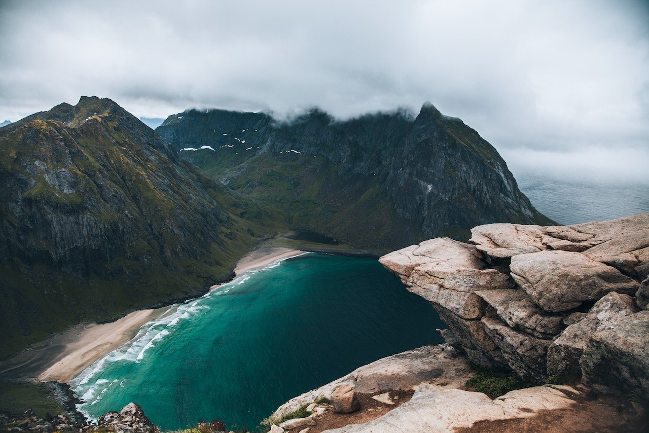
Lofoten - Moskenesøya
(Blog Post - A Journey to the Lofoten Islands: The Island of Moskenesøya)
The island of Moskenesøya is a part of the Lofoten archipelago in Nordland County, Norway. There are a plethora of hikes to undertake on the island: Reine, Ryten, Røren, Andstabben, and Munken. Some great beaches to check out are also at Kvalvika, Horseid, and Bunes. Lastly, the fishing villages of Hamnøy and Sakrisøy are incredibly picturesque and worth stopping for. Check out my blog post for more information on the link above.
Ryten - Ryten is a huge cliff that is 543 meters in elevation and because of that, it takes a few hours to get to the summit in a well marked path, however with somewhat steep terrain when you get close to the top. The photographic shot you want is the small outcrop of rocks that jut out into the air, over Kvalvika Beach below.
Hamnøy - One of the more iconic villages in all of Lofoten. You’ve seen those pictures before: these gorgeous red colored cabins [called rorbu, or rorbuer (plural)], standing on wooden planks above the turquoise blue water with a mountain backdrop.
Reine - This village has a population of only 314, but seems much larger giving all the tourists that love to visit.
Sakrisøy - Another small island similar to Hamnøy. It sits at the foot of Olstind mountain with its own set of fisherman cabins you can stay at. Take a walk around this island as well if you haven’t gotten your fix from Hamnøy.

Lofoten - Vaerøy
(Blog Post - A Journey to the Lofoten Islands: The Island of Værøy)
The island of Værøy is a part of the Lofoten archipelago in Nordland County, Norway. It is home to roughly 728 people and accessible only by ferry from Mostenes or Bødo. The viewpoint after hiking to Håen is one of the best in all of Lofoten. You can also hike at Nordlandsnuppen, Plantefeltet, and Værøyhornet. A day trip here is all you need to see the southern tip of the Lofoten Islands. Check out my blog post for more information on the link above.
Ferry - the ferry from Mosekenes to Vaeroy is FREE!
Sørland - This resort and fishing village is the administrative center of the municipality with a population of 640.

The Epic Lofoten Road Trip
(Blog Post - The Epic Lofoten Islands Road Trip)
The Lofoten Islands are located in Nordland County in Norway. They are composed of the islands Gimsøy, Austvågøy, Vestvågøya, Flakstadøya, Mostenesøya, and Værøy. These islands are some of the most beautiful in the world and a summertime road trip to Lofoten is a huge bucket list item. My favorite spots were Henningsvær, Reine, Ryten, Nusfjord, Vikten, Offersøykammen, and Eggum, to name a few! Check out my blog post for more information on the link above.
Finland
Helsinki, Suomenlinna
Just a few things to note about Finland before your visit:
Finland uses the Euro as its currency.
Finns are very much to themselves. They are known to be private and may come off shy…this changes with alcohol. Drunk or not they can be quite friendly.
Finland is almost always one of the happiest countries in the world. Despite the darkness and the cold, their appreciation of nature and saunas must provide them with such happiness.
Helsinki is just a short ferry ride away from Tallinn in Estonia so if you have the time, take the 2 hour trip and see a part of the Baltics that you may not be so familiar with.

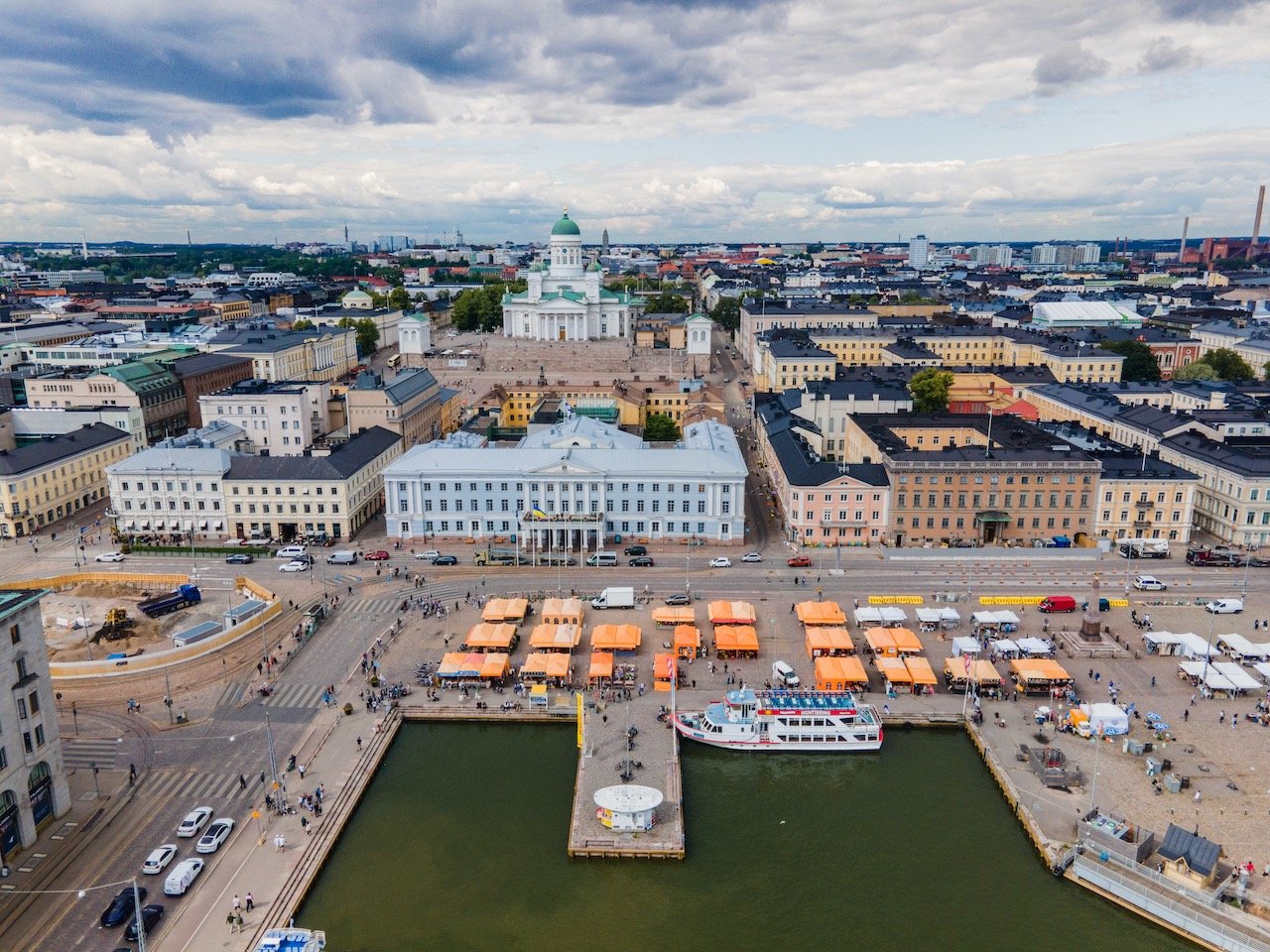


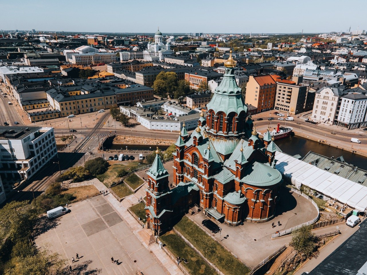
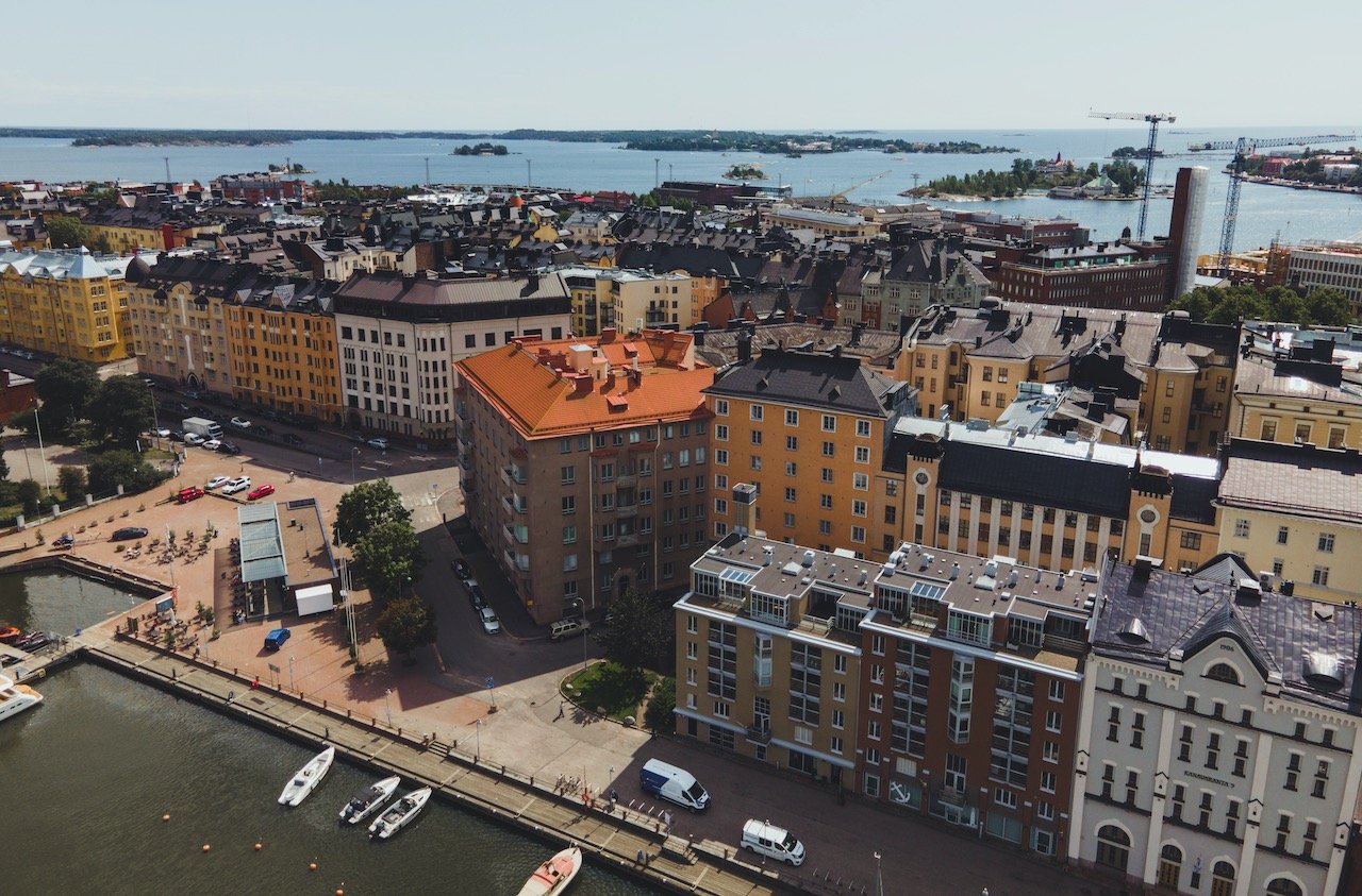
Helsinki
(Blog Post: Welcome to Helsinki: A Guide to the Finnish Capital)
Helsinki (and Finland in general), is not much like the rest of Scandinavia, at least with the language. It shares a border with Russia and has mainly daily ferries to Tallinn, Estonia. There is always a friendly rivalry between the Finns and the Swedes, especially in sport, where they don’t feel that they should have to be the best team around, but as long as they beat each other, it is sweet satisfaction. Most of all, I find the Finns to have a fantastic sense of humor; it can be dry and straight forward at times, which is endearing. I found myself here on two separate occasions, once in the winter and once in the summer.
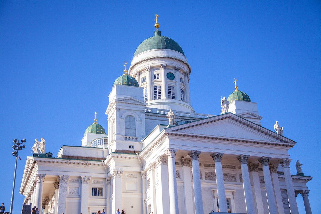
Helsinki Cathedral, Temppeliaukio Church, and Kamppi Chapel are cool places to check out.
Tervasaari and Suomenlinna are great for nature lovers.

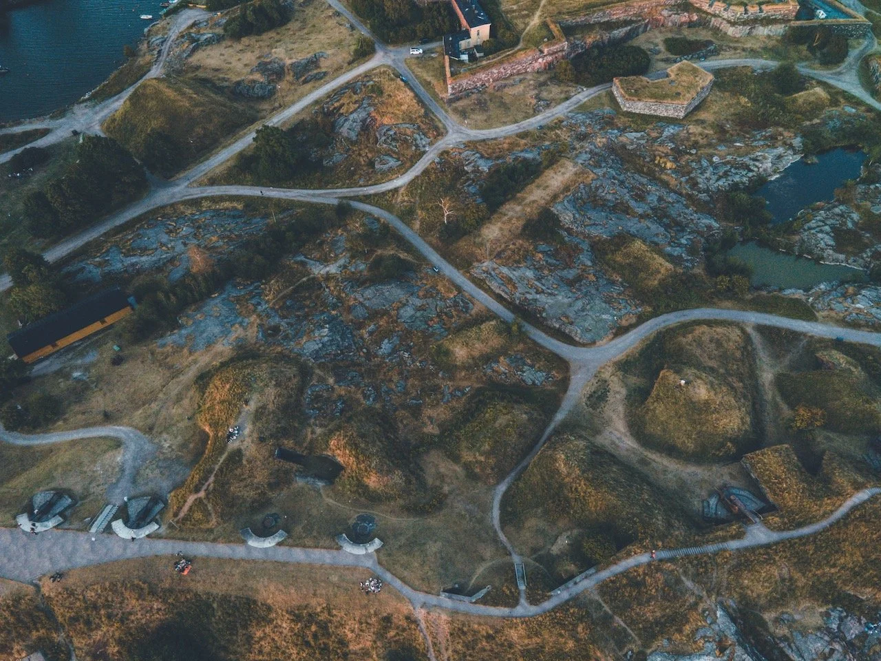
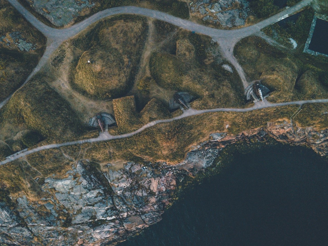
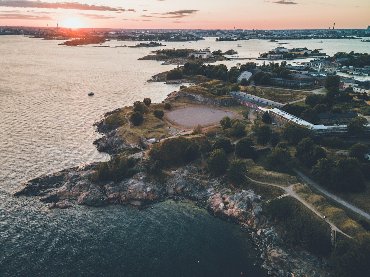
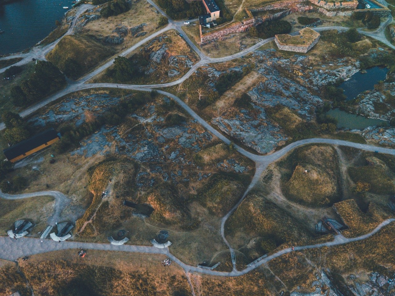
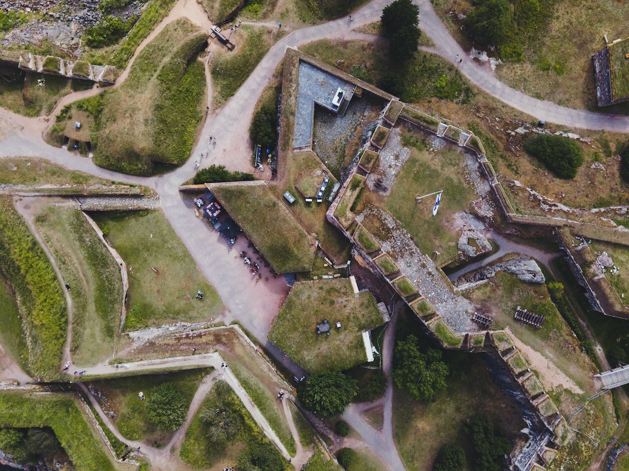
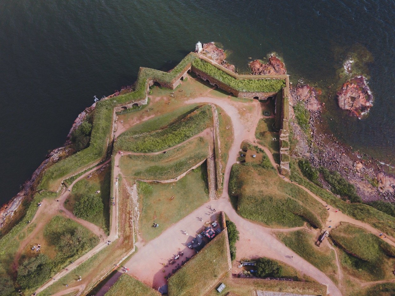
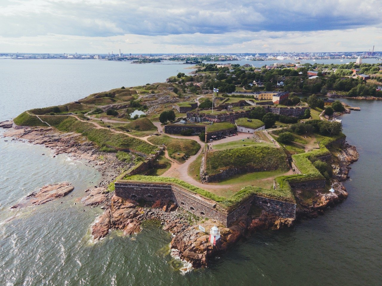
Suomenlinna
(Blog Post: A Guide to Suomenlinna)
‘Suomenlinna’ translates to ‘Castle of Finland’. The site was also called ‘Sveaborg’ by the Swedes. I think what I really enjoy about being there is that when you are walking along its paths, you don’t feel like you’re in a major city. It feels like the countryside as it’s quiet and peaceful. Then when you have had your dose of nature, you can simply hop onto the ferry and make your way back to Helsinki.
Kustaanmiekka Sand banks and Artillery and Submarine Vesikko are cool places to check out.
Sveaborgs Badstrand is a great beach on southern end of Suomenlinna.


Denmark
Aarhus, Odense, Copenhagen
Just a few things to note about Denmark before your visit:
Denmark’s currency is the Danish Krone (DKK).
When you first land in Denmark, you can already understand why the people here, and the country as a whole, are consistently considered the happiest in the world. From my experience, the Danish are very friendly and open minded. This probably stems from their access to health care and quality education, excellent social services, and trust in their government.
The Danes are fluent in ‘hygge’, which stands for ‘intentional intimacy’. These are described as interactions with friends and family that breed camaraderie and valuable shared experiences and are integral to the happiness they are known for having. The term is also used to describe a general cozy atmosphere, such as wearing comfortable clothes inside on a cold winter day in front of a lit fireplace (count me in).
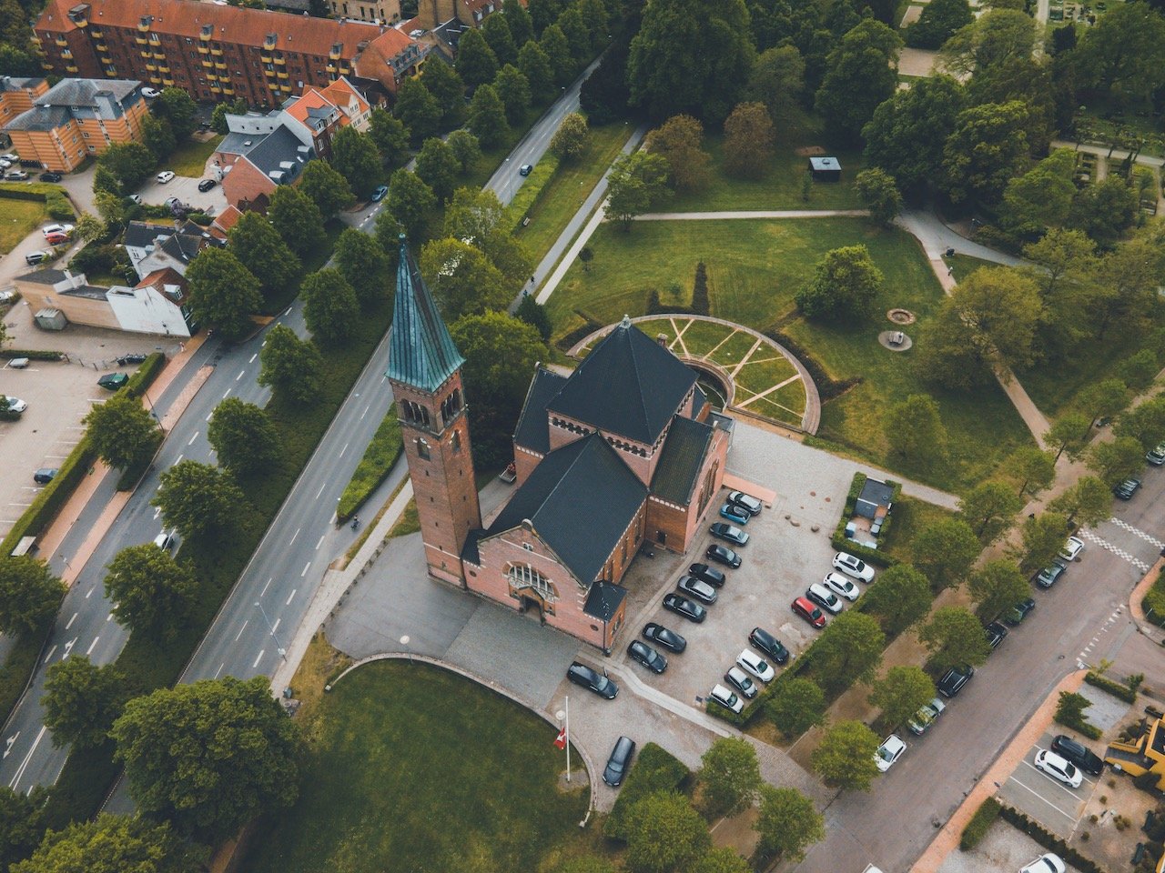

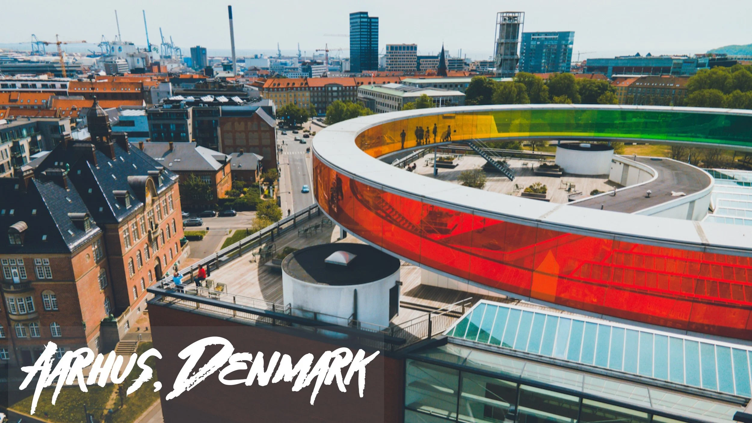
Aarhus
(Blog Post: A Weekend Trip to the Danish town of Aarhus)
Aarhus is the largest city situated in Jutland county in Denmark, home to about 336,000 inhabitants (at the time of writing this article). It is a city ripe with student life, as can be seen by the plethora of cafes and bicycles ever present on these city streets. After all it is home to the largest university in Scandinavia (Aarhus University). Furthermore, it is one of the oldest cities in Denmark, dating back to the 8th century.
Aarhus Museum of Art (ARos) and Marselisborg Slott are places to check out.
Mølleparken and The Dome are cool spots for chill.
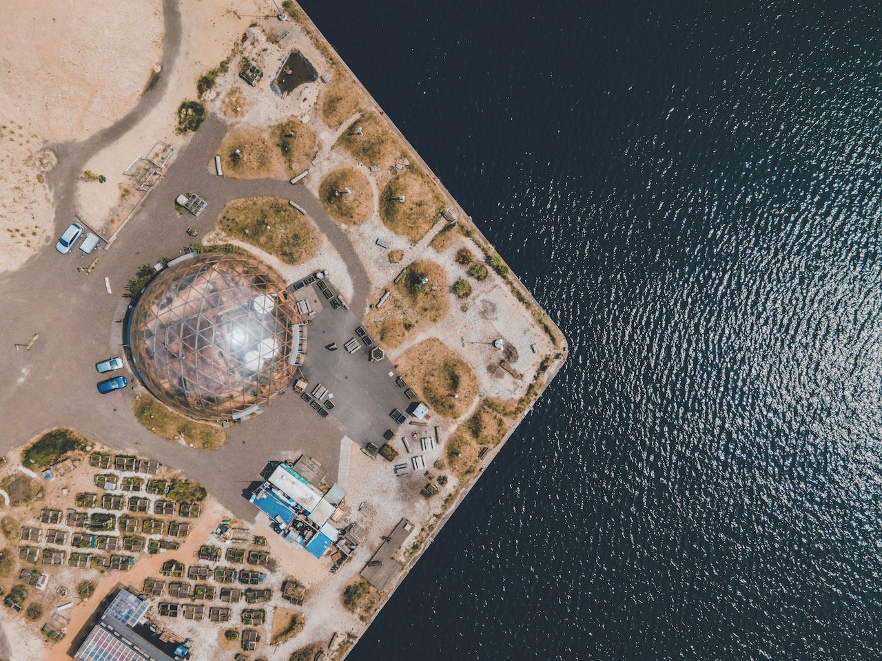
The Infinite Bridge is not to be missed!
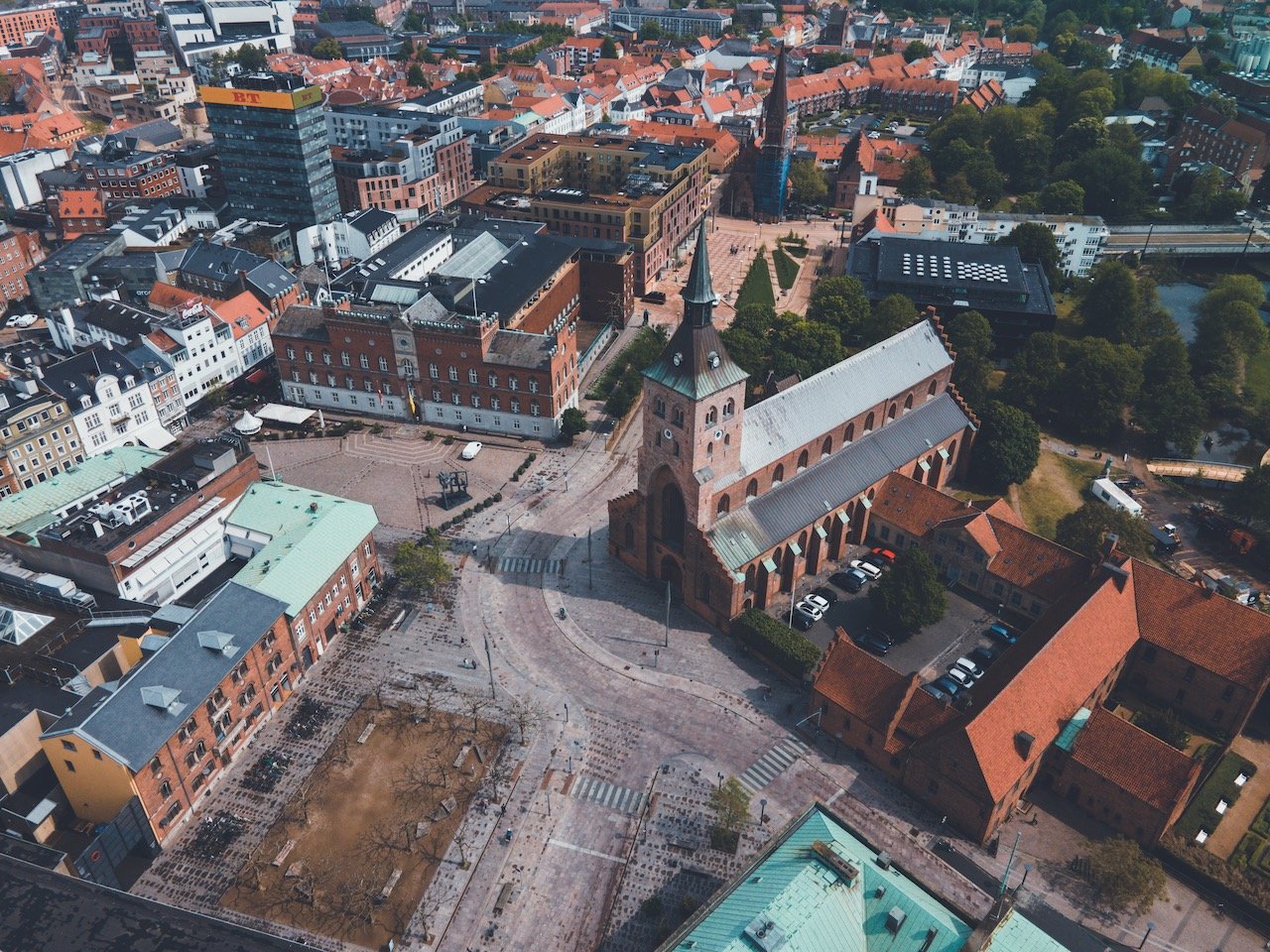
Odense
(Blog Post: Exploring Odense, Denmark: The Birthplace of Hans Christian Andersen)
Odense is the third largest city in Denmark and the birthplace of famous Danish author Hans Christian Andersen, who is highly esteemed in literature and perhaps most famous for writing The Little Mermaid. The city name itself comes from the phrase ‘Odins Vé' which means ‘Odin's sanctuary’ (Odin being a God in Norse Mythology).
Odense Cathedral and Odense Slott are worth seeing.
Eventyrhaven is an amazing park that is quiet and secluded.

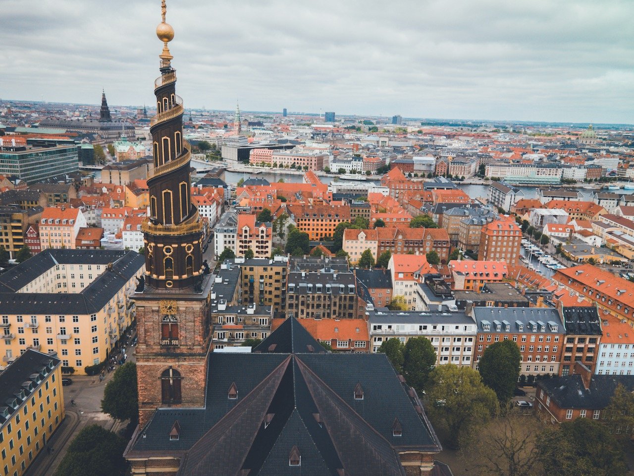
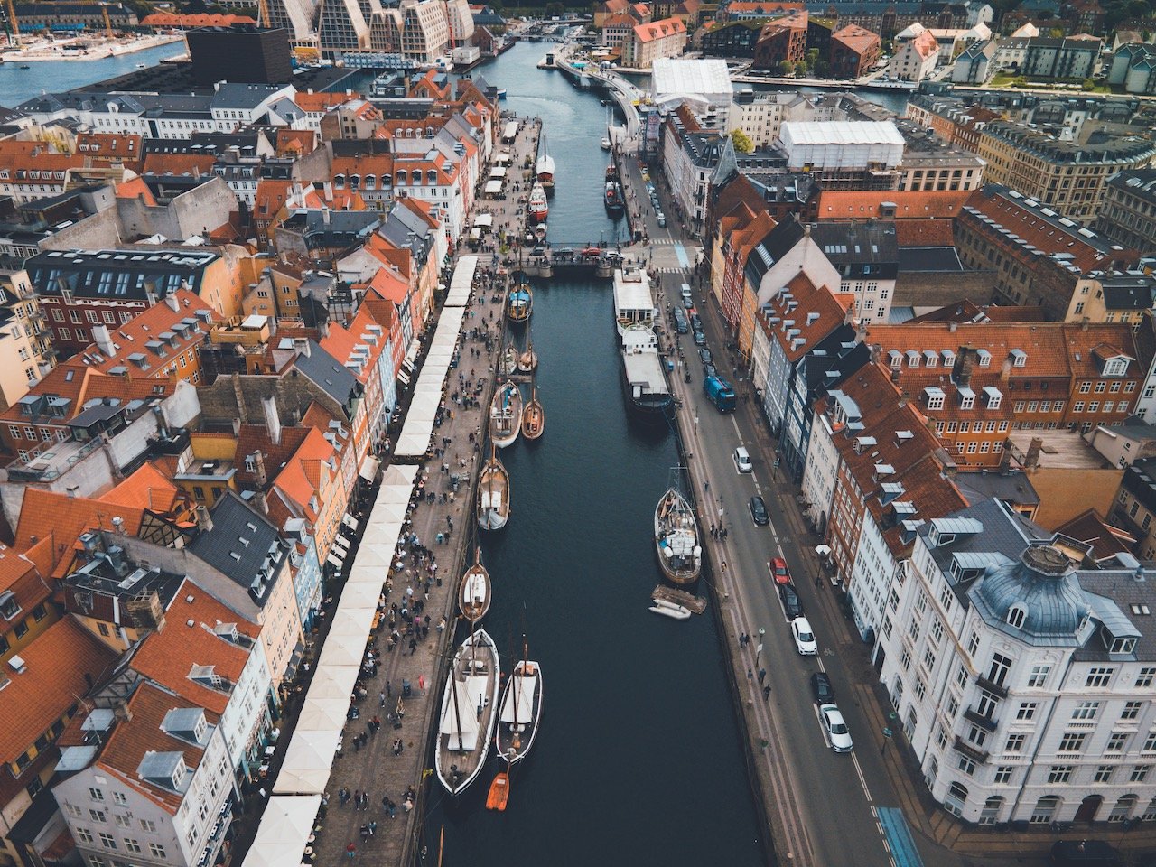
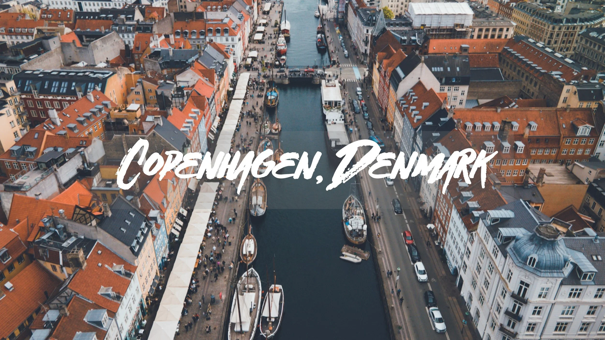
Copenhagen
(Blog Post: The Perfect Guide to Exploring Copenhagen)
The Danish capital of Copenhagen has plenty to offer at all times of the year. My journey there was around Easter, so the colder winter weather had subsided enough to make my stay more than tolerable there. Aside from doing a walking tour, I decided to walk aimlessly in the hope of stumbling upon interesting sights. The city is mostly flat, thus very walkable.
Kastellet is an amazing star fort that is popular for runners and walkers.
Nyhavn Harbor and the Danish Royal Library Gardens are must see places.
Iceland
Reykjavik, South Coast, Snaefellsnes Peninsula, Eastern Iceland, Northern Iceland, Iceland Waterfalls/Churches/Lighthouses
Just a few things to note about Iceland before your visit:
N1 is the most common gas station. To use the gas pumps, you can go inside the shop and purchase a N1 gas card (comes in 1000, 5000, and 10000 ISK). You can then take this card and use it on any N1 gas station pump in the country. Put in card face up, w/ magnetic strip to right side, facing down and select the pump you are at and fill ‘er up.
Iceland is a very electronic country, meaning that many places take card, even the campsites. During my two week road trip, I didn’t use cash at all. Be sure to confirm with your bank if you’re able to use your card in Iceland.
Since Iceland is a volcanic country, there may be times where you will take a shower or be visiting a geothermal areas and you will smell sulfur. This is entirely normal and poses no harm to you. Just the way it is!
No matter what season it is, remember to wear layers. The weather changes a lot and it can be windy as well, so this just allows you to be prepared for any type of weather. I find that a light, rainproof jacket is a must no matter the time.
You’ll want to stop everywhere on your drive to take photos, but be patient, you can usually find a turn off soon on the road. Do not stop in the middle of the road for photos.
The Main grocery stores are BONUS, Kronan, and Netti and they more or less have everything you need for your road trip.
Skyr is Icelandic yogurt, and it’s amazing. Great for breakfast and fueling up for your day of exploring.
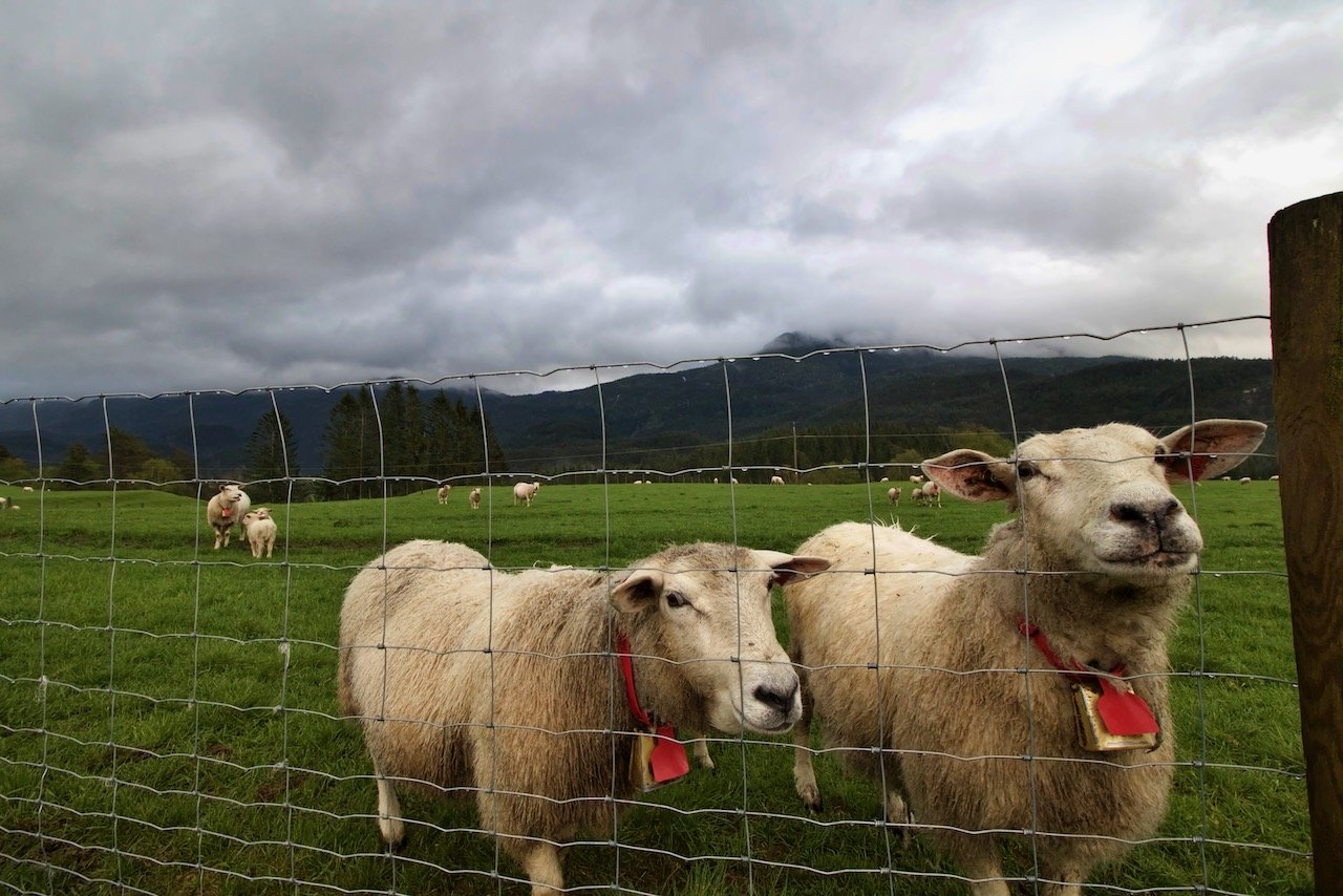
There are a TON of Horses and goats/sheep always on the road side. Slow down when passing them. They often cross the roads.
When renting your car or campervan, there are probably up to 5 or 6 types of insurance to add to the basic insurance that is already included. If you plan on taking a trip longer than a week and hoping to see some of the more secluded areas, but sure to also get the Gravel Insurance. My side window shattered in my car from an errant rock and I was able to swap out my campervan for a new one the same day and it cost me nothing.
Other Campervan companies in addition to Go Campers include, but are not limited to: Lava, Happy Campers, Kuku Campers, Campeasy, Rent.is, Cheap Campers, Affordable Campers.


Iceland’s The South Coast (3 Parts)
[Blog Post - The EPIC Iceland Road Trip: The South Coast (Part I)(Part II)(Part III)]
The South Coast is perhaps one of the more popular areas in Iceland due to its close proximity to Reykjavik and absolute plethora of sights to see and take in. It includes Þingvellir National Park where you can see a variety of waterfalls, geysers, and even the tectonic plates. The journey I will describe will take you to these places and so much more.
Glymer waterfall - Hike takes a good 3-4 hours from parking area. 2nd tallest in the country.
Öxarárfoss - Close to parking. Small. Can get really up close. No spray. In Þingvellir National Park.
Kerid Crater - Nice array of colors, can walk around crater and into it. Cannot fly drones.
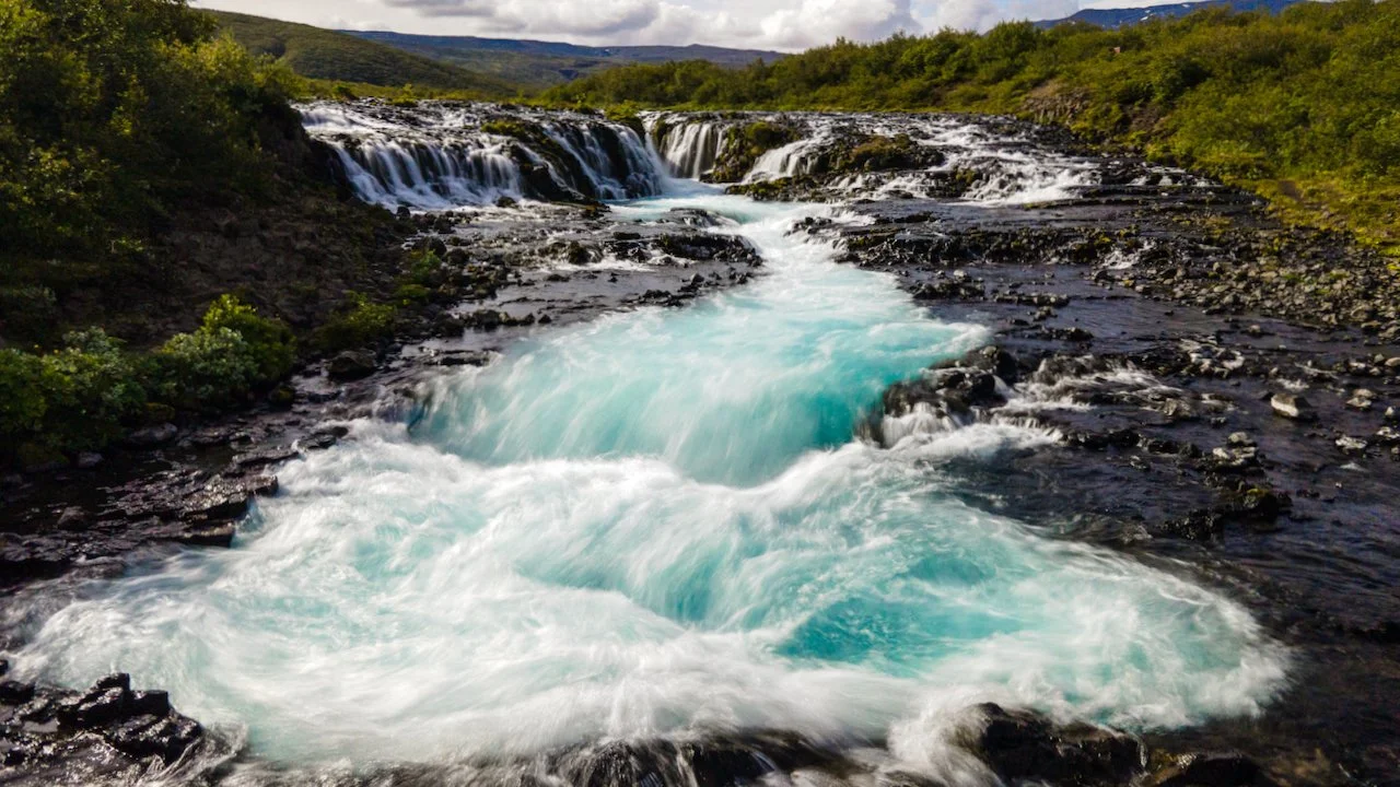
Bruarfoss - Gorgeous. Takes about 45-60 minutes each way. Will pass two other small waterfalls before getting to Bruarfoss.
Gullfoss - Common waterfall on Golden circle tours. No drones allowed.
Faxifoss - Barely any people, cafe nearby with excellent view of falls. Very wide. A bit of spray.
Urriðafoss - Very nice during golden hour, not many people.
Þjófafoss - Will find side road on Road 26 with a sign leading you to the falls. Amazing spectacle with wildflowers growing. Road is gravel but easily manageable in a non 4x4. Highly recommend.
Haifoss - Gorgeous waterfalls with small glacier. Deep canyon. Gravel road is longer but also manageable.
Gjáin - Road is gravel, the worse I had driven so I did not go all the way to falls. Drone took last 0.5 km or so. Terrible road condition without 4x4.
Hjalparfoss - Great converging falls and nice open area.
Seljalandsfoss - Very popular stop during South Coast tourist trips. Best to go at sunset or right before during golden hour since sun sits in the path of the falls from behind. Cannot go behind falls in winter. Lots of spray.
Gljufrabui - Hidden falls near Seljalandsfoss. Have to walk on rocks in water to get through, but amazing chamber of water coming down. You will get wet, not as well known as the other so less people.
Skógafoss - Very popular waterfall, also no drones allowed. Can take pathway leading up to top of falls. Do not come in peak times. Lots of spray when you get closer.
Kvernufoss - Just a short drive/walk away from Skógafoss, sort of like a small Seljalandsfoss. Perfect for a picnic. Can get behind the falls as well.
Sólheimajökull Glacier - Has receded a lot in recent years. Take a gravely path to edge of glacier. Lots of dirt/iron on glacier. Can organize hiking trips.
Sólheimasander Plane Wreck - Remains of an American DC-3 plane. Hike is 7 km total, round trip. Very windy, and desolate conditions. Start from car parking area just off the ring road. Come prepared and do not jump on plane.
Dyrhólaey Lighthouse - Gorgeous house on inlet. Bird nesting area, no drones allowed. Great for golden hour/sunset. Road up to lighthouse a bit gravely and lots of pot holes. Also narrow and sloped.
Reynisfjara - Very popular at all times of day but best during golden hour/sunset. Beach goes on for awhile and has a great view of Dyrhólaey.
Þakgil - Great for camping. Best views of Iceland on the way there. Gravel road is long and a bit rough at times. Good facilities. Extra cold since higher in elevation.
Hjörleifshöfði Cave - Great in the mornings. Really secluded area. Not many people. Gravel road.
Eldhraun Lava Field - Just off the ring road. Very nice formations of former lava field with moss.
Fjaðrárgljúfur canyon - Excellent. A must see. Get there in the morning, gets very full by lunch time. Go to last viewing point first.
Stjórnarfoss - Nice waterfall, near a campsite. Great for swimming.
Hundafoss/Svartifoss - Both in Skaftafell National Park. Nice waterfalls. Trek is uphill at first, pretty tiring.
Skeiðará Bridge Monument - Cool to see. Part of a bridge but flooded river bent beams. Nice for picnic.
Svínafellsjökull Glacier - Really cool. Have to drive gravel road. Not in best condition. Rock path leads to views of glacier.
Jökulsárlón Glacier Lagoon - Great, but really really crowded. Best time of day is morning or night. Good for sunsets.
Fjallfjara - Beach nearby that is nice earlier in the day before glaciers have gone back into the sea/lagoon.
Fjallsárlón Glacier Lagoon - quieter than Jökulsárlón, water is more still, can get some gorgeous photos. No drones allowed.
Múlagljúfur Canyon - Best to hike in the morning. Multiple paths along the way. Best is one along main valley. 2-3 miles one way, at least 1 hour to get up.
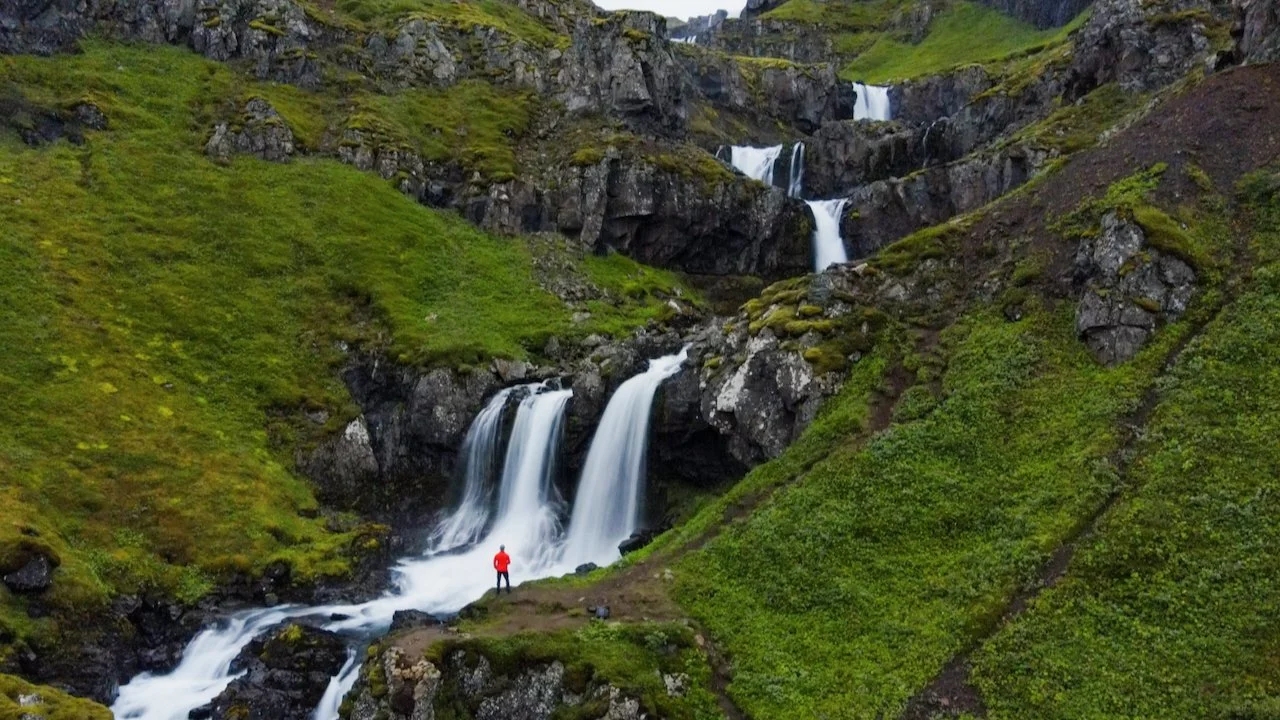
Eastern Iceland
[(Blog Post - The EPIC Iceland Road Trip: Eastern Iceland (Part IV)]
If you’ve gone this far through the Iceland South Coast, continue your way through Eastern Iceland for more wonderful, off the beaten path, places too see. What you’ll find immediately is that there will be less tourists after you pass the town of Höfn since most people only do (or have time for) the South Coast on their travels.
Stokksnes andVestrahorn Mountain - Amazing. Go in the morning when sunrises behind mountain. Can camp at Viking Cafe. Good campsite with restaurant, showers, wifi. Nice area around.
Hvalnes Lighthouse - Quiet. Basic, but good views of mountains.
Litlanesfoss/Hengifoss - Two more cool waterfalls in one hike. About 1 hour each way.
Klifbrekkufossar - Cascading waterfalls and amazing to see. Drive there on gravel road, which was manageable. High elevation meant driving through a cloud to come out on other side. No one else there. One of my favorites.
Seyðisfjarðarkirkja - Charming blue church in small town by the same name with rainbow steps leading up to it.
Gufufoss - Can be seen on the way out of small town from church, better seen when leaving. Small car parking lot on side of the road.
Stuðlagil Canyon - Nice drive on gravel road. Path down can be steep. Can get to the bottom near the water, just need to be slow and careful. Worth seeing.
Campground Möðrudal - Excellent place to camp at. Surroundings are eerily beautiful. Good facilities.
Northern Iceland
[(Blog Post - The EPIC Iceland Road Trip: Northern Iceland (Part V)]
I like to think of the South and North coasts of Iceland to be polar opposites. My experiences in the South have shown me largely pristine places, gorgeous in all weather, polished, clean, and unrivaled beauty. The North, while still beautiful, is more raw, gritty, and the most primordial environment I have ever been to. Make no mistake, northern Iceland is a necessary stop on your road trip through the country.
Dettifoss - Best from the EAST side. Lots of spray from the west side. Huge. Can get right up to it. Highly recommend.
Selfoss - a 1.4 km hike south from Dettifoss. Also worth seeing, very long. Little puddles and pools leading up to the falls.
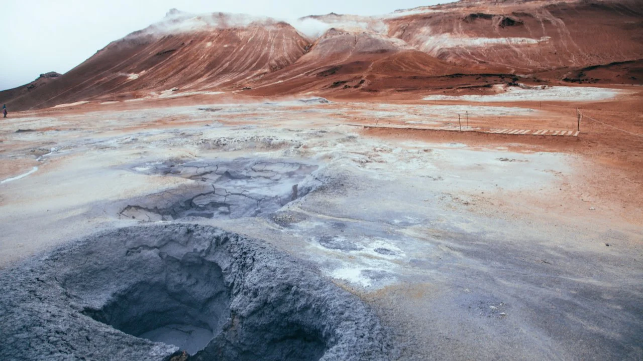
Námafjall Hverir - Amazing hot springs. Smells very awful. Very colorful. Right off the ring road.
Krafla Crater - Blue lake, very high up in elevation, very windy.
Goðafoss - Just an insanely beautiful blue/turquoise waterfall. It’s popular but so worth it. One of the sides allows you to get on the water level.
Hamrar Camping - big campsite just outside of Akureyri, good shower and facilities, very open.
Lemon - Cafe in Akureryi, very cozy and chill.
Hvitserkur - Pretty cool rock. Very windy and cold. Gravel road to get there is not very good. Can venture down to the pebbled beach. Use caution when going down.
Glambaer Church - Really nice church, museum next to it. Small quaint town. Small detour from Route 1.
Kolufoss - Cool waterfall, can get up close to it. Within 10 meters of falls. Small detour from Route 1.
Snaefellsnes Peninsula
[(Blog Post - The EPIC Iceland Road Trip: The Snaefellsnes Peninsula (Part VI)]
The Snaefellsnes Peninsula, located on the western part of Iceland, just north of Reykjavik, is a must see. It’s a perfect microcosm of the entire country, it has churches, waterfalls, lighthouses, caves, cliffs, and gorges. It can also be seen entirely in one (long) day but best to stretch it out over a long weekend.
Gerðuberg Cliffs - couldn’t find road to get there, but can see it from the main road. Pretty neat hexagonal columns.
Búðakirkja - Popular black church. Very nice to see up close.
Rauðfeldsgjá Gorge - Nice canyon, have to wade in deeper, might be able to cross over rocks in the water, be careful, can be slippery.
Gatklettur - nice rock formation with bird nesting area so no drones.
Londranger - another rock formation nearby with more birds. No drones allowed.
Malariff Lighthouse - Pretty nice. Sits on a black beach. Really chill and easy to get to.
Djúpalónssandur beach - Another huge beach. Very wide open.
Svörtuloft Lighthouse - Last few kilometers is gravel/rock road to get there. Manageable if you go slow enough and lighthouse is worth seeing. Nestled near a bird nestling area, so no drones.
Öndverðarnes Lighthouse - same road as previous one, smaller, but also orange. Can walk down a path to the beach. Good for sunset.
Ingjaldshólskirkja - A church that is really nice any time of day. Nestled up on top of a hill. Perfect for golden hour.
Svöðufoss - Waterfall that you can only see from afar. Birds nesting area and roaming sheep there.
Kirkjufellsfoss - Ideal for photographers, good for golden hour and sunset.
Kirkufell - same from above, excellent views of mountain from any part of town (Grundarfjörður)

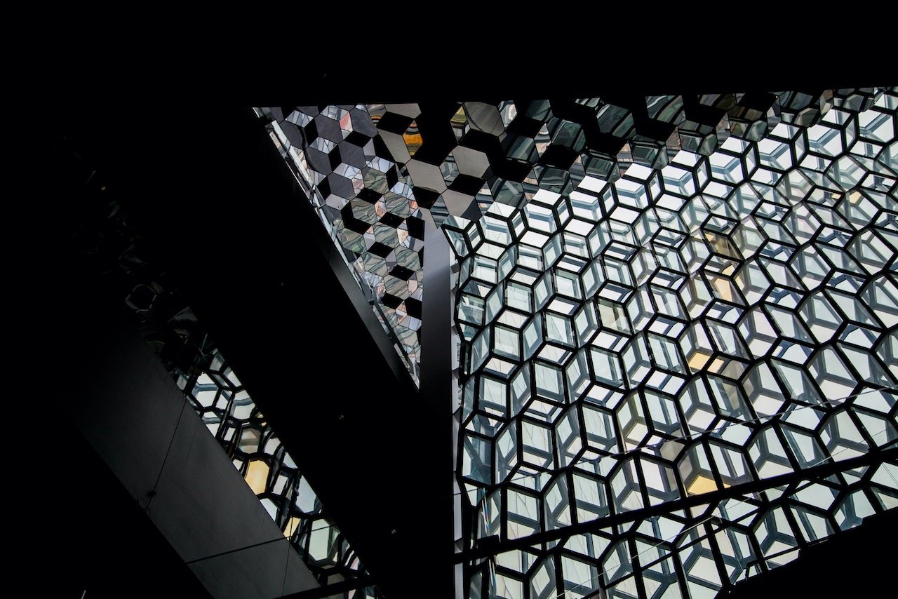
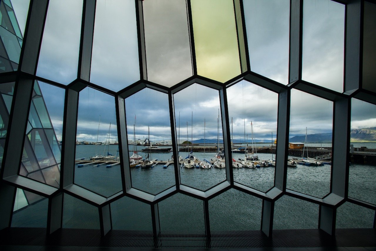
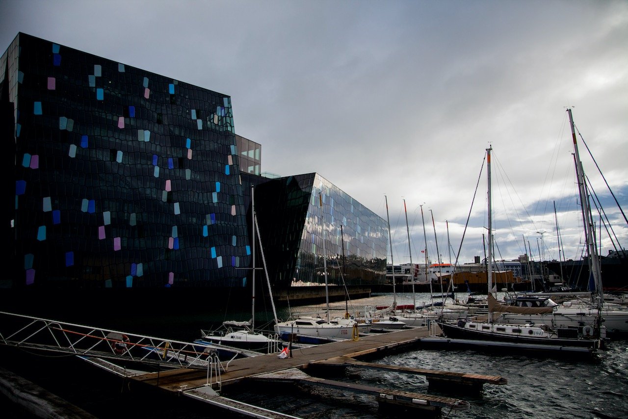
Reykjavik
(Blog Post - Let's go to Iceland: what to see in Reykjavik)
Reykjavik is one of the cleanest, greenest, and safest cities in the world. The first thing you may notice about the buildings are their colorful rooftops that line the city streets. This seems to be a theme in Scandinavia as a whole, which provides a great color contrast with the often cold and harsh, bleak winter environments they must endure for half a year.
Hallgrímskirkja - Nice church in the heart of Reykjavik. Can go inside and go up viewing tower. Great at all times of the year. Can be very very cold in the winter.
Þúfa - Art installation designed by the Icelandic artist Ólöf Nordal.
Harpa Convention Center - Performing arts center in the city. Open long hours. Nice to relax at.
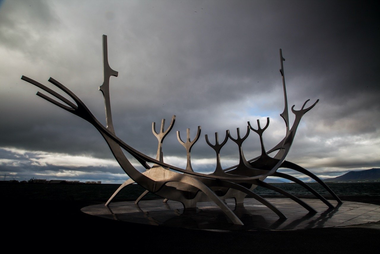
Sun Voyager - Sculpture by Jón Gunnar Árnason. Along the sea and meant to convey the promise of undiscovered territory, a dream of hope, progress and freedom
Blue Lagoon - outdoor thermal hot springs. Near Keflavik airport. A tourist trap but totally worth it.
Perlan - an exhibition center with a planetarium, observation deck, and a restaurant.
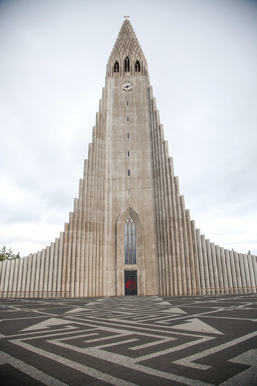
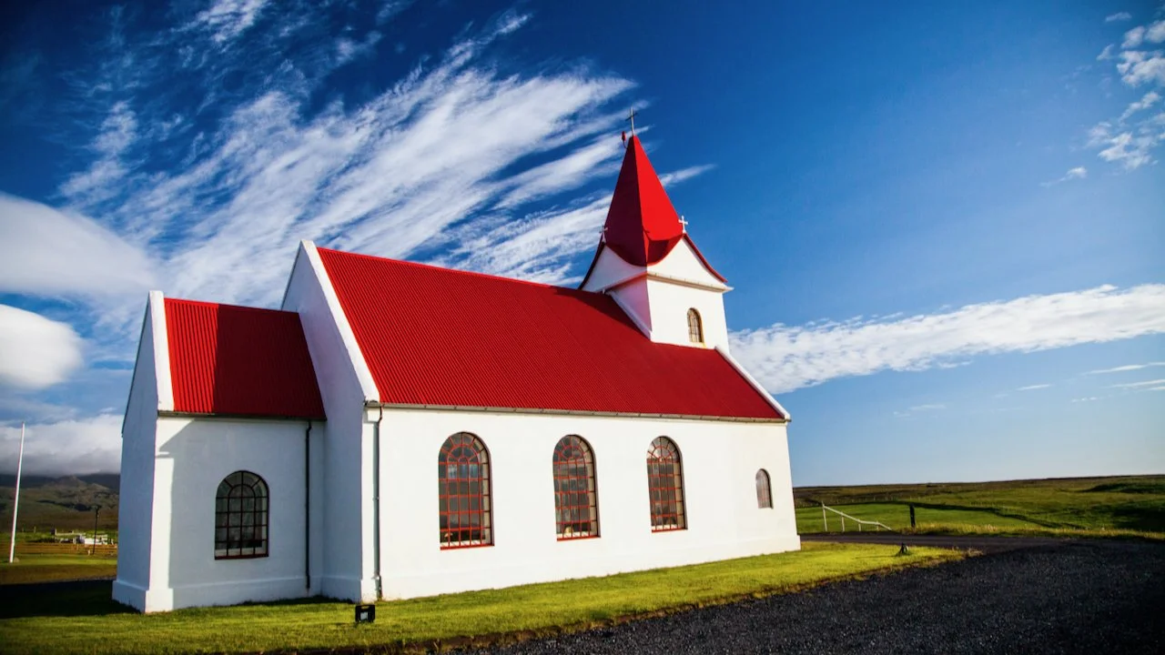
The Churches of Iceland
(Blog Post - The Churches of Iceland)
When Icelanders are born, they are registered as Christian or Lutheran for religious affiliation. As such, one would expect there to be quite a few churches in the country. The actual figures comes out to about 350 churches, big and small, in the whole of Iceland for approximately 330,000 inhabitants. This seems to be a bit excessive but with how spread out the country is, it makes more sense. The most interesting part of this is that Iceland is the 6th most atheistic country in the world.
The Lighthouses of Iceland
(Blog Post - The Lighthouses of Iceland)
With approximately 5,000 kilometers of coastline, Iceland needs a lot of lighthouses. About 104 to be exact. As a land settled by seafaring peoples, lighthouses have been crucial in Icelandic lore to guide sailors home after long expeditions and journeys. Modern technological improvements have since rendered these buildings defunct and most by and large are not needed, but they’re still awesome to look at and discover.

The Most Epic Waterfalls of Iceland
(Blog Post - The Most Epic Waterfalls of Iceland)
The word on the street is that Iceland has over 10,000 waterfalls. In my two weeks around the country, I believe I properly saw a paltry 50 or so. Nonetheless, there are waterfalls in all corners of Iceland so you can rest assured you are never too far from one. The waterfalls I’ll talk about from my own experiences will be: Hundafoss, Svartifoss, Svöðufoss, Hjalparfoss, Seljalandsfoss, Hengifoss, Öxarárfoss, Bruarfoss, Kirkjufellsfoss, Faxifoss, Haifoss, Goðafoss, Selfoss, Hraunfossar, Dettifoss, Klifbrekkufossar, Litlanessfoss, Skógafoss, Kolufoss, and Urriðafoss.

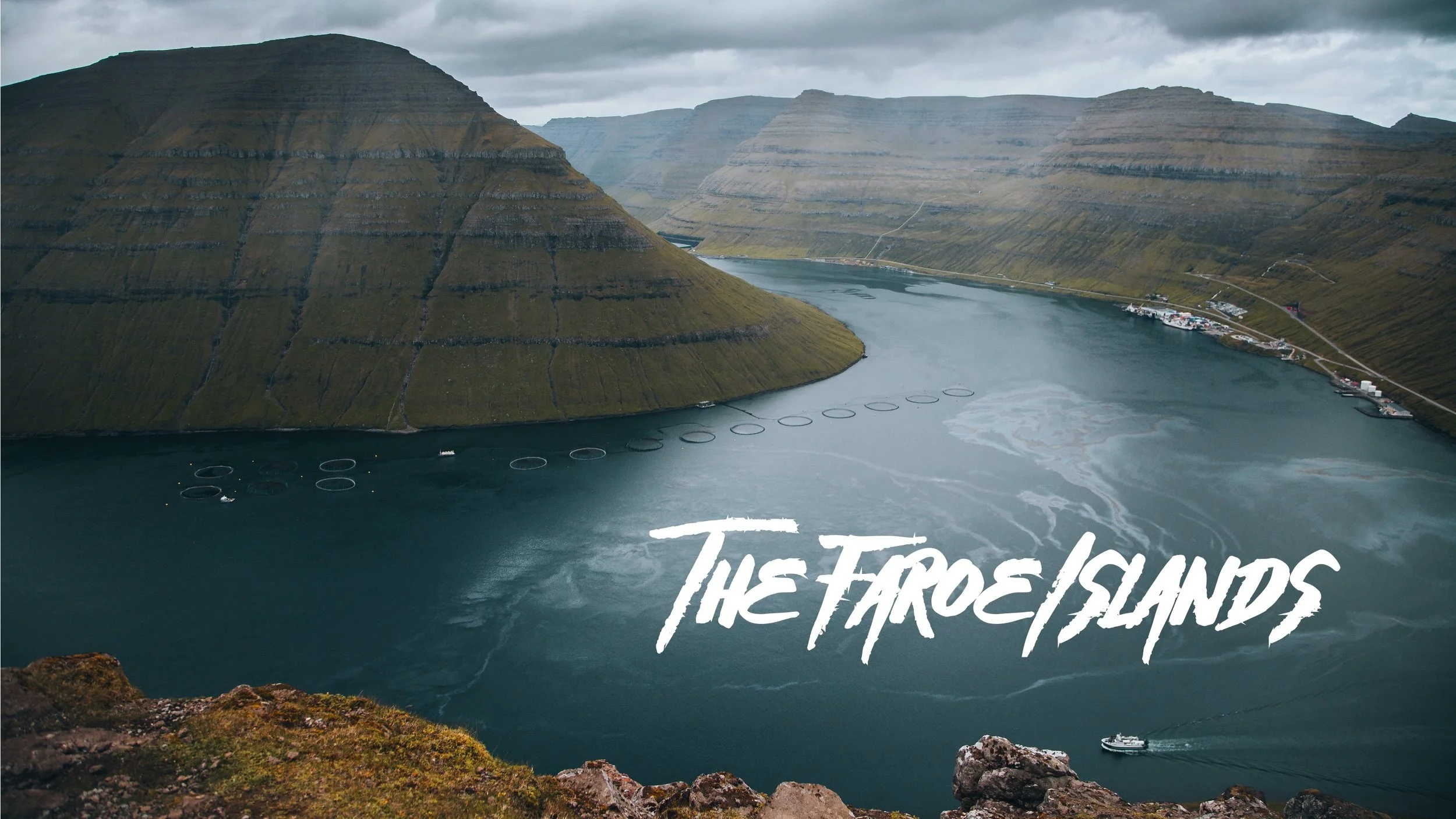
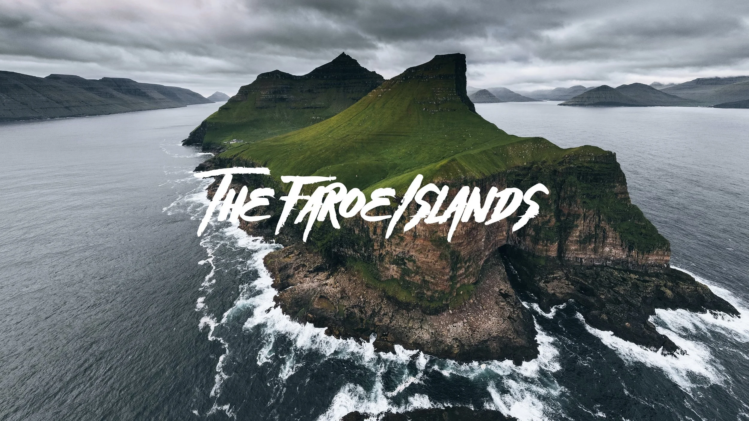
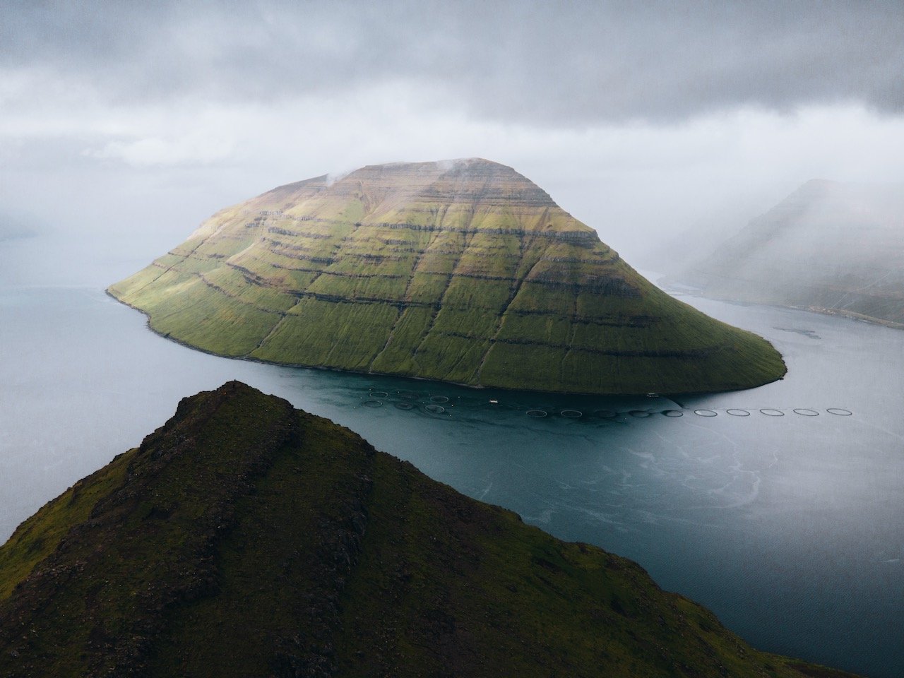
Faroe Islands
Tórshavn, Vágar, Streymoy, Eysturoy, Bordoy, Kalsoy, Vidoy, Mykines, Sandoy, Kunoy, Faroe Waterfalls
Just a few things to note about Faroe Islands before your visit:
The official currency of the Faroe Islands is the Faroese króna. This along with the Danish krone are accepted forms of currency. However, nearly all places in the Faroe Islands take card. Because of this, I didn’t get out ANY cash and it worked out just fine for me.
You can get around using the public transport buses in the Faroe Islands. Upon arriving in the airport, you can pick up an unlimited travel card on these buses for 4 or 7 days (more info here).
If you decide to rent a car (like myself), I HIGHLY recommend booking with Justdrive.fo. The owner’s name is Mike, a fellow Faroese citizen, who helped me every step of the way, especially after all my questions after renting his all electric Fiat 500.
Some of the places that you may be interested in are on private lands. Therefore, a fee is usually required to access these lands which can be done on site or online. For places like Drangarnir and Tindholmur, or the ferry to Mykines, use the website hiking.fo, to book in advance.
They say the Faroe Islands is the ‘land of maybe’, meaning it is heavily weather dependent on if things are happening or not. I learned this first hand with the cancelled ferries to Mykines the day of departure. Also, if it is raining, they say just wait 5 minutes, and the weather could change.
The Faroese people in my experience were incredibly kind people. From just exchanging smiles to whole conversations, I felt extremely welcomed by them and their hospitality.
There is no freedom camping in the Faroe Islands. You must be at a proper campsite, of which there are plenty scattered across the country.
I decided to stay in Vagar, just a few miles away from the airport and use that as my ‘home base’. It is not centrally located but I liked the convenience of getting back to the airport on my last day there in a timely fashion. You can also choose to stay in the capital of Torshavn or the second largest city of Klaskvik, but I imagine that accommodation there will be more expensive.
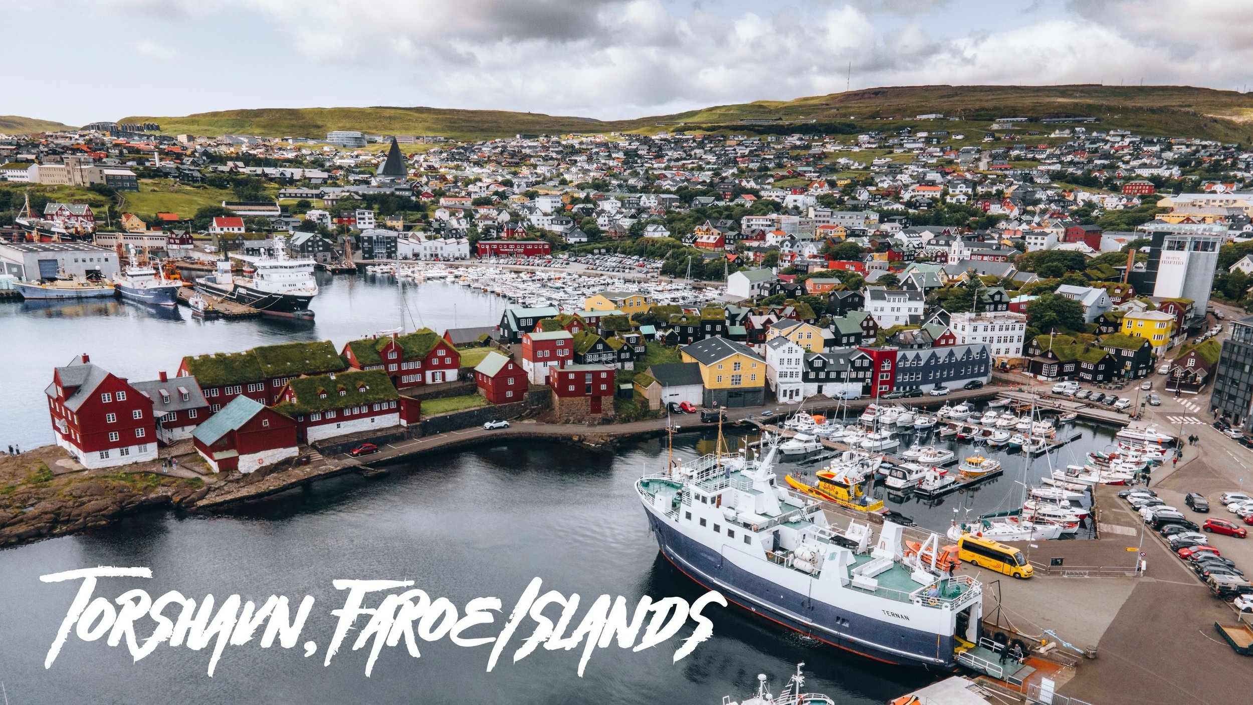
Tórshavn
(Blog Post: A Journey to the Faroese Capital of Tórshavn)
Tórshavn is the capital of the Faroe Islands and obviously, the country’s most populous city at 21,000. This is roughly 40% of the total Faroese population and is located on the island of Streymoy. Tórshavn is easily reached from all parts of Faroe using Bus 300 or 350 (depending on which direction you are heading/coming from). Furthermore, once you arrive in Tórshavn, you can rely on the very convenient bus network to get through the town (though the town is easily walkable). This was done to encourage the population and tourists to use public transport instead of driving and adding congestion to the Faroese capital (Bus Schedule and Map here). Places of interest include:
Vesturkirkjan and Tórshavn Cathedral
Svartafoss Waterfall
Skansin Fort and Lighthouse
Tórshavn Old Town and Tinganes Peninsula
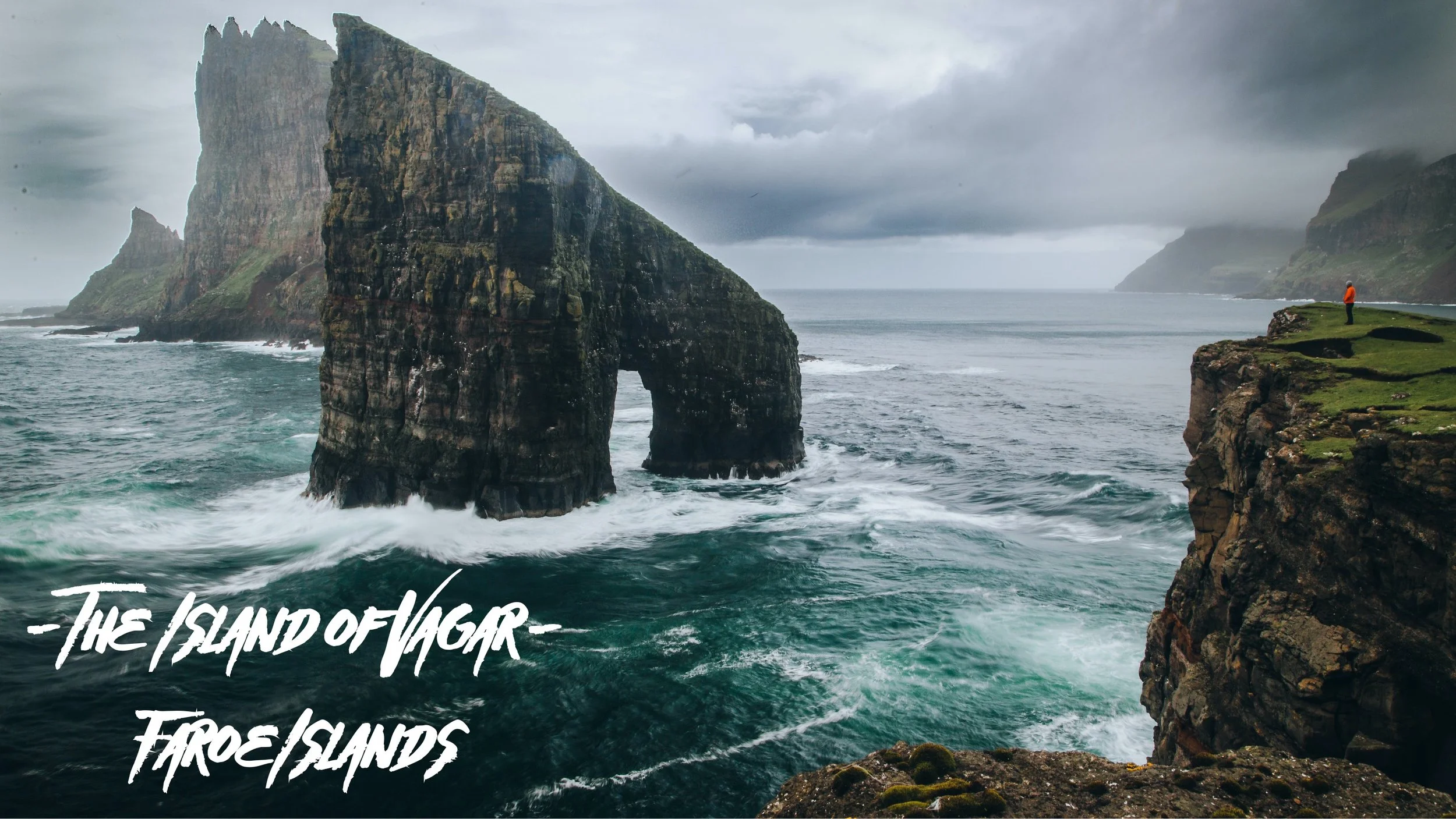
Vágar
(Blog Post: A Journey to the Faroe Islands: The Island of Vágar)
Vágar island of the Faroese archipelago is one of the ‘large islands’ and its general shape resembles a dog’s head (so they say). Since the airport is located on this island, it is the first taste of the Faroe Islands that tourists get. This airport served as an airfield during World War II and was used by the British, with the consent of the islanders. The airport was then modernized and commercialized for use in later years. It’s also a great island to start your Faroe Islands road trip adventure. Places of interest include:
Gasadalur, Bøur, and Sandavágur villages
Bøsdalafossur, Múlafossur, and Skarðsáfossur Waterfalls
Dunnesdranger and Witches Finger Trail (Trøllkonufingur) sea stacks
Trælanípa (Slave Cliff) and Drangarnir/Tindhólmur Hikes
Streymoy
(Blog Post: A Journey to the Faroe Islands: The Island of Streymoy)
The island of Streymoy bears most of the Faroese population, most of them centered around the capital city of Tórshavn on the southeast coast. Streymoy translates to ‘island of currents', presumably because this area also includes the islands of Hestur, Nólsoy, and Koltur (all a part of the Tórshavn Municipality).
The north of Streymoy is known for its mountains, in an area called Vestmannabjørgini (‘Cliffs of Vestmanna’). There are also a number of beaches spread out along the coastline of this island. What you won’t find much of on Streymoy though is trees, which is a common sight (or lack thereof) in all of Faroe. Places of interest include:
Saksun, Tjørnuvik, and Kvivik villages
Fossá, Kluftáfossur, and Svartafoss Waterfalls
The Capital City of Tórshavn
Saksun Church, Tórshavn Cathedral, and Magnus Cathedral (Kirkjubømúrurin)

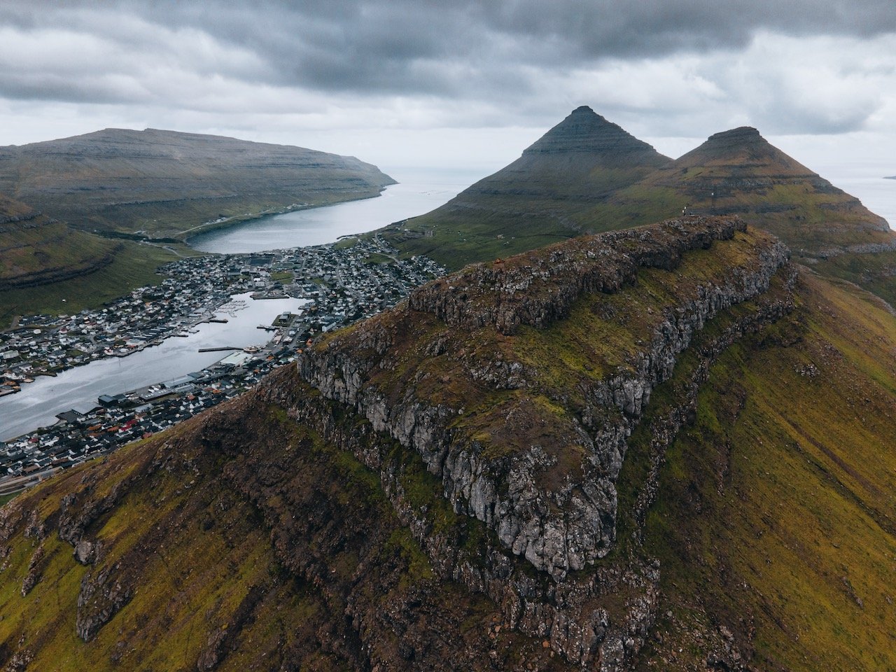
Eysturoy
(Blog Post: A Journey to the Faroe Islands: The Island of Eysturoy)
Eysturoy is one of the more mountainous islands in Faroe, with 66 separate peaks, the tallest being Slættaratindur. The fjords of Skálafjørður and Funningsfjørður nearly split the island into two. You can access this island by the Streymin Bridge from Eysturoy. It is also accessible via the Eysturoyartunnilin (the Eysturoy Tunnel) with direct access to the capital Tórshavn. You can explore this island in a day, checking out some of the towns, mountains, and natural formations most easily with a car. Places of interest include:
Gjógv, Eidi, and Funningur villages
Funnings and Eidi Churches
Slættaratindur - the tallest mountain in the Faroe Islands
Risin og Kellingin sea stacks

Kalsoy
(Blog Post: A Journey to the Faroe Islands: The Island of Kalsoy)
Kalsoy is located in Northeast Faroe Islands and only accessible by boat. Its name translated to ‘man island’ (neighboring Kunoy island translates to ‘woman island’). The island is long and narrow and the population is spread out over a small number of villages. There is a ferry service from Klaksvik to Sydradalur (a village on Kalsoy) multiple times a day (ferry schedule here). Places of interest include:
Húsar, Sydradalur, and Trøllanes villages
Kallur Lighthouse
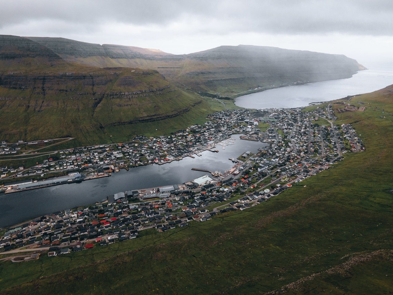
Bordoy
(Blog Post: A Journey to the Faroe Islands: The Island of Bordoy)
Bordoy island is located in the Northeast of the country, and translates to ‘Headland Island’. It contains 8 total settlements and the 2nd largest city in the Faroe Islands in Klaksvík. This portion of the Faroe Islands is often referred to as the Northern Islands. Places of interest include:
the city of Klaksvik
Klakkur Hike
Føroya Bjór, a Faroese brewing company
Christian’s Church (Christianskirkjan) and Árnafjardar Church
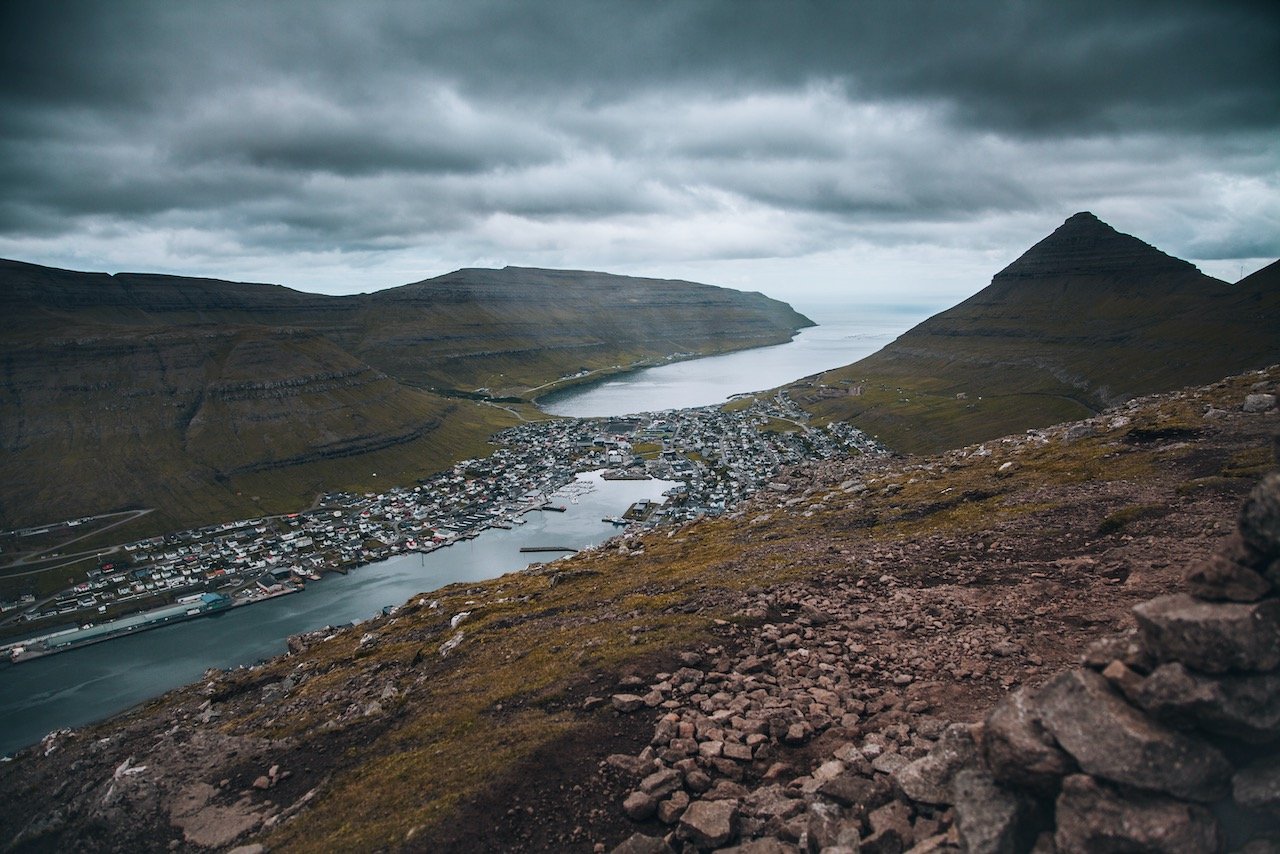
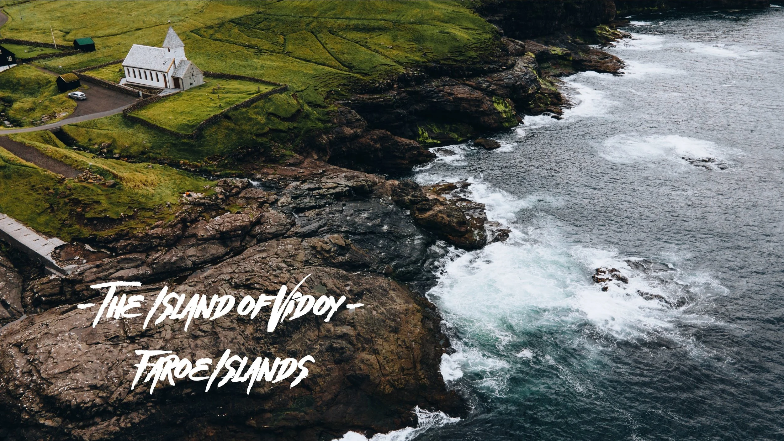
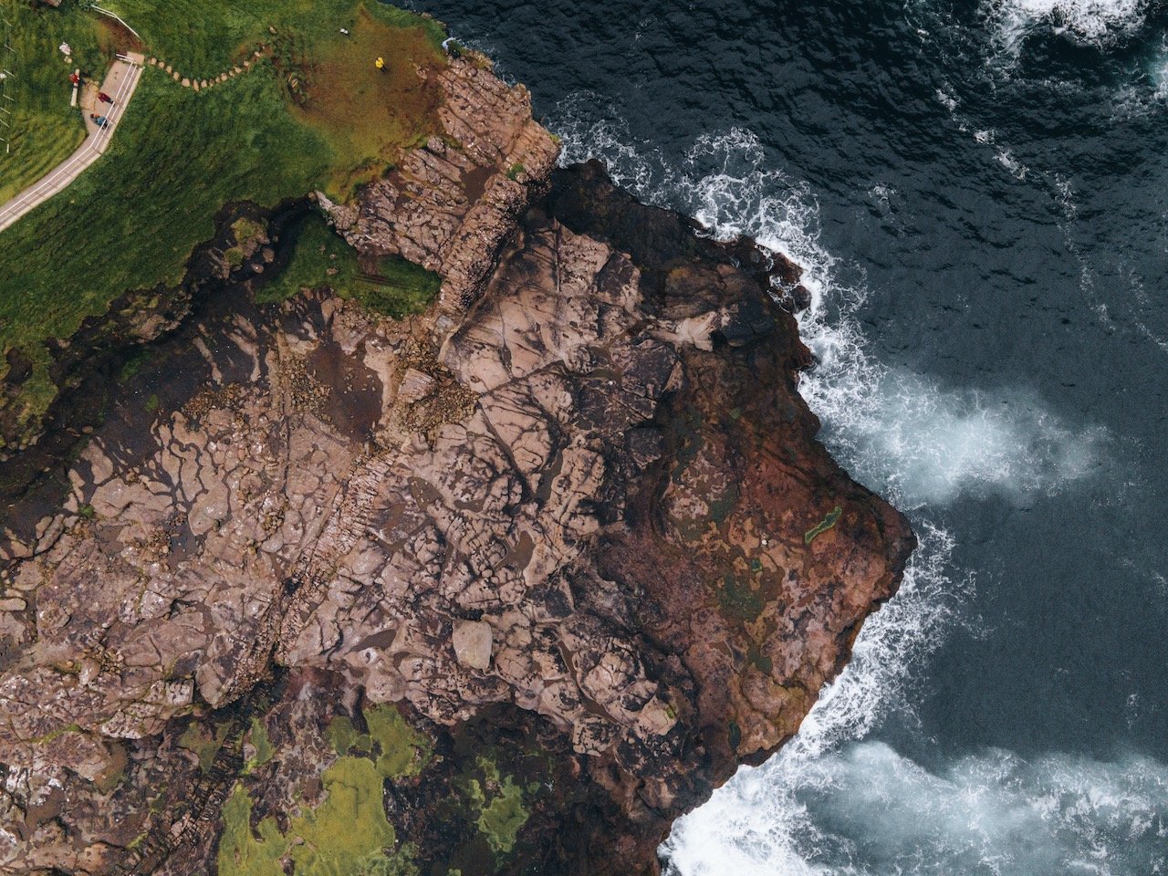
Vidoy
(Blog Post: A Journey to the Faroe Islands: The Island of Vidoy)
Vidoy is located to the east of Bordoy island and is the northernmost island in the Faroe Islands. It translates to ‘wood island’ even though there are not trees on it. It’s the furthest island away from Vágar that can be reached by car, a bit over 100 km away. Places of interest include:
Hvannasund and Vidareidi villages
Villingardalsfjall and Malinsfjall Mountain Hikes
Hvannasund and Vidareidi Churches
Mykines
(Blog Post: A Journey to the Faroe Islands: The Island of Mykines)
Mykines is the westernmost island of the Faroe Islands. It sits in the UTC-1 time zone officially but uses Greenwich Mean Time like the rest of the 17 islands that make up this nation. It is determined that the island was formed 60 million years ago from a series of volcanic eruptions. It is now home to plentiful bird life including puffins. Points of interest include:
Mykines Lighthouse
Mykineshólmur
Ramsar

Sandoy
(Blog Post: A Journey to the Faroe Islands: The Island of Sandoy)
Sandoy, translating to ‘Sand Island’, is considered one of the five southern islands in the Faroe islands. The village of Sandur is the largest population center on the island, standing at 532 inhabitants. It is the only island with sand dunes, a product of its sandy soil, of which Sandoy gets its name from. Places of interest include:
Husavik, Dalur, and Sandur villages
Sandskirkja
Sandur Beach

Kunoy
(Blog Post: A Journey to the Faroe Islands: The Island of Kunoy)
Kunoy is a long and narrow island, accessible by an embankment from Bordoy to Haraldssund. The mountain tunnel once you get only Kunoy is one lane and is also narrow so use caution! Kunoy directly translates to ‘woman island’ and therefore is the colloquial opposite to Kalsoy, meaning ‘man island’. Points of interest include:
Kunoy village
The Forest of Kunoy (Viðarlundin í Kunoy)
The gorge of Skarðsgjógv
The Waterfalls of the Faroe Islands
(Blog Post: The Waterfalls of the Faroe Islands)
There are a plethora of waterfalls on the Faroe Islands. They are everywhere you look and drive. Some are more spectacular and accessible than others. This is a small guide on which ones are the coolest to see and why they are significant. These waterfalls include Múlafossur, Bøsdalafossur, Fossá, Svartifossur, Skarðsáfossur, Týggjará, Kluftáfossur, and Svartidalurfoss.