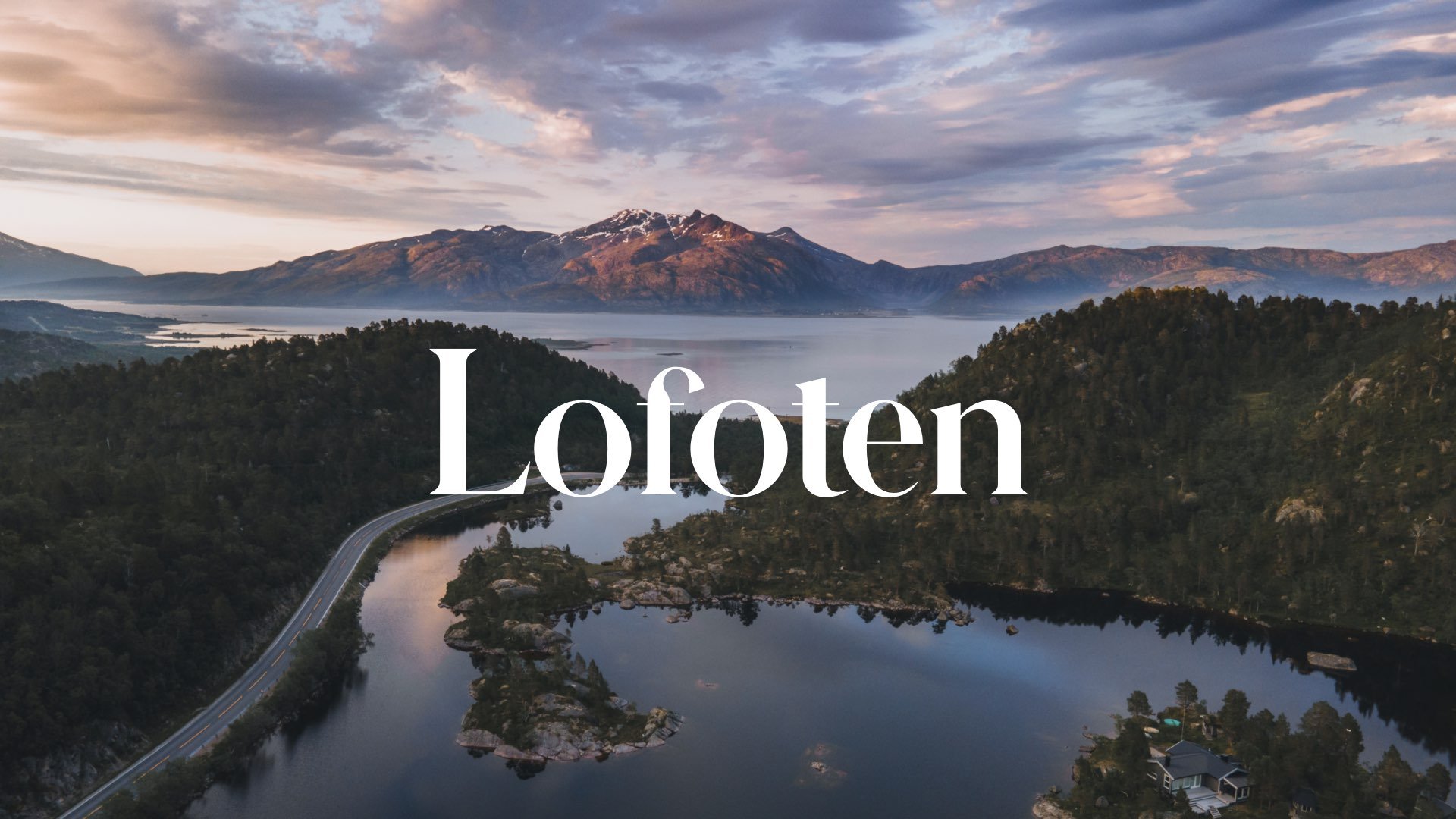
A Journey to the Lofoten Islands: The Island of Moskenesøya

Reine, Lofoten, Norway (ISO 400, 4.5 mm, f/2.8, 1/60 s)
(Some links in this post are affiliate links. If you click through and take action, I'll be compensated.) If you are also interested in any PRINTS from any of my posts, be sure to check out my store where you can buy prints as posters, in metal/wooden frames or on canvas.
**This post is the 4th of a 5-post series discussing what to see in this part of the Lofoten Islands (You can check out the other parts below, separated by each specific island: Part 1, Part 2, Part 3, Part 4, Part 5. Everything is also summarized in another post here.**
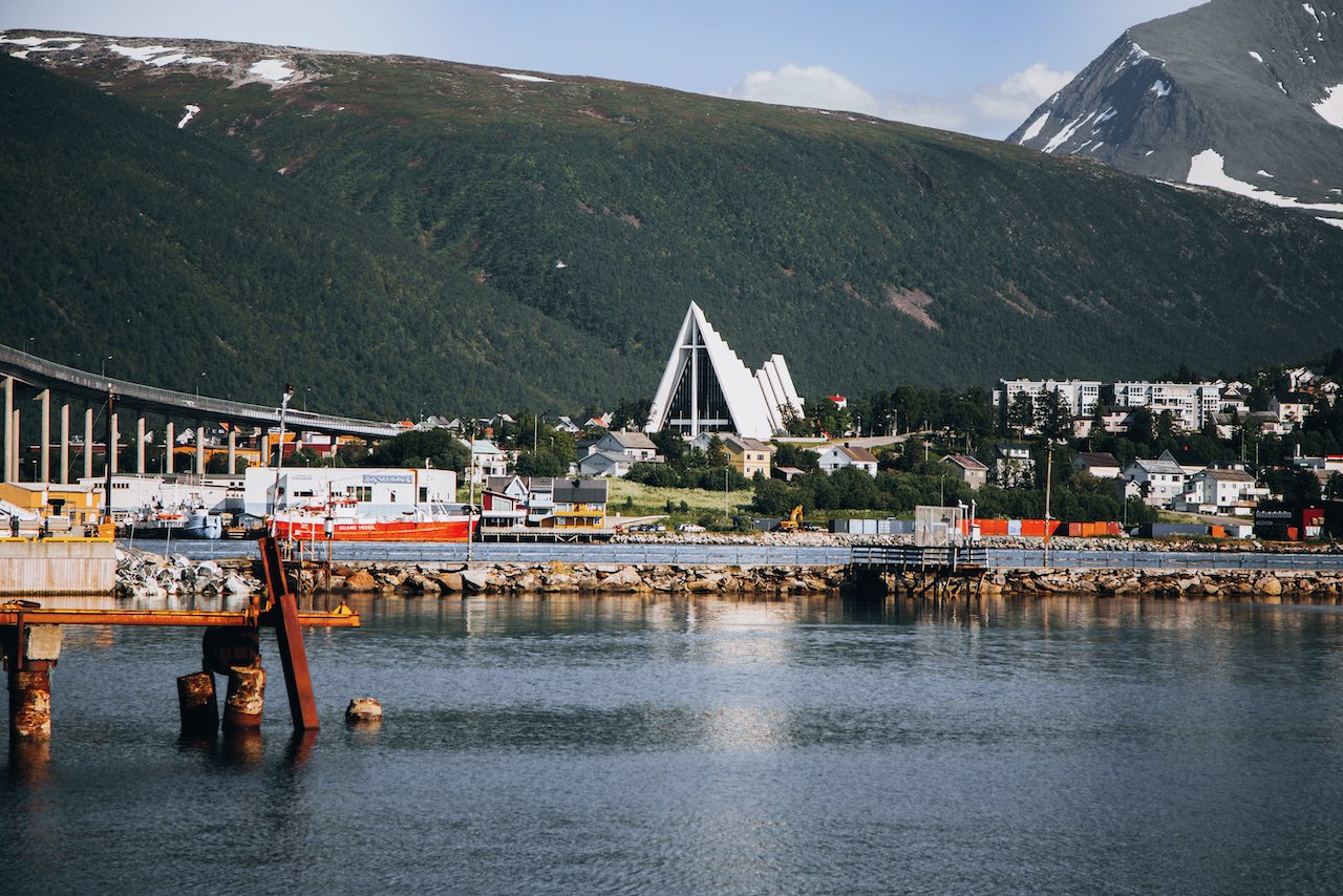
The Lofoten Islands are arguably one of the most beautiful archipelagos in the world. It is located in Northern Norway (Nordland County), within the Arctic circle tucked between the 68th and 69th northern parallels. I picked up a camper van with Arctic Campers in Tromsø, Norway (Blog Post: A Guide to Exploring Tromsø, Norway’s Northernmost City in the Arctic Circle) and had started the road trip towards Lofoten (about 4-5 hour drive).
The definition of which islands constitute Lofoten are always up for debate but for the purposes of this blog post series, I will cover 5 of the islands and reference some others. From North to South, they are composed of:
Gimsøy
Austvågøya (Blog Post: A Journey to the Lofoten Islands: The Island of Austvågøya)
Vestvågøya (Blog Post: A Journey to the Lofoten Islands: The Island of Vestvågøya)
Flakstadøya (Blog Post: A Journey to the Lofoten Islands: The Island of Flakstadøya)
Moskenesøya (Blog Post: A Journey to the Lofoten Islands: The Island of Moskenesøya)
Værøy (Blog Post: A Journey to the Lofoten Islands: The Island of Værøy)
In this blog post, I will cover the island of Moskenesøya. A Google Map of these places I will talk about can be seen at the end of this article. Check out my drone video of Reine in the Lofoten Islands below!
How to Get to the Lofoten Islands (Moskenesøya Island)
Moskenesøya is the southernmost island in the Lofoten archipelago, connected by road via the E10 highway. It’s famous for its dramatic landscapes, charming fishing villages like Reine and Å, and access to the ferry terminal for Bodø.
Car Rental – The easiest way to reach Moskenesøya is by car. Rent a vehicle from Harstad/Narvik Airport (EVE), Leknes, or Svolvær and drive west on the E10 all the way to the island’s end.
From Leknes: ~50 km
Driving Time: ~50–60 minutes
Route: Follow E10 west, crossing bridges and tunnels including Nappstraumtunnelen and Fredvang Bridges
Notes: Roads are well maintained year-round; perfect for scenic stops at Reine and Å
Bus – Public buses run from Leknes, Svolvær, and other Lofoten towns to Moskenes. The main route is Bus 300, which connects all major islands in Lofoten.
Route: Leknes → Napp → Ramberg → Moskenes → Reine → Å
Duration from Leknes to Moskenes: ~60 minutes
Cost: ~120–150 NOK
Tickets: Buy onboard or via the Reis Nordland app
Frequency: 2–4 times daily, varying by season
Ferry – If you’re coming from Bodø, take the ferry directly to Moskenes ferry terminal.
Ferry Time: ~3.5 hours (Bodø to Moskenes)
Notes: The ferry allows vehicle transport, making it convenient if you bring your own car
From Moskenes terminal, you can start exploring Moskenesøya by car or bus immediately

Ryten, Lofoten, Norway (ISO 200, 24 mm, f/4, 1/1000 s)
Fredvang Beach gives excellent views of the village of Vikten, which I talked about on a blog post about the island of Flakstadøya. This is a great spot for the Midnight Sun in the summer time as well as the Aurora Borealis (Northern Lights) in the Winter months. Fredvang camping next to the beach gives you the chance to experience waking up next to the ocean waves.
Ryten is perhaps the most popular hike in all of Lofoten. This is usually something that makes me shy away from it but it was well worth it in this case. Ryten is a huge cliff that is 543 meters in elevation and because of that, it takes a few hours to get to the summit in a well marked path, however with somewhat steep terrain when you get close to the top. The photographic shot you want is the small outcrop of rocks that jut out into the air, over Kvalvika Beach below. Use caution as it can get very windy and slippery in the rain.
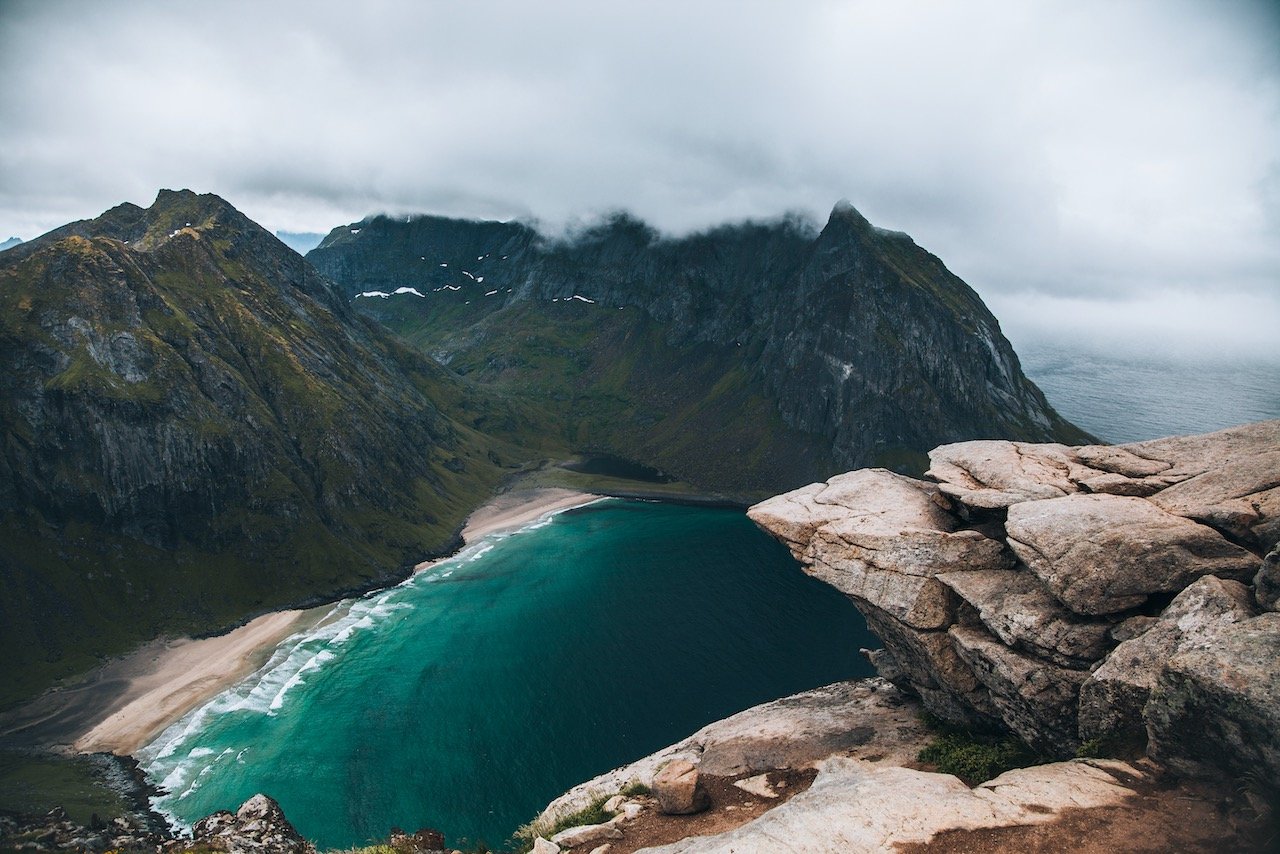
Kvalvika Beach, Lofoten, Norway (ISO 200, 24 mm, f/4.5, 1/800 s)
This is also the only way to real Kvalvika Beach, that sits below Ryten. The beach is stunning, and when its sunny, is illuminated in a gorgeous emerald color. To get there, you have to start the hike to Ryten, however nearly 1/3rd of the way, you take a trail to the left of the Ryten trail on a small plateau that takes you towards the beach. Since you can’t drive to the beach, the only other people there will be other hikers. I would recommend doing this beach hike AFTER going up Ryten, this way you can relax on the beach, knowing you have already conquered the towering mountain above.
You can camp here as well but just know that you will likely be surrounded by other tourists with the exact same idea. There are other beaches that are more isolated for this however it’s hard to stay away from the raw beauty of this place.
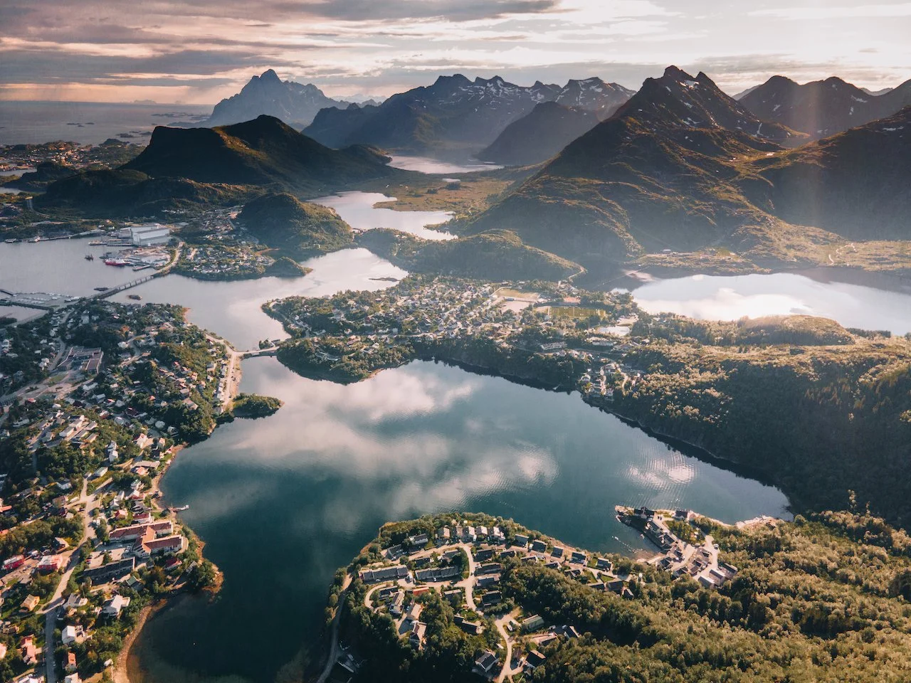
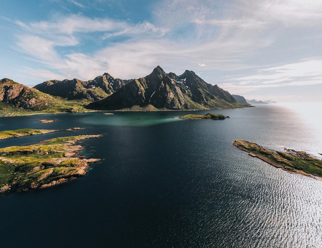
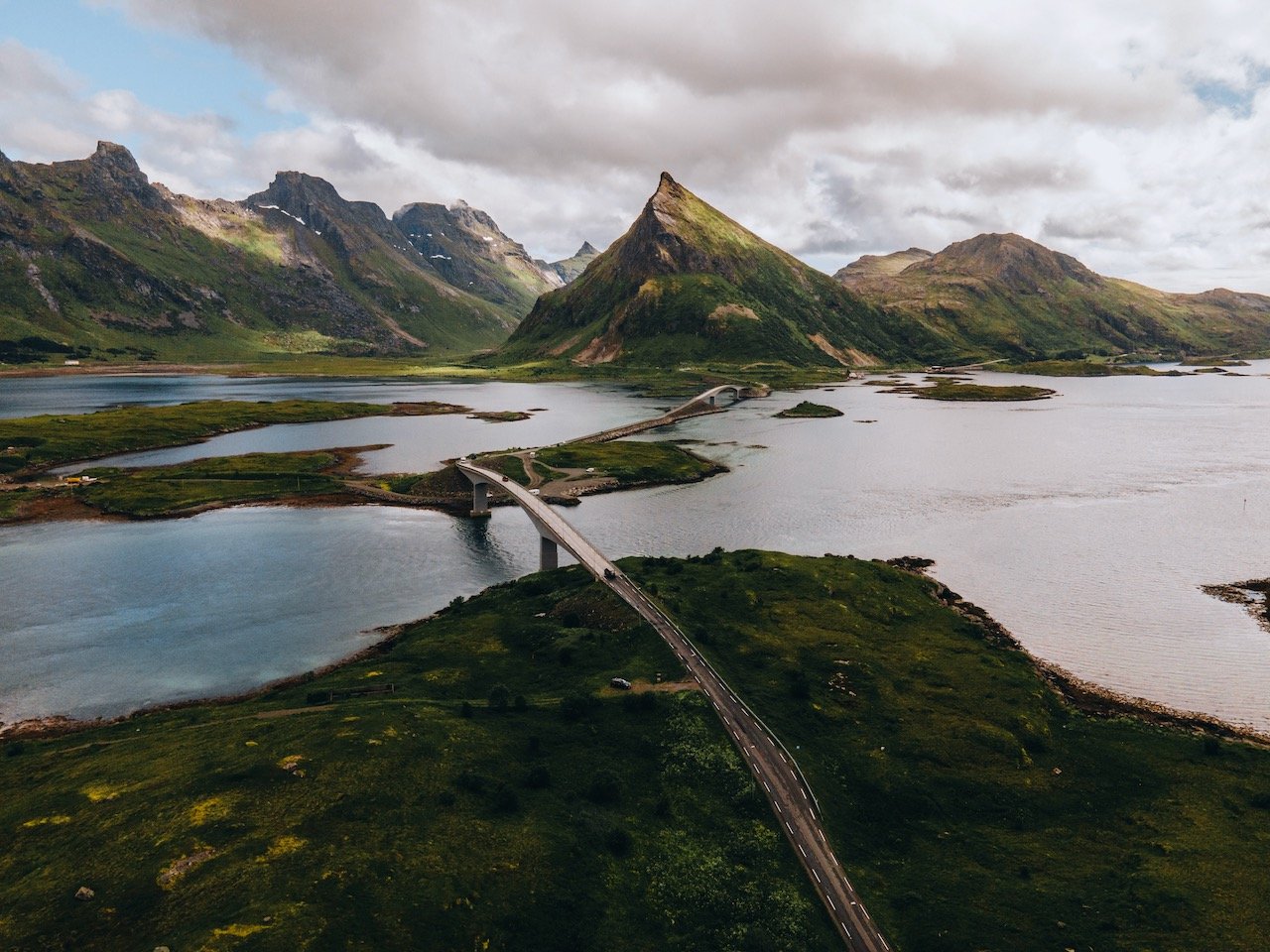
Lofoten, Norway (ISO 100, 4.5 mm, f/2.8, 1/50 s)
If you thought Ryten was fun, then go and try Fuglhuken, which is the larger sibling of Ryten, located in Lofotetodden National Park. You will find more sheep here than people, giving you the solitude you seek after sharing Ryten with everyone else in the world (seemingly). To get here, head to the village of Fredvang and go towards Yttersand.
If you like some of my photos that you have come across, just know that I have many prints showcasing a variety of landscapes, including Norway, available for purchase below! (Sold as Posters, Canvas, or in Metal-Frames and Wooden-Frames).


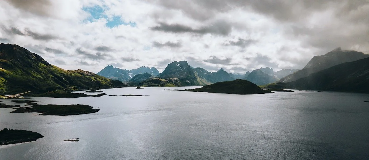
At the northernmost tip of Moskenesøya sits Roren (Ytresandheia). This is more of a mountain plateau with a great trail and low elevation. You can see Yttersand beach in the distance as well as the mountains of Flakstadøya. It’s a relatively easy hike that you can enjoy than some of the others I have mentioned in this post.

Hamnøy, Lofoten, Norway (ISO 200, 24 mm, f/4.5, 1/1250 s)
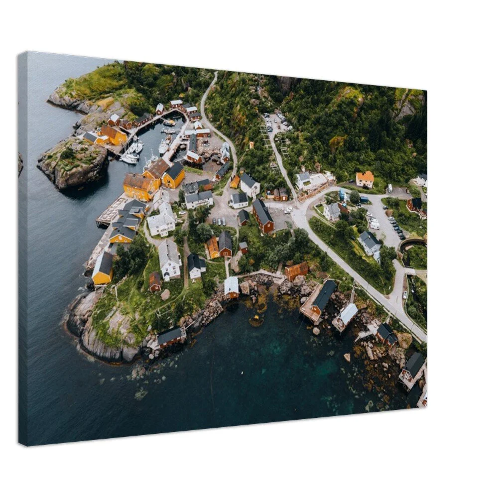
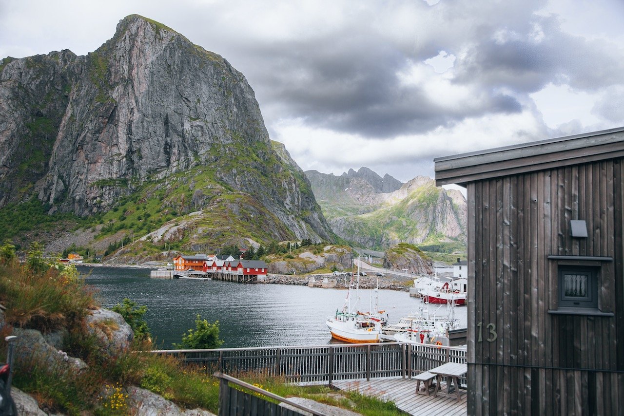
Hamnøy is one of the more iconic villages in all of Lofoten. You’ve seen those pictures before: these gorgeous red colored cabins [called rorbu, or rorbuer (plural)], standing on wooden planks above the turquoise blue water with a mountain backdrop. Welcome to Hamnøy. These cabins are very popular places to stay, if they are in your price range. We merely stayed in our campervan and enjoyed them from afar. Nonetheless, you can still walk on this little island, which is full of great viewpoints of the mountains, rorbuer, and harbor, along with a cafe and nice restaurant.
Hamnøy, Lofoten, Norway (ISO 200, 32 mm, f/4.5, 1/800 s)
Sakrisøy is another small island similar to Hamnøy. It sits at the foot of Olstind mountain with its own set of fisherman cabins you can stay at. Take a walk around this island as well if you haven’t gotten your fix from Hamnøy. If time permit, head on over to Anitas Sjømat, a seafood bar serving delicious delicacies from around Lofoten.

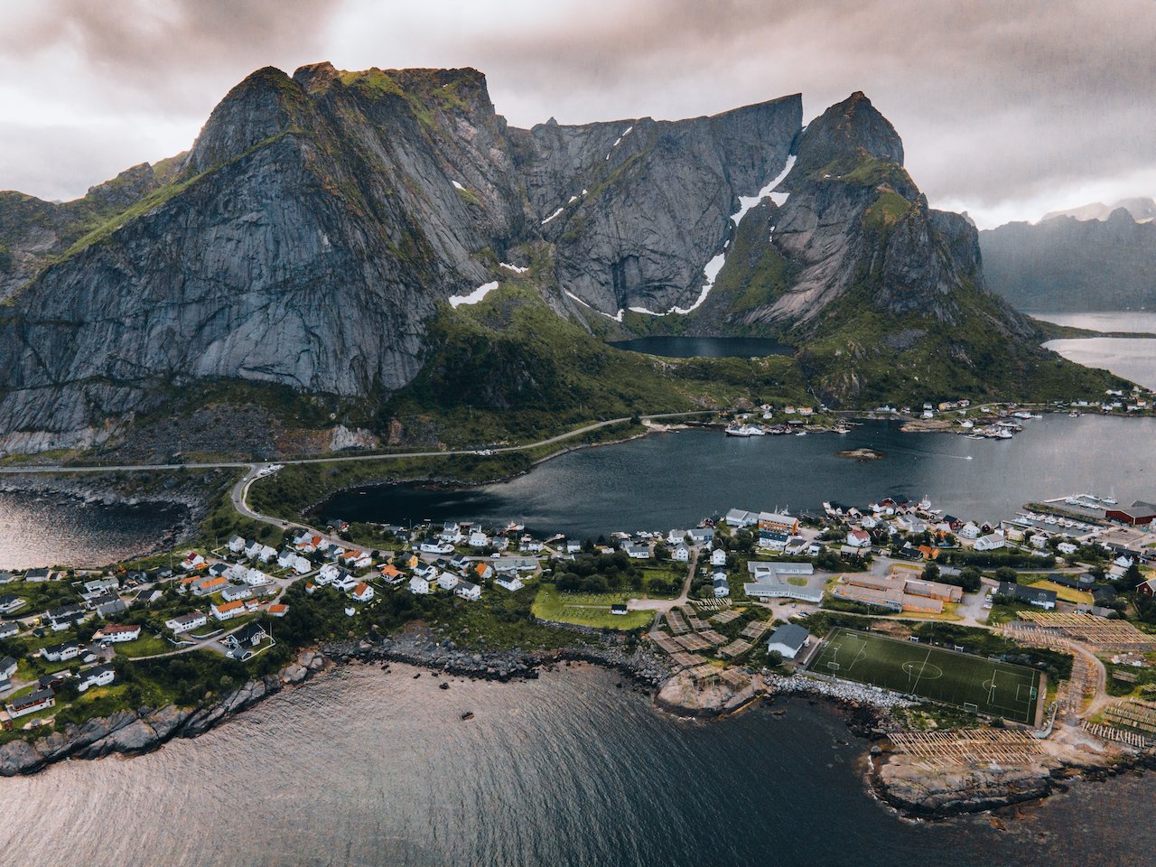
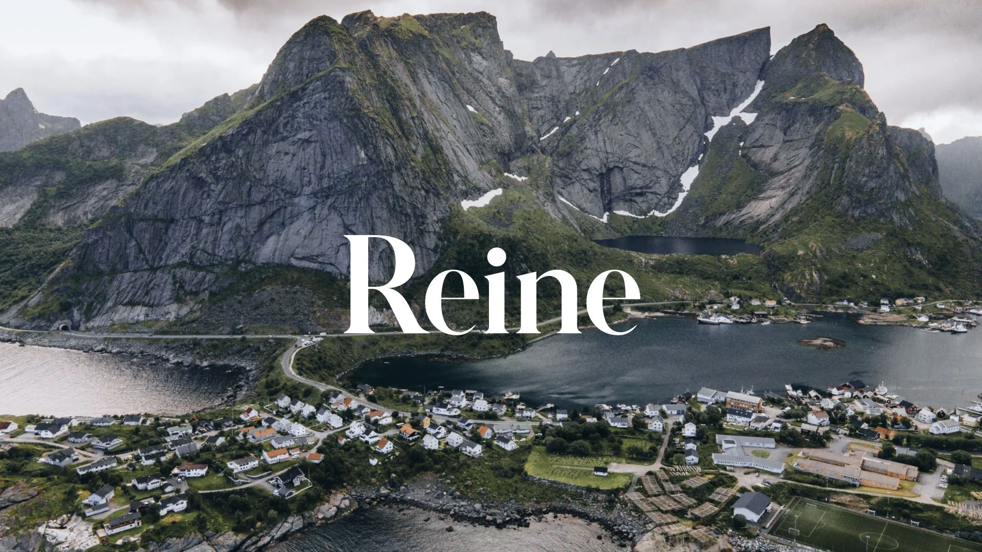
Reine, Lofoten, Norway (ISO 400, 4.5 mm, f/2.8, 1/60 s)
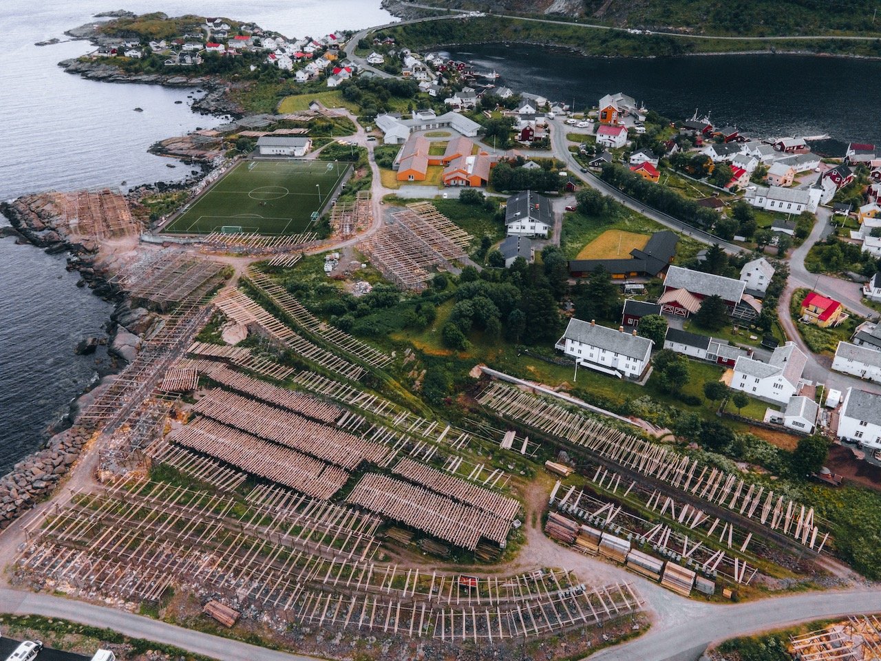
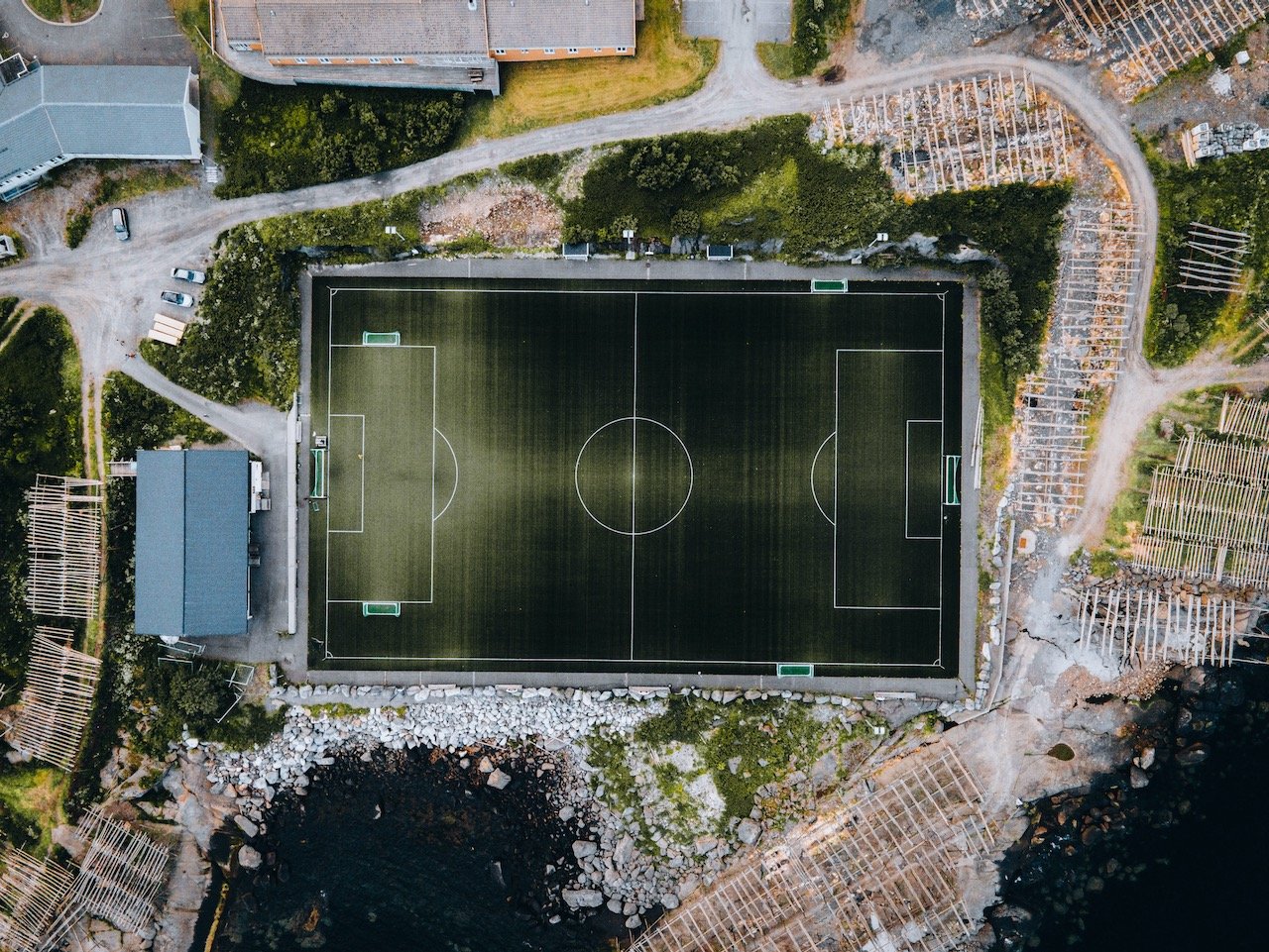
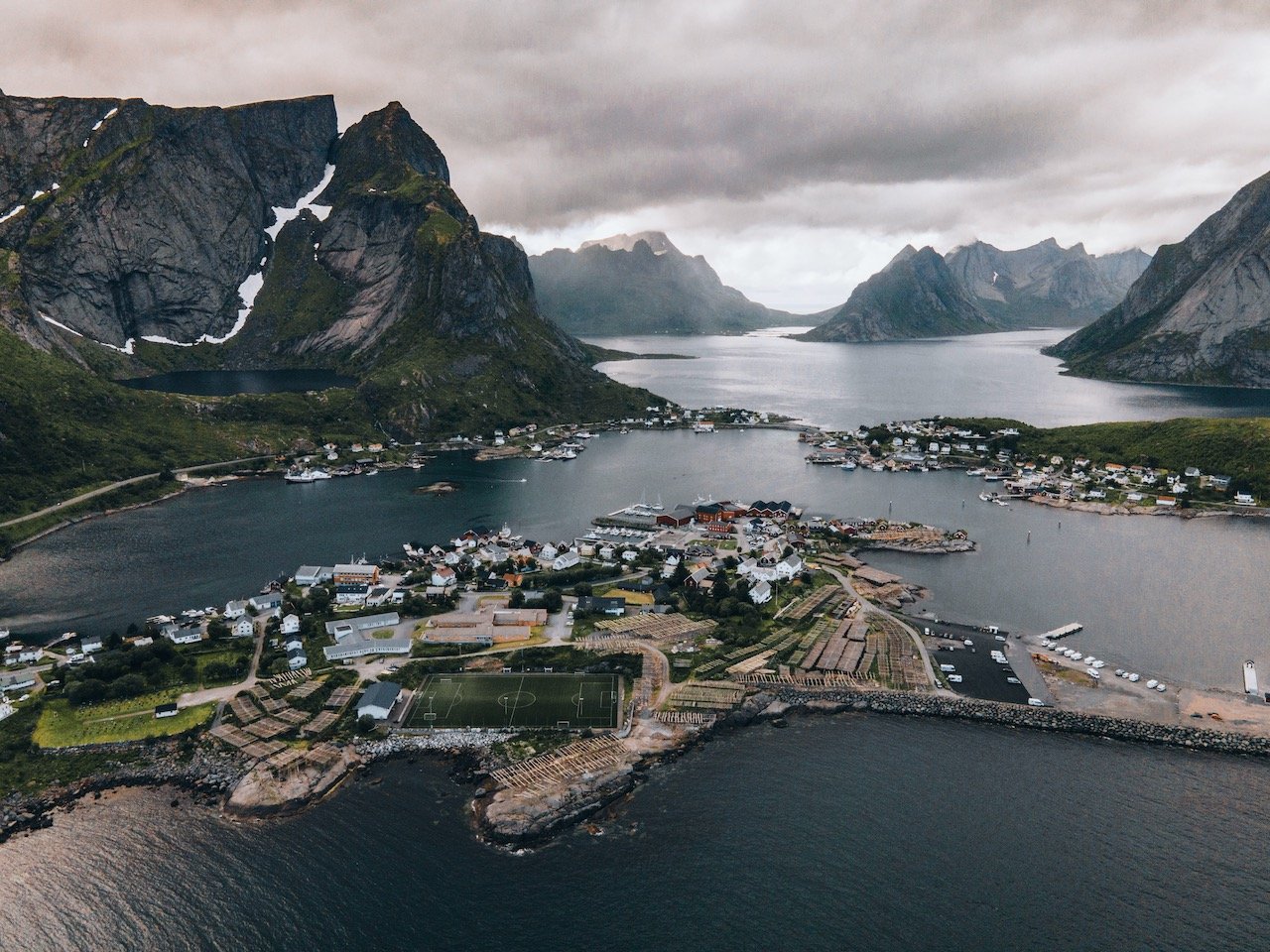
Reine is the administrative center of Moskenes. This village has a population of only 314, but seems much larger giving all the tourists that love to visit. While driving along the E10, you will find signs for Reine and take a left. Immediately after taking this left, take another left and you will arrive at a small parking lot viewpoint of the village with a gorgeous mountain backdrop.

Fish Drying Racks in Reine, Lofoten, Norway (ISO 200, 105 mm, f/4.5, 1/500 s)
Venture further into the village and you will find shops with all the modern conveniences (grocery store, gas station, cafe, souvenir shop). If you follow the signs for parking, you will eventually end up in a large lot, passing fish drying racks along the way. We actually wanted to take a photo around the racks themselves but couldn’t even get too close since the smell was AWFUL. Good luck with that.
Reinebringen is the popular hike to do here, for great aerial views of Reine below. The mountain is 448 meters high, one of the highest in Lofoten. Hundreds of people make this hike everyday abut I would go out on a limb and say that it is worth it simply for the killer views. The stairway, known as the Sherpa Stairway, with its perfectly manicured stairs, lead you up to the summit.
Lofoten, Norway (ISO 200, 4.5 mm, f/2.8, 1/50 s)