
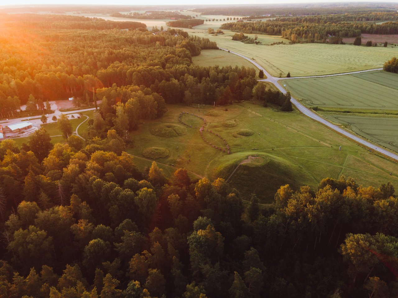
Anundshög in Västerås, Sweden
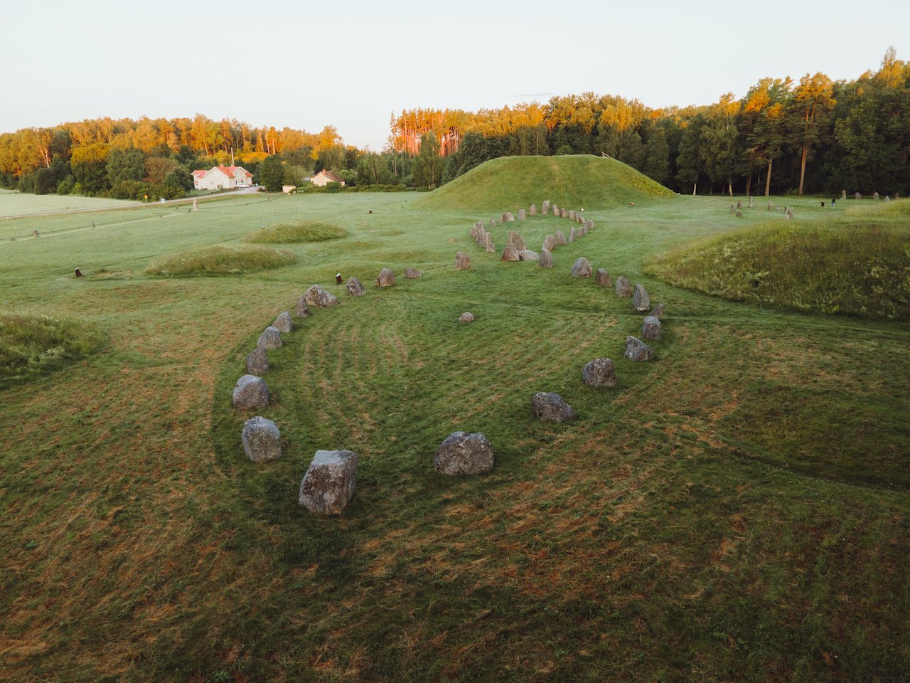
Learning Viking history while in school versus seeing it in real life is such a different experience. I remember being fascinated by Viking culture but now I live in Sweden, so I am always surrounded by this storied history and see the relics of its time via old Castles and Runestones. The viking ship is a symbol of pride and importance for the culture and the descendants of the Viking people. Anundshög is a place that exemplifies this culture and history. A collection of stones resembling that of a Viking ship sitting below an ancient burial mount is just as Viking as it gets.
In this post, you’ll see my latest photos from Anundshög and tips on how to get there.
Anundshög, A Brief History
Anundshög, located near Västerås in central Sweden, is the largest burial mound in the country, standing around 9 meters high and 64 meters wide. Archaeologists believe it dates back to the 5th–7th century AD, during the Migration Period, when powerful chieftains were buried in monumental earthworks to signify status and legacy. The site later became a symbol of authority and gathering.
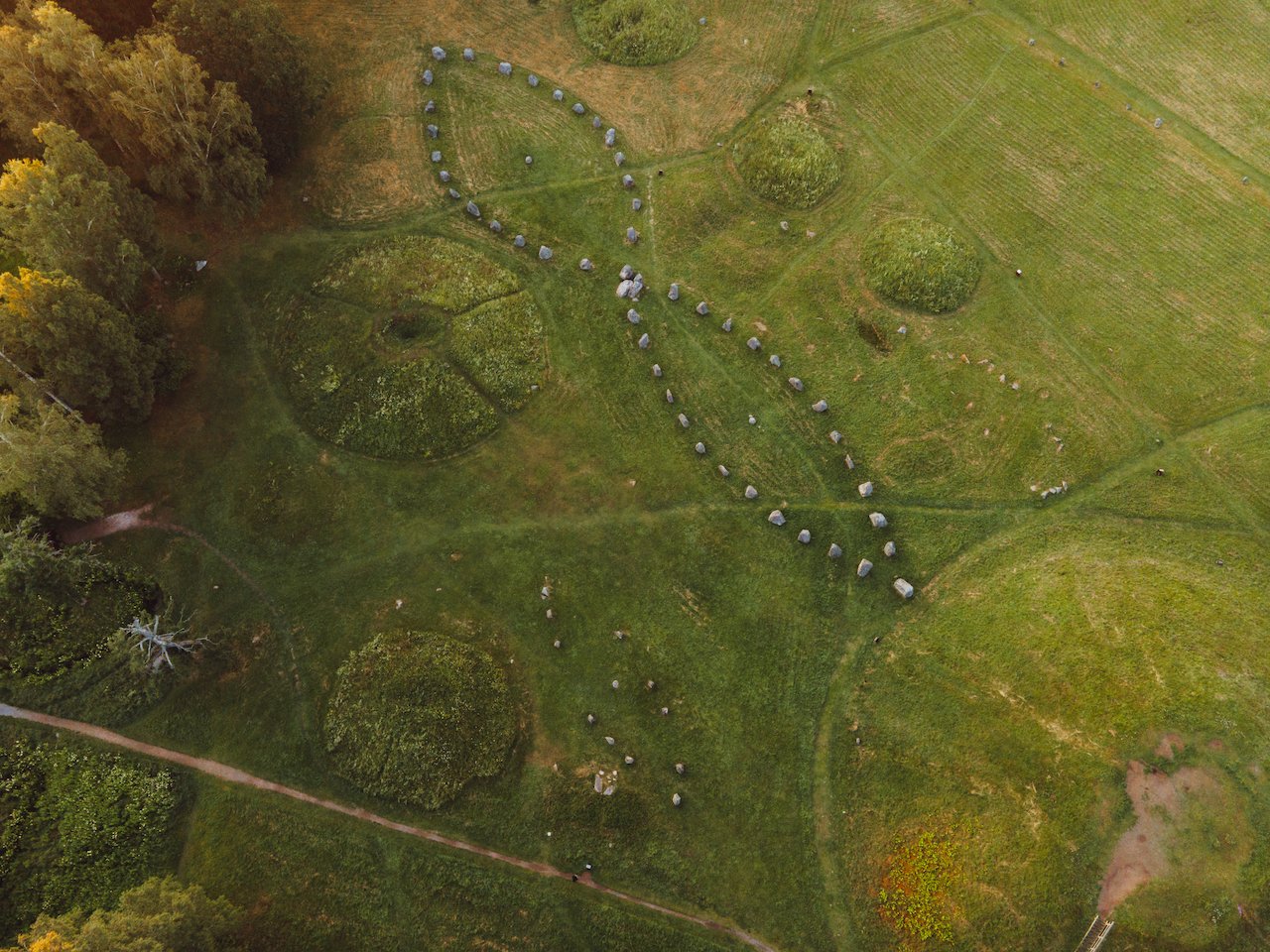
Surrounding the mound are stone ship settings—large stone formations arranged in the shape of Viking ships, believed to be symbolic graves or ceremonial markers. These formations reinforce the theory that Anundshög served both funerary and ritual purposes, possibly linked to pagan worship or early legal assemblies known as “Things.”
The name Anundshög is thought to reference King Anund, a semi-legendary ruler mentioned in Norse sagas. By the Middle Ages, the site became a landmark for pilgrims and travelers, with medieval roads passing nearby. Today, Anundshög stands as an open-air archaeological monument, freely accessible and deeply atmospheric.
Anundshög Photos
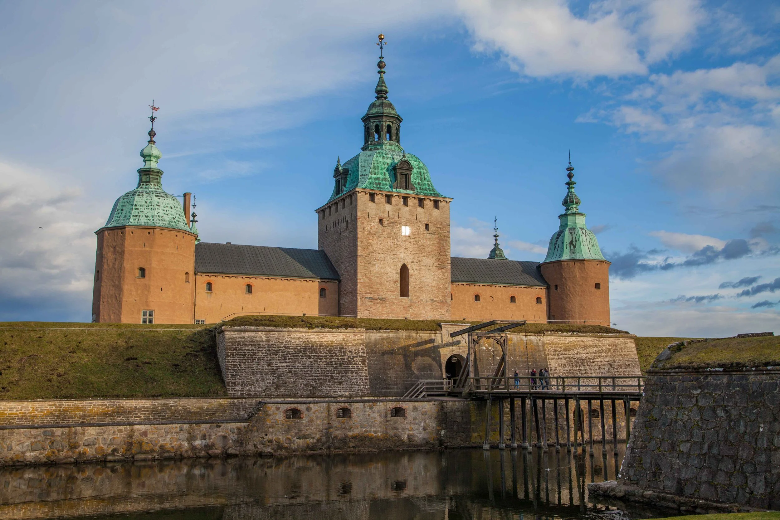
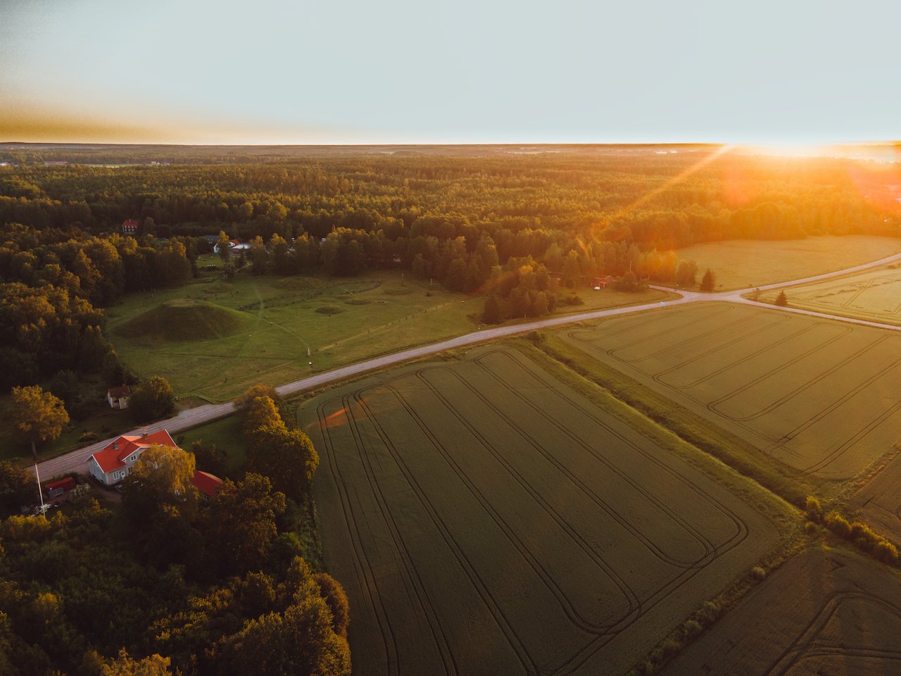
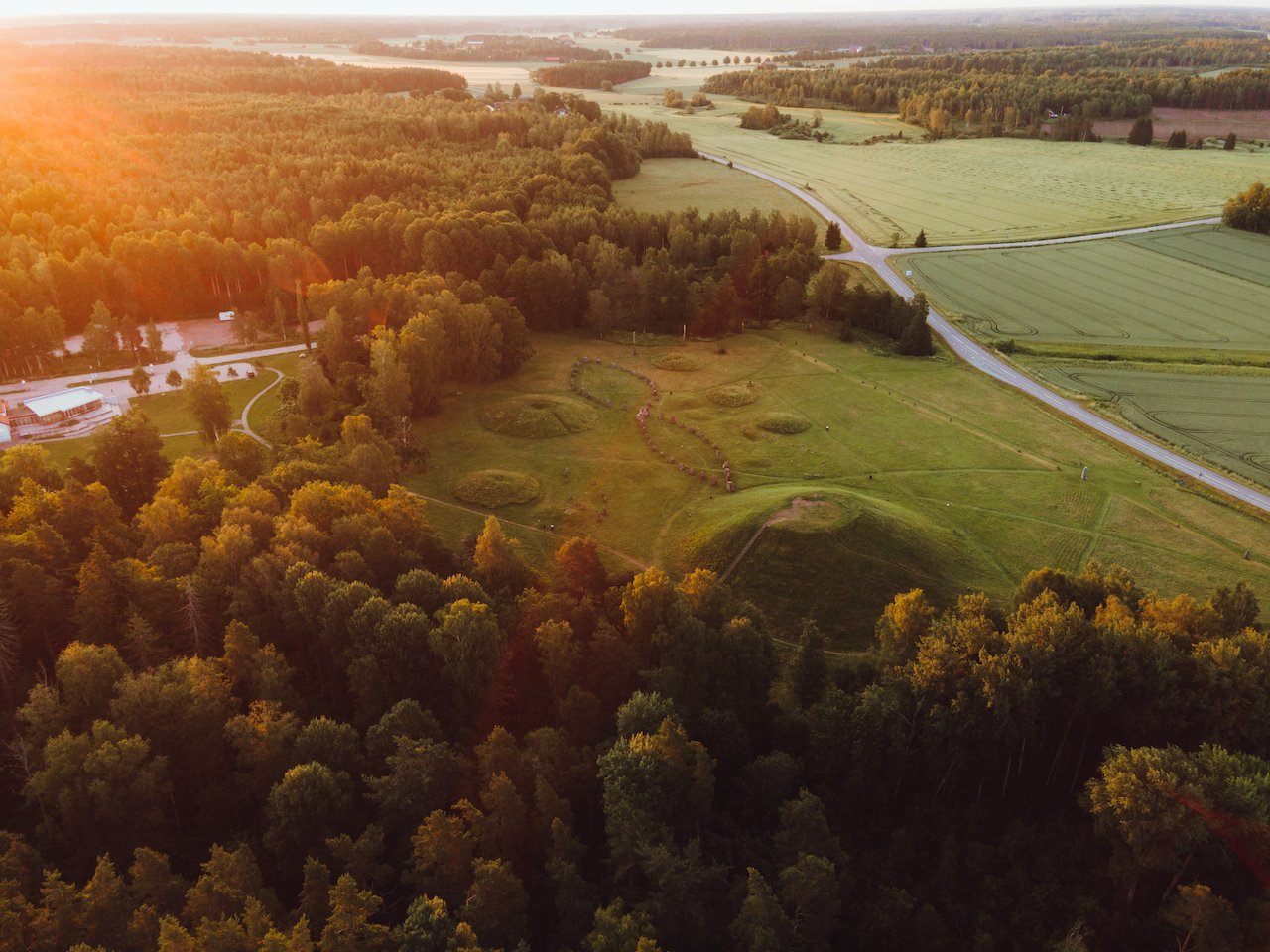
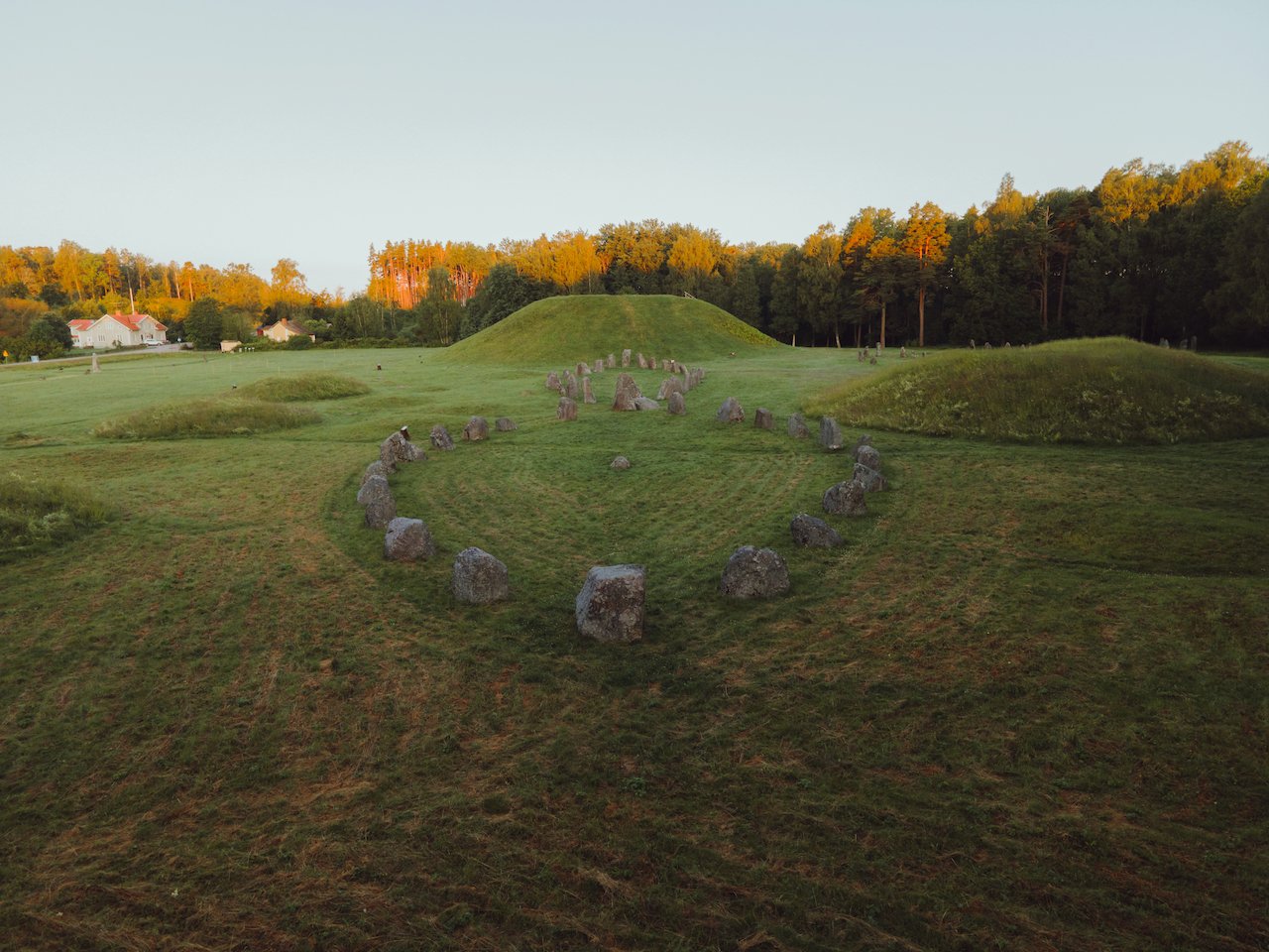
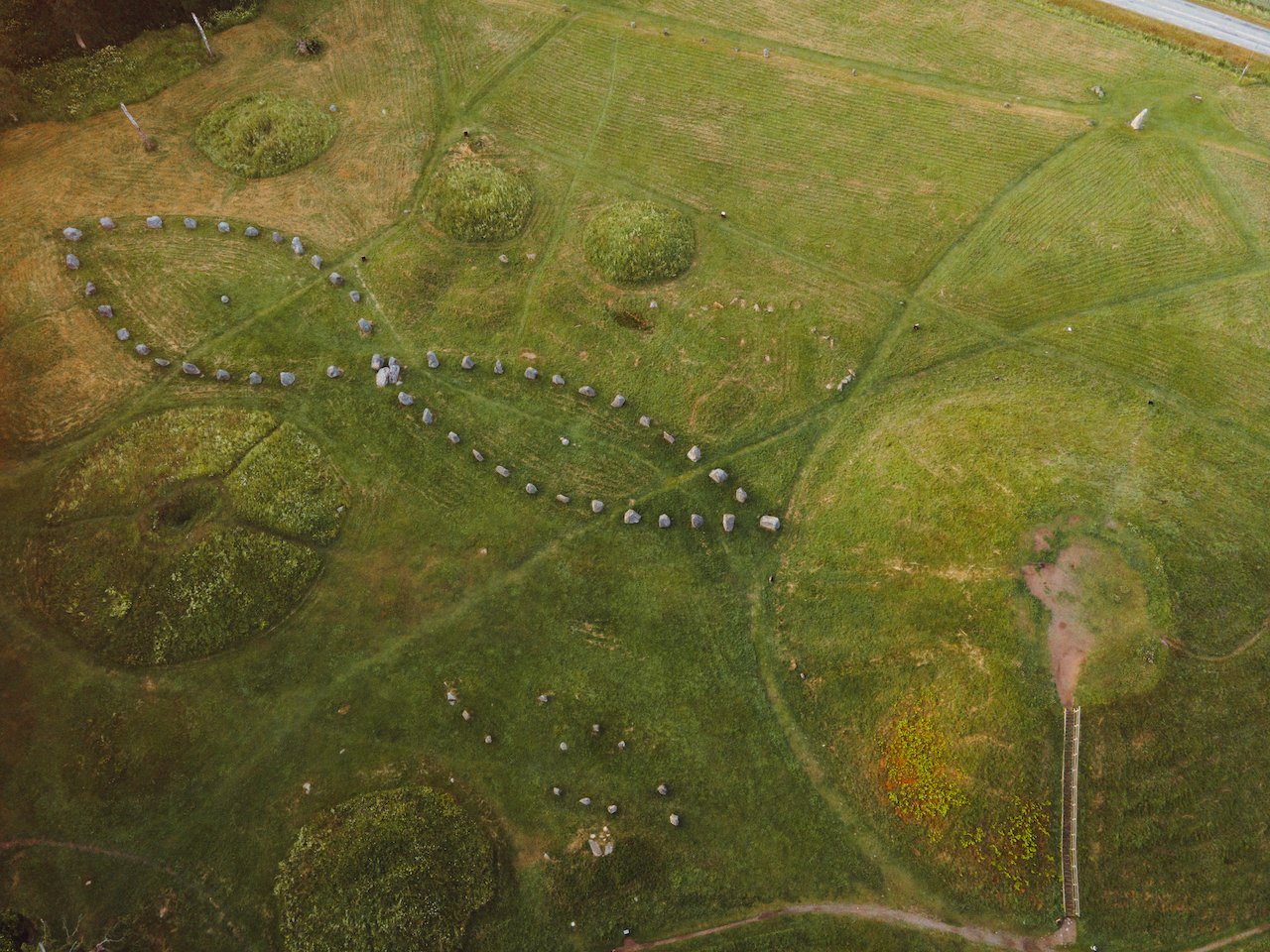
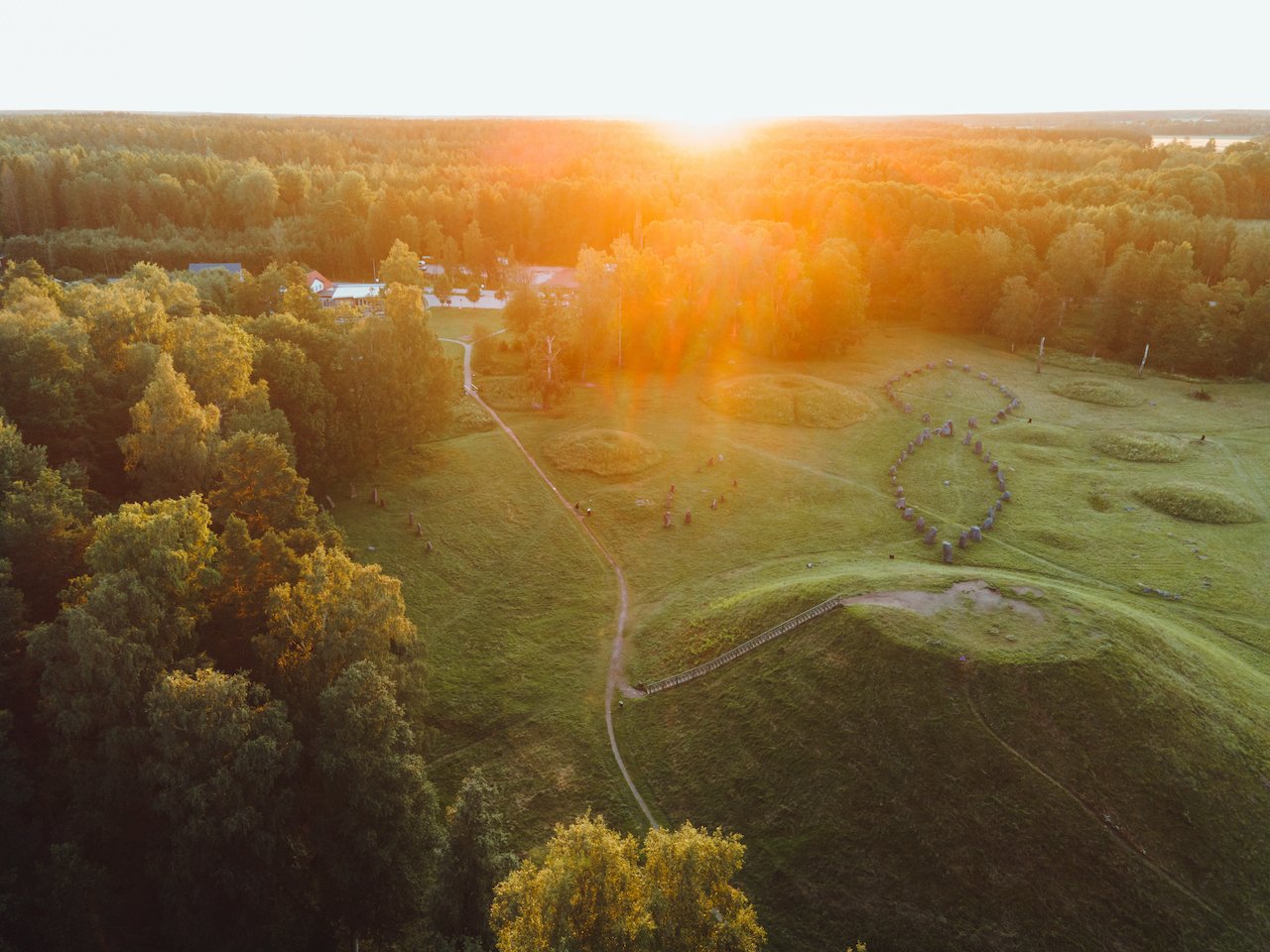
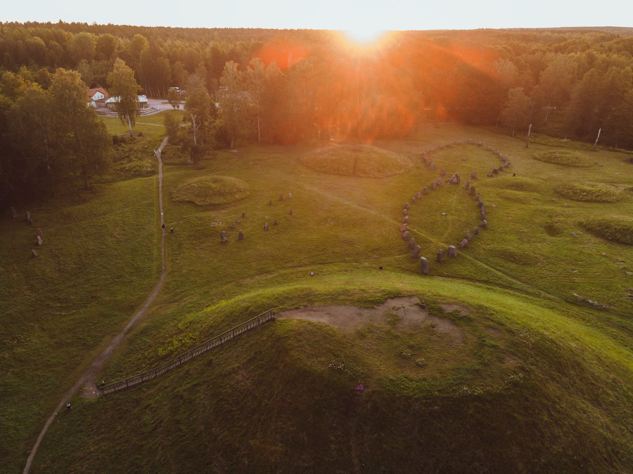
Getting to Anundshög
Here is some advice on how to get to Anundshög depending on your time and budget:
Closest Airport
Stockholm Arlanda Airport (ARN) – Approximately 1 hour 20 minutes by car to Anundshög.
By Car (Fastest Option)
From Stockholm, take E18 westbound → Västerås.
At Västerås, follow signs toward Anundshög / Badelunda (about 6 km northeast of the city).
Free parking is available at the site.
By Train + Bus
Take an SJ or Mälartåg train from Stockholm Central Station → Västerås Central Station (Approx. 55–60 minutes).
From Västerås, board Bus Line 21, 22, or 569 toward Irsta/Badelunda — get off at the Anundshög stop.
Walking distance from the bus stop to the mound is about 5 minutes.
By Guided Tour (Seasonal Option)
Several tour operators in Stockholm and Västerås offer Viking heritage day tours that include Anundshög, often paired with Strömsholm Castle or Old Uppsala.
Cycling Route
From Västerås city center, it’s a 20-minute bike ride along well-marked countryside paths — ideal in summer.
When to see Anundshög
The best seasons to visit Anundshög in Sweden are spring, summer, and early autumn. In spring (April–June), the surrounding fields and forests bloom with fresh greenery, providing excellent contrast with the ancient burial mounds and stone ship formations, ideal for photography. Summer (June–August) offers long daylight hours, warm weather, and easier access to the archaeological site, making it perfect for exploring the Viking mounds and runestones. Early autumn (September–October) presents stunning fall colors, softer light, and fewer visitors, allowing for a more peaceful and scenic experience. Winter visits are possible, but snow and short daylight hours can limit outdoor exploration.
The best time of day to visit Anundshög depends on your goals. Early morning is ideal for capturing soft light, long shadows, and minimal crowds around the burial mounds and stone ships. Late afternoon and golden hour provide warm, dramatic lighting that highlights the textures of the runestones and the contours of the mounds. Twilight and early evening can create striking silhouettes of the mounds against the sky, perfect for dramatic landscape photography. Planning your visit around these times ensures the best experience and most visually compelling shots of Anundshög.
Photography
Here are some photo spots with respective coordinates as suggestions for ways to capture this amazing spot:
Main Burial Mound
Location: Largest mound (~59.2648° N, 15.2120° E)
Details: Capture scale and perspective of the main mound; show walking paths
Best Time: Morning for soft shadows
Lens: Drone or wide-angle ground shot
Stone Ship Formation
Location: Circular stone arrangement (~59.2650° N, 15.2115° E)
Details: Perfect overhead symmetry to show Viking stone ship layout
Best Time: Mid-morning or late afternoon for soft shadows
Lens: Drone (high altitude)
View Toward Mälaren
Location: North edge overlooking lake (~59.2655° N, 15.2125° E)
Details: Mounds leading to lake in distance; panoramic composition
Best Time: Sunrise for reflective water or golden hour
Lens: Drone or panorama lens
Viking Runestones
Location: Cluster of runestones (~59.2645° N, 15.2110° E)
Details: Close-ups of inscriptions; emphasize textures and carvings
Best Time: Morning for directional light
Lens: Macro lens or 35–50mm prime
Walking Path with Mounds
Location: Main path (~59.2649° N, 15.2118° E)
Details: Leading lines along multiple mounds; adds depth and scale
Best Time: Early morning for soft light
Lens: Wide-angle (16–35mm)
Aerial Over Entire Site
Location: Center of the site (~59.2650° N, 15.2120° E)
Details: Drone captures full layout of mounds, stone ships, and forest
Best Time: Morning or afternoon for even lighting
Lens: Drone camera
Sunset Silhouette of Mounds
Location: South ridge (~59.2648° N, 15.2125° E)
Details: Dramatic silhouette of mounds against colorful sky
Best Time: Sunset / golden hour
Lens: Telephoto or wide-angle for silhouette
Trees Framing Runestones
Location: Around small grove (~59.2646° N, 15.2112° E)
Details: Natural frames of trees around runestones; seasonal compositions
Best Time: Late afternoon for warm light
Lens: 50mm or 24–70mm zoom
Close-Up of Stone Textures
Location: Individual stones (~59.2645° N, 15.2115° E)
Details: Capture weathering, moss, and stone detail; artistic composition
Best Time: Overcast for soft, even lighting
Lens: Macro lens
Panorama from North Ridge
Location: Elevated northern ridge (~59.2652° N, 15.2128° E)
Details: Panoramic view of entire archaeological site, mounds, and forest
Best Time: Sunrise or golden hour
Lens: Drone or panoramic lens







This is a close up shot of one of the towers of Kalmar Castle in Småland, Sweden. What I really love about this photo is how lucky I was to catch the details of the bricks as well as the Swedish Tre Kronor (Three Crowns) emblem at the top of the tower. This is one of the coolest castles in all of Sweden and is definitely worth visiting.