The EPIC Iceland Road Trip: The South Coast (Part III)
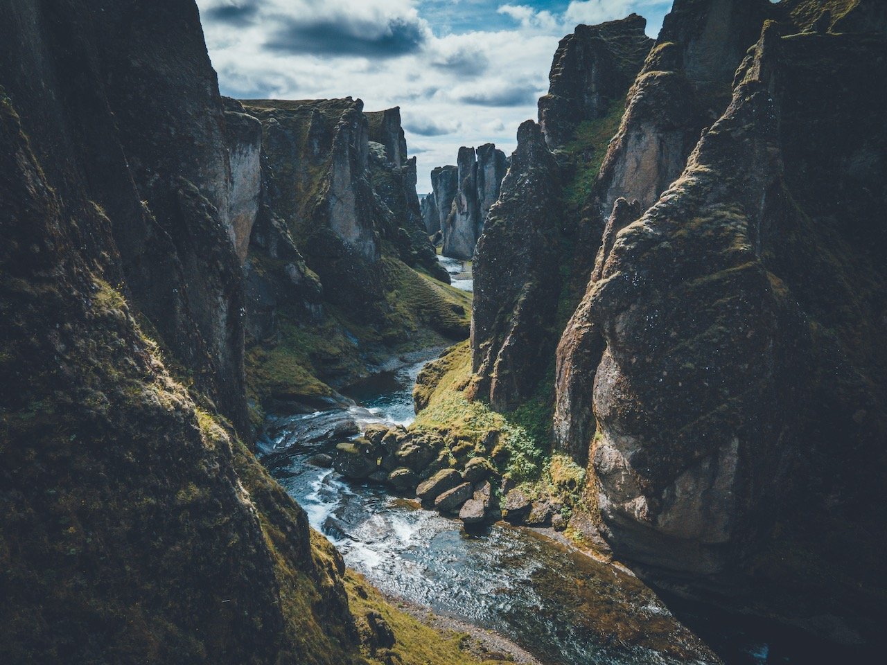
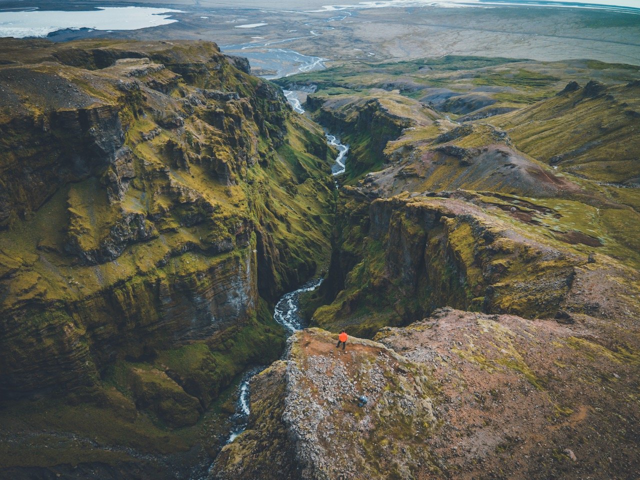
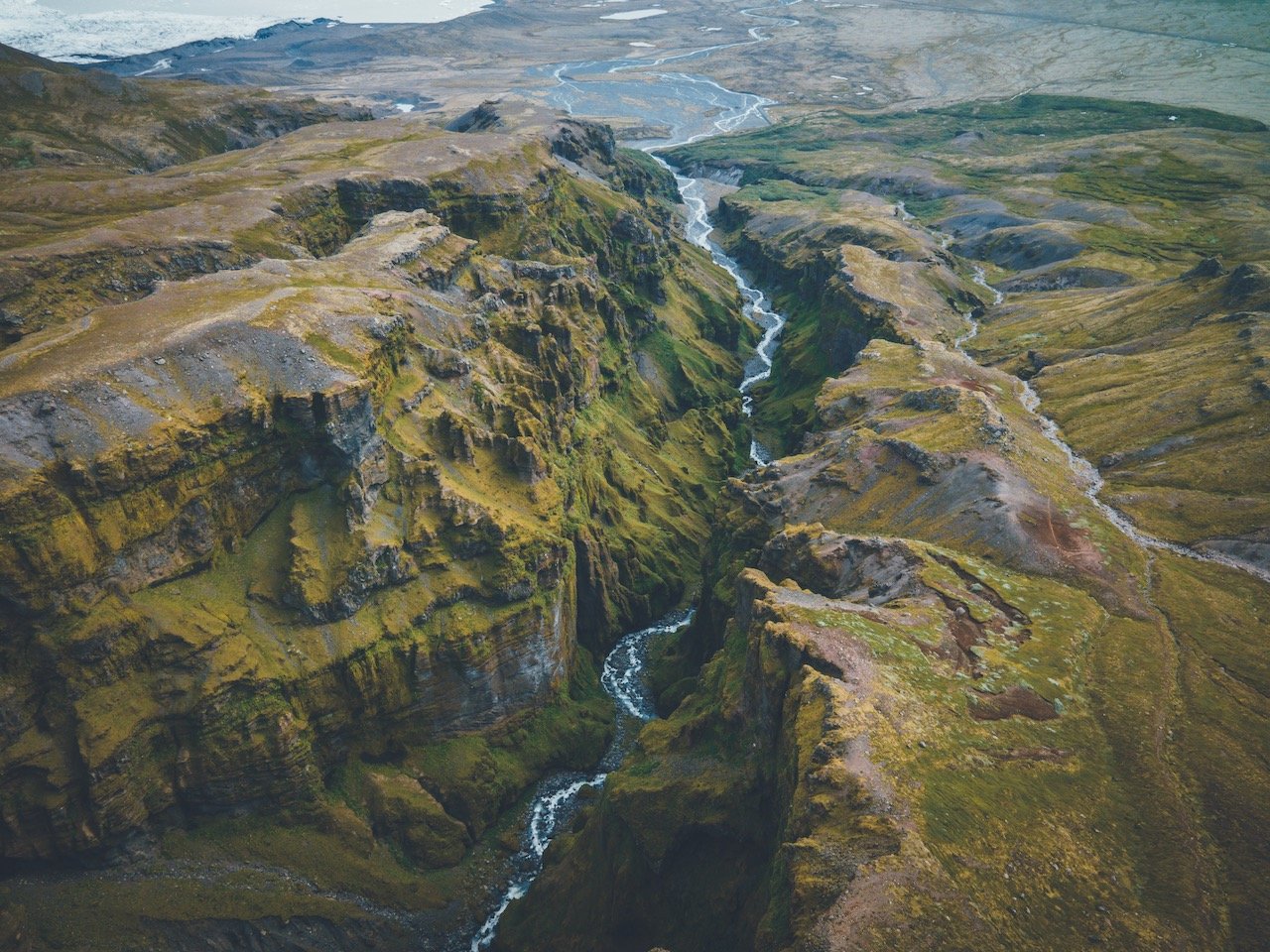
Fjaðrárgljúfur Canyon, Iceland (ISO 100, 4.5 mm, f/2.8, 1/50 s)
(Some links in this post are affiliate links. If you click through and take action, I'll be compensated.) If you are also interested in any PRINTS from any of my posts, be sure to check out my store where you can buy prints as posters, in metal/wooden frames or on canvas.
**This post is the 3rd of a 6-post series discussing what to see in this part of Iceland (You can check out the other parts here: Part 1, Part 2, Part 3, Part 4, Part 5, Part 6. Everything is also summarized in another post here.**
After stopping by the town of Vik on the South Coast, keep heading east on the Iceland Ring Road to start your last day in this part of the country.
You can find a Google map of the places I will discuss at the end of this post.
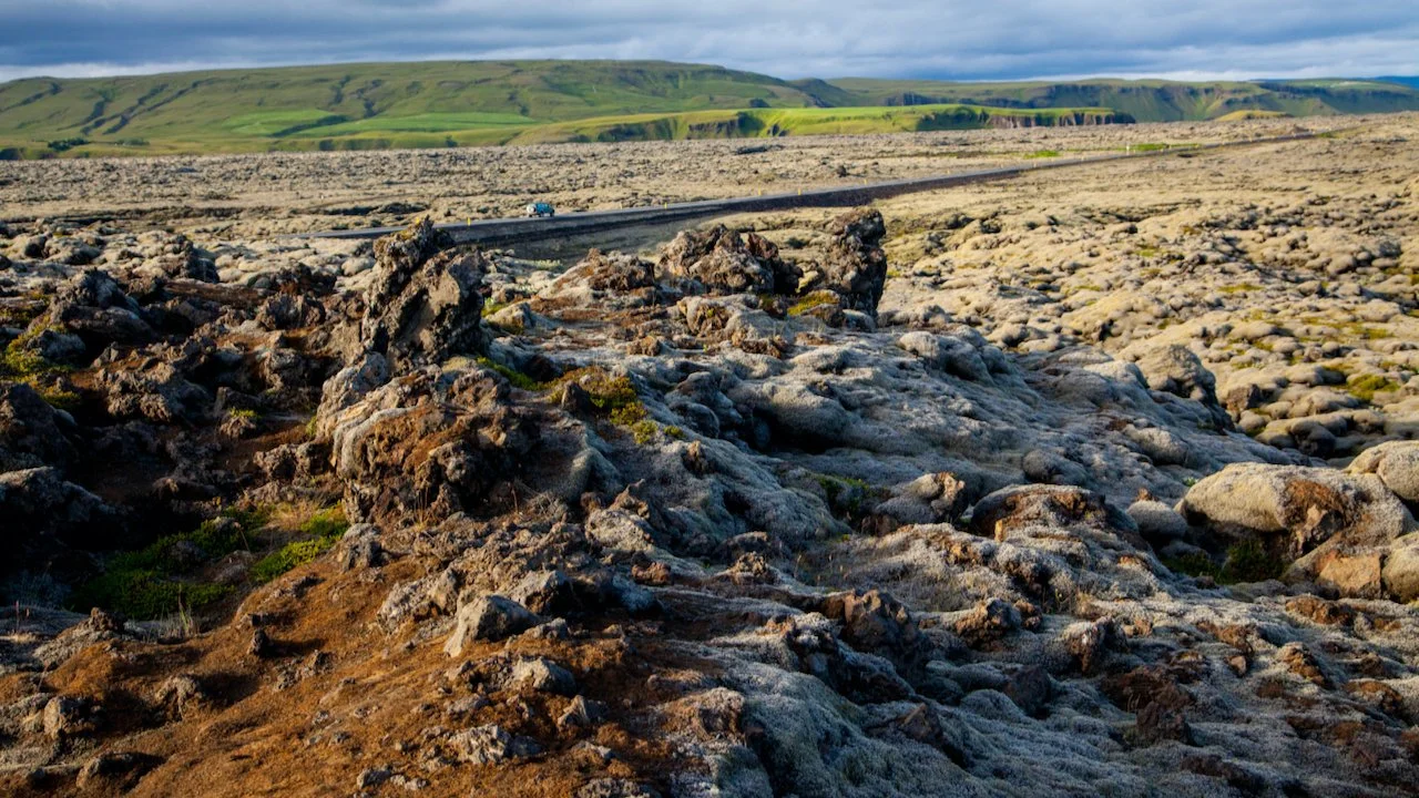
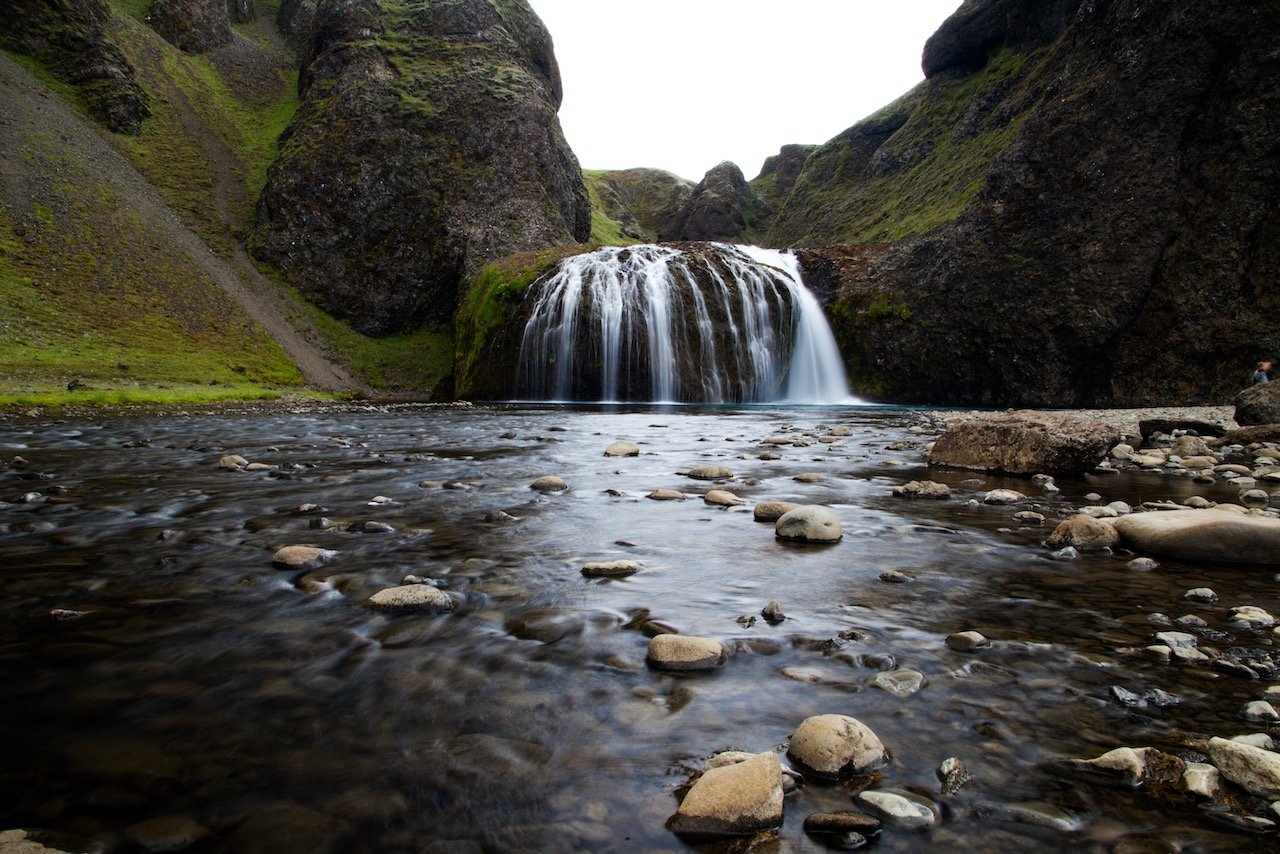
The first stop this day should be the Eldhraun Lava Field. This area was once covered in lava, but has since become the most primordial-like landscape full of moss and rock. It was formed by an eruption that started in 1783, the event being known as ‘Skaftáreldar’.
The area is the largest of its kind measuring to be about 565 square kilometers. The moss that has grown here has literally taken decades to grow. That being said, there are several paths from the parking lot that allows you to explore to area, but do not stray from these paths.
This is a perfect place to see in the morning or later in the evening, preferably during golden hour since the light paints the whole area with a gorgeous yellow hue.
Check out my drone video below on Iceland’s Waterfalls!

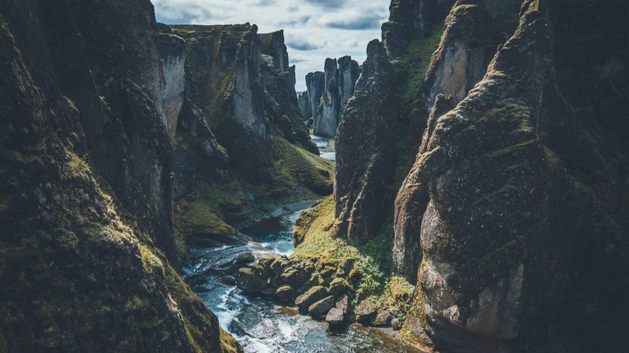
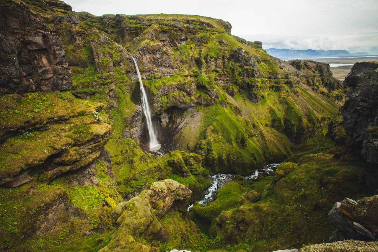
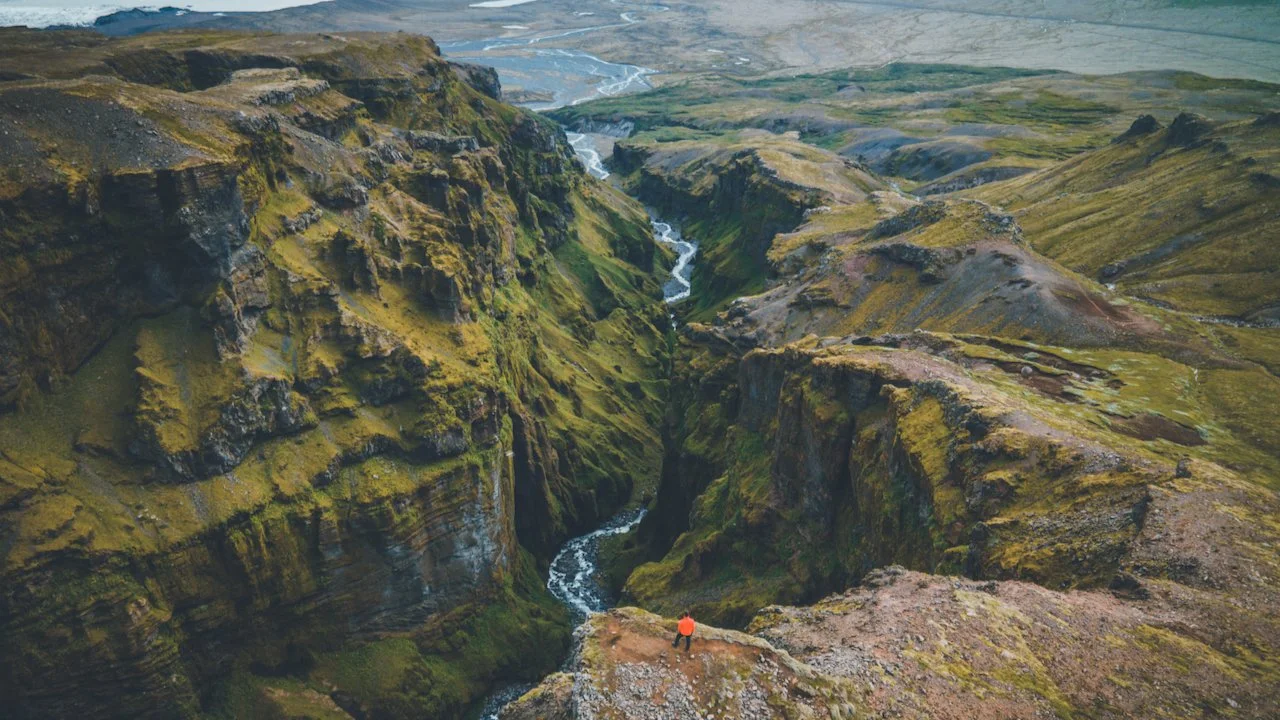
The next stop from here is one of my most favorite in the entire country. The Fjaðrárgljúfur Canyon is a gorgeous valley that was formed during the last ice age, around 10,000 years ago. It has exploded in popularity in recent years. From the parking lot, getting to the canyon takes just a few minutes and will lead you to a variety of different view points.
It’s best to go to the very last viewpoint first, and stop by the others on your way back. When I arrived there in the morning, there were just a few people, however by the time I was leaving, there was quite the traffic jam on the small road leading to the site.
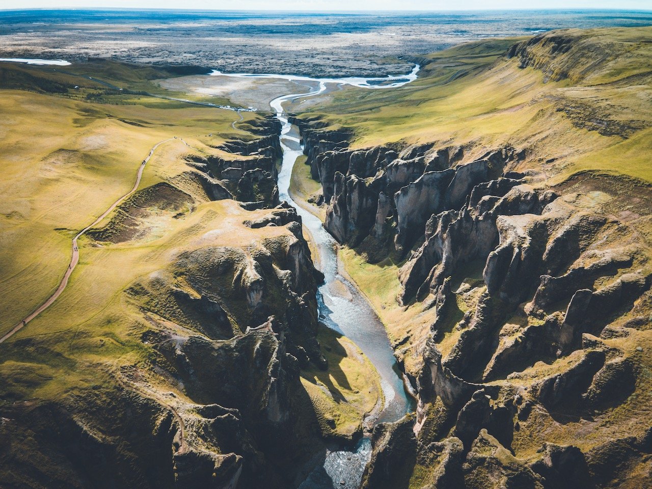
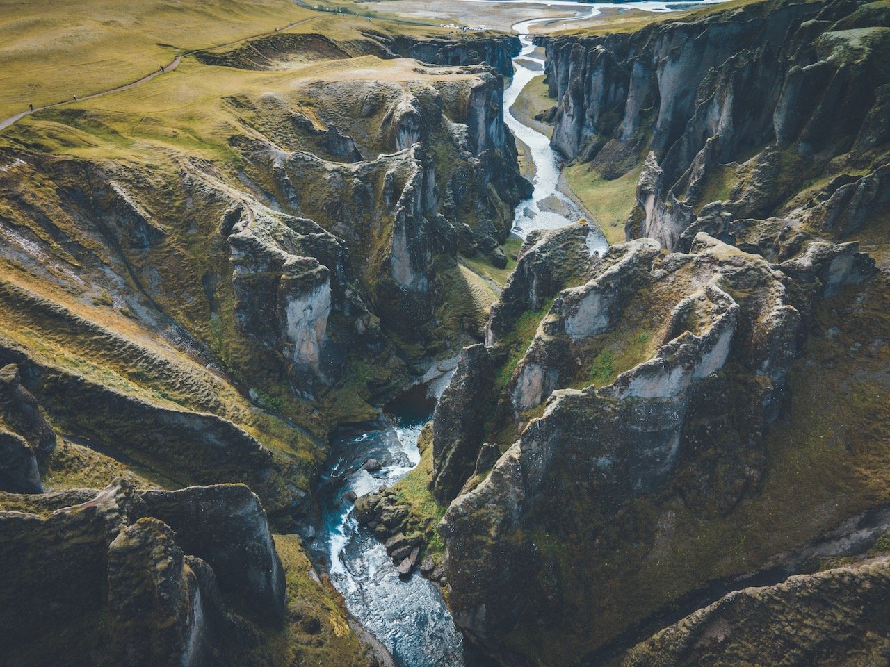
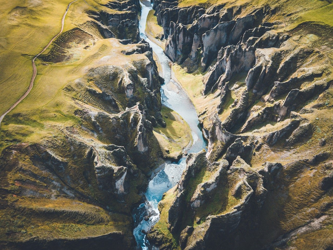
Although I never did this myself, it is certainly possible to hike through the valley along the river. There looked to be certain points however where you must wade through the river to cross sides. Nonetheless, if I return someday, this will be something I would do to get a different perspective of the cliffs. Or, if you’d rather not do that, just have a drone handy to get the shot for you.
Stjórnarfoss is a waterfall that is fed by the Stjórn River (go figure). It’s just off the ring road, east of Fjaðrárgljúfur Canyon. The area is quite open and the not visited by too many people (two times here during the trip and encountered maybe 10 people total). What’s pretty cool about Stjórnarfoss is that you can walk right up to it and swim in the water as well (assuming that you don’t mind the cold water).
Further down the ring road, you’ll undoubtedly pass by the Skeiðará Bridge Monument. It may not look like much, but there’s more than meets the eye with these two mangles steel beams. The beams were part of a bridge and now, serve as a reminder to the awesome forces of nature.
If you like some of my photos that you have come across, just know that I have many prints showcasing a variety of landscapes in Iceland, available for purchase below! (Sold as Posters, Canvas, or in Metal-Frames and Wooden-Frames).


Skeiðará Bridge Monument, South Coast, Iceland (ISO 100, 24 mm, f/8, 1/200 s)
The story begins in 1996, when the Vatnajökull volcano erupted. This volcano sits underneath the Skeiðarárjökull glacier, giving rise to massive floods and enormous icebergs, which wiped out the bridge. This place is pretty cool for an afternoon picnic before you head into the Skaftafell Nature Reserve.
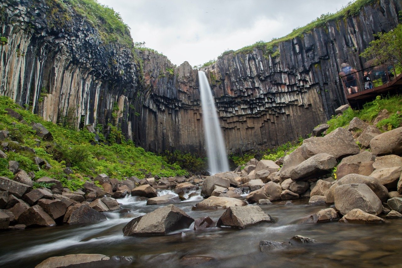
The next set of waterfalls require a bit of hiking to reach. Hundafoss essentially means ‘dog falls’ after the Icelandic word ‘hundar’. You will encounter this waterfall first on your way to Svartifoss, the main attraction. It’s name translated to ‘black falls’ due to the presence of the black columnar basalt formations that frame the waterfall.
In terms of taking photos of the falls, the best place is not from the viewing point, but from one or two of the large boulders that lie in the middle of the stream. The trip to get here and back to the parking lot is about 5.5 km long, the first part of which being the most difficult as it’s mostly a steep uphill.
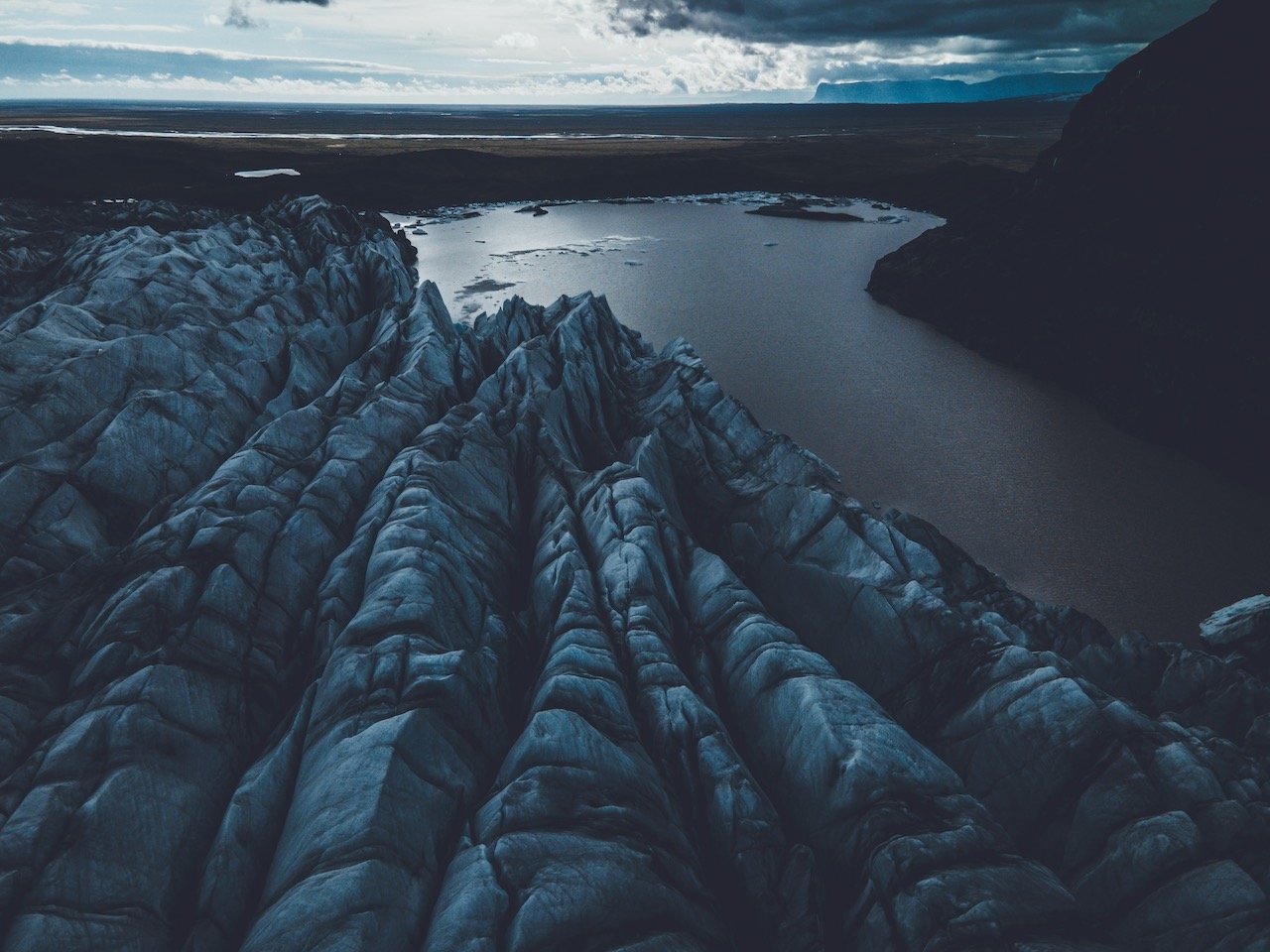
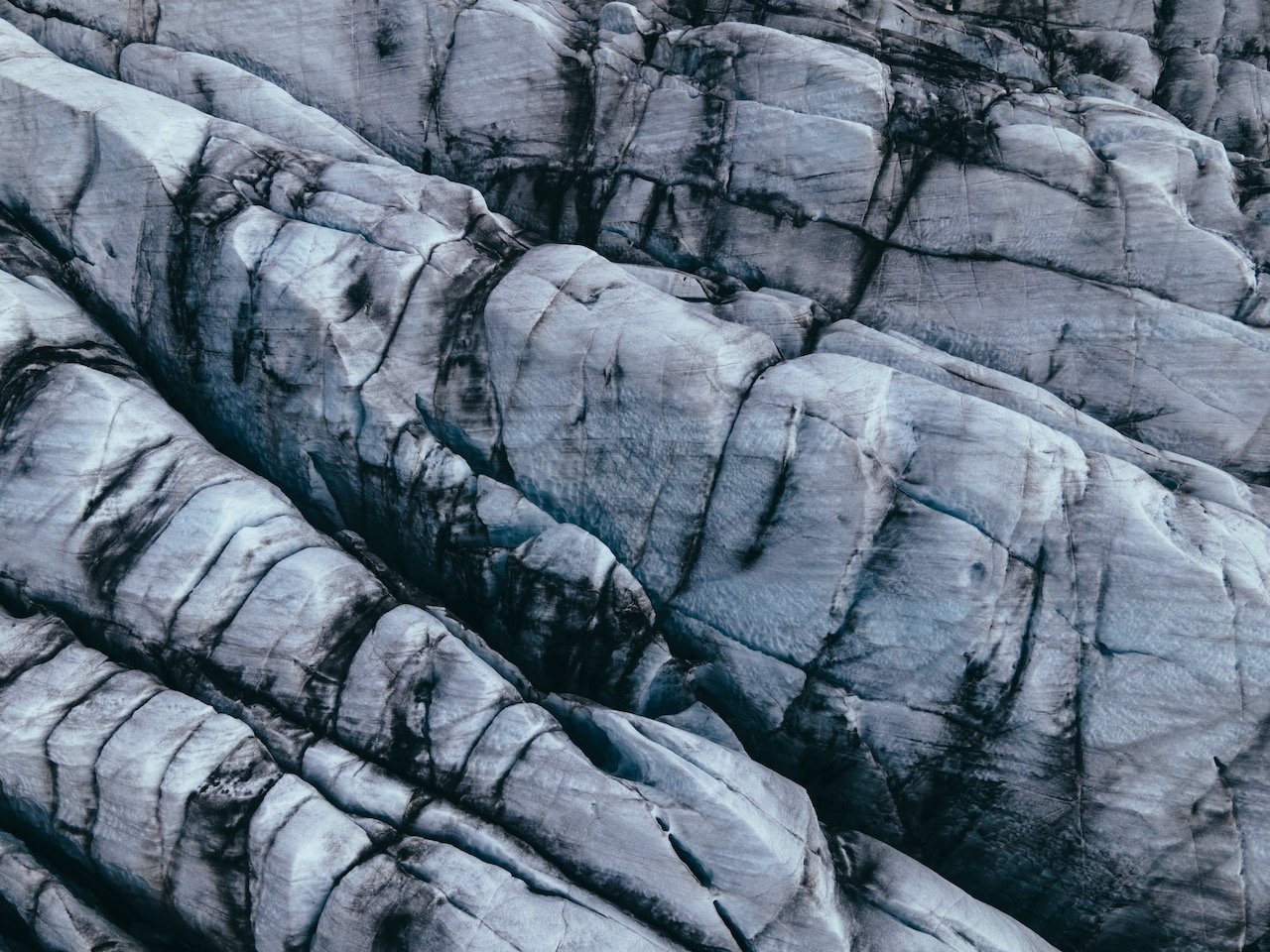
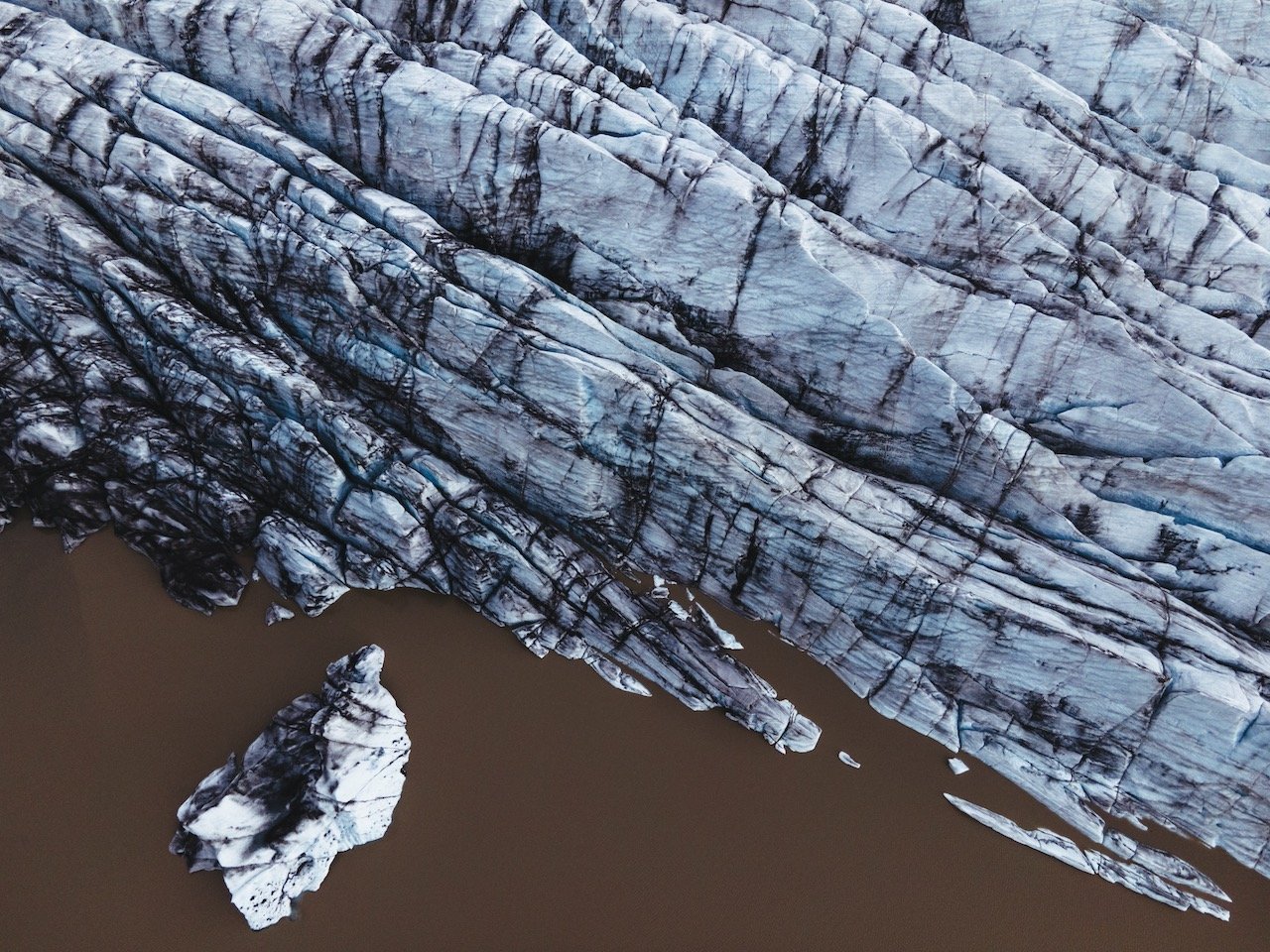
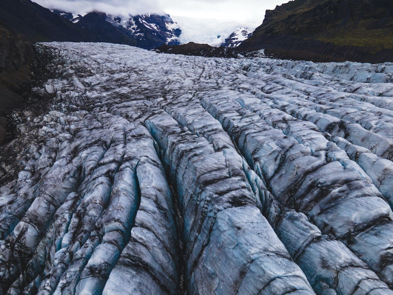
A highlight of the entire trip is seeing the ‘teeth’ of the Svínafellsjökull Glacier. Getting here is a little trickier. The glacier itself is a few kilometers off the ring road, however the gravel road to reach it is plagued with many large rocks and potholes, however this place is worth the drive. If you take it slowly, you should be just fine.
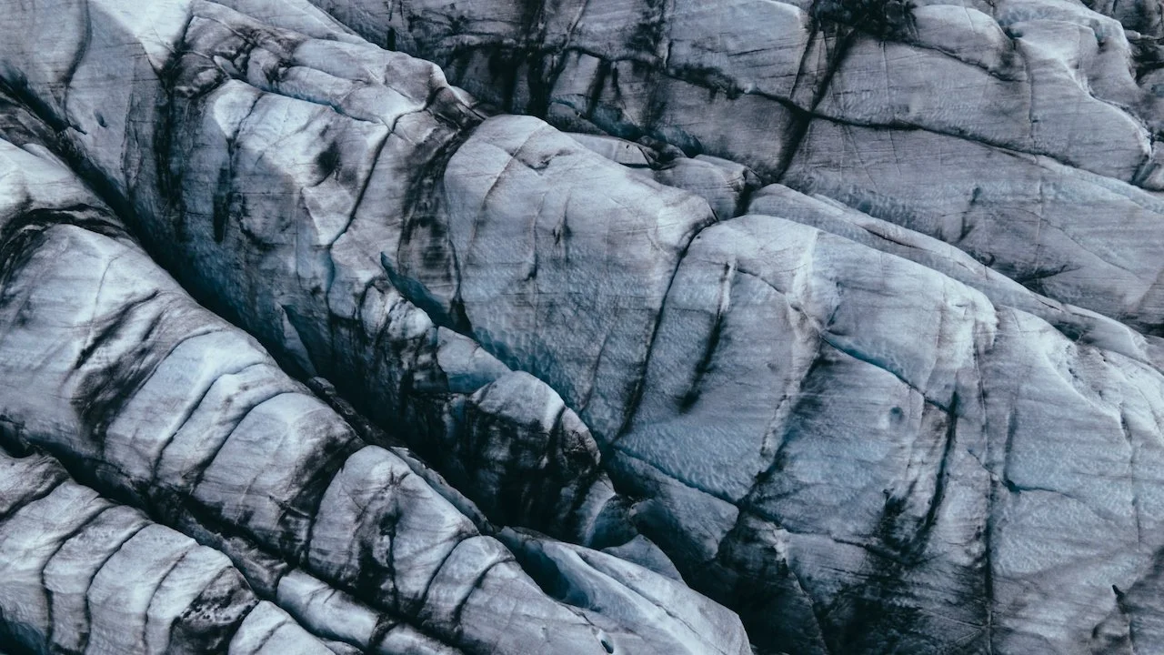
The path to get to the glacier from the car park more or less just leads you along the edge of the mountainside cliffs. It’s difficult to actually get very close to the glacier itself but any viewpoint along the cliffs will provide you with an excellent photographic opportunity. I was a bit nervous flying my drone here since I have heard that the iron content that may exist in some of these types of places can interfere with the drone signal, but alas, I had no such issues. Also, there’s a handful of glaciers we saw during our trip, but this was easily my most favorite.

Hofskirkja, South Coast, Iceland (ISO 100, 24 mm, f/4, 1/800 s)
Put this place on the list for one of the most unique churches you’ll ever see. Hofskirkja is the last turf church built in Iceland. It’s quite small and has a cemetery right next to it. Keep to the paths around the church as there are burial mounds everywhere that make the ground uneven. Turf buildings like this were made to protect these structures from the effects of the harsh Icelandic winter. There are only a few that remain in Iceland and all are protected as historical monuments.
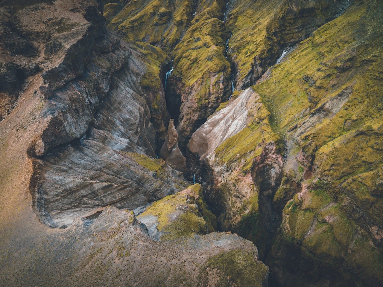
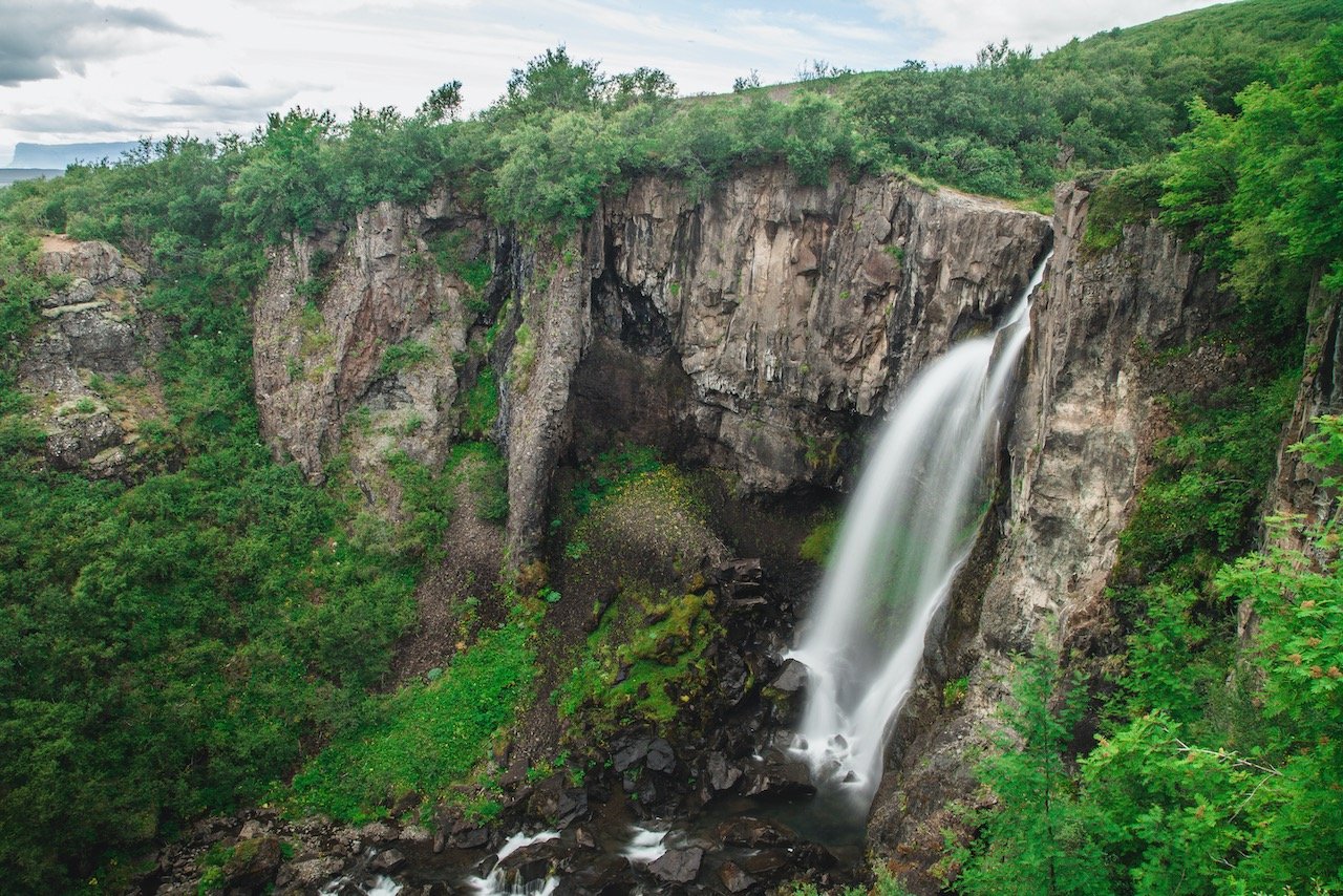
The next stop on the trip took a bit of time to actually get to. There is no signs that tell you which road to turn on to get to Múlagljúfur Canyon but after some searching, I found it. While driving on the ring road, going east, there will be a turn off on your left at coordinates 63.98866, -16.39715 (labeled as ‘Side road leading to Múlagljúfur Canyon’ on the google map at the bottom of this page). Then just drive a few kilometers until you can’t drive anymore. This will set you up at the beginning of the trail.
The trail itself isn’t as well marked as others, but so long as you don’t rush through, you’ll be able to keep track of it up the cliffside. It’s pretty much a steady uphill all the way to the top covering brush and a few streams, but the views are absolutely worth it. I didn’t even really find an end point. I stopped when I figured I had reached the best viewpoint on the side of the cliff (see video). There are two waterfalls that flow into the canyon, where the Múlaa river flows out to the ocean below. The melt water from the Öræfajökull glacier is the source of the river.
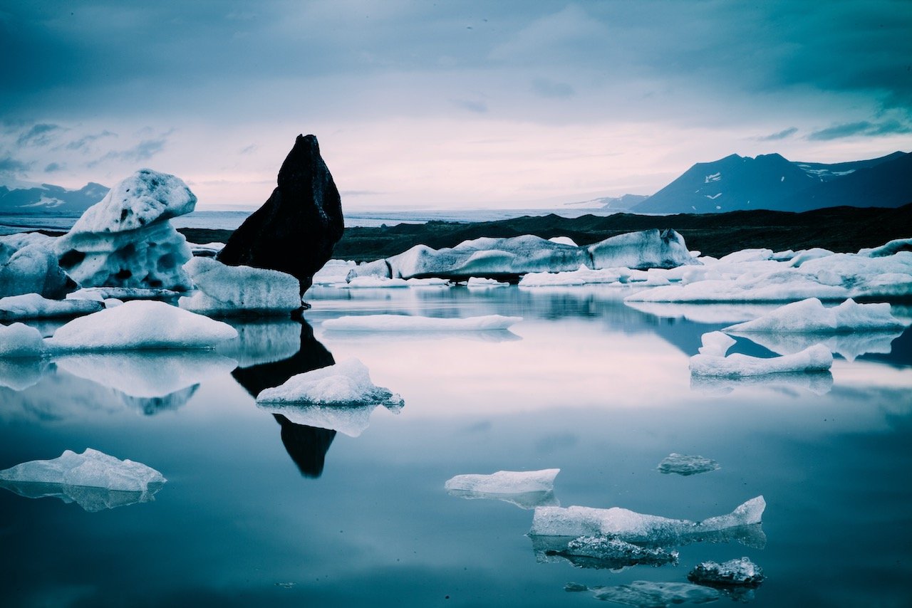
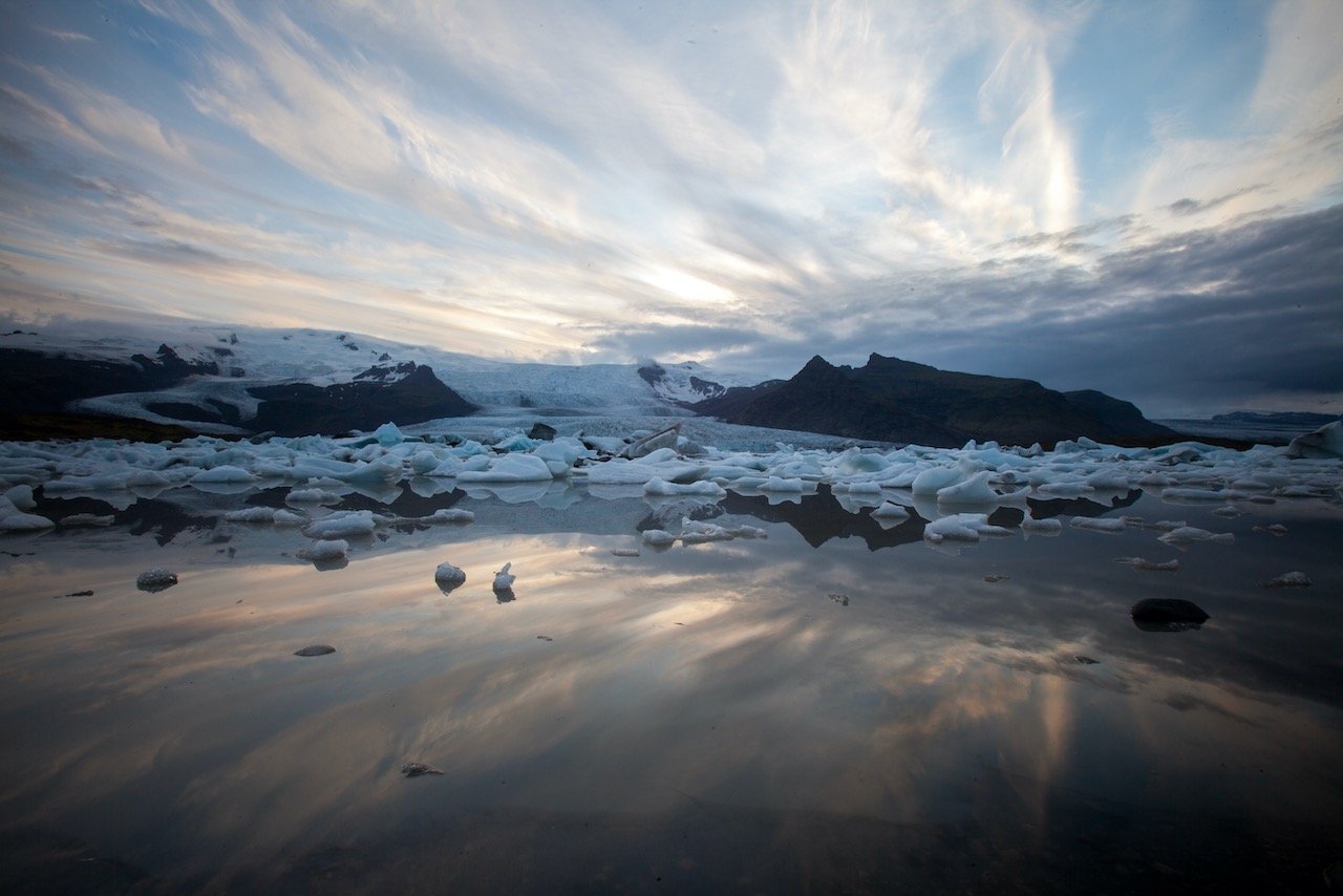
Now, the next few stops involve seeing a lot of icebergs, big and small. There are two glacier lagoons just a few minutes away from one another. Jökulsárlón (more detail below) and Fjallsárlón. The first is much much MUCH more popular, with a whole trove of food stalls and tour agencies. The other is small, but just as good. Fjallsárlón is much quieter and personally my favorite lagoon in Iceland. I think many people don’t bother coming to see this one since they have already seen Jökulsárlón before, and that’s the lagoon all the tour companies tend to go to, but it would be a mistake to miss Fjallsárlón. I arrived around 9pm one night here and had it entirely to myself.
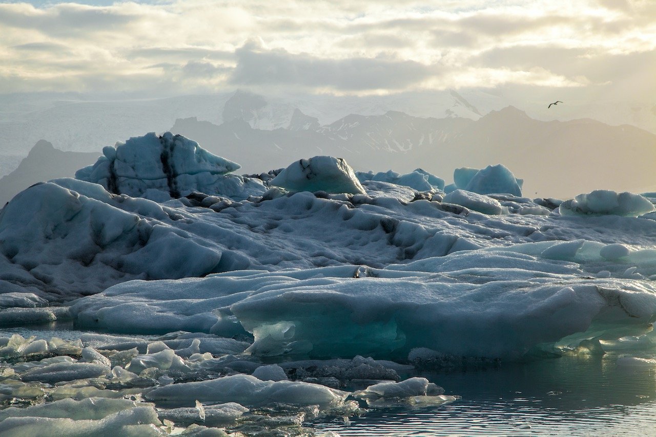
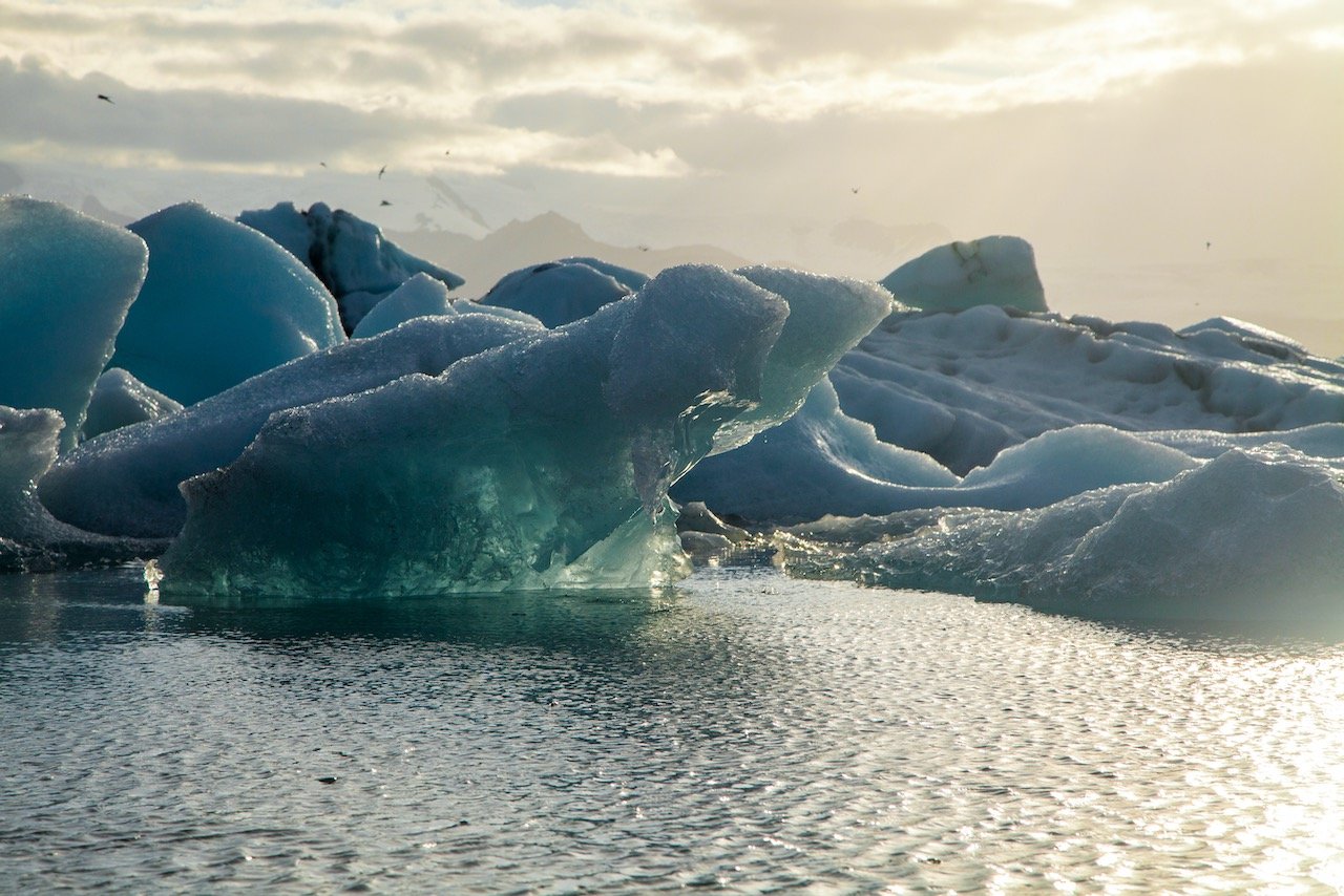
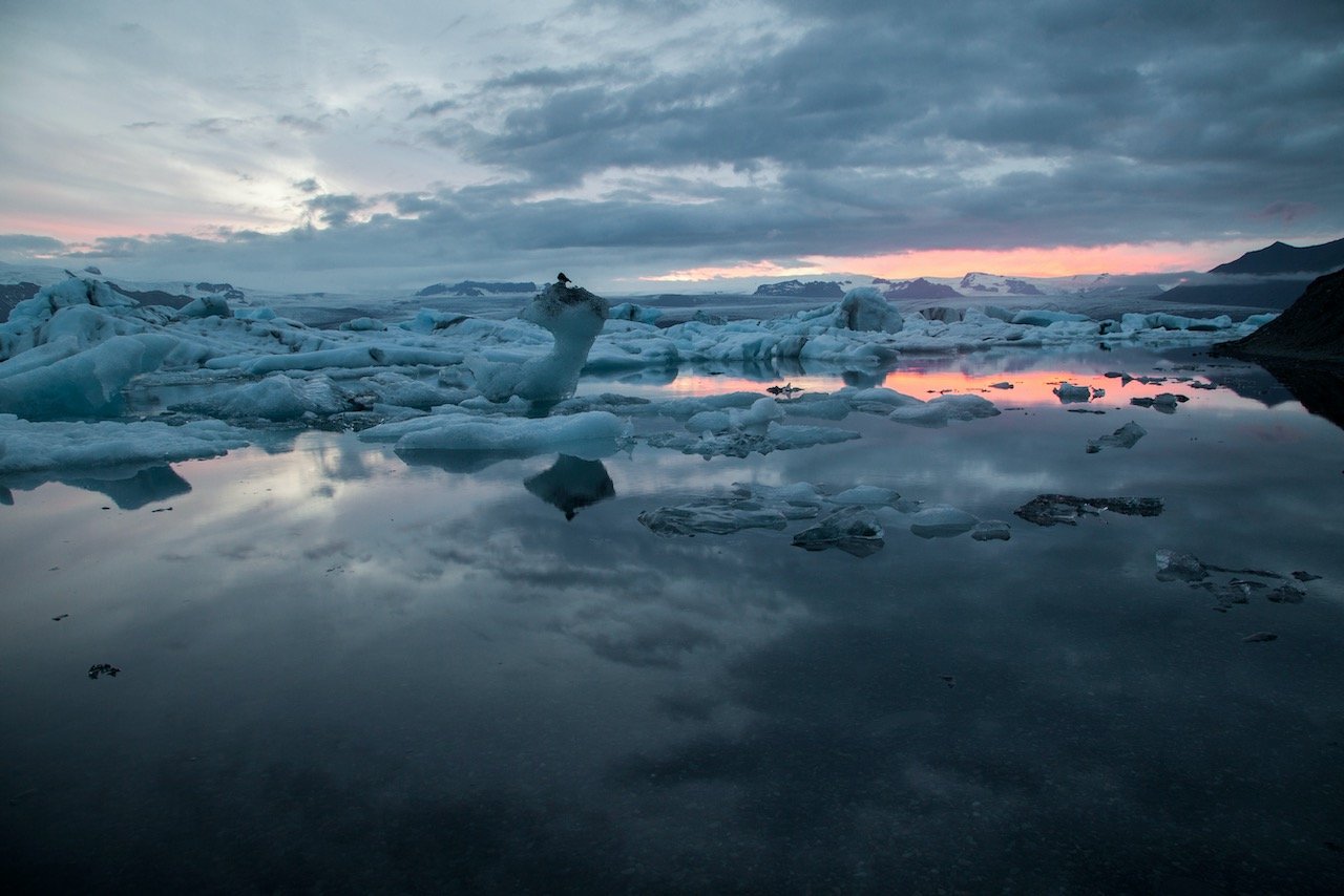
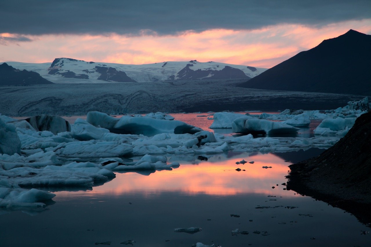
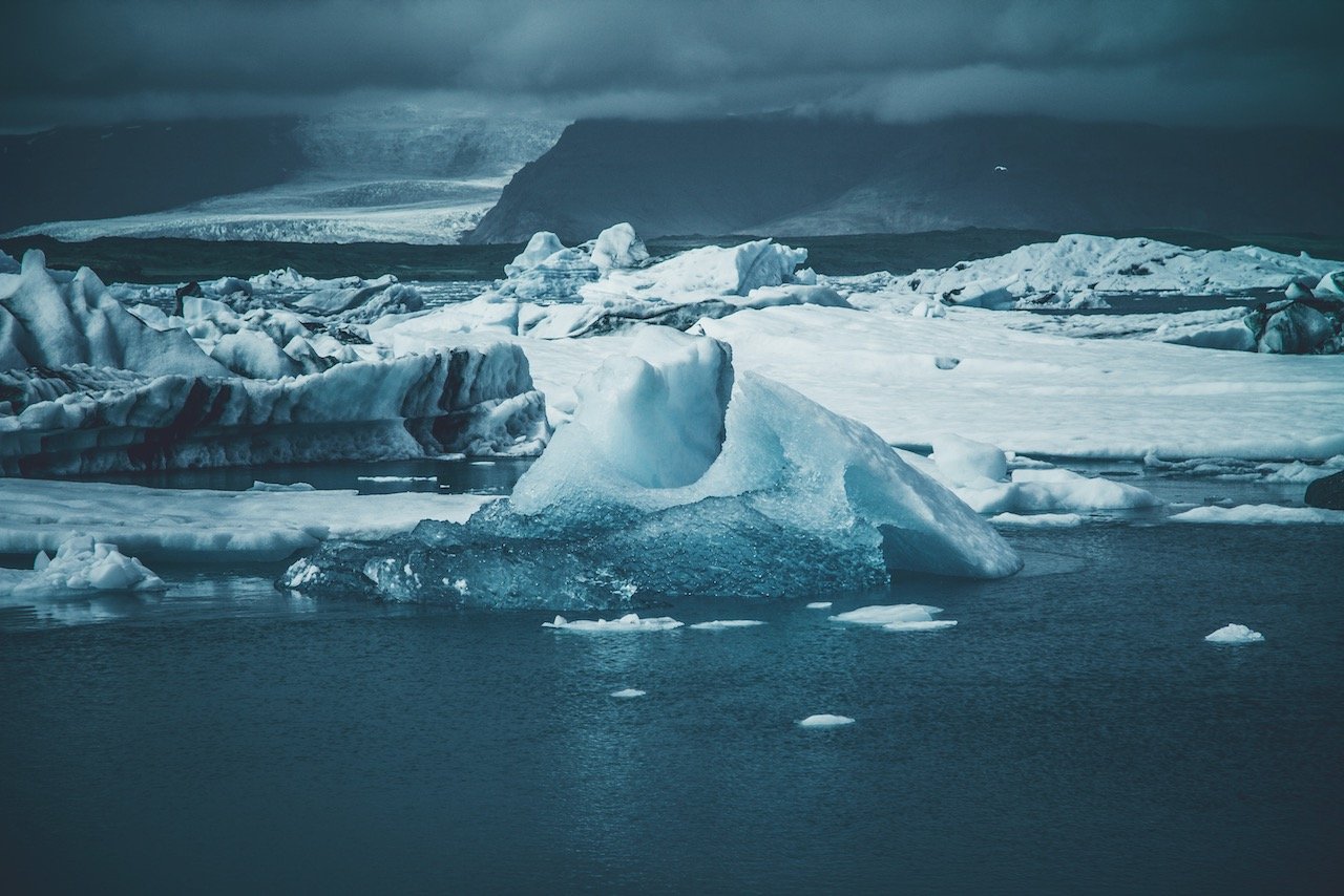
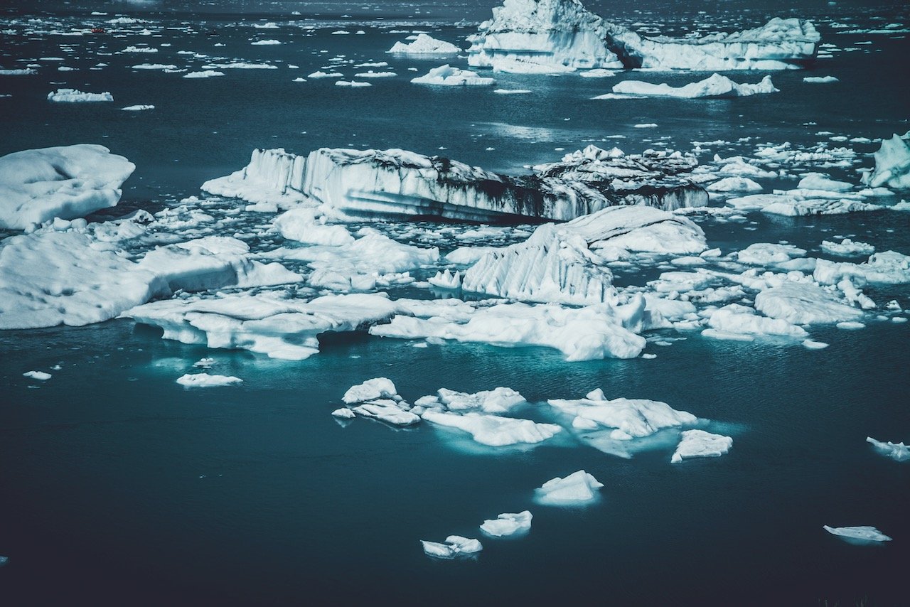
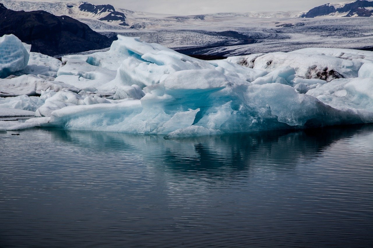
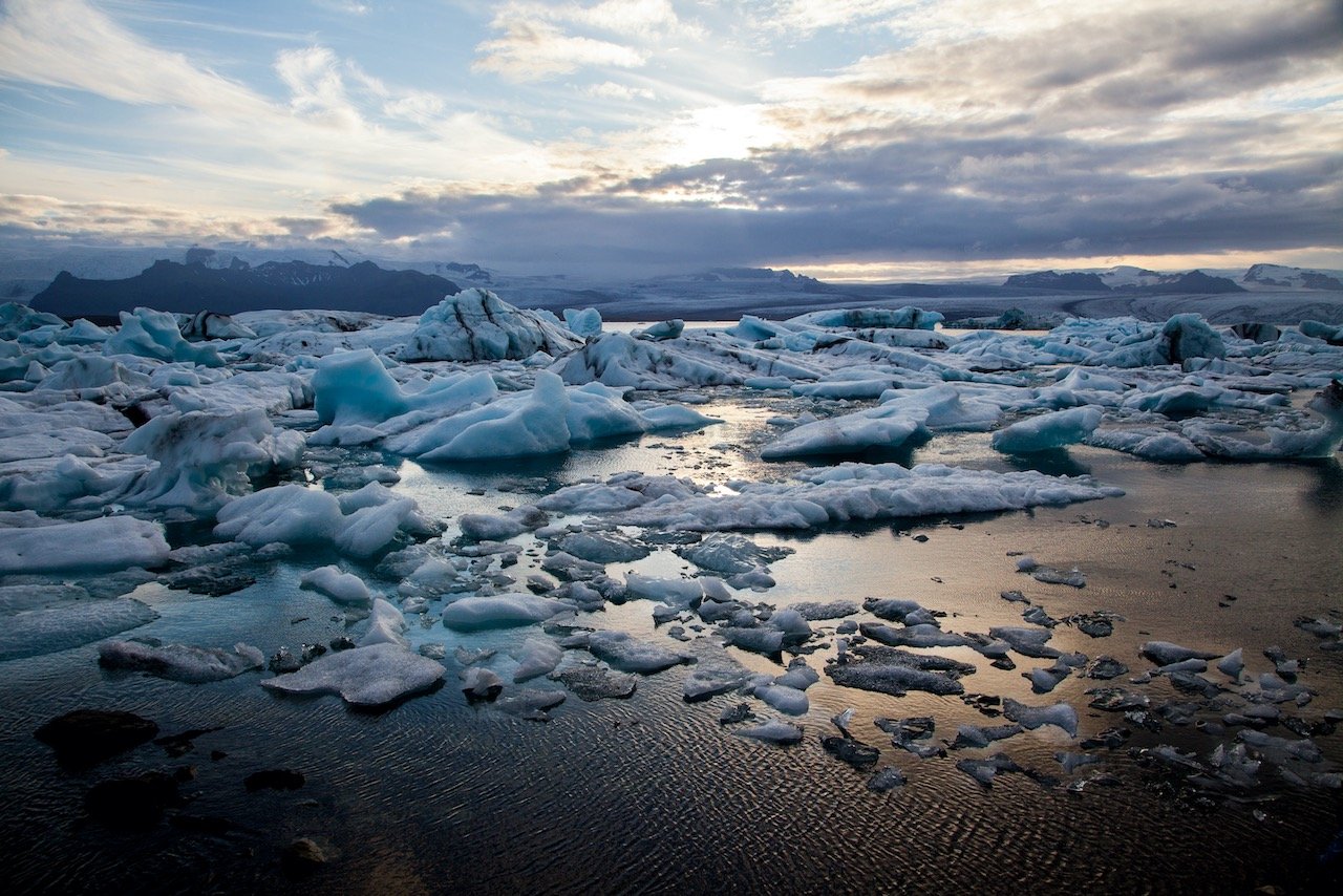
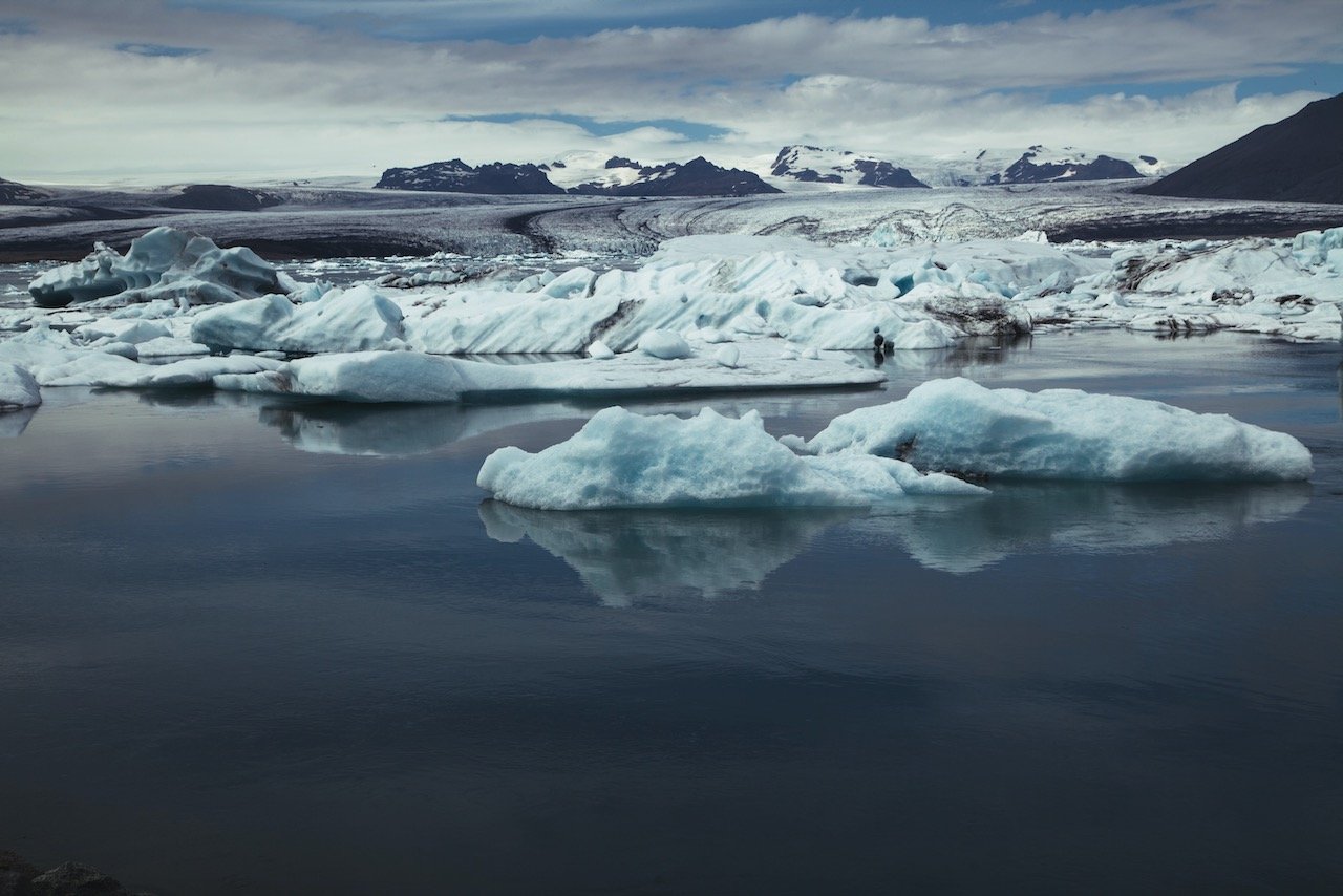
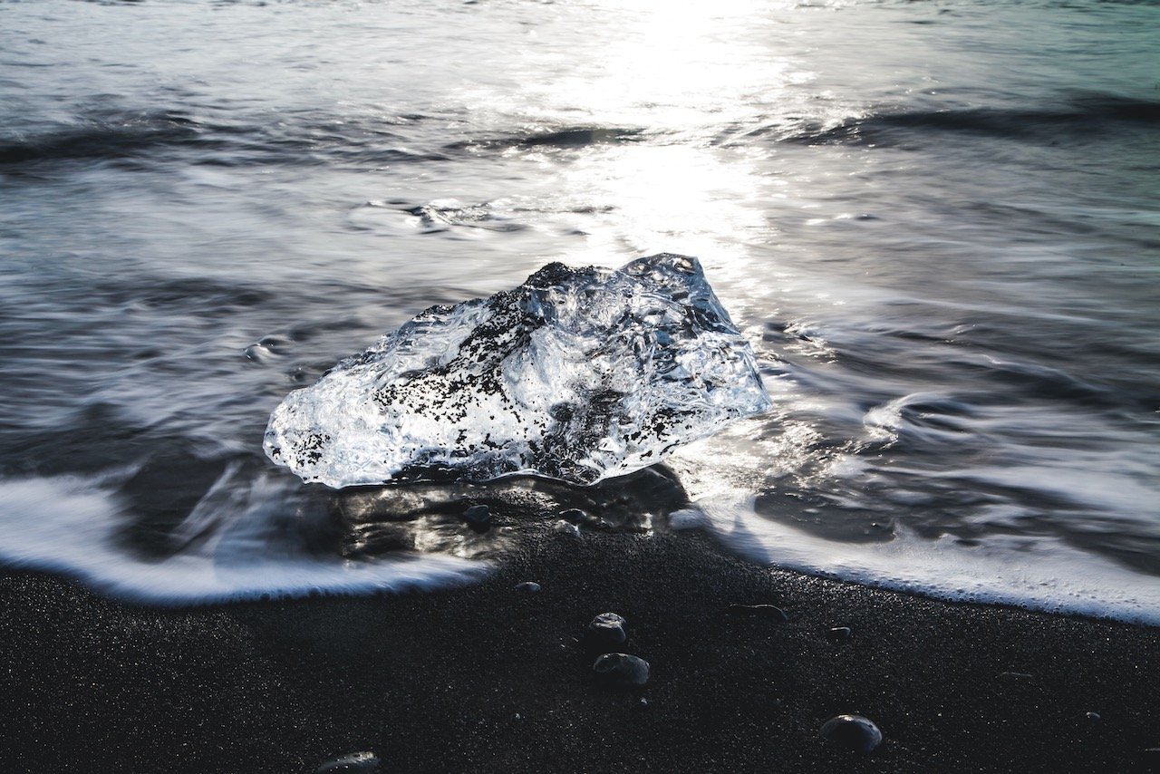
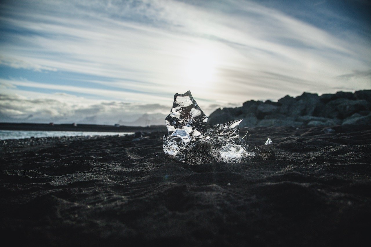
Now let’s talk about Jökulsárlón. The entire area is absolutely beautiful. You can park the car just off the ring road and walk all along the lagoon. There is also a path leading you under the bridge of the ring road to the beach at the other side (Fjallfjara). You can get so many photographic angles of capturing the lagoon. Furthermore, in all types of weather, the area is just gorgeous. The slow moving water provides a great reflective surface, great for brilliantly colored sunsets. The small glaciers are fed by the Breiðamerkurjökull glacier in the distance and make their way out to the sea, and return when the tide changes. A lot of times, these glaciers also beach themselves nearby at Fellsfjara.