A Trip to the Azores: Faial Island

Capelinhos Lighthouse, Faial, the Azores (ISO 200, 4.5 mm, f/2.8, 1/40 s)
(Some links in this post are affiliate links. If you click through and take action, I'll be compensated.) If you are also interested in any PRINTS from any of my posts, be sure to check out my store where you can buy prints as posters, in metal/wooden frames or on canvas.
**This post is the 2nd of a 7-post series discussing what to see in this part of the Azores (You can check out the other parts in the list below, separated by each specific island/city. Everything is also summarized in another post here.**
The Azores islands are one of two autonomous regions of Portugal (the other being Madeira), located roughly 1000 miles from mainland Portugal. It is a 9-island archipelago that are split into three groups: Eastern (São Miguel, Santa Maria), Central (Terceira, Pico, Faial, São Jorge, Graciosa), and Western (Corvo, Flores). Their discovery dates back to the 14th century and were named ‘açor’, meaning Goshawk, which was a common bird known in that time. Each island is accessible either by plane or by ferry. For those who love nature and a bit of adventure, the Azores are an absolute must see.
In this blog post, I will cover the island of Faial. A Google Map of these places I will talk about can be seen at the end of this article. You can see all my Azores islands related blog posts below:
Ponta Delgada (Blog Post: A Trip to the Azores: Ponta Delgada on São Miguel Island)
São Miguel Island (Blog Post: A Trip to the Azores: São Miguel Island)
Horta (Blog Post: A Trip to the Azores: Horta on Faial Island)
Faial Island (Blog Post: A Trip to the Azores: Faial Island)
Madalena (Blog Post: A Trip to the Azores: Madalena on Pico Island)
Pico Island (Blog Post: A Trip to the Azores: Pico Island)
Summary (Blog Post: A Trip to the Azores: A Summary)
Check out my drone video on Faial Island of the Azores below!

Getting to Faial Island
Getting to Faial will most likely require a trip first to Ponta Delgada, at least when coming from outside of the Azores. From Ponta Delgada, you can take a flight with Sata Air Azores to the island of Faial. This may or may not require a layover in the island of Terceira.
You can also take a flight to any other Central Azorean island (Pico, São Jorge, Terceira, Graciosa) from Ponta Delgada, and then take a ferry to Faial from those islands using Atlantico-Line. Depending on the time of year, certain ferry lines are more active than others.

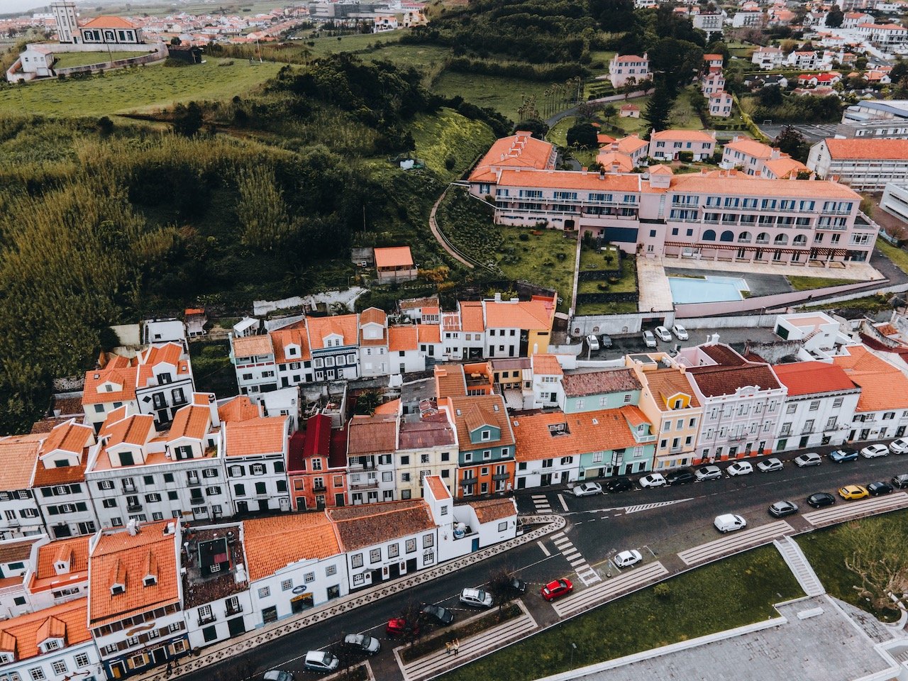
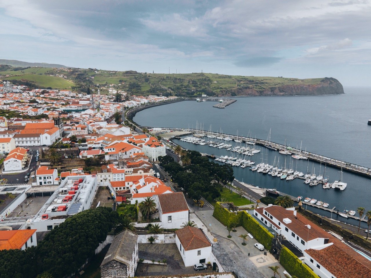
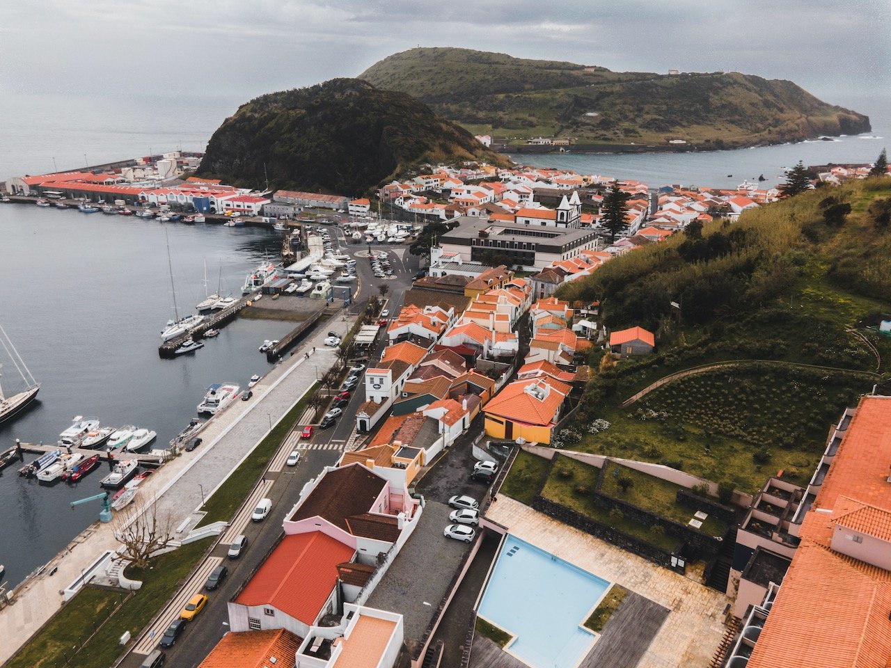
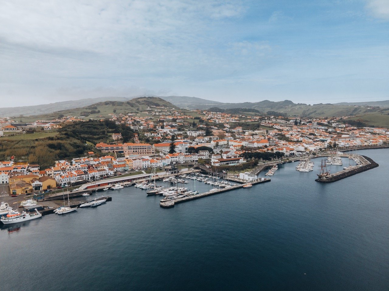
Horta
Horta is the largest city on the island of Faial, which is one of the five central islands of the Azores, and home to half of the island’s residents. It is situated on the eastern side of Faial and faces the island of Pico. In fact, you can get an amazing view of the Pico volcano from most points in Horta.
The town was ‘starting’ by a Flemish nobleman named Josse Van Huerter in 1467 who came through Faial on an expedition, landing at Horta Bay. From there, he built a small chapel which served as the focal point of the community. The name ‘Horta’ is thought to come from his surname. Nonetheless, ‘Horta’ also means ‘orchard’ in Portuguese, which could also be the origin of the town’s name.
The city is small and walkable, and can thus be seen in just half a day. What I personally appreciated most from this city was its very chill vibe compared to Ponta Delgada on São Miguel island.
If you decide to spend quite some time in Horta, here are a few things that are worth checking out:
Mercado Municipal da Horta - One of the main markets in Horta. There are plenty of vendors selling a variety of goods, choirs from other Azorean islands singing Portuguese songs and playing instruments, prominent chefs preparing cuisine for all the patrons, and one of the best burger places in all the Azores (Called Ah! Boca Santa).
Horta Pier - A must see place! You will see hundreds of murals, left by visitors passing through. The artistry of some of these murals is so impressive that they must have brought their own artistic materials with them for just this purpose.
Jardim Florêncio Terra - This park, named after Florêncio Terra, is found just outside the Mercado Municipal da Horta. The ornate decor of the park benches and central gazebo and the well manicured grounds make this spot a great place to settle down for a bit.
Miradouro da Lira - This viewpoint is atop a small hill/mountain that gives a great aerial view of Horta. It is easily walkable and the perfect spot to catch great views of Mt. Pico nearby, and sunset/sunrise views of Horta.
Forte de Nossa Senhora da Guia - The origins of this fortress date back centuries. Situated over Horta Bay on a point called Monte da Guia, this fort served to defend Faial against pirate attacks. The fort is also referred to as Fort da Guia, Fort da Greta, and Castelo da Greta.
If you like some of my photos that you have come across, just know that I have many prints showcasing a variety of landscapes, including the Azores, available for purchase below! (Sold as Posters, Canvas, or in Metal-Frames and Wooden-Frames).


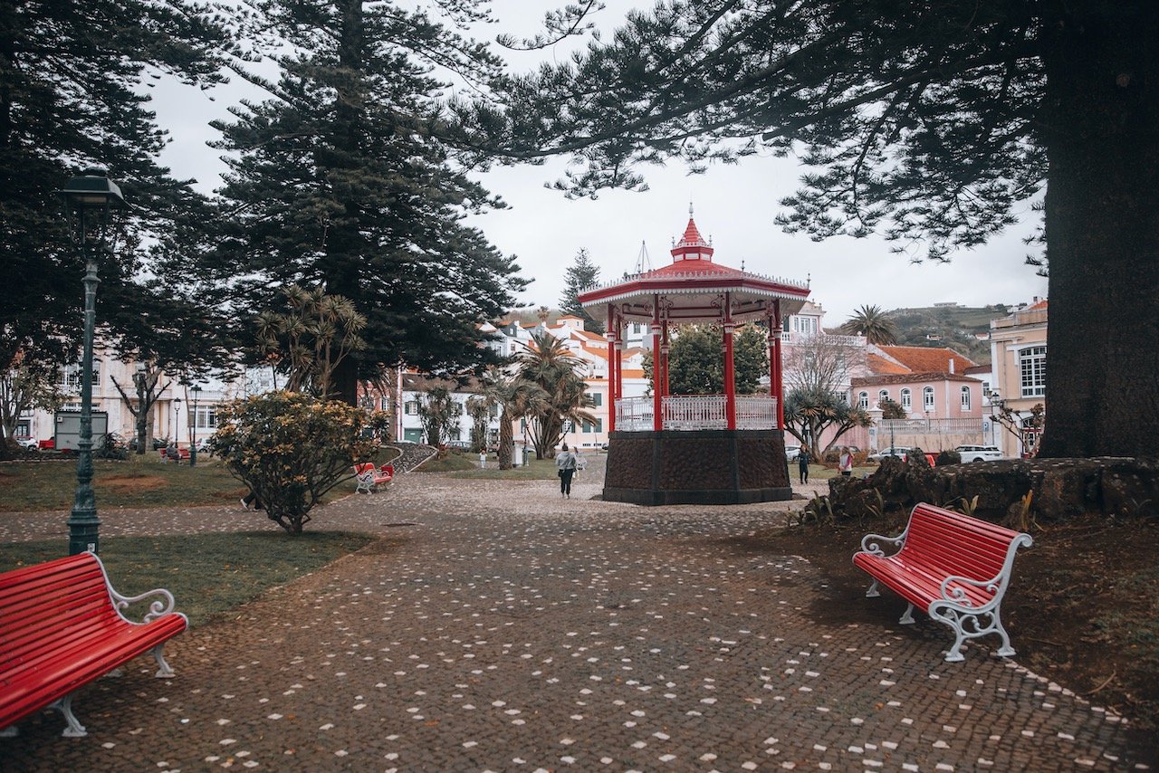
Jardim Florêncio Terra, Horta, Faial, the Azores (ISO 400, 24 mm, f/4.5, 1/1000 s)
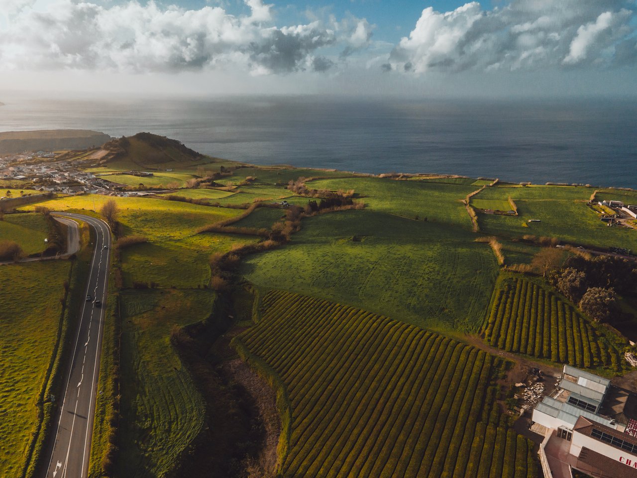
Ponta do Morro
This cool rock formation is about 10 minutes drive from the airport and is located in the Castelo Branco perish. It is a small nature reserve about 16 hectares in size and the Morro de Castelo Branco, a giant rock that juts out into the water, stands 149 meters tall. This part of the reserve is a remnant of a volcano in the Caldeira do Faial and its whitish color is indicative in its name Castelo Branco, meaning ‘White Castle’ (NOT the burger joint).
The area is also immensely popular as a habitat for birds with protected status such as the Shearwater (Calonectris borealis ), the Berry Shearwater (Puffinus lherminieri baroli), and the Common Tern (Sterna hirundo). Furthermore it is a place for protected marine species such as the common dolphin (Delphinus delphis), bottlenose dolphin (Tursiops truncatus), and the loggerhead turtle (Caretta caretta).

Ponta do Morro - Castelo Branco, Faial, the Azores (ISO 400, 24 mm, f/4.0, 1/1600 s)
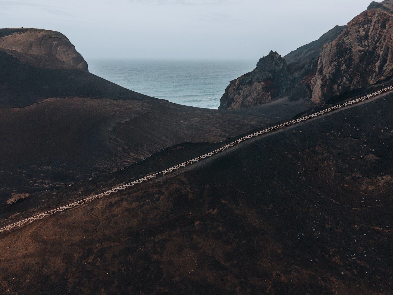
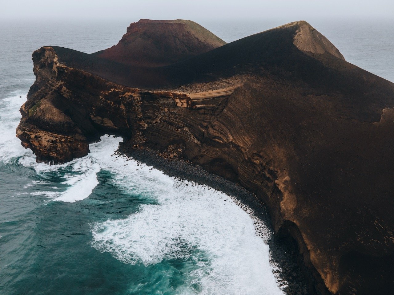
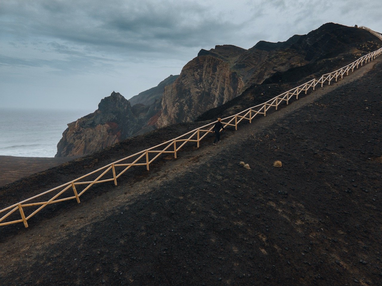
Capelinhos Peninsula
This has to be one of my favorite places in all of the Azores. The Capelinhos (meaning ‘Little Cape’) peninsula was formed by lava flows from a series of volcanos along a fault line where the last volcano, dubbed the Capelinhos volcano (Vulcao dos Capelinhos), erupted in 1957. The expelled materials from that volcano created what is known as the Capelinhos peninsula today. The eruption also destroyed 300 homes, enlarged the area by 2.4 km², and went on for 13 months.
Also, Capelinhos is part of a large volcano complex called Capelo and is considered the westernmost point of Europe as the western islands of the Azores are part of the North American Plate.
On a personal note, the black sand landscape, with the old feel of the lighthouse, and crashing blue waves and white wash make this place so unique, so if you manage to see one place in Faial, this is it!
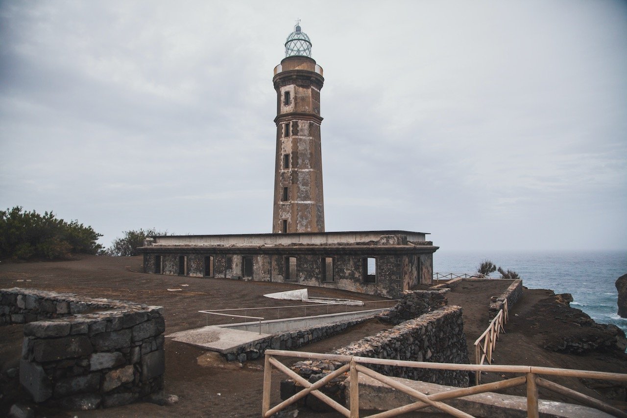
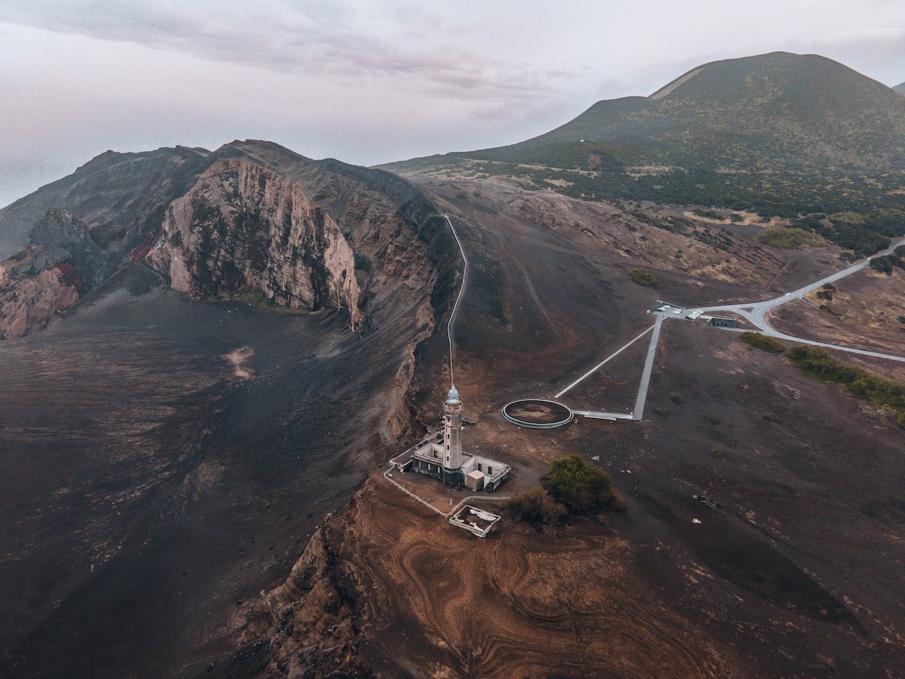
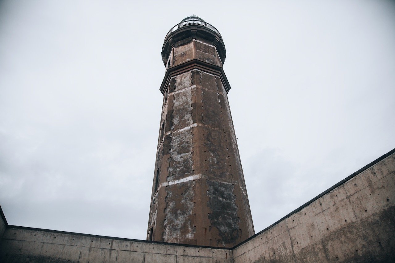
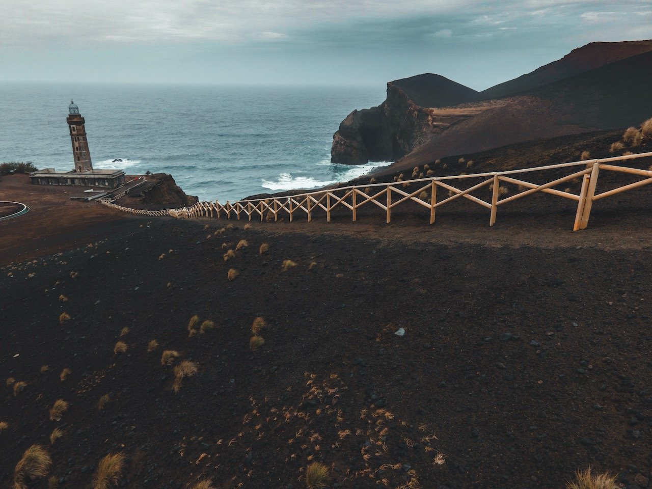
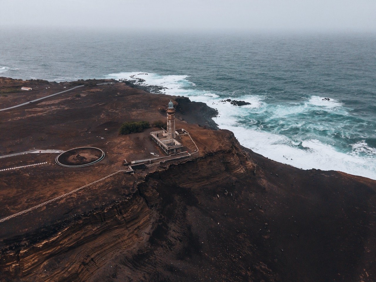
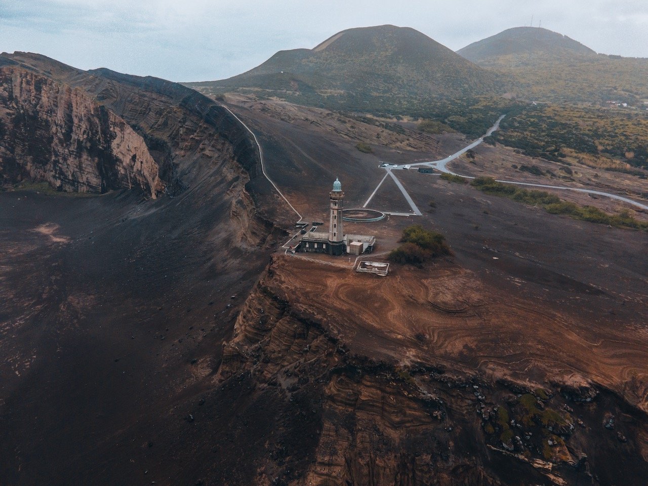
Lighthouse of Ponta dos Capelinhos
The Lighthouse of Ponta dos Capelinhos (Farol da Ponta dos Capelinhos) is a defunct lighthouse located in the Capelinhos peninsula. Since it was built before the volcano eruption, its facade is a symbol of its ability to endure. A number of shipwrecks were recorded at the end of the 1800s which prompted the need to build such a structure. Shortly thereafter, work was started on the lighthouse in 1894.

Caldeira do Cabeço Gordo
The name of this caldera translates to ‘fat mound’. It is the highest point on Faial island standing at 1,043 meters. Though the cloudcover and the occasional rain obstructed our views from this point, I am told that you can see most of the islands in the central Azores group (Pico, São Jorge, and Graciosa). There is also a hiking path that takes you around the outside perimeter of the caldera. The hike is about 8 kilometers and takes approximately 2.5 hours. You are exposed the entire time so it is only recommended in good weather and/or if you have the necessary gear to stay protected. You can also check out the lake in the middle of the caldera.

Caldeira do Cabeço Gordo, Faial, the Azores (ISO 200, 4.5 mm, f/2.8, 1/50 s)
Miradouro de Nossa Senhora da Conceição
Meaning ‘Viewpoint to Our Lady of Conception’, miradouro is situated just north of Horta. It is easier if you have a car to reach this point but it can also be reached by walking. On clear days, you can see all of Horta to the South in addition to the islands of São Jorge and Graciosa. There is also a 3 meter tall monument to the Virgin Mary.

Igreja de São Mateus, Faial, the Azores (ISO 400, 24 mm, f/4.5, 1/200 s)
Igreja de São Mateus
The Church of São Mateus is an abandoned church in Ribeirinha, just norta of Horta. The church was built back in 1934 but was destroyed by an earthquake in 1998 which caused extensive damage. An older temple was built in this same location back in 1666, and was also destroyed by an earthquake in 1926 (I’m starting to see a pattern here). The area is mostly closed off that but doesn’t stop you from still getting a few shots of the interior and exterior facades.