A Guide to the Swedish island of Gotland

Gotland, Sweden (ISO 400, 24 mm, f/4, 1/8000 s)
(Some links in this post are affiliate links. If you click through and take action, I'll be compensated.) If you are also interested in any PRINTS from any of my posts, be sure to check out my store where you can buy prints as posters, in metal/wooden frames or on canvas.
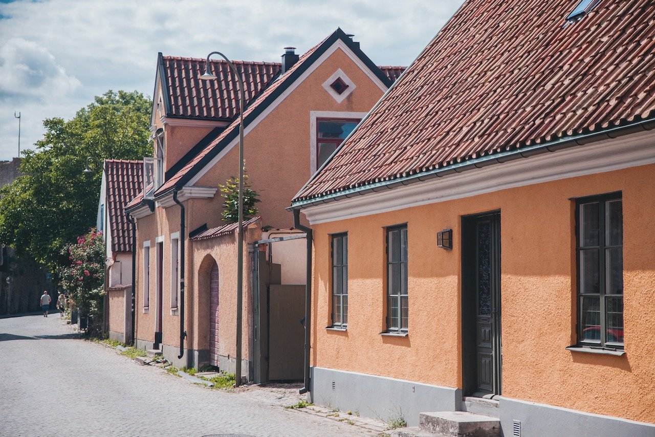
Gotland, located in the Baltic Sea, is the sunniest part of Sweden and arguably the best destination in Scandinavia. Its extensive shoreline and warmer climate (compared to the rest of Sweden), along with its long medieval history and intact walled city at Visby, easily made it one of my favorite places to see in Sweden.
The population of Gotland is roughly, 57,000, with about 40% living in the county capital of Visby. The island can be reached by air via the Visby airport or by ferry from either Nynäshamn (via 1.5 hour train South from Stockholm) or Öland.
Quite obviously, summer is the best time to go however be forewarned…Swedes and other Scandinavians alike think the same thing and therefore ferries can book up very early (so booking well in advance in strongly recommended).
Furthermore, there are two weeks in the summer that people usually avoid to stay way from larger than normal crowds. These weeks are:
Almedalen Week - Usually week 26 - A forum for Swedish politics
Stockholm Week - Usually week 29 - One week of partying from Stockholmers
Nonetheless, regardless of when you go, I recommend spending at least four days in Gotland and preferably with a car rental to maximize what you can see and enjoy. I will highlight some of the best places to see in the rest of this blog post.
Check out my drone video of Gotland below!

Even further, if you have lots of time in Sweden, I suggest checking out some of the other cities in the country. You can check out my blog posts on some of them below:
Stockholm (Blog Post Title: Why Stockholm is the best Scandinavian capital)
Stockholm Tunnelbana (Blog Post Title: The World’s Longest Art Gallery - Riding on the Stockholm Tunnelbana)
Uppsala (Blog Post: Uppsala: the hidden gem just North of Stockholm)
Helsingborg (Blog Post: Just a few reasons to see Helsingborg in the South of Sweden)
Malmö (Blog Post: Take a weekend break in Malmö, Sweden)
Lund (Blog Post: A Day tour of the university town of Lund)
Kalmar (Blog Post: Kalmar: The town you should know more about in Sweden)
Öland (Blog Post: A Day Tour of the Swedish island of Öland)
Marstrand (Blog Post: A day trip to the Swedish island of Marstrand)
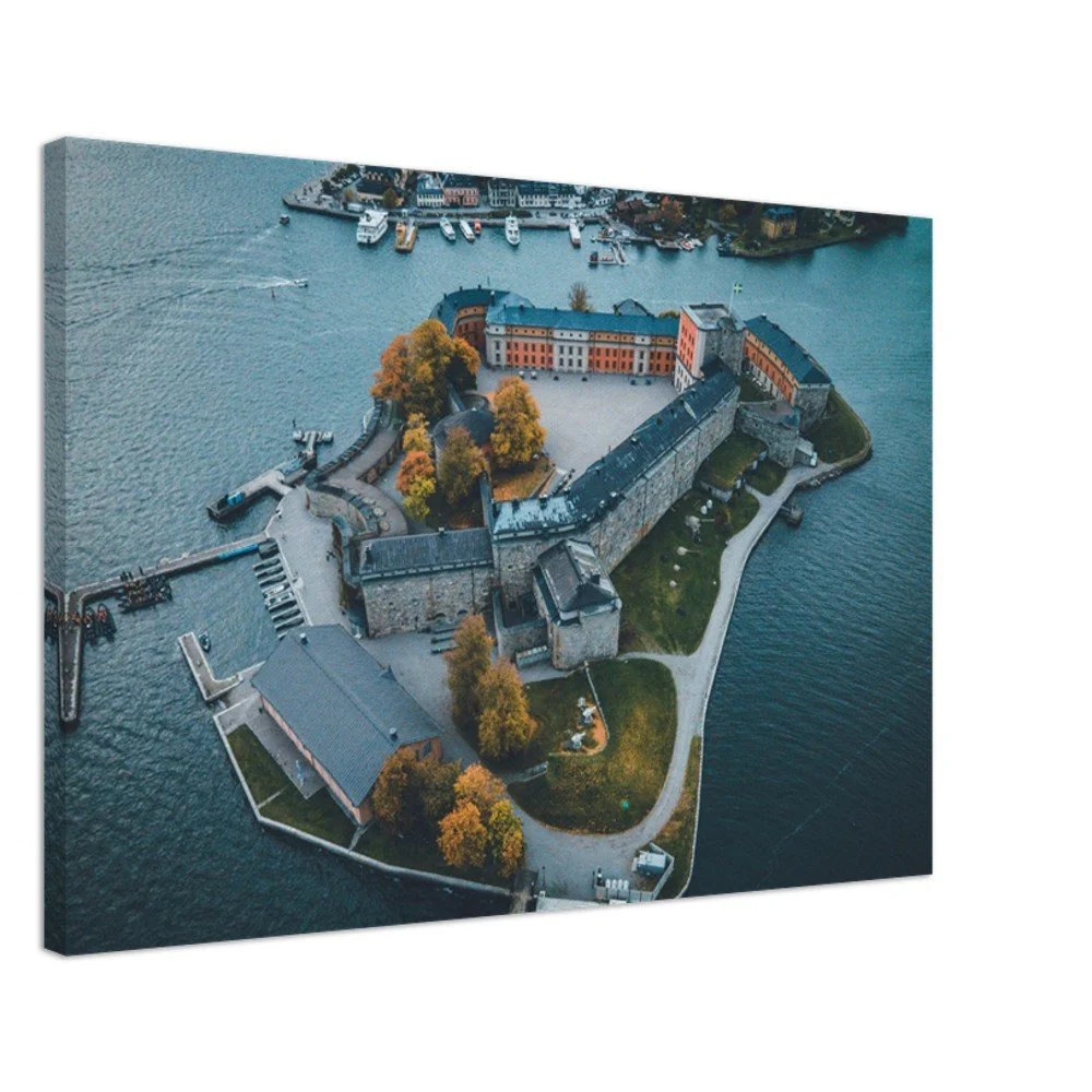
Swedish Castles (Blog Post: A Tour of Sweden’s Coolest Castles)
Fårö (Blog Post: A Guide to the Swedish Island of Fårö)
Visby (Blog Post: A Closer Look at the Hanseatic Town of Visby)
Gotland (Blog Post: A Guide to the Swedish Island of Gotland)

How to get to Gotland
If you’re planning a trip to Gotland, you’ve got a couple of solid options for getting there. The most convenient is to fly straight to Visby Airport (VBY)—just a few kilometers from the island’s main town. But if you prefer a scenic route or want to bring a car, taking the ferry from Nynäshamn (just south of Stockholm) is another great choice.
To get started, most international travelers will want to fly into one of Stockholm’s two main airports:
Stockholm Arlanda (ARN) – Sweden’s largest international airport
Stockholm Bromma (BMA) – Closer to downtown Stockholm, mostly domestic flights
From there, you can either take a domestic flight to Visby or make your way to Nynäshamn and hop on a ferry.
Option 1: Flying from Stockholm to Gotland
From Arlanda or Bromma to Visby Airport (VBY)
Both SAS and BRA offer daily flights to Gotland. The flight takes just 40–45 minutes, and prices start at around €50 one way. It’s the fastest and most direct way to get to the island.
Option 2: Taking the ferry from Nynäshamn to Gotland
If you prefer a more leisurely (and scenic) journey—or if you’re road-tripping and want to bring your car—this is the way to go.
Step 1: Get to Nynäshamn from Stockholm
Train – Take the Pendeltåg (commuter train) from Stockholm Central Station to Nynäshamn. The trip takes about 1 hour 15 minutes, and costs around 39–65 SEK (~4–6 Euros). Trains run frequently throughout the day.
Car – If you're driving, the journey from Stockholm to Nynäshamn takes about 1 hour via Route 73.
Step 2: Take the ferry to Visby
Ferry (Destination Gotland) – Ferries depart several times daily from Nynäshamn to Visby. The crossing takes about 3 hours, and ticket prices vary:
Walk-on passengers: from around 150–300 SEK (~13–26 Euros)
With a car: from around 500–1000 SEK (~43–86 Euros), depending on season and vehicle size
It’s best to book tickets in advance at destinationgotland.se.

Gotland, Sweden (ISO 400, 105 mm, f/4.5, 1/2500 s)
Here are some of the coolest places to see around Gotland once you have arrived:
Högklint
The cliffs at Högklint are situated just south of the city of Visby and are approximately 1.3 kilometer long at a height of 48 meters above sea level. You can get a great view of the sea from here and also walk down a staircase to a lower ledge, known as "Goatsvältan". This was used by goats to get down to the grass off the cliff shelf. What’s cool about this area is that the sea has hollowed out many caves in the cliff.

Hallshuk, Gotland, Sweden (ISO 1000, 32 mm, f/4, 1/8000 s)
Hoburgen
Hoburgen is the spot that is at the very southern tip of Gotland. The area around Hoburgen is actually the Husrygg Nature Reserve. This area, as one may suggest, is incredibly windy due to its location at the tip of the island. You can get a great view of the Baltic Sea from here and admire the waves crashing against the beach rocks and limestone cliffs. Tread carefully here, there is a NATO radar station here which is off limits to visitors.
If you like some of my photos that you have come across, just know that I have many prints showcasing a variety of landscapes, including Sweden, available for purchase below! (Sold as Posters, Canvas, or in Metal-Frames and Wooden-Frames).


Hallshuk
Hallshuk is known for its high cliffs, on the northwestern coast of Gotland. It was an important fishing village back in the 17th century with flounder being the catch of interest for fisherman (in addition to herring and cod). Despite a small, modern fishing harbor being built here, the area is rather barren and sparsely populated (making it a great place to explore). This area, known as the Hall-Hangvar Nature Reserve, was established in 1967.

Gotland, Sweden (ISO 400, 40 mm, f/4.5, 1/2500 s)
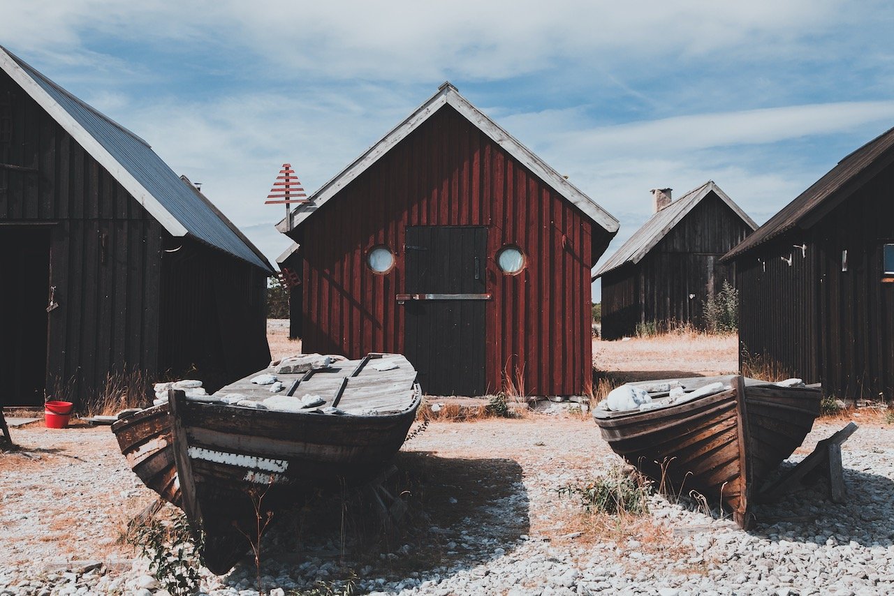
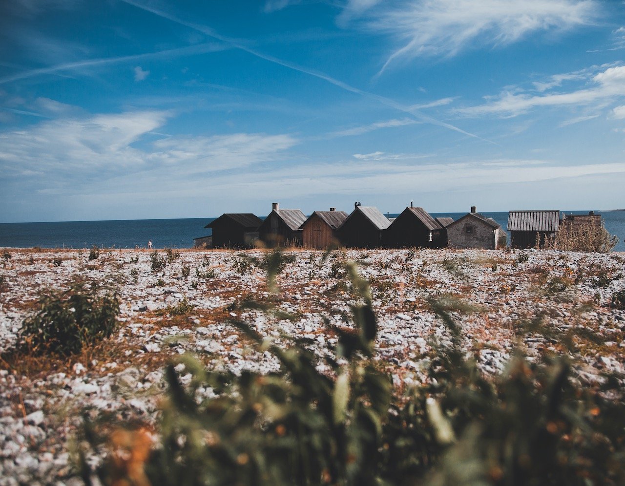
Grostäde Fishing Village
The Grostäde Fishing Village is located in Fleringe, Gotland, Sweden. This picturesque village is a look into the past of this old industry, exemplified by these small wooden houses and boats on the coastline. There are several of these types of fishing villages scattered about the Gotland coastline, some more charming than others. Take some time to walk around to appreciate the good condition of these structures.

Hallshuk, Gotland, Sweden (ISO 1000, 24 mm, f/4, 1/5000 s)
Katthammarsvik
Katthammarsvik (Strand and Katthammarsviks fiskeläge) is a settlement in Östergarn. Known for its limestone industry back in the 17th century (1645 to be exact), this is now a practice of the past. Because of its fluctuating population size, from 220, to 182, to 176…the village was defined as a ‘small locality’ (småort), instead of a ‘locality’. There is a small beach area and stone dock that leads out into the bay that people are known to jump off of and swim around.

Hallshuk, Gotland, Sweden (ISO 1000, 24 mm, f/4, 1/5000 s)
Katthammarsviks Rökeri AB is THE place to eat lunch at when in this part of Gotland. Try to make it early though since there are always lines here around lunch time. The menu was a wide selection of sea food, every dish as fresh and delicious as you can imagine. What I really liked about this place as well was its large expansive seating area outside. Cozy benches with blankets aplenty under the sun but with the rather cool windy breezes.
Sandviken Beach
Sandviken Beach is known for its bright white sand and is also called the Riviera of Blekinge. It is one of the most popular beaches in Blekinge and even attracts visitors from Skåne and Småland, on the Swedish mainland. From the parking lot, it is just a stone’s throw away, through a small forest and sand dunes. Some amenities in this area are toilets, kiosks, a snack bar, playground, and a beach volleyball court.
Fårö is actually not on Gotland, however, it is its own little island to the northeast of Gotland that can be reached by ferry. It is a must see place when visiting Gotland, so here are some places to check out in Fårö! (Blog Post: A Guide to the Swedish island of Fårö)
Norsta Aurer
Another long sandy beach is Norsta Aurer. Although not as accessible as other beaches, it is worth the rather long walk. You have to park along the side of the road, of which you will find other cars already parked, then a hike through the woods will get you there. It all feels like a bit of an adventure to get to, which makes the experience that much more worth it as well. But in this case, you will find more solitude here as some people are turned off by the effort it takes just to get there.

Langhammarsgubben, Fårö, Sweden (ISO 400, 28 mm, f/4, 1/8000 s)
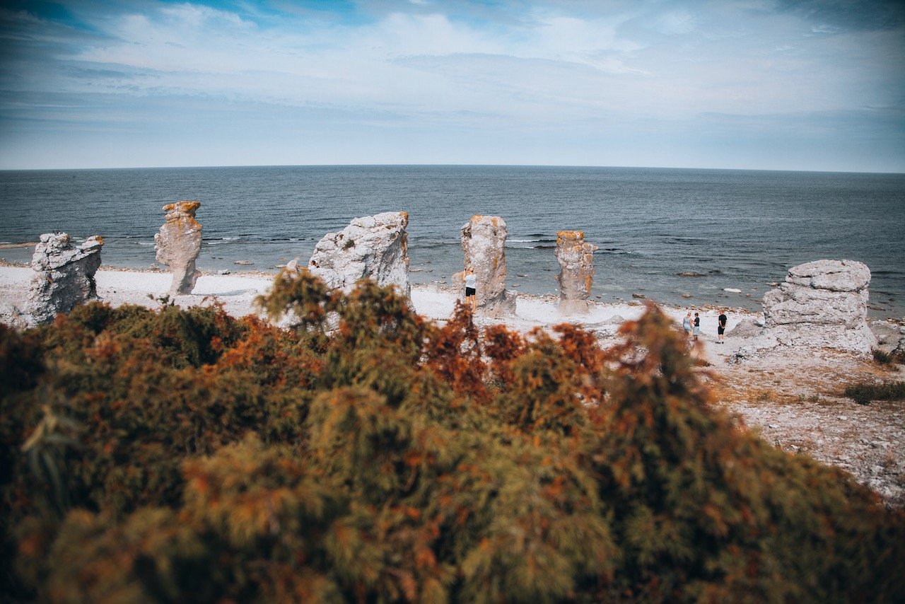
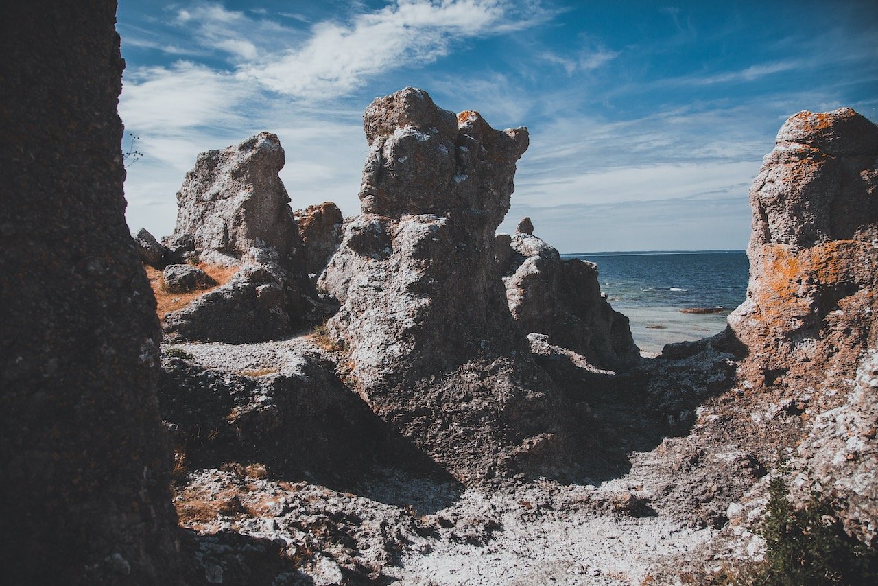
Langhammarsgubben
As I mentioned before, Rauks are common sights in this part of Fårö with the most popular of sites being at Langhammarsgubben (unofficial name). There are about 50 rauks total in Langhammar’s nature reserve (official name). If you have seen postcards showing these features before, I can promise you they come from this place. The beach is expansive these rauks sit on, and some of them are fairly easy and safe to climb upon, without risk of damaging the formations. Swimmers beware though, the water may look enticing but there are several points along the coastline where the water levels drops many meters, so they advise against it.
Fika at Sylvis Daughters, bakery and cafe
Fika is a swedish way of life. The time to take for yourself and others to engage in polite and casual conversation while enjoying coffee/tea and pastries. The best place to experience this on Fårö has to be at Sylvis Daughters, bakery & cafe. They have cakes, bread, and sandwiches here with a relaxed vibe and a lot of outdoor seating. It’s the perfect spot for a rest.

Gotland, Sweden (ISO 100, 24 mm, f/4, 1/800 s)
Sudersand Beach
Being on an island, of course you can have your pick of beaches to see. We went to a few of them but two really stood out to us. The first is Sudersand Beach, one of the longest on Gotland and considered to be the most beautiful (your opinion may vary). There is a large camping site here along with kiosks and restaurants, bars, and cafe. What I remember the most was just how soft the sand was, not to mention how the beach was positioned with respect to the sun. You get sunlight ALL day.
Fårö Lighthouse
I will never shy away from seeing a lighthouse wherever I am at. I like what they represented back in the day, their history, and how each one can be so visually different despite the same overall shape. Fårö Lighthouse is located on the easternmost tip of the island, built after complaints that Gotland had too few lighthouses in the 19th century. Over the decades, its light source has been changed from oil to paraffin to electric.

Fårö Lighthouse, Fårö, Sweden (ISO 400, 35 mm, f/4, 1/6400 s)
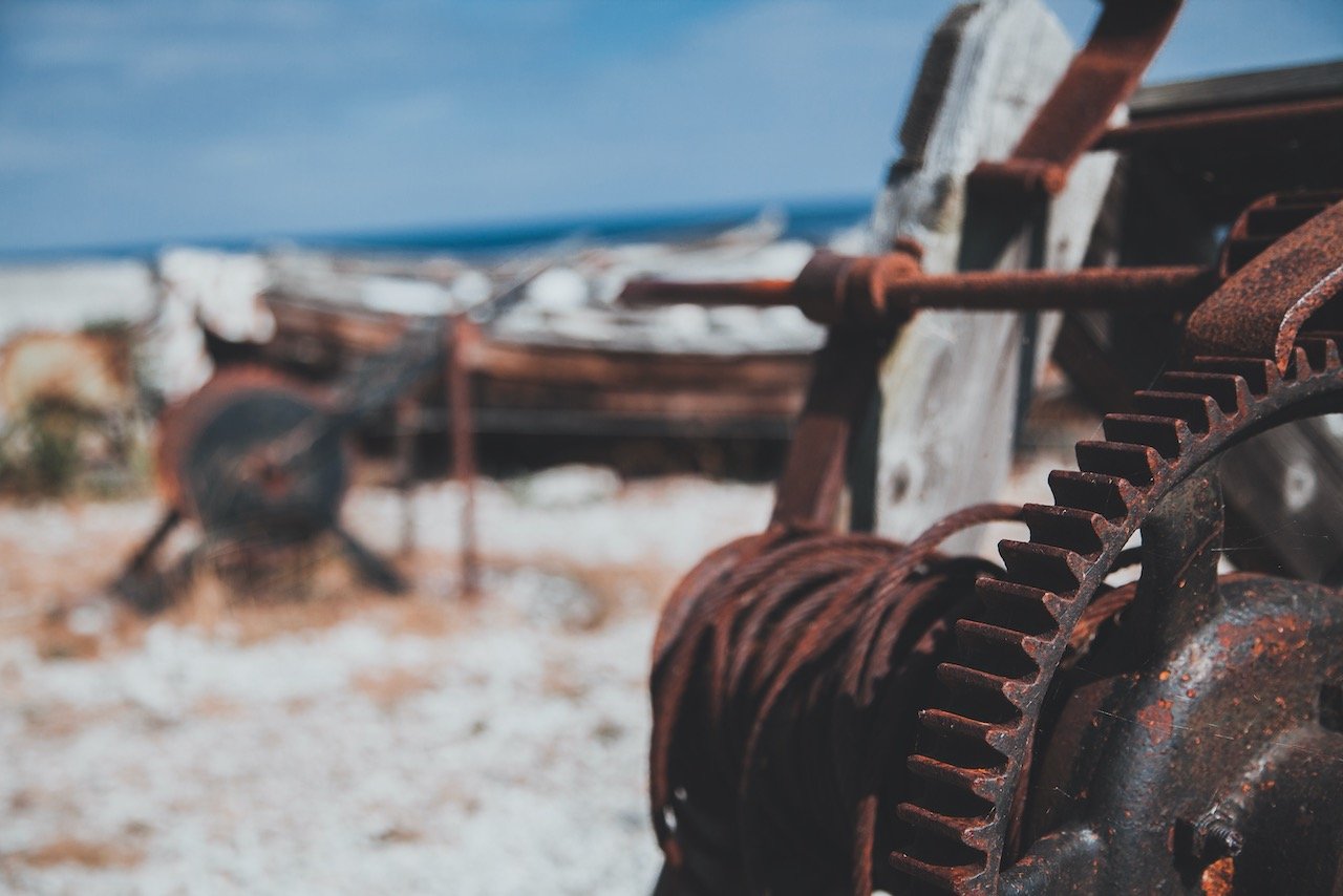
Helgumannen’s Fishing Village
Just north of Digerhuvud is the remnants of an old fishing village, which are common in this part of Sweden. Helgumannen’s Fishing Village was used to fish herring back in the day. It sits amidst the most barren of beach landscapes but is still well intact, though abandoned. Here you can take a picnic admiring the houses that were built according to old traditions, all 15 of them. The preservation of these homes and the boating and mechanical equipment is impressive. This is a great place to stop at to explore.

Fårö Lighthouse, Fårö, Sweden (ISO 100, 24 mm, f/4, 1/1250 s)
Digerhuvud
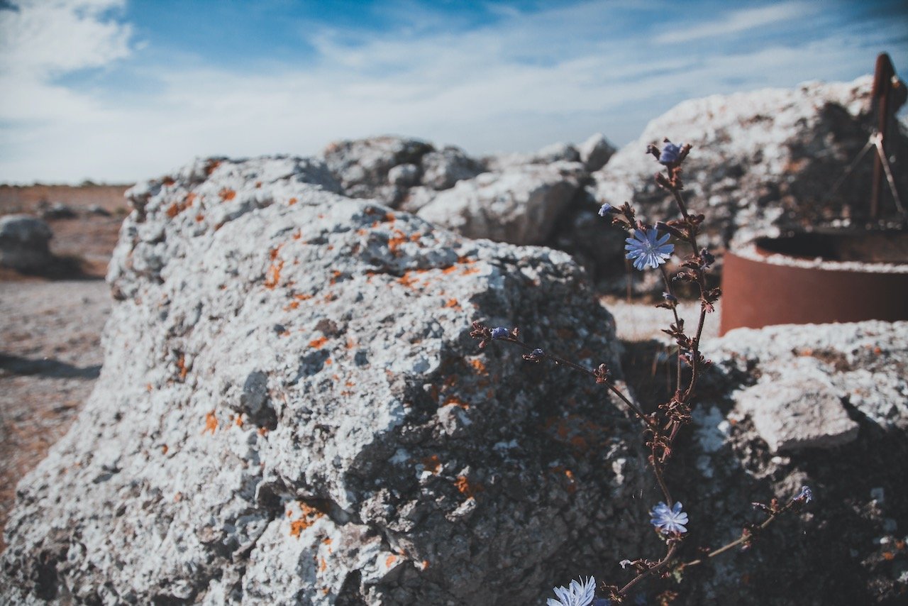
We started off by driving towards Digerhuvud. This is a nature reserve that is protected as a natural monument, since 1930. It is composed of a 3.5 km stretch of beach containing a few rauks that Gotland is known for. Rauks are made up of stone and are column-like features that are found in Scandinavia. You can find them along the rocky coastline of Fårö. They can often be as tall as 8 meters. Climbers beware, it’s best to not climb on them due to how old they are and the cultural significance they have.
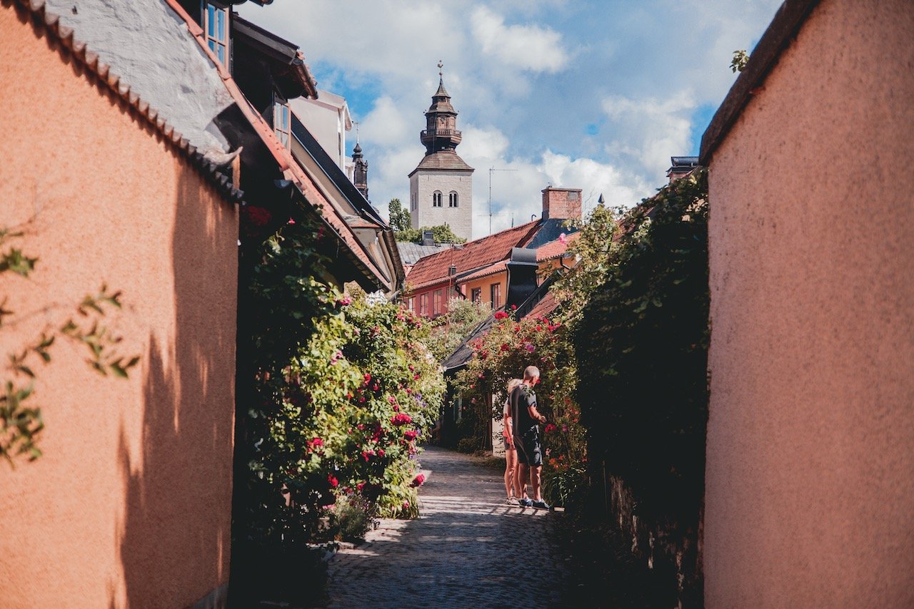
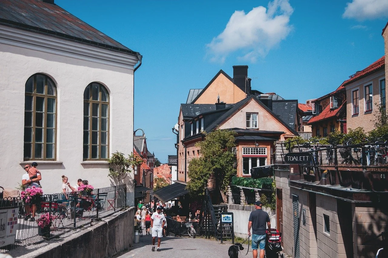
Visby, Gotland, Sweden (ISO 400, 73 mm, f/4, 1/2000 s)
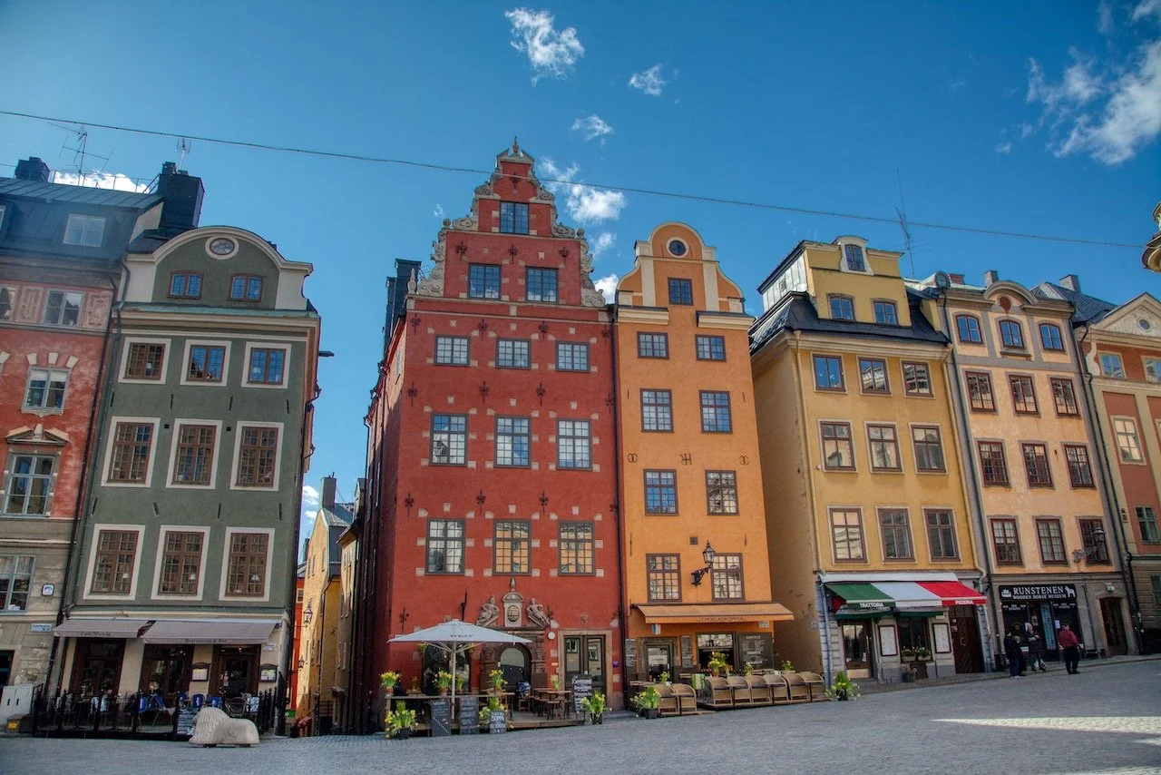
The major city of Gotland and the airport you fly into and the ferry you take will take you to Visby. You can’t avoid seeing the city even if you really try. Here are some place sto see around Visby (Blog Post: A Closer Look at the Hanseatic Town of Visby in Gotland, Sweden)
St. Görans Ruin
St. Görans Ruin (St. George) is the site of a former medieval hospital church outside the city wall. Because the church was made to serve those who had leprosy, it was built outside the ring wall of Visby. Dating way back to the 13th century, it was built on the site of another church that was erected a century before. Unfortunately, you can only see the ruin from the outside as it is closed to visitors.
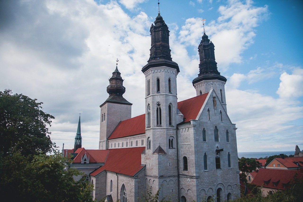
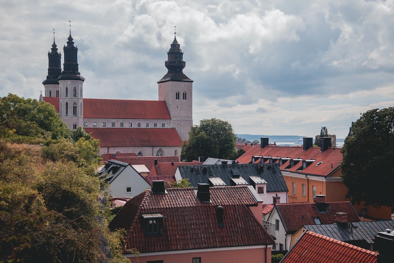
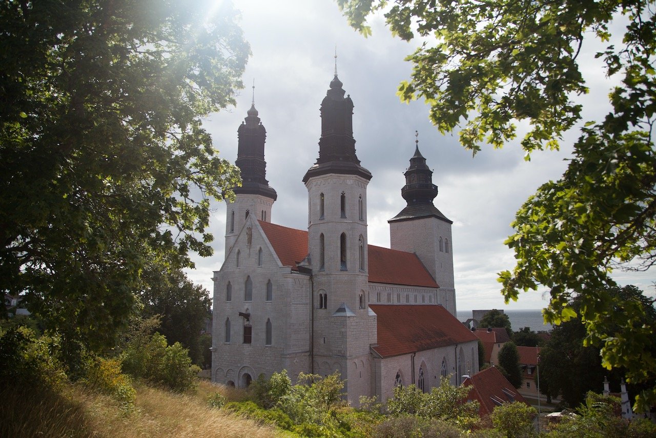
Visby Cathedral
Visby Cathedral, also known as Visby Saint Mary's Cathedral (Visby S:ta Maria domkyrka) is a cathedral and seat of the Bishop of Visby. You can’t miss it as it occupies a space in the center of Visby. Construction was started in the 13th century, originally as a wooden church, then replaced with stone…then expanded during the Middle Ages. Its transformation continued throughout the centuries, even while Sweden was under Danish rule. It has always been under Swedish rule however from the year 1645.
The best part about this church is not just how nice it is inside, it is all the unique vantage points you can get within the city walls of the structure. A lot of the places are very popular but there are some passages that only locals know about for such views. Make your way to the side road Norderklint, just beyond the Kramhållplats, and you will usually find few people in this area of Visby.
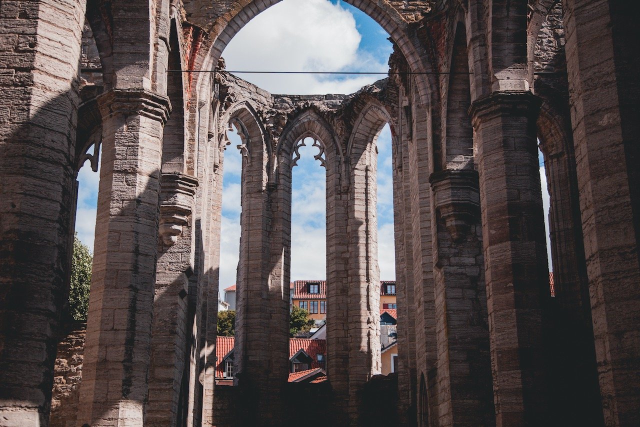
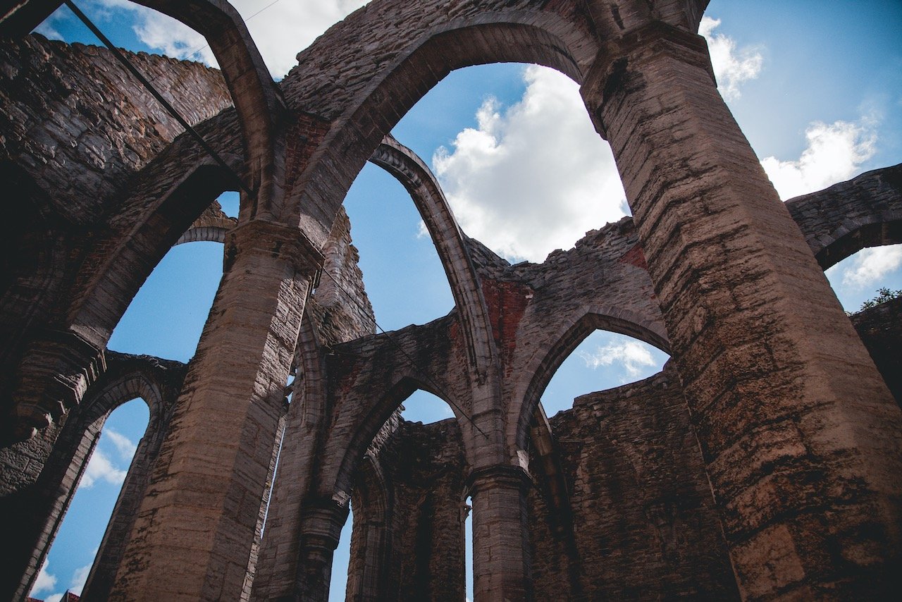
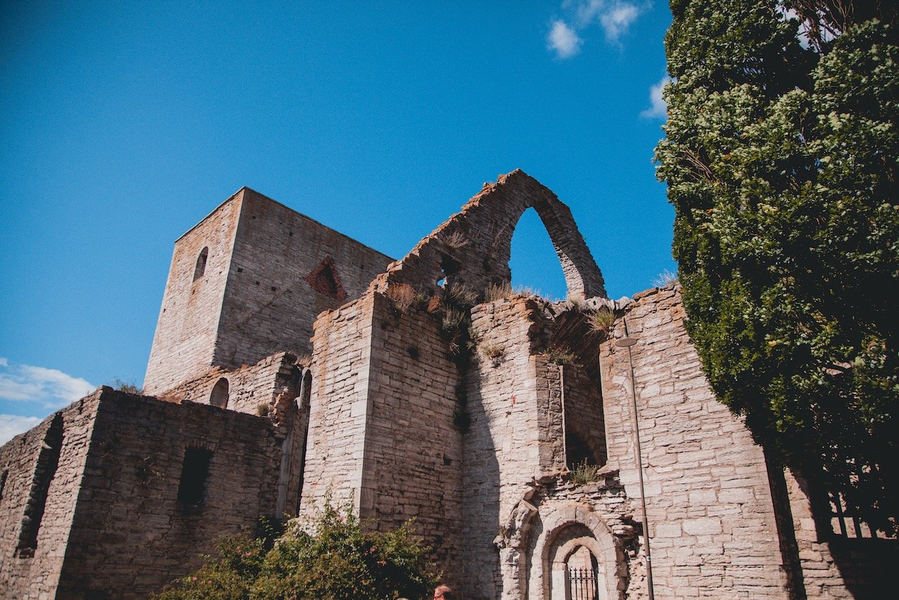
St. Nicolai Ruin
The St. Nicolai Ruin was named after the patron saint of sailors, built around 1220 AD. Originally built for Germans, a fire destroyed it shortly after its construction and Dominican friars reconstructed it thereafter. Like many ruins that are located within Visby, this one is also has a long and storied history.


Visby Town Wall
The Visby Town Wall is perhaps the most famous and obvious attraction in Visby. This wall was built as a defensive wall in the Middle Ages. Due to how well preserved it is (the best in all of Scandinavia), it is deemed a UNESCO World Heritage Site.
Two periods of construction were performed on the wall in the 13th and 14th centuries with a length of 3.6 km total. Surprisingly today, 3.4 km of the wall is still standing as well as a number of homes from that era as well. This wall construction was considered unusual back in that time because this practice of building city walls in the Nordics were typically not done, illustrating the importance Visby was at that time.
Snäckgärdsporten
There are PLENTY of different towers and gates within the Visby city walls that have certain significance. Google would provide a much better resource than I could in discussing all of them. But one such gate of particular importance has to be Snäckgärdsporten otherwise known as the West Gate. This tower is one of the oldest in the entire wall and protected against assault actions, for example with battering rams.
St. Karin Ruin, Visby, Sweden (ISO 400, 24 mm, f/4, 1/4000 s)
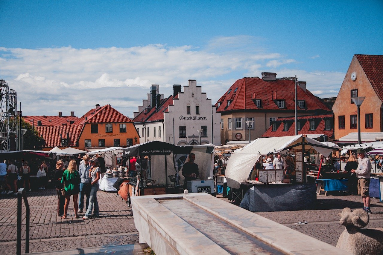
Almedalen is the week whereby all Swedish politicians descend upon Visby. It is also the name of a park, centrally located within Visby. It was the site of the city harbor back in Medieval times, however these days the park is a popular green space for locals and tourists alike.
Botaniska Strand is a set of linked gardens that run along the beach in Visby. They have been protected by the ring wall from the harsh conditions of the Baltic Sea. The amount of vegetation and flora and fauna here is quite striking, especially for this part of Sweden.